Roman Ruins of Quinta da Abicada: A Roman Villa in Portugal
Site at a Glance
- Popularity
- Medium
- Country
- Portugal
- Primary era
- Classical
- Eras represented
- Classical, Modern
- Civilizations
- Portuguese, Roman
- Site type
- Domestic
- Remains
- Villa
On this page20 sections
History
Roman establishment and prosperity
The Roman ruins of Quinta da Abicada are the remains of a Roman villa at Caminho da Abicada in Portugal, probably founded in the 1st century AD. A Roman villa was a rural estate combining a residence with productive facilities. Abicada served as a wealthy home as well as a place for agricultural and fishing-related work, and it is the principal known Roman archaeological site in the parish of Mexilhoeira Grande.
The estate belonged to a broader pattern of Roman properties in southwestern Iberia, where fertile land and coastal resources supported farming and maritime commerce. The surrounding region produced fish products, wine, olive oil, and dried fruit for nearby communities and wider trade. Abicada’s position beside the Ria de Alvor gave it access to navigable water and land routes. The estuary once carried substantial commercial traffic, and nearby settlements included Ipses at Alvor, Portus Hannibalis at Portimão, and Lacobriga at Lagos. Abicada may have been administered from Lacobriga.
Regional prosperity peaked in the 2nd century, during the Pax Romana, the extended period of relative stability and imperial consolidation associated with the first and second centuries AD. A concentration of Iron Age sites around Abicada has also been taken to suggest continuity between areas used by indigenous communities and those occupied in the Roman period, although it does not establish uninterrupted occupation at the villa itself.
Later occupation and abandonment
The villa was occupied mainly from the 1st through the 4th centuries AD. Evidence points to activity in the 5th century and possibly later, but the date when the estate was finally abandoned remains uncertain. Fourth-century bronze coins have been associated with destruction and abandonment. The wider abandonment of Roman settlements in the region, including Abicada, has also been linked to the decline of maritime trade in the 6th and 7th centuries.
Discovery and conservation
Portuguese archaeologist José Leite de Vasconcellos identified the site in 1916 after finding roof tiles, walls, and mosaics. He excavated there in 1919, after the villa had been mentioned in print in 1917. José Formosinho conducted major investigations in 1937 and 1938 while establishing the Lagos museum. His excavations left mosaics exposed to rain and sunlight, hastening their deterioration. The ruins became a National Monument in the 1940s. Excavation was confined to the state-owned plot, while surrounding land remained privately owned.
Conservation by the Portuguese heritage authority took place from 1984 to 1989, following damage from erosion, visitors, and landowners. The University of Frankfurt investigated the site from 1999 to 2003 under archaeologist Felix Teichner, and research into its geological and archaeological setting began with the University of Jena in 2006. Further conservation in 2010 and 2011 addressed the mosaics, walls, and drainage. A large agricultural complex built beside the Roman remains in the mid-20th century was later abandoned.
Remains
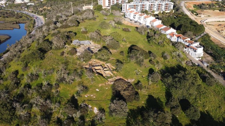
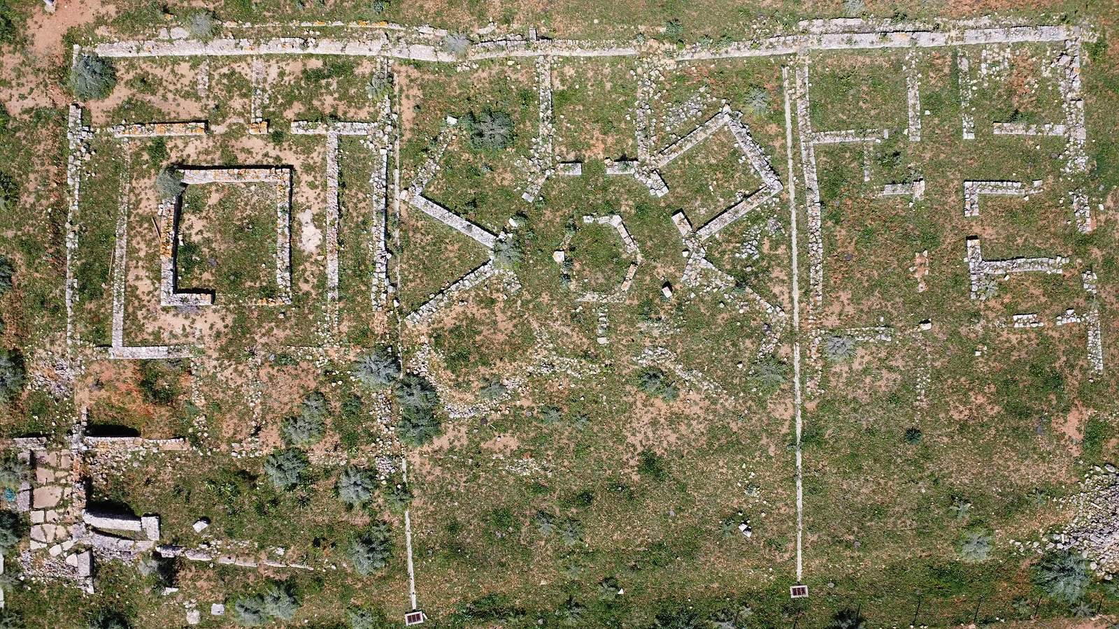
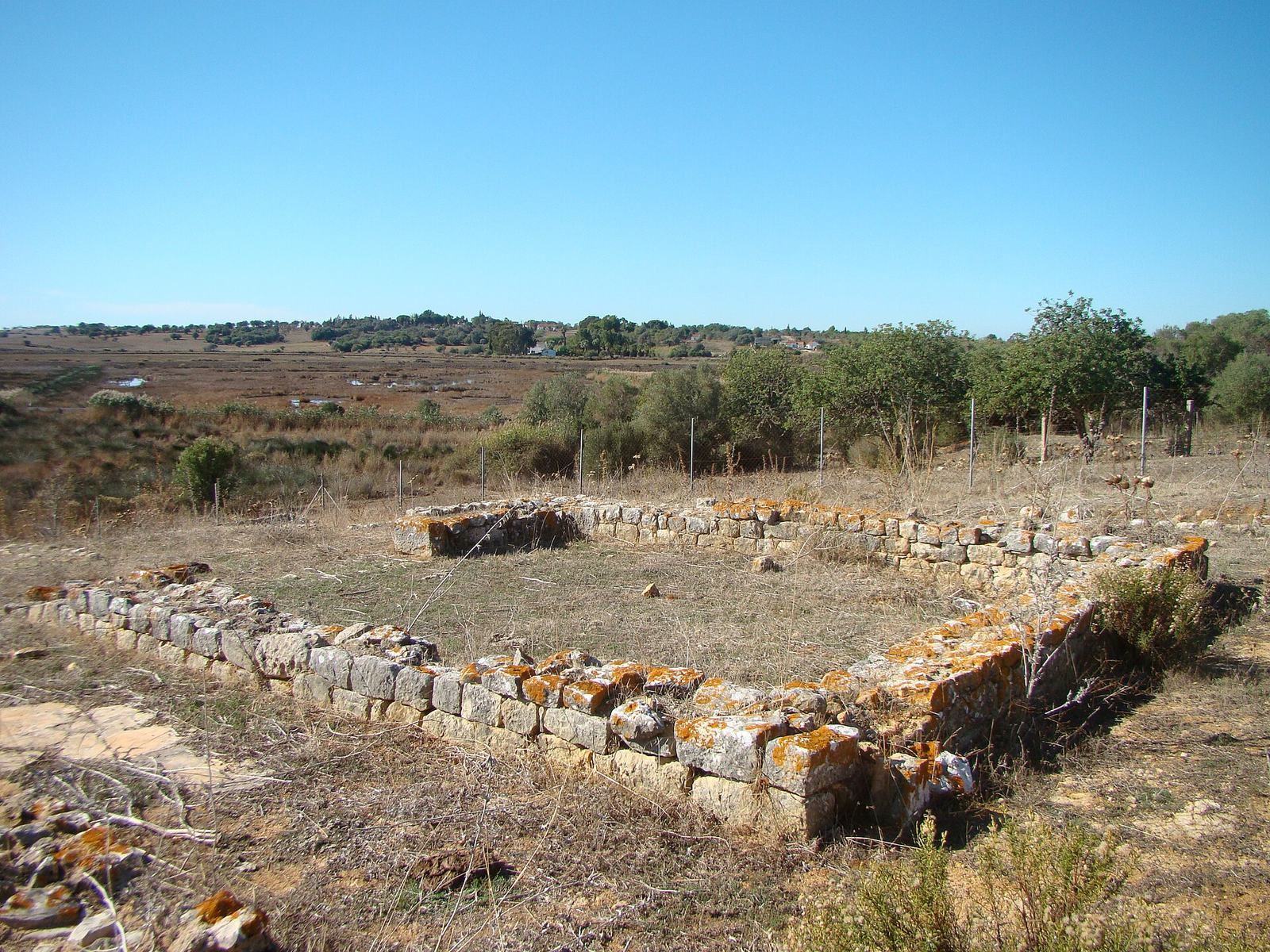
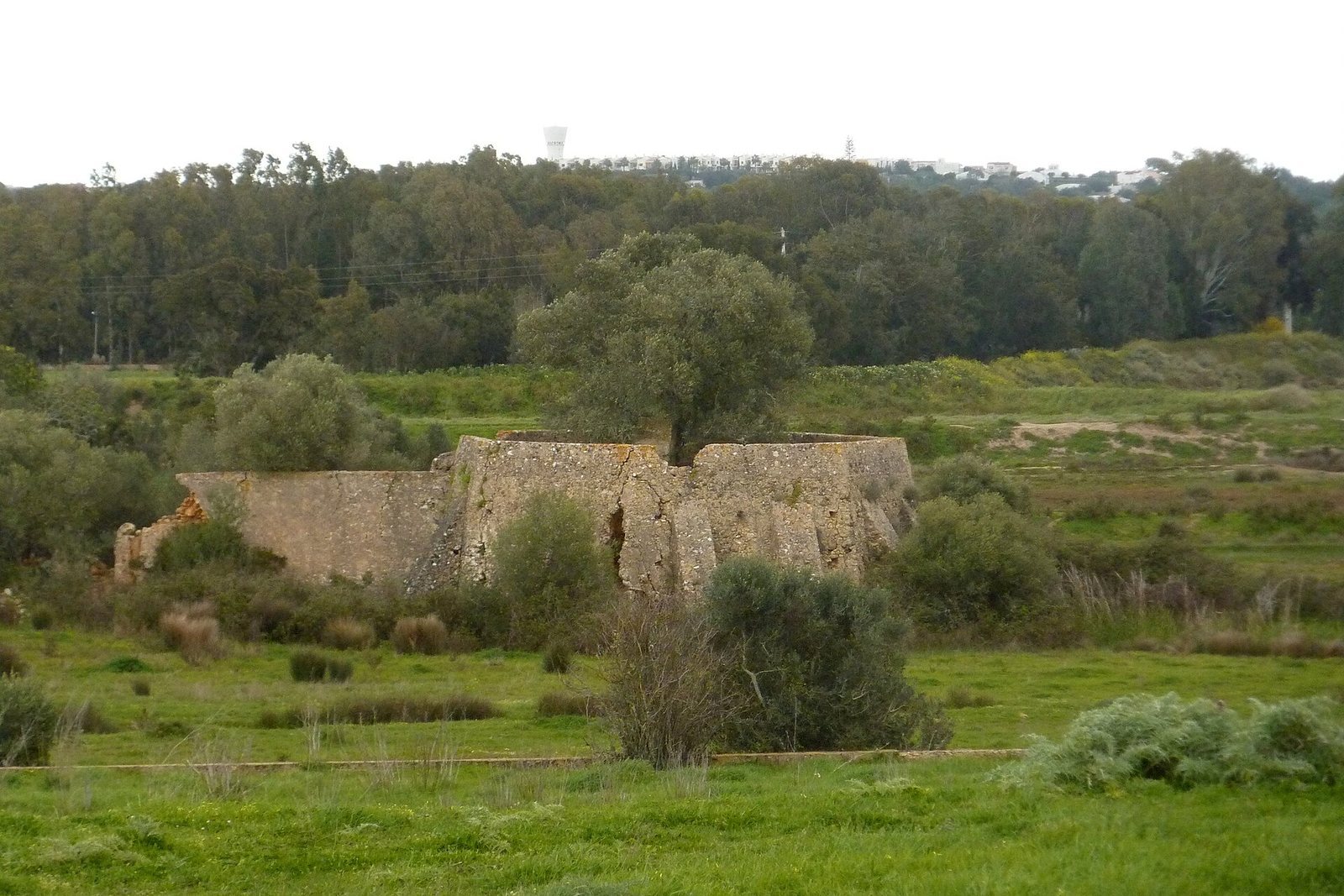
The villa occupies a raised point of land between Mexilhoeira Grande and Alvor, about eight metres above sea level, where the Farelo and Senhora do Verde streams meet the Ria de Alvor. It faced south toward the water and the sea. Sediment has since shifted the coastline southward, turning the former bay into a brackish delta where fresh and salt water mix. The visible ruins cover a publicly owned plot about 80 by 30 metres; the wider complex covers approximately 2,000 square metres. Its identified areas, A to E, include a building complex of about 1,300 square metres and more than 30 rooms. The rooms extend from west to east along the slope.
The main residence had a rectangular plan divided into three principal sections, each with at least one exterior doorway facing south. Damaged wall sections mark parts of the building. Rooms around the central courtyards had flat, rectangular roof tiles supported by columns with hexagonal sections, built from quarter-circle bricks.
Residential areas
Western rooms and courtyard
Area A, at the western end, covers about 250 square metres. Its rooms, A1 to A10, are interpreted as private residential spaces arranged around central room A6 and corridor A5. Rooms A4 and A7 are considered ornamental gardens because they lack flooring; the other rooms have been interpreted as living or sleeping spaces.
The western part of the house is also described as arranged around a rectangular courtyard surrounded by columns, with a corridor giving access to five rooms. These rooms have been tentatively interpreted as a women’s area and a reception room. Narrow side rooms traditionally associated with ancestral portraits and a household shrine were also situated in this part of the residence.
Central reception area
Area B formed the central reception section. From portico D3, an entrance led through antechamber B6 to hexagonal room B9 and a matching basin, B10. Lead pipes and a lining of Roman concrete support the interpretation of B10 as a water basin, with columns at its corners. The basin collected rainwater. Formosinho interpreted this part of the house as the men’s area, with six individual rooms around the hexagonal courtyard. The arrangement was unusual among Roman houses.
Rectangular rooms B3 to B5 and B7 to B8 were grouped around the courtyard. Rooms B1 and B2 linked the rectangular sections A and C with B’s polygonal plan, but their use remains uncertain because neither access points nor floors have been identified.
Eastern service rooms
Area C, on the eastern side, is interpreted as a service area. Its rooms, C1 to C11, lack mosaic floors, and may have included storage spaces, a kitchen, and quarters for enslaved workers. The condition of the remains does not allow those uses to be assigned room by room. A lead water pipe in this section connected with the exterior.
Portico, production area, and drainage
Portico and seafood production
Portico D3 adjoined the residential sections and faced the meeting of the streams and the sea. One reconstruction gives it a length of 50 metres. Area D4, linked to the main building by corridor D2, contained basins interpreted as installations for processing seafood.
Northern drainage and rooms
Area E lies north of the main building. Its drainage system used lead pipes laid in a bed of gravel. A further group of rooms stands to the east, but their function is unknown.
Floors and wall decoration
Mosaic floors
Mosaic floors were found in almost all rooms in areas A and B and in the central and western parts of the house. The eastern service section instead had ceramic tiles. The mosaics were made from small, coloured stone pieces and included geometric and floral designs, as well as vessels. One repeated pattern shows six-rayed stars within squares, framed by geometric designs in white, black, and red.
Three floors transferred to Lagos have distinct designs. One shows stylized four-petalled flowers in white, dark blue, yellow, and red. Another combines white, blue, red, pink, and grey and includes a swastika, an ancient motif associated with renewal of life and the sun’s rays. A third has leaves arranged in circles in white, blue, and yellow. Principal mosaics have been moved to museums in Lagos and Portimão for preservation. Deteriorating mosaic pieces removed in 2010 and 2011 were conserved at the Portimão Museum, where a restored dining-room mosaic was exhibited in 2014.
Painted walls
Painted stucco survives on some western walls. Geometric wall designs associated with the interpreted women’s area used white, dark red, ochre yellow, and petroleum blue.
Production remains and archaeological finds
Cellar and nearby quay
A cellar or production area about 20 metres from the main building was destroyed by the landowner in the 20th century. Its remains included presses for wine and olive oil and basins lined with a waterproof Roman building material. Fish-salting has been proposed for the installations, but their location makes that interpretation unlikely. A quay or pier has also been identified near the villa.
Pottery and glass
Pottery finds include fragments of terra sigillata, fine Roman tableware often finished with a red slip, including part of a figure shown in profile and offering an object. Three fragments of African red-slip ware, a type of fine tableware made in North Africa, have dates ranging approximately from AD 90–100 to AD 180–220. Other ceramic finds include a small quantity of everyday vessels and amphorae, large containers used to transport and store goods, from the 2nd and 3rd centuries AD.
Three small glass fragments include part of a pale green urn filled with bubbles, probably made in the late 1st or early 2nd century, part of a colourless cup, and a colourless lid described as rare. The pieces may have belonged to perfume containers. Another glass find is a plate with a collar-shaped rim, dated to the 1st century.
Metal objects and coins
Metal finds include part of a mirror decorated with geometric patterns, objects of lead and bronze, and tools associated with fishing and cosmetics. Coins span the 1st to 4th centuries, including small bronze pieces and coins from the periods of Constantine and the later 4th-century Theodosian emperors. Finds excavated in the 1930s are held at the Dr José Formosinho Municipal Museum in Lagos. Because they were not recovered from recorded archaeological layers, they offer limited evidence for establishing the villa’s chronology.
Ground conditions
Slope erosion continues to affect the ruins. The clay-rich soil swells when wet and develops deep cracks as it dries, conditions that have complicated the preservation of the walls and mosaics. Conservation work stabilized walls and improved drainage, and a concrete retaining wall was built on the southern side with foundation piles extending 10 metres into the ground.