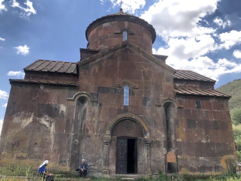
Marmashen Monastery: An Armenian Apostolic Monastic Complex


Site at a Glance
- Rating
- 4.9
- Popularity
- Low
- Country
- Armenia
- Primary era
- Medieval
- Eras represented
- Medieval
- Civilizations
- Armenian
- Site type
- Religious
- Remains
- Monastery
On this page16 sections
History
Marmashen monastery is a former Armenian Apostolic monastery in Armenia, developed by Armenian builders mainly from the late tenth to the early eleventh century. Associated with the Pahlawuni princely family, it became a major religious and cultural center in the fertile Akhuryan valley and belonged to the architectural traditions of the Ani-Shirak school.
Foundation and Pahlawuni patronage
The monastery’s foundation belongs to the tenth century, and one tradition places its establishment in 988. Its principal construction campaign is associated with Wahram Pahlawuni, a sparapet, or senior military commander of the Armenian kingdom. This work is generally dated between 988 and 1029, during the period when the Bagratids, the Armenian ruling dynasty that restored an independent kingdom in the late ninth century, ruled from Ani.
Armenian historians first mentioned Marmashen in the tenth century. Samuel of Ani associated the construction of a building at the monastery with the years 989 to 994, while an inscription on the cathedral’s south facade dates its dedication to 1029. The complex became the hereditary burial place of the Pahlawuni family. An inscription on the cathedral’s south wall identifies it as the family’s ancestral resting place and records Wahram Pahlawuni’s role in its development.
Invasion, restoration, and decline
In 1064, Seljuk forces led by Malik Shah, the son of Alp Arslan, besieged and ravaged Marmashen. Later invasions by Mongols, Kurdish warlords, Seljuks, and Ottomans further damaged the complex. Earthquakes recorded in 1139, 1275, 1668, and 1926 also progressively affected the enclosure walls and subsidiary buildings.
A major restoration took place in 1225 under Archbishop Grigor and his brother Gharid, grandsons of Wahram Pahlawuni. Their inscription records the repair work and donations of furnishings, liturgical objects, fields, and villages to the monastery. Marmashen later declined as repeated invasions contributed to the depopulation of Shirak. By the beginning of the nineteenth century, it had ceased to function as a major religious center and subsequently served as a rural church rather than as a monastery.
Excavation and conservation
By the late nineteenth and early twentieth centuries, the monastery was in poor condition. Limited repairs began in 1888 at the initiative of Catholicos Mkrtich Khrimian. These interventions included replacing some stone blocks and modifying the umbrella-like roof of the main church. The monastery may also have been looted after the Turkish capture of Alexandropol, now Gyumri, in 1920.
Excavations and archaeological investigations began in the 1950s, followed by more extensive work from the early 1970s for about ten years under the archaeologist Sergei Harutyunian. The work exposed parts of the enclosure wall and remains of subsidiary buildings. A former Zvartnots-type building, a centrally planned Armenian church form with a circular or polygonal outer structure, was identified in 1938 beneath a village stable.
Soviet-period restoration replaced the cathedral’s tuff roof slabs between 1950 and 1954, with further work continuing through 1957. After the 1988 Spitak earthquake, the cathedral’s west facade had partly separated from its side walls and a broad crack had formed in the dome. Italian conservators stabilized the structure with steel cables, reset displaced masonry, and filled the cracks with mortar.
Marmashen is recognized as a cultural monument of Armenia. The complex is no longer administered as a monastery or as church-owned land, although the Armenian Apostolic Church retains the right to conduct liturgy, services, weddings, and baptisms there. A nearby Urartian inscription, carved on rock below the village, records the eighth-century BC king Argishti I’s conquest of the land of Eriakhi and his advance to Ishkigulu. It reflects the earlier occupation and strategic importance of the wider Shirak region, rather than proving that a pre-Christian building stood beneath the monastery. Claims that Alexander Yeritsyan identified a pagan temple remain uncertain in both existence and location.
Remains
Marmashen occupies a terrace on the left bank of the Akhuryan River. Its principal group, traditionally called the Great or Lower Monastery, was enclosed by a perimeter wall extending toward the river. Four churches, a gavit, a bell tower, and a cemetery formed the main complex. A separate Upper Monastery stood on a hill about 200 meters north, on the opposite bank, with its own church and cemetery.
The cathedral and adjoining churches
Cathedral of Saint Stephen
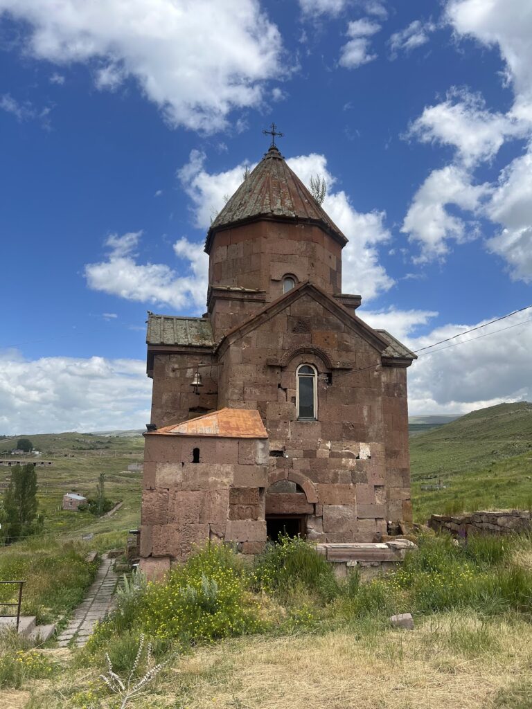
The centrally placed cathedral, known as Katoghike and dedicated to Saint Stephen, is a rectangular, fully domed hall measuring approximately 12.8 by 20 meters. It is built from massive volcanic tuff blocks, some about two meters long. Its cross-in-rectangle plan includes a raised altar platform, side chambers linked to the altar by steps, and one western entrance. Seven arched windows pierce the eastern altar wall, while projecting wall piers and arches articulate the interior.
Blind arcades surround the exterior, carried on paired wall shafts. Larger central arcades frame the windows, with an arched window on the south facade and rectangular windows on the other principal facades. Large triangular niches in the east, north, and south walls lighten the heavy masonry. Above the walls rises a twelve-sided drum supporting an umbrella-shaped roof with a stepped, jagged cornice. Grouped shafts, carved vegetal ornament, palmettes, bead-like bands, torus-and-roll capitals, and a western portal framed by a dentil frieze enrich the exterior. Wahram Pahlawuni’s inscription occupies the wall field beneath the south window.
Northern church of the Mother of God
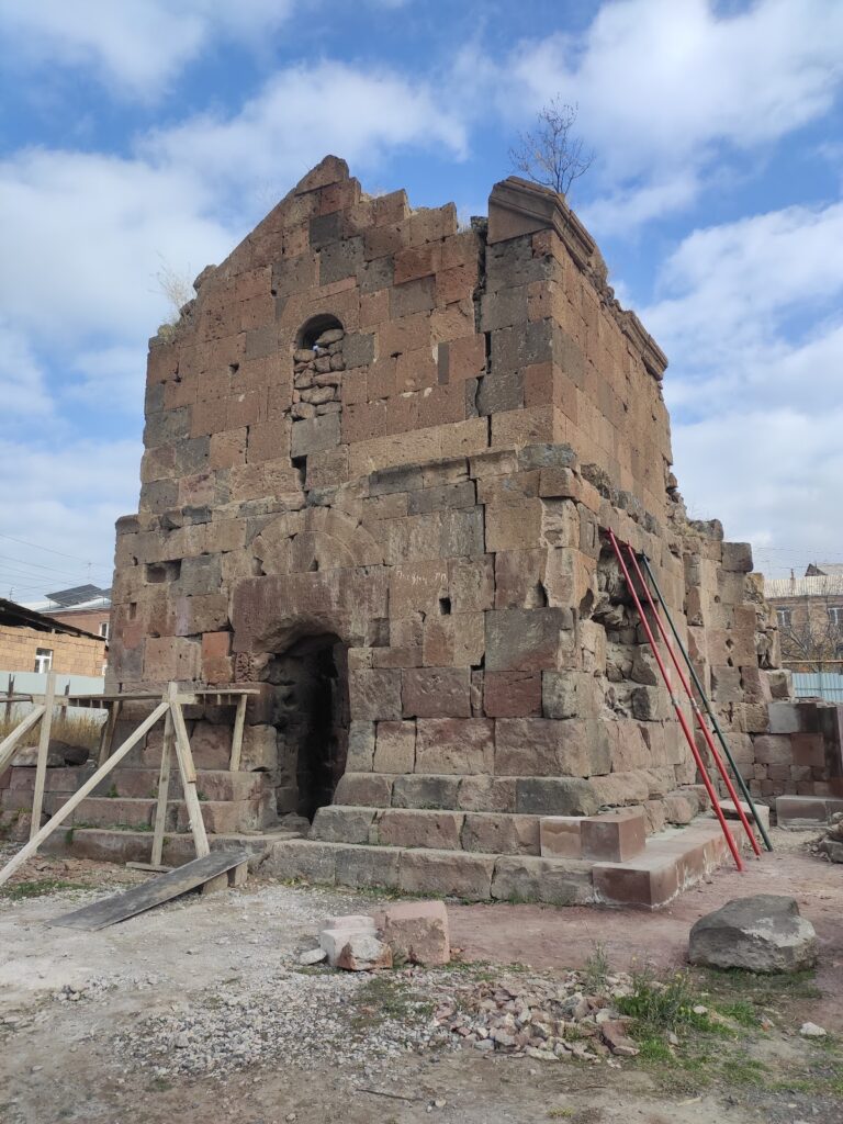
The smaller northern church stands directly beside the cathedral’s north wall and repeats aspects of its design. It was probably built during approximately the same period. Its drum and substantial portions of the north and west facades survive in a reduced form, while the remaining masonry has been stabilized. The former drum was circular and carried a conical roof.
Southern church of Saint Petros
Saint Petros stands about 11 meters south of the cathedral and measures approximately 7 by 9 meters. This small cross-domed church has four rectangular subsidiary rooms, each with a semicircular apse. Its relatively high cylindrical drum supports a conical roof. The restrained exterior is concentrated around the western entrance and a later rectangular relief frieze surrounding the western window slit.
The building belongs to a cross-domed type in which a cross-shaped interior is enclosed within four straight outer walls. Its construction is generally placed between 994 and 1029. It has also been interpreted as the oldest church in the ensemble and as a possible building mentioned by Samuel of Ani.
Western church and funerary hall
Western circular church
A circular church stood west of the gavit. Its surviving remains consist of a stepped base, part of the lowest course of the outer wall, and a triple-stepped roll molding. The plan indicates a circularly enclosed tetraconch, a church with four apses arranged around a central space, together with four rectangular subsidiary rooms and a western entrance.
The church has been dated either to the seventh century or, by comparison with the similarly planned church at Khtzkonk, to the eleventh century. The structure may have remained unfinished. A rectangular wall structure between the church and the gavit has been interpreted as a mausoleum.
Gavit and Pahlawuni mausoleum
The gavit, an Armenian entrance and funerary hall, stood west of the cathedral and measured approximately 13.3 by 12.6 meters. Its surviving fabric includes the ruined west and north walls, the lower masonry of the south wall, four wall bases, and fragments of octagonal columns. Traces of the roof form remain against the cathedral’s west wall.
Tombstones flanked the cathedral’s western doorway within the gavit. An inscription on the northern tomb identifies Wahram Pahlawuni. The hall also held the tombstones of Archbishop Grigor Pahlawuni and his son Apughamr, and functioned chiefly as a dynastic mausoleum for the Pahlawuni family. A late nineteenth-century memorial stone near the former hall marks Wahram’s grave. The gavit also preserved the remains of Kharip, Wahram’s grandson and Grigor’s brother, who was said to have died in battle against an enemy in 1045.
Cemeteries and the Upper Monastery
Great Monastery cemetery
The cemetery of the Great Monastery lies east of the churches. Older tombstones stand level with the church foundations, while later inscribed stones show that a newer burial ground developed over an earlier cemetery. Stones associated with Sophia, Wahram Pahlawuni’s wife, and with the wife of his son Apughamr appear to have been moved from the Upper Monastery cemetery to this lower burial ground.
Upper Monastery cemetery church
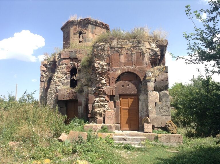
The Upper Monastery on the hill north of the main group formed part of the same complex. Its cemetery church was a four-armed, centrally domed building, of which much of the north wall survives. One interpretation dates it to the seventh century. Another connects its construction with Sophia’s death in 1015 and places its completion before 1029.
The cemetery surrounded a chapel-like structure and contained Sophia’s burial place. Her inscribed tombstone was moved to the Great Monastery cemetery, so the grave’s location within the upper site is no longer identifiable. Fragments of medieval khachkars, carved Armenian stone crosses, are scattered around the northern chapel, while many of the large gravestones there date from the nineteenth century.
Enclosure and surrounding archaeological landscape
The monastery enclosure was built of rough masonry and survives in fragments. Excavations in the 1950s revealed parts of the fortification wall and remains of other buildings, along with architectural fragments, elements from khachkars, and stones bearing construction inscriptions. Across the surviving and ruined buildings, the principal decorative language consists of blind arcades, false arches, grouped shafts, carved niches, and other modeled stone details. Volcanic tuff, rather than marble, was the principal building material, despite an interpretation that the name Marmashen may derive from a word meaning “made of marble.”
The nearby Urartian cuneiform inscription is carved into rock below the village of Marmashen. It belongs to the surrounding cultural landscape rather than to the medieval church fabric, and records Argishti I’s campaign in the region.
Nearby sites