Maiden Castle: A Prehistoric Hillfort near Dorchester
Site at a Glance
- Popularity
- Very High
- Country
- United Kingdom
- Primary era
- Iron Age
- Eras represented
- Stone Age, Iron Age, Classical, Early Modern
- Civilizations
- Celtic, English, Roman
- Site type
- Military
- Remains
- Fortified Town
On this page16 sections
History
Maiden Castle is a prehistoric hillfort, a fortified settlement on elevated ground, near Dorchester in the United Kingdom. Its first fort was built around 600 BC during the Iron Age. Expanded around 450 BC, it became the largest hillfort in Britain and, under some definitions, one of the largest in Europe.
Neolithic and Bronze Age activity
The earliest known activity on the hill was a causewayed enclosure, a prehistoric enclosed area with ditches interrupted by gaps. Built around 4000 BC, it was abandoned around 3400 BC. Gatherings and rites connected with death are among the possible uses proposed for the enclosure. Pottery from distant places suggests that people travelled there, while arrowheads in its ditches may point to a violent end to its use.
Within about 50 years, a bank barrow, a long earthwork that can serve as a monument or boundary, was raised over the enclosure. As it covered no burials, it may have marked a boundary. Activity on the hill was limited for roughly the next 500 years. Around 1800 BC, people cleared the area for farming, but the soil was soon exhausted and the site was abandoned. The low barrow remained and was avoided by later construction.
Iron Age hillfort
The first fort stood on a territorial boundary and was rebuilt at least once. Its eastern double entrance may have let separate farming communities approach the site by different routes. Around 450 BC, the enclosure was greatly enlarged westward to include Hog Hill. As developed hillforts grew in importance, smaller forts in the surrounding area were abandoned. The scale of Maiden Castle’s defenses has been interpreted as expressing status and authority as well as providing protection. Its position near fertile land also supports the view that hillforts helped control farmland and food supplies, and may have served as places for trade. Researchers differ on whether developed hillforts are best understood as town-like settlements or as agricultural centers rather than towns.
The site remained occupied throughout the Iron Age. Around 100 BC, its orderly street pattern gave way to less regular settlement, concentrated toward the eastern end and extending beyond the eastern entrance. Ironworking became an important activity, making the site a major center of late Iron Age iron production in southern Britain.
Roman and later use
Settlement at the hillfort was already declining around 100 BC. By the Roman period, the site lay within the territory of the Durotriges, an Iron Age people whose lands included parts of what is now Dorset and southwest England. Maiden Castle appears to have ceased functioning as a settlement by the end of the first century AD, when Durnovaria, the Roman-era name for Dorchester, became the Durotriges’ regional center. A Roman military presence after the conquest of Britain has been proposed, but the idea that the hillfort became an outpost remains uncertain. A 2015 survey found no evidence of a Roman fort; that year, archaeologists also suggested that the settlement of Duropolis might be connected with the hillfort’s abandonment.
The cemetery’s burials showing violent deaths led Mortimer Wheeler to argue that Roman forces had besieged the hillfort and massacred its inhabitants. That explanation is now considered unlikely: there is no evidence that the dead were killed at the site, and the charcoal layer is linked to ironworking.
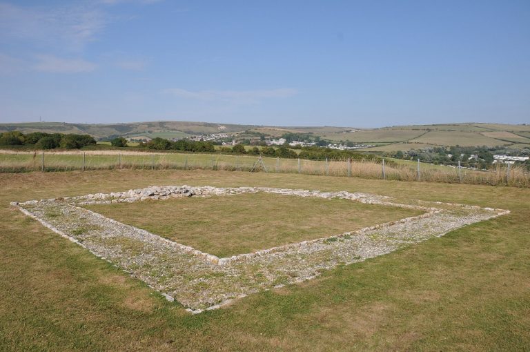
Sometime after AD 367, a Romano-Celtic temple, combining Roman and Celtic religious forms, and nearby buildings were constructed in the hillfort’s eastern half. The eastern gateway was refurbished at about the same time, but the temple gradually fell out of use. The hilltop was abandoned by the sixth century. In the medieval period it served as farmland and pasture rather than as a settlement. Some post-Roman or Anglo-Saxon burials were later made at the site, a few of which may have been Christian. A barn was built over the cemetery in the sixteenth or seventeenth century. After a brief period of cultivation in the seventeenth century, the hill became open pasture and drew antiquarian interest.
Excavation and cultural legacy
The name Maiden Castle appears in a written record from 1607. It has been interpreted as referring to an apparently impregnable fort, or one never captured in battle. Another proposed origin is the Brittonic mai-dun, meaning great hill. Linguist Richard Coates suggested that the name arose in the medieval period and was applied to many places around the country.
Hillforts received growing archaeological attention in the second half of the nineteenth century, including through the work of Augustus Pitt-Rivers. At Maiden Castle, Mortimer and Tessa Verney Wheeler led the first large, systematic excavations from 1934 to 1937, investigating the interior and defenses. Xia Nai took part in the 1936 work. Excavations by Niall Sharples in 1985–86 accompanied repairs to the site after its condition had deteriorated, partly through heavy visitation. The later work used radiocarbon dating, then unavailable to Wheeler, and developed understanding of the site. Maiden Castle became a Scheduled Monument in 1981, giving it legal protection against unauthorized alteration, and English Heritage maintains it.
The hillfort has also inspired works of literature and music. Thomas Hardy’s 1885 story Ancient Earthworks and What Two Enthusiastic Scientists Found Therein features an antiquarian investigating the site, while his 1893 story A Tryst at an Ancient Earthwork centers on an illicit nighttime excavation in the Roman temple. The site is also associated with Hardy’s The Mayor of Casterbridge and the 1967 film adaptation of Far from the Madding Crowd. John Ireland’s 1921 symphonic rhapsody Mai-Dun concerns the hillfort and was adapted for piano duet in 1931. John Cowper Powys published his Dorset-set novel Maiden Castle in 1936.
Remains
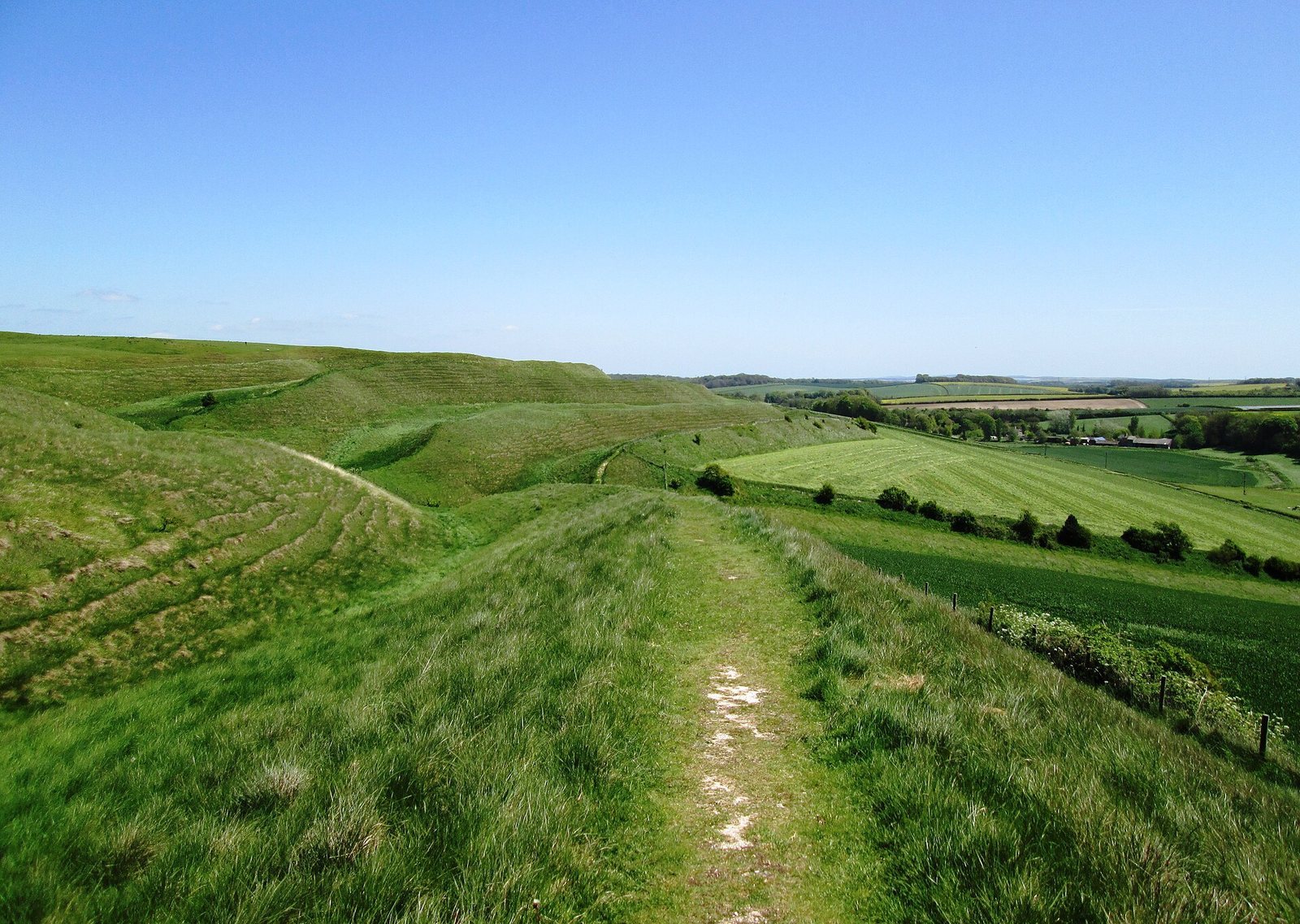
The site occupies the eastern end of a ridge on the north side of the South Winterborne valley, which drains toward the River Frome. Its summit reaches about 132 m above sea level, and the hill rises roughly 40 m above the surrounding countryside. Hog Hill, included within the later fort, is about 1 m higher. The remains include prehistoric earthworks, successive Iron Age defenses and settlement areas, a Roman-period temple, and traces of later farming.
Neolithic and Bronze Age earthworks
Causewayed enclosure
The Neolithic enclosure was oval, with two ditches divided into sections by gaps and a low bank about 17 cm high. Farming and later occupation disturbed its interior. Finds include pottery from coastal and inland areas, arrowheads recovered from the ditches, and a grave containing the remains of two children aged about six or seven.
Bank barrow
The bank barrow was an earth mound about 546 m long, flanked by two parallel ditches about 19.5 m apart. It covered no burial and survived into the Iron Age as a low mound.
Iron Age fortifications and settlement
Defensive earthworks
The first hillfort covered about 6.4 hectares. Its defenses, about 8.4 m high, combined a V-shaped ditch with a raised defensive bank, or rampart, probably faced with timber near the entrances. People entered through a northwest opening or a double eastern entrance. During rebuilding, the ditch was deepened from about 1.5 m to 7 m, and the excavated soil was piled behind the bank. Additional banks and ditches were added outside the eastern entrances, with another bank between them. A bank there also carried a limestone-faced wall built with stone brought from more than 3 km away.
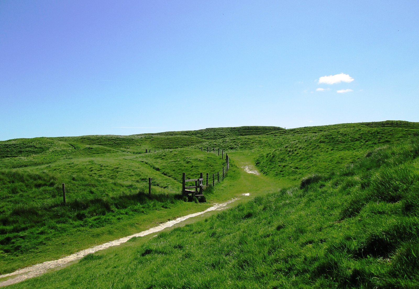
Expansion westward enclosed Hog Hill and increased the fortified area to about 19 hectares. A dry valley divided the two summits, and a shaft dug into the valley may have supplied water. The enlarged defenses included a bank about 2.7 m high and a shallow ditch. The earlier rampart was later raised to about 3.5 m, followed by further ramparts and ditches. The southern side had four ramparts and three ditches, while the steep northern slope had three ramparts. Added earthworks made the eastern approach longer and more complex.
Homes, storage, and ironworking
Iron Age residents lived in roundhouses, circular dwellings common in prehistoric Britain. Later houses appear to have been set out in rows and were broadly similar in size. Four-post structures, each about 2 m square, may have served as granaries. Finds of bronze pins, jewelry, and rivets indicate that bronze objects were reworked at the site, although bronze was not produced there. Pottery initially came mainly from within about 15 km; by the Late Iron Age, around 95 percent came from the area around Poole Harbour, more than 56 km away.
Excavations near the eastern entrance revealed houses, storage pits, and an ironworking area. More than 62 kg of iron slag, the waste left by iron production, came from an area of about 30 square metres. Production at the site has been estimated at roughly 200 kg of iron. The ore was probably brought from specialist production areas, including the Weald, southwest England, and Wales.
Eastern-gateway cemetery
Excavators uncovered 52 burials in part of the cemetery near the eastern entrance; the full number may have been at least twice as high. Fourteen of the excavated burials showed signs of violent death. One body had a Roman catapult bolt embedded in its back.
Roman and later structures
Temple and associated buildings
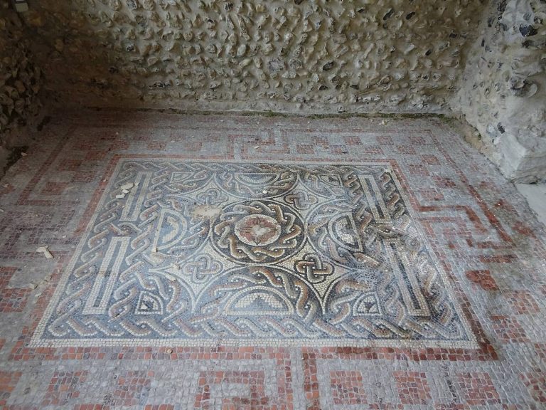
The Romano-Celtic temple had a central room about 6 m square, surrounded by a passage about 3 m wide. A coin hoard beneath the mosaic floor helped establish the date of construction. Nearby stood a rectangular building, about 7.9 by 5.5 m, divided into two rooms and possibly used as a priest’s house. A circular building may have been a shrine, and another shrine may have stood within the eastern gateway.
Later land use
A barn was built over the eastern-gateway cemetery in the sixteenth or seventeenth century. Traces of ridge-and-furrow ploughing, a pattern of raised ridges and intervening furrows, remain from the brief period of seventeenth-century cultivation.