Sandsfoot Castle: A Tudor Artillery Fort at Weymouth


Site at a Glance
- Rating
- 4.5
- Popularity
- Medium
- Country
- United Kingdom
- Primary era
- Early Modern
- External website
- Open
- Eras represented
- Early Modern
- Civilizations
- English
- Site type
- Military
- Remains
- Fort
On this page11 sections
History
Sandsfoot Castle is a Tudor artillery fort in the United Kingdom, built near Weymouth in Dorset by the Crown during the reign of Henry VIII. Completed by 1542, it formed part of the Crown’s Device programme, a royal initiative to strengthen coastal defences against invasion. Positioned opposite Portland Castle, it guarded the anchorage in Weymouth Bay and was designed chiefly to fire on enemy ships.
Construction and Tudor coastal defence
Henry VIII was king of England from 1509 to 1547. His break with the papacy and the international tensions that followed helped create fears of invasion. In 1538, France and the Holy Roman Empire, then a large central European political entity under Emperor Charles V, formed an alliance against England. The Crown responded in 1539 with a programme of new and improved coastal forts, including Sandsfoot Castle.
The castle was administered by a captain appointed by the Crown and cost £3,887 to build. Its position on the cliffs gave its artillery command of the waterway, while its arrangements offered only limited defence against an attack from the land. An early agreement probably required the nearby village of Wyke Regis to support the fort. In return, local inhabitants traditionally enjoyed exemption from taxes and militia duties.
John Leland, an English antiquary, visited soon after construction and called Sandsfoot a “right goodlie and warlyke castle.” His reference to “one open barbican” probably described the gun platform rather than a separate entrance work. Coastal erosion soon affected the fort. By 1583, a large gap had opened on the seaward side, requiring repairs costing £383. John Wadham of Catherston completed the work while serving as both Member of Parliament and Recorder for Weymouth, as well as captain of the castle.
The invasion alarm surrounding the Spanish Armada in 1588, when the Spanish fleet threatened England, led to an increase in the normal garrison by 50 men. Further repairs were undertaken by Captain Sir George Bampfield in 1610 and 1611 at a cost of £211. A survey by Sir Richard Morryson in 1623 judged the castle to be in poor condition and estimated additional repairs at £459. At that time, the garrison consisted of the captain, five gunners, and three soldiers.
Civil War and changing military importance
During the English Civil War, the seventeenth-century conflict between supporters of Charles I and Parliament, Weymouth was mainly Parliamentarian. Sandsfoot Castle, however, was held by Royalist forces from August 1643 until June 1644, after the Earl of Carnarvon entered Dorset with an army. The castle may also have served as a Royalist mint during this period.
The Earl of Essex later restored Parliament’s control over Dorset. William Ashburnham, the Royalist governor of Weymouth, withdrew to Portland Castle without a fight, and Sandsfoot surrendered to Essex after three hours of negotiations. Parliament ordered the garrison to be disbanded in 1647, but the order was not carried out, and John Hayne became captain.
After Charles II returned to the throne in 1660, a second order called for the garrison to be disbanded. The decision prompted a dispute between Humphrey Weld, lieutenant-governor of Portland and captain of Sandsfoot, and Charles Stewart, Duke of Richmond. Wyke Regis petitioned Weld because the village feared that demobilisation would end its traditional exemption from militia service.
Weld was dismissed as lieutenant-governor, and the Duke of Richmond occupied Sandsfoot with his militia. A compromise announced in 1665 restored Weld to his former office but declared the fortress redundant and ordered its demolition. The order was not implemented. Instead, the castle continued to serve as a storehouse until at least 1691, while captains continued to be appointed formally, with Gabriel Stewart holding the post as late as 1795.
Decline, reuse, and preservation
By 1725, Sandsfoot had become ruinous. Early in the eighteenth century, its remains were sold to the town of Weymouth, and some of the stone was reused in the construction of the new town bridge. A nineteenth-century local tradition also associated stone from the castle with several houses in Weymouth. In 1825, the carved Elizabethan arms from the castle were moved to All Saints Church in Wyke Regis.
Continued erosion carried away much of the gun platform and caused successive falls into the sea. The timing of the principal collapse was disputed: Henry Symonds placed the first falls in the eighteenth century, W. Norman dated the main fall to 1835, and T. Groves argued for a collapse later in the nineteenth century. Artists including Samuel Buck, J. H. Grimm, C. Sawyer, and Edward Pritchard depicted the ruins. The castle also appeared in Joseph Drew’s 1876 short novel The Poisoned Cup.
Weymouth Corporation purchased Sandsfoot Castle for the town from the Department of Woods and Forests in 1902 for £150. Safety concerns led to its closure to the public in 1930. During the Second World War, the site housed an anti-aircraft battery forming part of the defences around Portland Harbour. Civic gardens were planted beside the castle in 1951, although the remaining embrasure of the gun platform collapsed during that decade and erosion eventually carried away the platform.
A survey and major repair programme carried out between 2009 and 2012 included a three-dimensional laser survey of the masonry and repairs to the surviving structure. The work enabled the site to reopen in 2012, and Sandsfoot was removed from English Heritage’s register of buildings at risk in 2013. It is protected under UK law as both a Grade II* listed building, meaning a particularly important building of more than special interest, and a scheduled monument, an archaeological or historic site protected because of its national importance. The two designations were made in 1953, on 12 December and 15 May respectively.
Remains
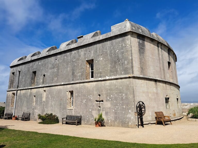
The surviving castle is centred on a two-storey blockhouse of Portland stone, with finely cut ashlar facing over a rubble core. An attached octagonal gun room once extended toward the sea, while rectangular earthworks protected the landward side. Coastal erosion has reshaped the seaward portion, but the remaining masonry and defensive banks still show the relationship between the residential fort and its supporting works.
Principal buildings
Blockhouse
The main blockhouse measures approximately 42 by 32 feet, or 12.8 by 9.8 metres. Its landward gate-tower contained a small first-floor room and was designed for a portcullis, a heavy barred gate lowered vertically in a fortified entrance. The building probably contained four rooms for the garrison’s accommodation and cooking, with staircases leading to the first floor and down into the basement. Parapets, low protective walls along the edges of a fortification, probably protected the building.
Much of the ashlar facing has been robbed, leaving fragmentary but substantial masonry. The roof and floors have also disappeared, while surviving portions preserve the form of the Tudor blockhouse. Historic England regards the ruins as one of the most substantial surviving examples in England of an unaltered sixteenth-century blockhouse.
Octagonal gun room
The attached gun room measured approximately 36 by 28 feet, or 11.0 by 8.5 metres. Its octagonal plan provided five gun embrasures, openings through which artillery could fire, and its flat roof probably supported additional guns. A parapet probably protected the roofline. Coastal erosion reduced the structure to surviving evidence associated with its collapse, including the south-western embrasure on the beach below.
Landward defences and gardens
Earthwork defences
Rectangular earthworks enclosed the landward side of the castle. They probably date from 1623 and included bastions, projecting defensive positions, at the north and west corners. A stone structure of some kind also ran along part of the earthworks. Eighteenth-century descriptions called the defensive ditch a “deep trench,” while nineteenth-century accounts placed its depth at about 12 feet, or 3.7 metres.
Approximately 100 feet, or 30 metres, of the bank and ditch survives. The earthworks measure about 10 metres, or 33 feet, across overall, with a depth of 2.2 metres, or 7 feet 3 inches, between the top of the bank and the bottom of the ditch. The north bastion remains largely intact, while the west bastion survives in a more reduced form.
Sandsfoot Gardens
Sandsfoot Gardens occupy the area outside the entrance to the earthworks. The civic gardens were laid out in 1951 in a Tudor style and include an ornamental pond. Their creation forms part of the twentieth-century setting of the surviving castle remains.
Nearby sites