Archaeological Park Magdalensberg: A Noric and Early Roman Trading Settlement in Austria


Site at a Glance
- Rating
- 4.7
- Popularity
- Low
- Country
- Austria
- Primary era
- Classical
- External website
- Open
- Eras represented
- Classical
- Civilizations
- Celtic, Roman
- Site type
- City
On this page20 sections
History
Archaeological Park Magdalensberg in Austria preserves a Noric and early Roman settlement occupied from the 1st century BC to the middle of the 1st century AD. Developed by the Celtic Norici and Roman merchants, it became an important trading center for Noric iron during the transition to Roman rule. Its occupation lasted about 90 years, after which the settlement was rapidly abandoned and succeeded by the planned Roman city of Municipium Claudium Virunum.
The Noric settlement and Roman trade
The Norici, a Celtic people who occupied the region later known as Noricum, had settled in present-day Carinthia by the 3rd century BC. The area’s rich iron deposits supported trade with Mediterranean communities. In 170 BC, the Norici concluded a hospitium publicum, a formal public hospitality agreement between political communities, with Rome.
Around the middle of the 1st century BC, Roman merchants settled on Magdalensberg and created an emporium, an organized market and trading center. The settlement stood close to the iron-producing regions of the Görtschitztal and Lölling. Its position may also have been connected with the residence of a Noric king or with the protection of a sanctuary on the summit.
The earliest Roman market may have included iron-smelting areas and simple accommodation. Its growing importance is reflected by the dedication of the Youth of Magdalensberg by two merchants during this period. Trade with Rome expanded considerably around the middle of the 1st century BC, probably as Caesar’s campaigns in Gaul and the civil wars that followed increased demand for weapons and other goods.
A forum, a civic and commercial public square, and surrounding commercial buildings were established as the settlement expanded. The complex developed through pre- and early Augustan, mature Augustan, late Augustan and early Tiberian, and early Claudian phases. Merchant buildings show a period of material and cultural prosperity, during which Italian customs were adopted and Roman artistic influence became prominent.
Fortification and integration into Rome
In the 20s BC, the Norici built a fortified complex with a central sanctuary on the summit plateau. Roman fortress architects appear to have been involved in its construction before 20 BC. The fortification was later dismantled during the late Augustan and Tiberian period. It is uncertain whether this followed the peaceful Roman occupation of Noricum in 16 or 15 BC or resulted from a possible earthquake between AD 10 and 20.
Noricum was incorporated peacefully into the Roman Empire in 16 or 15 BC. Noric traditions and tribal structures were largely retained, while the settlement gained a higher status and became the political center of the Roman eastern Alpine region. This change prompted extensive construction and reshaped the forum and its surrounding buildings.
The settlement’s economy centered on the trade and processing of Noric iron, a high-value product known in antiquity as ferrum Noricum. Iron from the Hüttenberg region was processed partly on a wholesale scale. Locally made non-ferrous metal goods were sold within Noricum and in Italy, while gold and rock crystal were also traded or worked at the settlement. Imports included Italic pottery, glass vessels, and metal objects.
Numerous commercial inscriptions, labels attached to money bags, and counting tokens point to several northern Italian trading houses. Customers came from Rome, Italian towns, and especially Aquileia. Coin finds include nearly all Roman denominations of the late Republic and early imperial period, together with Noric silver issues.
Imperial rebuilding and abandonment
Earlier buildings may have been damaged or destroyed by an earthquake between AD 10 and 20, although no historical account records such an event. The forum was substantially reorganized, and the Praetorium was built while commercial buildings were altered. During the reign of Tiberius, a podium temple was constructed on the northern side of the forum. A major fire in the eastern forum area destroyed mainly houses and warehouses.
During the early Claudian period, work began to convert the temple into a peripteral building, meaning a temple surrounded by columns, but the project was not completed. In the Tiberian and Claudian periods, much of the former metalworking quarter was replaced by housing. A large bathhouse was built southwest of the forum, and substantial two-storey residences appeared on the eastern and southern slopes.
By this period, the settlement covered an estimated three square kilometres and probably had between 3,000 and 5,000 inhabitants. Settlement finds end shortly before the middle of the 1st century AD, except at the summit sanctuary, where activity continued into Late Antiquity. The abandonment was rapid, leaving buildings such as the temple unfinished.
In the late 40s AD, the settlement was succeeded by Municipium Claudium Virunum, a planned autonomous Roman city established at the foot of the mountain on the Zollfeld. Virunum inherited the political role of the earlier center and possibly its name. The older settlement’s ancient name has not survived. It has been identified hypothetically with Noreia, with Virunum, or with a settlement that changed its name from Noreia to Virunum, but none of these interpretations is conclusive.
Rediscovery and archaeological investigation
After its abandonment, the settlement rapidly decayed and was forgotten. Knowledge of the earlier occupation survived at least from the discovery of the Youth of Magdalensberg in 1502. The position of a church directly above a Celtic shaft has prompted the hypothesis that the summit continued to function as a sanctuary.
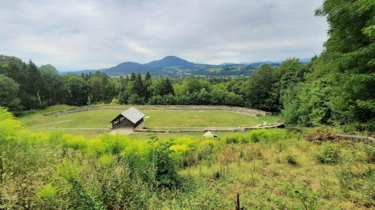
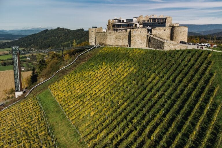
The first excavations took place in the mid-19th century. Annual excavation campaigns have been conducted since 1948, exposing, conserving, and partly reconstructing much of the settlement, particularly around the forum. The excavated buildings are presented largely as an open-air museum, and the Archaeological Park Magdalensberg operates as a branch of the State Museum of Carinthia.
Remains
The settlement extended across the slopes and summit plateau of Magdalensberg. Its central Roman area occupied a shallow depression on the southern slope, about 200 metres below the summit. A level forum was created by cutting into the mountainside and placing earth and rock along its southern side. The summit sanctuary and its fortifications formed a separate upper complex, while residential, commercial, industrial, and administrative buildings spread across terraces below.
Summit fortifications and sanctuary
Ramparts and gates
Excavations on the northern side of the mountain in 2006 dated one of several visible ramparts to 40–30 BC. It was an earthwork without stone facing or timber reinforcement, with a flat-bottomed ditch and a counterscarp, the outer slope of a ditch. Its form resembles the Fécamp type known mainly from Late Celtic central and northern France.
The summit sanctuary was enclosed by a monumental fortification. At the approach to the church, surviving walls belonged to a gate complex with a 30-metre-long corridor gate and a box gate in front. Large projecting bastions flanked the entrance, and a glacis, or sloping defensive bank, extended for 90 metres and measured 30 metres across.
The summit plateau had two circuits of walls. The outer walls reached 2.1 metres in thickness at their bases, while a ditch up to 3 metres wide ran between the circuits. A third circuit with another gate stood inside the fortification, and the gates may have carried marble facades. The masonry, wall dimensions, and mortar indicate construction by Roman military builders before 20 BC. The scale of the complex has also prompted the hypothesis that it served as a princely seat constructed under the Noric king, although only wall foundations survive.
Summit ritual structures
West of the church, an excavated structure had either a clay floor or a rock surface raised 50 centimetres and covered with yellow mortar. Round timber posts had been set into holes cut in the rock. Two pits, each 1.5 metres deep, lay within the building; they were carefully filled and covered with marble slabs. The remains may represent a roofed structure comparable to Late Celtic sanctuaries at Gournay-sur-Aronde and Acy-Romance.
Near the church, emergency excavations in 2006 revealed a podium temple. The rock was levelled across an area about 25.5 by 16.5 metres to create a platform approximately 2 metres high. The podium was faced with Kraiger marble, and its floor was paved with slate slabs. Its proportions were about 85 Roman feet long, 55 feet wide, and 7 feet high, suggesting a six-column facade approached by an open staircase on the west.
Associated finds include a clay figure of a boatman interpreted as a votive offering, part of an offering bowl, fragments of a draped statue, roof tiles, antefixes, and pieces of a cornice. The Youth of Magdalensberg may originally have stood in this sanctuary. The temple is broadly dated to after the middle of the 1st century BC, and the sanctuary remained in use into Late Antiquity.
A later rock sanctuary behind the temple consisted of an open niche with a hearth and a setting for an altar. Behind it lay a shaft containing vessel fragments and bones from domestic animals, poultry, bears, and wild boar. Three mountain pits were found in the temple district, including one with a deliberately cut human skullcap. The complex may have occupied an older Celtic sacred place.
Forum and civic buildings
Forum and temple district
The forum measured 110 by 42 metres, and the route to the summit ran along its southern long side. In its earlier phase, associated with the Noric kingdom, a merchant basilica occupied the eastern side. A basilica was a large public hall used for commercial, judicial, administrative, or representational purposes. Merchant tabernae, meaning shops, workshops, offices, or commercial rooms, stood along the other sides. The first tabernae were wooden and were soon replaced by stone houses with cellars.
In the imperial phase, the merchant basilica was demolished and its functions moved to the Praetorium on the northwestern side. A temple replaced the northern tabernae. New tabernae served as shops and workshops and had large folding gates that allowed goods to be moved through the buildings.
The temple district stood on the northern side of the forum, about 2 metres higher on the mountainside, and measured 54.6 by 45.3 metres. In its final planned form, the podium temple was 30 metres long and 17.6 metres wide. Its enclosed central chamber, or cella, measured 21 by 11 metres and was probably surrounded by either eleven or six columns. Broad courtyards and halls extended along both long sides.
Only the temple’s substructure survives. It contains two basement rooms, or favissae, reached by a staircase on the mountainside. These spaces stored public funds. The large temple had a smaller predecessor and was probably dedicated to Divus Augustus, the deified Emperor Augustus, and Dea Roma, the personification of Rome in imperial religion. If so, it would be the earliest known imperial cult temple in present-day Austria.
A second temple begun under Claudius remained unfinished, including its staircase from the forum. Much of its marble facing was probably reused at Virunum. Remains of tabernae dating from the middle of the 1st century BC lie beneath the forum-facing side of the temple district.
Praetorium and council room
The Praetorium, also called Room M, stood west of the temple district on the northern side of the forum. This basilica-like building measured 100 Roman feet, or 29.6 metres, in length and was surrounded by halls on its northern, southern, and eastern sides. A double staircase on the west led to a deliberation room and a tribunal, or suggestus, a raised platform from which officials addressed the public, delivered judgments, issued announcements, and conducted votes.
This interpretation remains disputed. The building has also been understood as a basilica, an archive known as a tabularium, or an assembly hall. A little-explored building on the plateau to the northwest may have served as the official building.
Room K, identified as the council or deliberation room, contained Tiberian wall paintings. Their design used rectangular fields in several colors.
Representation House
The Representation House formed the central block of a north–south-oriented complex on the western side of the forum. The complex included a three-storey northern block with smaller rooms, the central Representation House, and a later addition with two halls. The central block contained an entrance corridor, an anteroom, a niche room, and an apse hall known as Room A.
In its first phase, Room A and its apse belonged to a 12-metre-long basilica that may have served as the office of the market administrators. During the second phase, associated with the Roman occupation in 15 BC, the basilica became a three-room building with an entrance corridor. Room A received underfloor heating, a water basin was installed in the apse, and a probable bathtub lay to the north. A reservoir west of the building supplied water through a lead pipe.
The third phase followed the fire of AD 15. The room arrangement remained unchanged, but the floor of Room A was raised by about 1 metre and the basin was covered. The building probably then served as a meeting hall for discussions between Roman representatives and Noric envoys. Room B, which had 13 wall niches, probably functioned as an archive.
Residential and industrial districts
NG houses and workshops
The residential and workshop district known as the NG buildings occupied the hillside east of the forum. It contained large workshops for non-ferrous metals, excavated smelting furnaces, and locally made cauldrons, buckets, bottles, pots, and brooches in indigenous forms.
The houses were arranged across several terraces. House NG/33 is well preserved. Its bedroom had a terrazzo floor, while its living room had a mortar screed and a niche stove. Non-load-bearing walls used opus craticium, a timber framework filled or covered with wattle and mortar.
Eastern gate and southern residences
A double gate stood at the highest point on the edge of the hollow beside the ancient eastern road. Built during the Tiberian period after AD 14, it was probably a representative building rather than a city gate because the settlement continued east of it. Small workshops stood in a row on the upper terrace beside a path leading from the double gate toward the main road.
South of the forum, large residential buildings occupied several mainly artificial terraces. Smaller irregular houses dating to around 30 BC were replaced during the Tiberian period by more regular structures. Some rose to two storeys and had interior areas of up to 150 square metres. Their largely wooden upper floors served partly as storage areas or shops.
AA buildings and gold processing
The AA buildings lay below the road crossing the excavation area, a route also used in antiquity. One large building contained a six-room bathing area, a large bakery, a large kitchen, and a 19-by-24-metre courtyard surrounded by columns. It was built during the Tiberian and Claudian period over earlier taberna-like structures.
The lower AA buildings extended eastward across three terraces. Some were elongated two-storey structures with ridge heights of up to 15 metres. Under Emperor Caligula, an imperial gold-smelting facility was established there. Excavations uncovered two gold-ingot moulds, rock crystals stated as weighing 50 to 50 kilograms, and the remains of 19 gold-smelting furnaces in two rooms.
The furnace rooms were enclosed by walls up to 13 metres high and could be reached only by wooden stairs. The gold came from the Gastein Tauern. A storage hall, AA/44, adjoined the furnace rooms and had a vault-like chamber called the Thesauros, or AA/45. Inscriptions on the moulds indicate that the ingots belonged to the emperor.
Construction and decoration
Building materials and engineering
Most walls used opus incertum, a Roman method in which irregular stones were set into concrete. Two outer layers of rubble enclosed a concrete core mixed with rock fragments, slag, and charcoal. Stone came mainly from the mountain itself or from quarries on its northern side. About 95 percent consisted of Ordovician tuffs or tuffites and basalts.
Roman cast concrete, or opus caementicium, formed a 6-by-10-metre water basin below the bathhouse. Room A in the Representation House had a concrete floor reinforced with iron bars made from Noric iron. Dating to around AD 15, this floor is described as the oldest known use of steel reinforcement in a concrete floor.
Marble was used for tombstones and for the cladding of official buildings. Little of that facing survives, probably because it was reused at Virunum. Early tombstones used lower-quality local marble, while later examples used stone from Gummern, Krastal, and the Spitzelofen quarry, up to 50 kilometres away in a straight line. Fired roof tiles are exceptionally scarce. Buildings may have been roofed with wooden shingles, or the tiles may have been removed and reused at Virunum.
Wall paintings
Wall paintings from several rooms span about 80 years, from the late Caesarian period to the late Tiberian period. Their strong stylistic connections with the classical tradition of southern Italy and their refined execution distinguish them from a merely local provincial style. Paintings from the final Claudian phase are not known because the associated buildings were unfinished.
Room OR/23 contains the simple Second Pompeian Style, a Roman painting tradition that commonly used architectural illusion, dating from after the middle of the 1st century BC. Four panels on its southern and western walls depict deities including Athena with her shield and Aphrodite with the child Eros. The Aphrodite image derives from a Greek work created shortly after the middle of the 1st century BC.
Room K contains reconstructed examples of the mature Third Pompeian Style from the reign of Tiberius. Three walls have ten colored fields with black base strips and red, white, yellow, and blue panels. Ionic capitals, a pediment with an ornamental frieze, dolphins, golden shells, and a perspective-painted round-arched frieze on brackets complete the decoration. The spandrels contain bull skulls and sound basins.
Fragments from Room AA/15 were recovered from rubble and reassembled in the Iphigenia complex. The paintings include mythological and pastoral scenes, among them Theseus and Peirithoos before Persephone in Hades, a shepherd scene with a flute-playing youth and a mountain god as judge, Dionysus with dancers identified as Cassandra and Ino, and Iphigenia holding a greenish statue of Artemis. The work has been tentatively attributed to a master from the Hellenized southeastern Mediterranean.