Lancaster Roman Fort: A Roman Military Site in Northwest England
Site at a Glance
- Popularity
- Medium
- Country
- United Kingdom
- Primary era
- Classical
- Eras represented
- Classical
- Civilizations
- Roman
- Site type
- Military
- Remains
- Fort
On this page14 sections
History
Lancaster Roman Fort was a Roman military installation on Castle Hill in northwest England, United Kingdom. The Romans probably built its first timber fort around AD 80, likely to command a crossing of the River Lune. The initial construction has been associated with the reign of either Emperor Vespasian or Emperor Titus. Roman coins dating to the early 60s AD, found in Lancaster, point to activity in the area before the fort was established.
Roman occupation
Later in the first century, the fort’s northern defences were extended by 37 metres. The fort then appears to have been abandoned for a time, although the cavalry unit ala Augusta may have served there during part of this period. It was occupied again in the second century and rebuilt in stone around AD 102. Further intervals of abandonment seem to have occurred in the mid-second century and near the start of the third.
In the mid-third century, an inscription records rebuilding work on the bathhouse and a basilica, a large public hall. The garrison around this time apparently included the auxiliary cavalry unit ala Sebosiana and the auxiliary troop unit numerus Barcariorum Tigrisiensium. Around AD 330, extensive remodelling began. The fort was enlarged further and appears to have remained in use until Roman rule in Britain ended in the early fifth century; it was abandoned during that century. Its late Roman form is the only known example of its type in northwest Britain.
The fort’s Roman name is uncertain. A milestone found four miles from Lancaster carries an inscription ending “L MP IIII,” meaning “from L, four miles.” In 1998, historian and archaeologist David Shotter proposed that Galacum, previously associated with the fort at Over Burrow, was a better identification for Lancaster.
The fort is thought to have given Lancaster its name. The Domesday Book, an English survey completed in 1086, gives the settlement’s name as Loncastre. Lon refers to the River Lune, while cæster derives from the Latin word castrum, meaning “fort.”
After Roman rule
A Saxon monastery probably occupied the site from the sixth century. In 1094, Roger de Poitou, a Norman nobleman, founded a priory there for Benedictine monks, followers of the Rule of St Benedict. A priory was a monastery headed by a prior, and the new foundation replaced the earlier religious establishment.
Modern identification and protection
In 1950, the surviving fourth-century wall was identified as part of the Roman fort. A Romano-Celtic religious temple was discovered near Lancaster Castle in 2023. The fort area is protected as a scheduled monument, and Wery Wall has Grade II listed status.
Remains
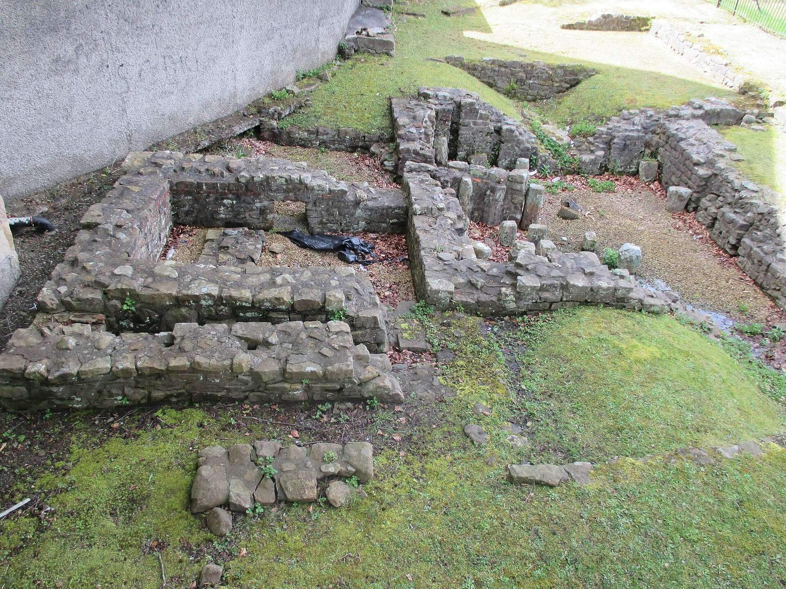
On Castle Hill, the fort developed from a timber and earthwork enclosure into a stone stronghold and then an enlarged late Roman circuit. Its greatest extent was about 9–10 acres. Earthworks and ruined masonry survive, including Wery Wall, which forms part of the late fort’s northern defences.
Fort defences
Early enclosure
The first fort had a rectangular plan with rounded corners. Its rampart was made of clay and turf and was protected by two V-shaped ditches. The main gate stood on the east side, aligned with Church Street. The northern wall ran east to west north of the Old Vicarage and measured about 187 metres long.
Second-century stone defences
The second-century fort had a stone retaining wall almost two metres thick in front of the earlier clay-and-turf rampart. Earthworks at Vicarage Field are thought to mark the fort’s northwest corner.
Late Roman circuit
The remodelling around AD 330 included a northern wall about three metres thick. It ran southwest across remains of the earlier forts and had polygonal bastions, projecting defensive platforms, on its outer face. A fragment of a southern wall was recorded in the eighteenth century. It was not parallel to the northern wall and is thought to belong to the late fort, whose plan therefore differed from the standard Roman arrangement.
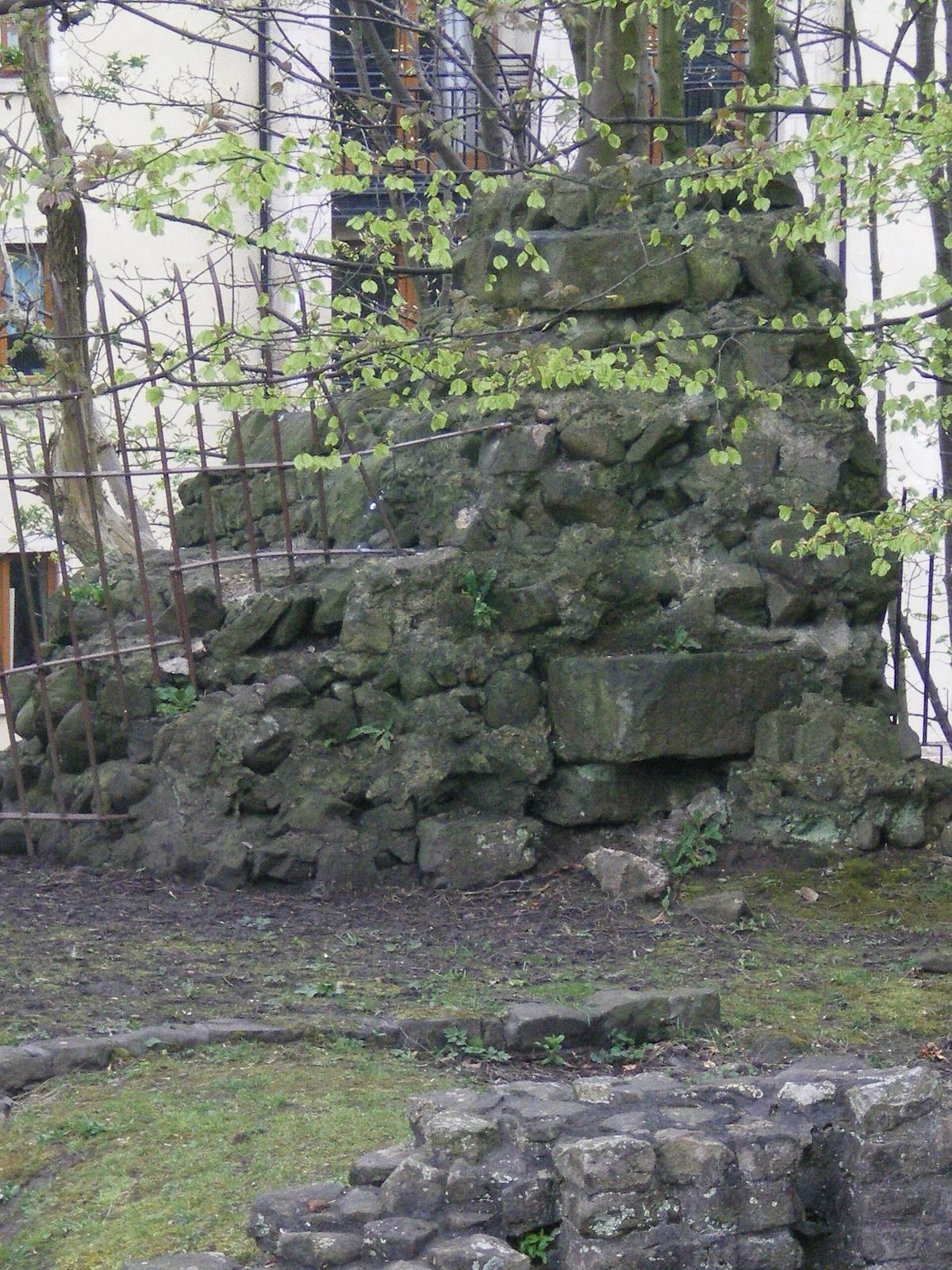
Wery Wall
Wery Wall is the only surviving ruined wall of the fourth-century fort. It is thought to form the core of an external bastion at the northern angle of the fort’s circuit and may have supported a heavy artillery piece.
Settlement and associated buildings
Settlement outside the eastern gate
A substantial vicus, a settlement outside a Roman fort, developed along Church Street beyond the eastern gate. The north gate of the later fort may have stood east of Vicarage Lane, where a road led toward the River Lune crossing.
Bathhouse and courtyard building
Remains of a bathhouse near Wery Wall, close to the junction of Bridge Lane and Church Street, were discovered in 1812. The building incorporated a reused inscription of Postumus, ruler of a breakaway Gallic Empire, dating to 262–266. The bathhouse was associated with a large courtyard building in the settlement. This may have been an important residence or a mansio, a stopping place used by officials and travellers. The courtyard building was demolished to make way for fourth-century construction.
Religious temple
A Romano-Celtic religious temple was discovered near Lancaster Castle in 2023.