Koh Ker: The Khmer Imperial Capital of Chok Gargyar
Site at a Glance
- Rating
- 4.7
- Popularity
- Very Low
- Country
- Cambodia
- Primary era
- Medieval
- Eras represented
- Medieval
- Civilizations
- Unclassified
- Site type
- City
On this page29 sections
History
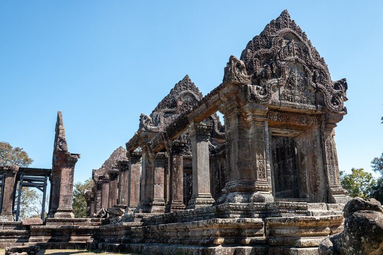
Koh Ker is an Angkorian archaeological complex in Preah Vihear Province, Cambodia, built by the Khmer civilization and briefly used as the empire’s capital in the tenth century. Known in Old Khmer as Chok Gargyar and in Sanskrit as Lingapura, meaning “city of lingas,” it became the royal center of Jayavarman IV during an ambitious period of construction and political change.
Before the capital
Occupation at Koh Ker began well before the tenth-century capital. Excavations carried out in 2015 produced radiocarbon dates indicating substantial activity in the seventh or eighth centuries, often associated with the Chenla period, an earlier phase of mainland Southeast Asian history before the Angkorian Empire. Some pottery may be even earlier and connected with the Funan period. More than 24,000 artifacts and biological remains from three test areas indicate over a millennium of activity, including connections with China, Thailand, Vietnam, and possibly Persia.
The location also formed part of a major route between Angkor and Beng Mealea, Preah Vihear, Phimai in Thailand, and Wat Phu in southern Laos. This network connected the Mekong basin with northeastern Thailand. Archaeological research has confirmed a Khmer route between Koh Ker and Wat Phu, helping explain the settlement’s position within wider regional movement and administration.
Jayavarman IV and the new capital
Jayavarman IV established the new capital at Koh Ker in the early tenth century. A 921 inscription records the transfer of the devaraja, the royal “god-king” cult centered on a consecrated linga, from Yashodharapura to Chok Gargyar. The change initially created competing political centers, but Jayavarman IV secured the throne after the death of Isanavarman II.
Jayavarman IV ruled from Koh Ker approximately from 928 to 941, although some chronologies place his accession in 921 or 928. Tradition connects him closely with the region, possibly as its local ruler or as someone born there. His government financed a large building program through rice taxation and the organization of labor from different provinces. A city, a large reservoir, temples, and shrines were constructed, while inscriptions suggest that more than 10,000 people lived at Koh Ker during its period as capital.
Koh Ker was already a center of Shiva worship before it became the imperial capital. Shiva-lingas, symbolic representations of the Hindu god Shiva, were present in the area, and Jayavarman IV was a committed worshipper of the deity. In 921, a royal linga named Tribhuvaneshvara, or “Lord of the Threefold World,” was consecrated as the principal cult image of the new capital.
Return to the Angkor region
Jayavarman IV’s son, Harshavarman II, ruled at Koh Ker from about 941 to 944. In 944, his cousin Rajendravarman II became king and transferred the capital back to Yashodharapura in the Angkor region. Koh Ker therefore served as the imperial capital for only a short period, although building and religious activity continued after the political center moved away.
An inscription records work under Udayadityavarman I in 1001. In the late twelfth or early thirteenth century, Jayavarman VII built Prasat Sralau, also known as Prasat Andong Kuk, as part of his network of more than 100 hospital-sanctuaries. Another sanctuary was added at Koh Ker in the early thirteenth century. These later works show that the site remained connected to Khmer religious and administrative activity after its brief role as the royal capital.
Koh Ker’s strong association with Shiva helped preserve the character of its earlier sanctuaries. Later Khmer rulers adopted Buddhism and ordered religious changes at temples elsewhere, but Koh Ker’s remote position limited many of those alterations. After the decline of the Khmer kingdom and the movement of the capital toward Phnom Penh, the settlement was abandoned and gradually covered by forest.
Rediscovery and archaeological research
French explorers and researchers began recording Koh Ker during the late nineteenth century. Louis Delaporte investigated the site in 1873, and his description, published in 1880, provided the first recorded account after its rediscovery. Jules Harmand visited in 1876, while Étienne Aymonier studied the monuments and inscriptions in 1882. Étienne Lunet de La Jonquière surveyed the site in 1900 and listed 19 monuments in an inventory published between 1902 and 1911.
George Groslier examined the northeastern area in 1923, and Henri Parmentier undertook further research from 1924, including aerial archaeological work in 1935. Parmentier interpreted the northeastern architecture as transitional, with building traditions associated with wooden gable roofs translated into stone. Researchers developed the idea of a distinctive Koh Ker style during the 1940s, and gable pediments supporting that interpretation were identified in 1954.
Research was interrupted by the Khmer Rouge period and the wider Cambodian conflict. Mine and unexploded-ordnance clearance began in 1992 through the Cambodian Mine Action Centre and continued into the twenty-first century. Satellite analysis, Japanese surveys, and Cambodian, French, Japanese, and Australian research expanded knowledge of the archaeological landscape. Japanese teams recorded the locations of 184 monuments over five years.
From the late 1960s through the 1990s, looting removed many sculptures and other antiquities from Koh Ker, and numerous objects were trafficked abroad. Some were taken into government custody for protection, while others entered museums and private collections outside Cambodia. Efforts to recover looted sculpture included a 2012 legal action by the United States and Cambodia concerning a statue associated with the site.
The Cambodian Law on the Protection of Cultural Heritage, enacted on 25 January 1996, strengthened legal protection. A royal decree in 2004 established Koh Ker as a specially protected area, and the measures were revised in 2020. The protected area covers 81 square kilometers. UNESCO inscribed Koh Ker, Archaeological Site of Ancient Lingapura or Chok Gargyar, as a cultural World Heritage site on 17 September 2023 under criteria (ii) and (iv).
Remains
Koh Ker’s archaeological landscape extends across hilly, seasonally forested terrain between approximately 60 and 115 meters above sea level. The ground generally descends from south to north. More than 180 sanctuaries lie within the protected area, while other inventories identify approximately 60 principal built monuments and 127 recorded archaeological elements. These include temples with shrines, platforms, laterite structures, boundary markers, ponds, embankments, quarries, and other remains. Brick buildings have generally survived better than laterite structures.
Water and urban landscape
The Rahal reservoir
The Rahal is the largest physical feature of the ancient capital. This rectangular baray, or large artificial reservoir, measures about 1,200 meters from north to south and 560 meters from east to west. Its long axis turns approximately 15 degrees west of north, apparently following the terrain, and nearby structures share a similar orientation. The reservoir was partly cut into bedrock and includes laterite water-control structures and three laterite dams with stepped sides. Much of the basin is now dry and covered with grass, although pools remain near the double sanctuary.
The ancient urban center
The ancient urban center occupied the northeastern corner of the Rahal. Earlier interpretations described a square city wall measuring about 1,200 meters on each side, but later research understands the linear remains as embankments connected with canals and water management. No remains of the city’s wooden buildings have been identified, leaving the urban center represented mainly by its earthworks and hydraulic setting.
Trapeang Andong Preng
Trapeang Andong Preng lies about 200 meters south of the Prasat Thom–Prang complex. Its excavated basin is approximately 40 meters long, with laterite steps on all four sides. During the rainy season it held water to a depth of about 7 meters. The basin was not part of a temple and may have served as a royal bath. A wooden royal palace was formerly located nearby.
Prasat Thom and Prang
The central complex
The central Prasat Thom complex lies northwest of the Rahal. Its principal axis extends approximately 1.17 kilometers from east to west in one description, while the main monumental complex is also described as about 800 meters long. The axis turns roughly 14 to 15 degrees and intersects the orientation of the Rahal at a right angle. It also corresponds to the direction of sunrise at the Khmer New Year.
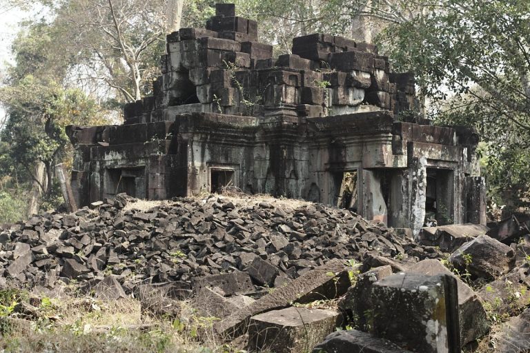
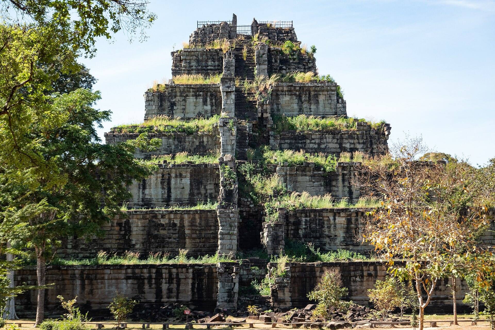
The Prasat Thom–Prang complex has a linear plan rather than a series of concentric enclosures. Its outer enclosure measures approximately 328 by 151 meters and is divided into eastern and western courts. The eastern court, about 153 meters long, contains Prasat Thom and its moat. The western court, about 171 meters long, contains Prang, the seven-tiered pyramid. Much of the complex is in poor condition, although Prasat Krahom and Prang survive comparatively well.
The palaces
Two structures known as palaces stand on the eastern side of the present division through the complex. Each consists of four rectangular buildings surrounding a court. The eight buildings contain three rooms each, and some include columned patios. Their purpose remains uncertain, although they may have supported meditation or prayer by the king or nobles. The palaces stand approximately 185 meters from the nearest monument.
The entrance pavilion
A sandstone entrance pavilion stands about 45 meters from the double sanctuary. It has a cruciform plan, with a crossbar approximately 60 meters long and a longitudinal section about 30 meters long. Two halls run parallel to the crossbar. Behind it are the ruins of two large laterite towers.
Prasat Krahom
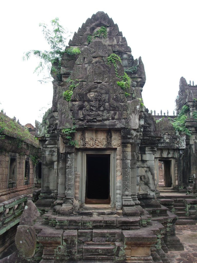
Prasat Krahom, whose name means “red,” is a red-brick entrance tower with a cruciform plan. It remains comparatively well preserved. The tower once housed a 3.5-meter-high image of Dancing Shiva with five heads and ten arms. The sculpture is now broken, while a hand fragment about half a meter long is preserved in the National Museum in Phnom Penh.
The moat and sanctuary
A moat approximately 47 meters wide surrounds Prasat Thom in the eastern court. Eastern and western dams cross it, and naga balustrades line the dams. A naga is a serpent-like mythological being frequently represented in Khmer architecture. A columned gallery once stood on the eastern dam, while large Garuda figures stood behind the nagas on its eastern side.
Parts of Prasat Thom, including its moat and inner enclosure, probably predate 921. Jayavarman IV expanded the sanctuary, which has two enclosures within the moat. The inner wall is brick, while the outer laterite wall measures approximately 66 by 55 meters and has entrances on its eastern and western sides. Rectangular structures occupy the space between the walls and may represent later additions. The central sanctuary stands opposite two libraries, while nine towers on a rectangular platform form two rows of five and four. Twelve smaller prasats, or Khmer sanctuary towers, surround the platform in groups of three. All 21 towers once housed lingas.
Prang
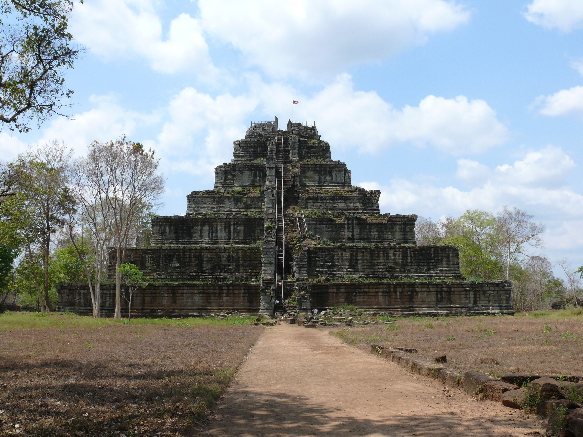
Prang is a seven-tiered pyramid probably intended as Jayavarman IV’s state temple. Construction began in 928. Its square ground-level platform measures about 62 meters on each side, and the pyramid rises approximately 35 to 36 meters. A steep staircase ascends the northern side. The original staircase is badly damaged, and an earlier twentieth-century bamboo ladder is unusable; a newer staircase reaches the upper edge of the pyramid.
A huge linga once stood on the upper platform. It was probably more than 4 meters high and weighed several tons, while one inscription gives an approximate height of 4.5 meters. Inscriptions describe it as the tallest and most beautiful Shiva-linga, and some researchers propose that it stood inside a shrine about 15 meters high. Reliefs of Garudas on the seventh tier have led to the interpretation that this level formed the shrine’s platform.
The Tomb of the White Elephant
Behind the pyramid court is a precisely circular artificial hill covered with trees, known as the Tomb of the White Elephant. Its purpose is uncertain. It may be the foundation of a second pyramid or, in another interpretation, the burial place of Jayavarman IV.
Southern access-road sanctuaries
Prasat Pram
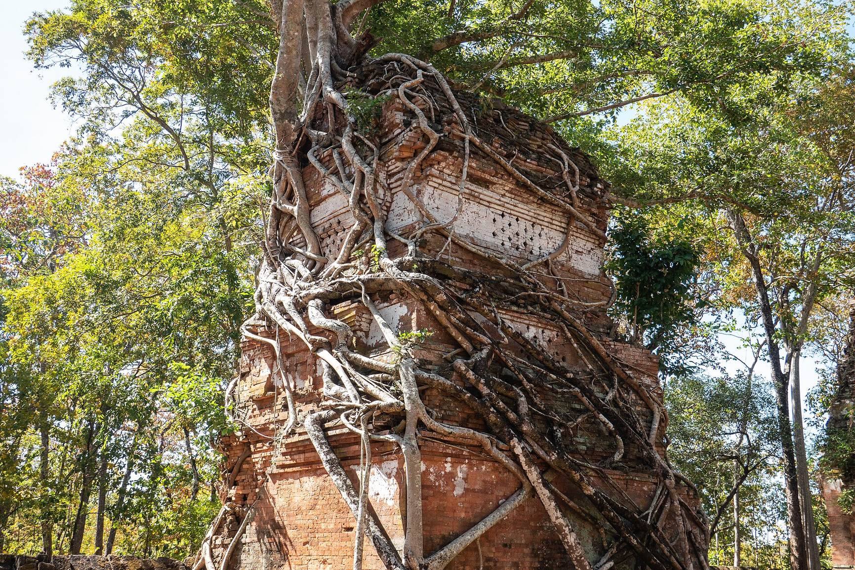
Prasat Pram is a five-tower sanctuary along the southern access road. Three east-facing brick towers stand in a row on one platform, with the central tower slightly taller. Each once contained a linga. Two west-facing structures stand before the platform. One has diamond-shaped openings and may have been a fire sanctuary, while the other is a smaller laterite building in poorer condition.
The towers were originally coated with white stucco, traces of which remain, and roots now envelop two of them. An enclosure surrounds the group, with a collapsed eastern entrance structure. A damaged lion and fragments of a four-armed standing Vishnu from Prasat Pram are preserved in the National Museum in Phnom Penh.
Prasat Neang Khmau and Prasat Bak
Prasat Neang Khmau lies about 12.5 kilometers south of the principal pyramid. This early tenth-century temple is built of sandstone and brick and was dedicated to Shiva. Its fire-damaged or blackened exterior probably explains its modern name, “Black Lady.”
Prasat Bak is a small square laterite sanctuary measuring approximately 5 meters on each side. It is now in very poor condition. A colossal seated image of Ganesha remained there until 1960; the sculpture is now held in a collection outside Cambodia.
The northern sanctuary
The northern sanctuary in this access-road group has two enclosures. Its collapsed entrance was itself a sanctuary with a square central room measuring about 4 meters on each side. Three partly collapsed laterite towers stand on one platform, with the remains of two brick libraries in front. Sculptures of the fighting monkey kings Sugriva and Valin were found there and are now in the National Museum in Phnom Penh. A fragment of a multi-armed Vishnu was found in front of the central tower. Five inscriptions record the names and functions of groups associated with the temple.
Eastern and ring-road sanctuaries
The linga temples
Prasat Thnoeng, also called Linga Temple 1, Prasat Balang, or Linga Temple 2, Prasat Balang Tbong, or Linga Temple 3, and Prasat Andong Kuk, or Linga Temple 4, form part of the eastern or ring-road group. Other monuments in this area include Prasat Sralau, Prasat Krachap, Prasat Plae Beng, Prasat Banteay Pir Choan, Prasat Chrap, Prasat Damrei, and Prasat Khtum.
Prasat Balang is a square laterite linga shrine on a platform, with one doorway and an open roof. Its linga is about 2 meters high, nearly 1 meter in diameter, and weighs several tons. It was carved together with its yoni from the bedrock. A yoni is the associated base of a linga, often fitted with a channel and spout for ritual liquid. The yoni is about 1 meter high, and its channel and spout remain intact. Reliefs on the yoni and Garudas at its four corners were looted.
Prasat Thnoeng resembles Prasat Balang. Looters tried to cut away its linga but did not remove it, leaving a gash approximately half a meter deep. The linga remains standing on its damaged yoni.
Prasat Sralau
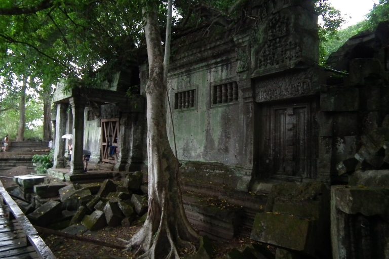
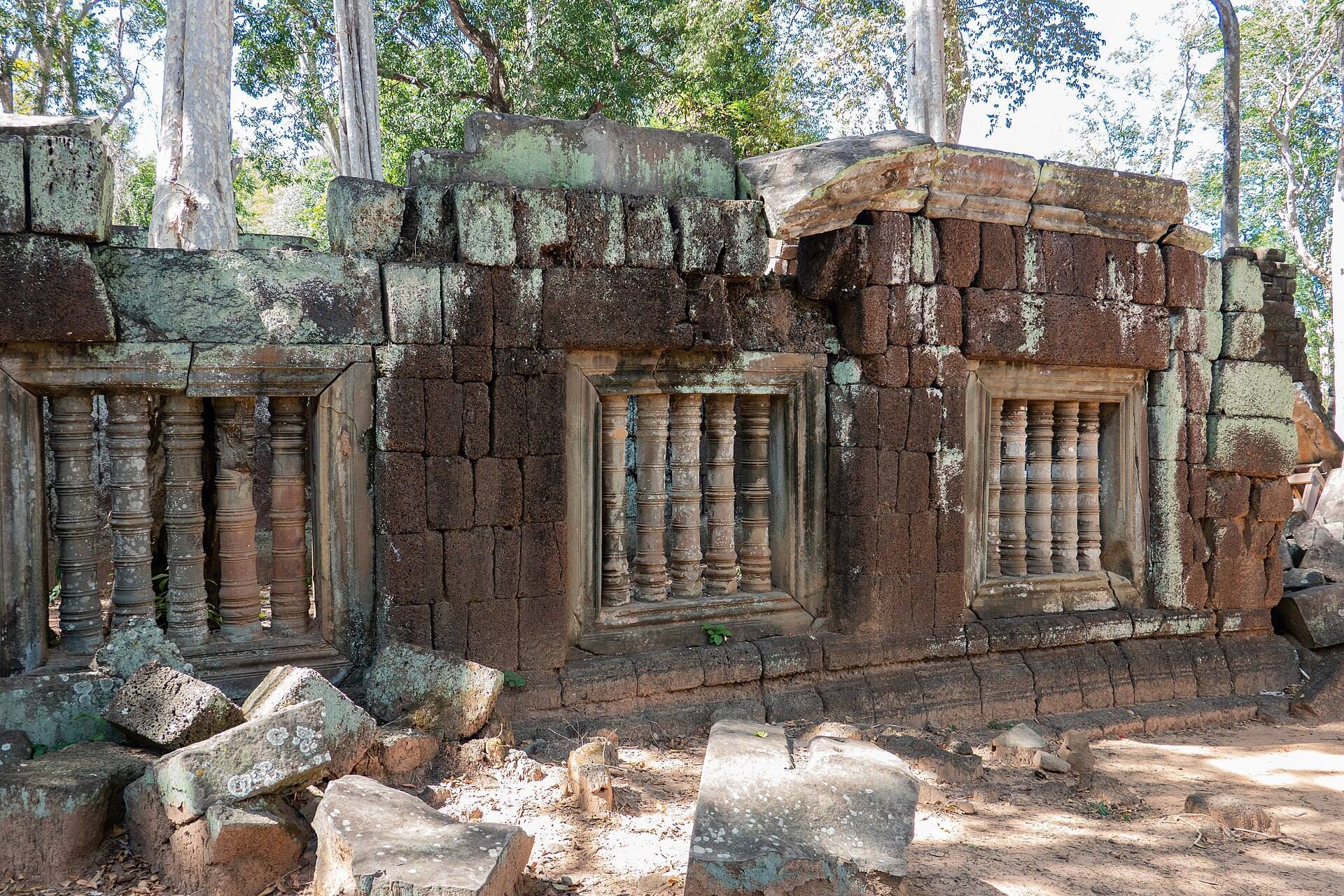
Prasat Sralau, also known as Prasat Andong Kuk, is a Buddhist temple built in the late twelfth or early thirteenth century under Jayavarman VII. It formed part of his network of hospital-sanctuaries. The temple has a well-preserved entrance gate and the ruins of five towers, with four at the corners and one at the center.
Prasat Krachap
Prasat Krachap retains its entrance gate and the remains of five towers arranged in a quincunx, with four elements at the corners of a square and a fifth at the center. Inscriptions around the doors identify its dedication in 928 to Tribhuvanadeva, a linga representation of Shiva.
The laterite three-tower temple
Another temple in the ring-road group has three laterite towers. The towers are severely damaged, their interiors show fire damage, and the western facades have been destroyed. No surviving inscriptions date the temple or identify its deities.
Prasat Damrei
Prasat Damrei stands on a high platform within an enclosure. Stairways of approximately ten steps rise on all four sides. Eight stone lions once flanked the stairways, but only one remains in its original position. Elephant sculptures formerly stood at the four corners, of which two survive. The brick sanctuary is in good condition. A Sanskrit inscription found there states that a linga had previously been erected on top of Prang.
Inscriptions and sculpture
Seventy-three inscriptions from nine temple remains are written in Sanskrit and Old Khmer. They describe the capital, religious dedications, administration, labor organization, and the distribution of rice taxes used to support workers brought from different provinces. Together with the architecture, they provide evidence for the administrative systems behind Koh Ker’s construction program.
Koh Ker sculpture is known for massive, forceful, and dynamic forms. Documented examples include a 2.16-meter Garuda from Prasat Thom, a 1.29-meter dancing Uma from Prasat Krahom, a 1.47-meter Brahma in Koh Ker style, and a 0.94-meter guardian lion. Many sculptures were looted and are now dispersed among the National Museum in Phnom Penh, the Guimet Museum in Paris, other museums, and private collections. The principal archaeological area covers approximately 1,187.61 hectares, with a buffer zone of about 3,523.77 hectares. The site is generally ruined, although Prasat Krahom, Prang, Prasat Damrei, and several entrance structures survive in better condition than many surrounding remains.