Knowth: A Neolithic Passage Tomb in County Meath, Ireland
Site at a Glance
- Popularity
- Very High
- Country
- Ireland
- Primary era
- Stone Age
- Eras represented
- Stone Age, Iron Age, Medieval
- Civilizations
- Celtic, Irish, Norman
- Site type
- Burial
- Remains
- Burial Mound
On this page16 sections
History
Knowth is a passage tomb built around 3200 BC in County Meath, Ireland, during the Neolithic, the later part of the Stone Age. It formed part of the Brú na Bóinne complex in the Boyne valley, a landscape of prehistoric monuments. In a later period, Knowth became the capital of Northern Brega, a medieval kingdom in eastern Ireland, and a royal residence associated with its rulers, the Kings of Knowth.
Neolithic and later prehistoric activity
Activity continued near the mound during the late Neolithic and Bronze Age. A timber circle close to the eastern passage appears to have served a ritual purpose, and objects placed as religious offerings were found among and around its timbers. Bronze Age occupation has been linked to Bell Beaker communities, associated with distinctive bell-shaped pottery. Later activity has also been attributed to Celtic communities in the Iron Age.
As the cairn shifted, it covered the entrances to both tomb passages. Knowth then saw little use for about two thousand years, though it was briefly used for burials.
Hillfort and royal center
In the late Iron Age and early Christian period, people lived at Knowth as a fortified settlement. The tomb entrances appear to have been rediscovered during this phase. Early Christian graffiti and four names carved in ogham, an early Irish writing system of strokes and notches cut along a line or stone edge, provide evidence of activity at the site.
Knowth grew into a political center and the capital of Northern Brega. It served as a royal residence for the Kings of Knowth, the kingdom’s rulers.
Medieval and modern history
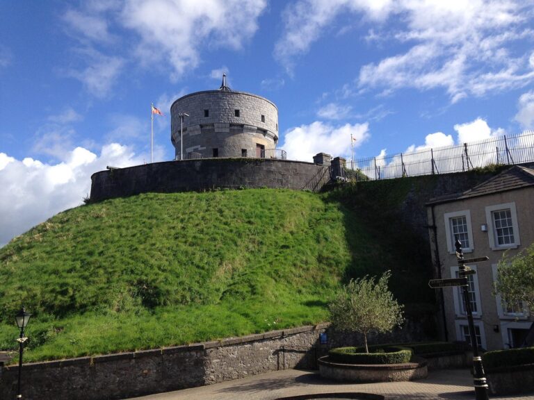
After the 12th-century Norman invasion of Ireland, the Normans briefly used the mound as a motte, a raised mound supporting a fortification or castle. The site later passed to Cistercian monks from Mellifont Abbey. It appears to have returned to agricultural use as a grange, or monastic farm. Following the dissolution of the monasteries, the land was used mainly for agriculture.
The state took over most of Knowth in 1939. Macalister carried out a brief excavation in 1941, followed by a larger investigation led by George Eogan of University College Dublin from 1962. Excavators uncovered the western and eastern passage entrances in 1967 and 1968, respectively, and revealed successive periods of activity. Conservation, restoration, and reconstruction followed, including the rebuilding of some parts of the monument.
Knowth forms part of the Brú na Bóinne UNESCO World Heritage Site, inscribed in 1993, and is also a National Monument of Ireland. The Triads of Ireland, a work dated between the 14th and 19th centuries, lists the “Caves of Knowth” among “the three darkest places in Ireland.” The Irish name developed from the Old Irish Cnogba, through Cnoghbha, to modern Cnóbha; its meaning is unclear.
Remains
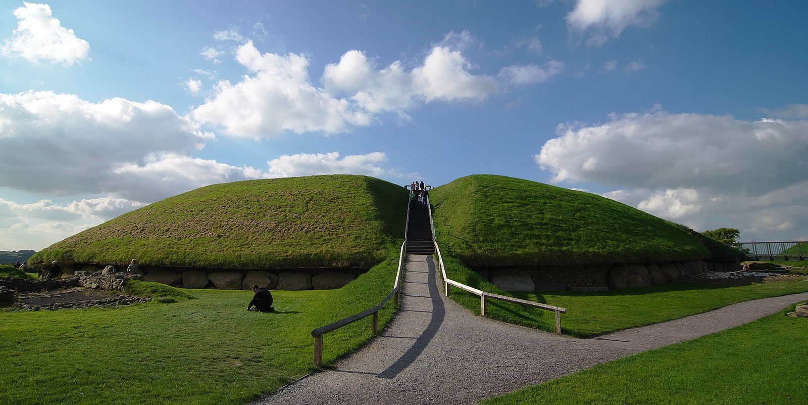
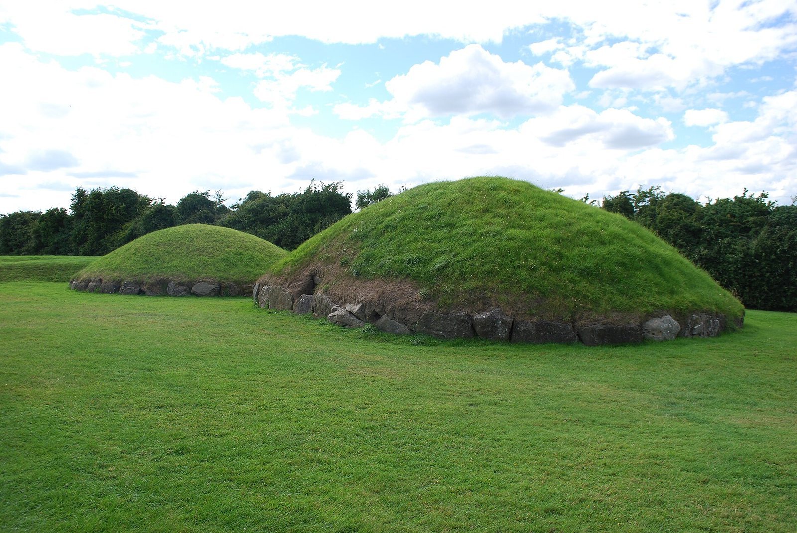
The site is arranged around a large central mound and 17 smaller satellite tombs. The main mound overlooks the River Boyne and lies about 9 km west of Drogheda. Newgrange is about 1 km to its southeast, and Dowth about 2 km to its east. Two separate passages lead into the central mound, while other archaeological features reflect later uses of the site.
Main mound and burial chambers
Mound and kerb
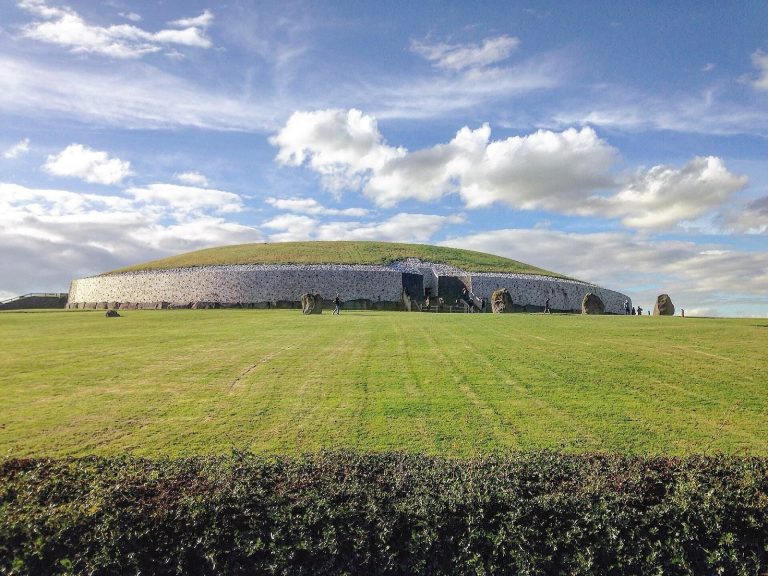
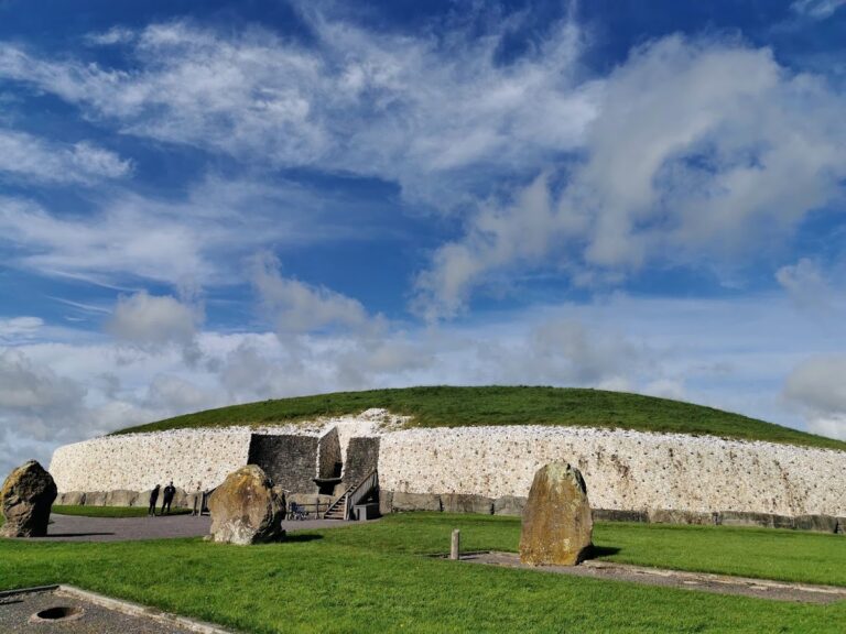
Known as Site 1, the main mound is about 12 m high and 67 m in diameter, covering roughly one hectare. It is the largest passage tomb in the Brú na Bóinne complex. A ring of 127 large stones, called kerbstones, was set around its edge; four stones are badly damaged.
Passages and chambers
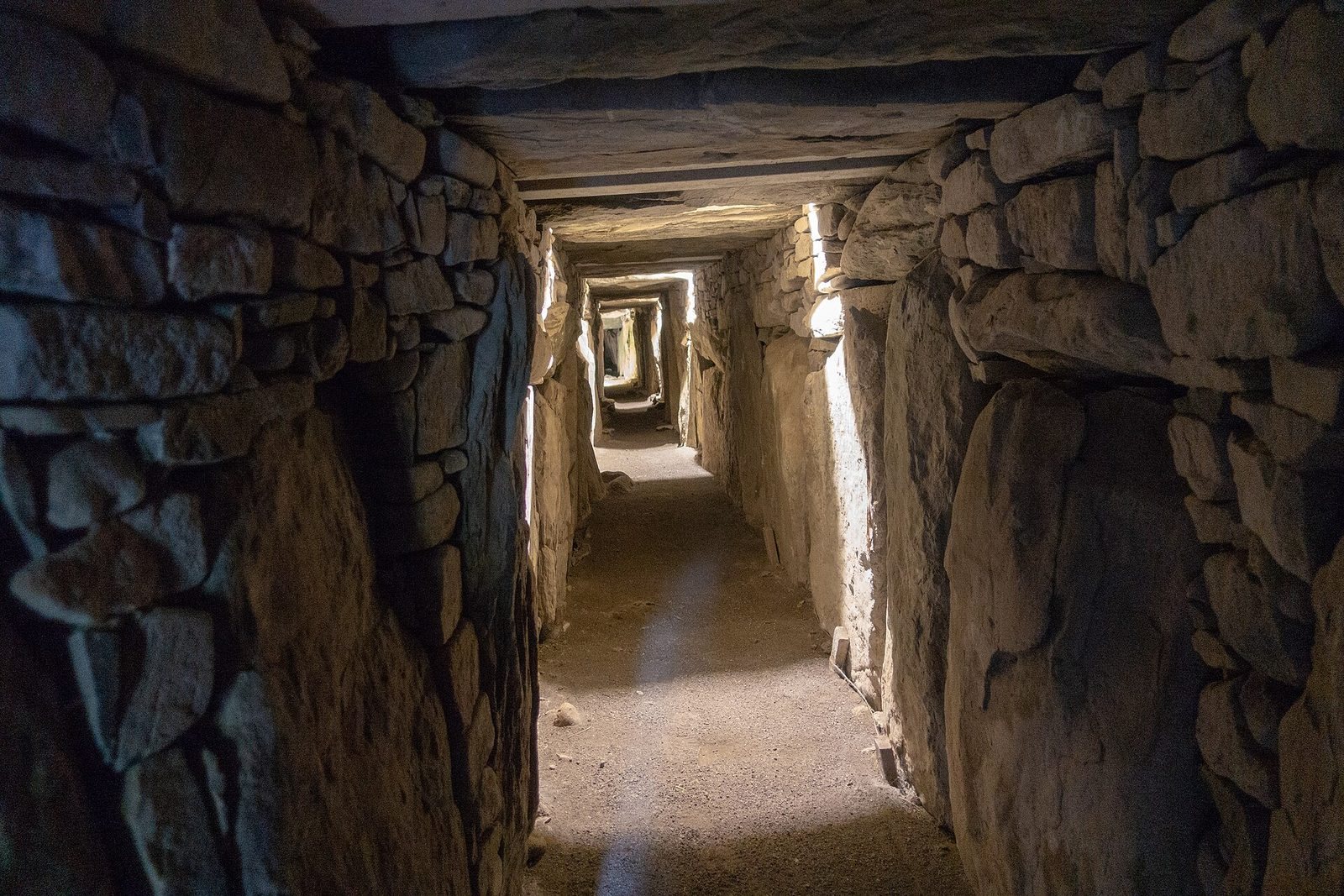
The two independent passages run east to west and measure approximately 34 m and 40 m. The eastern passage opens into a cross-shaped chamber with three recesses and basin stones for cremated remains. Its right-hand recess is larger and more elaborately carved than the others. The western passage ends in a single, undivided chamber, separated from the passage by a sill stone, a threshold between spaces. A basin stone apparently intended for the chamber was moved during an attempt to remove it, then became stuck about two-thirds of the way along the passage.
Proposed equinox alignment
The passages’ east-west direction has prompted the suggestion that they were intended to align with the equinoxes, when day and night are approximately equal in length. Later disturbance, including the incorporation of the passage entrances into underground passages, altered or destroyed their original forms, making the question difficult to resolve. A concrete slab wall inside a passage entrance further restricted investigation. Long-term changes in Earth’s orbit and axial orientation, known as Milankovitch cycles, have also been proposed as a factor in ancient alignments.
Carved stones and entrance features
Megalithic art
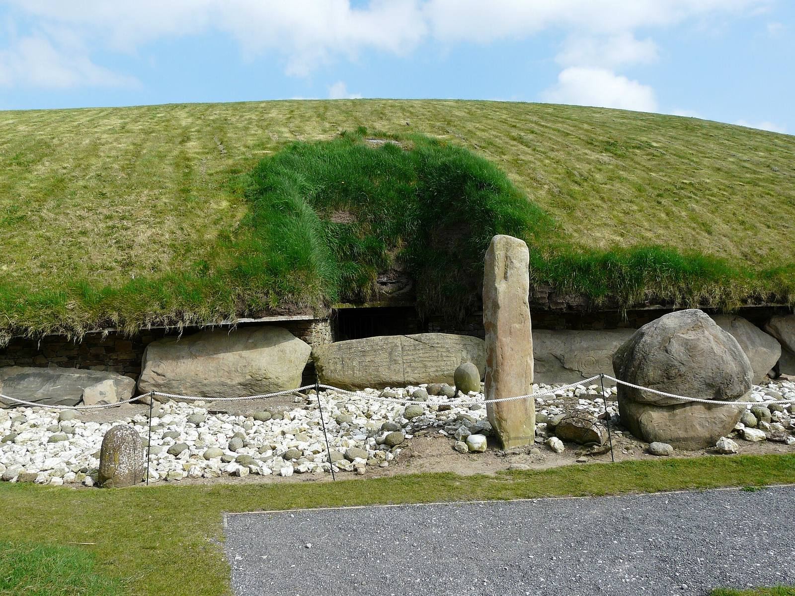
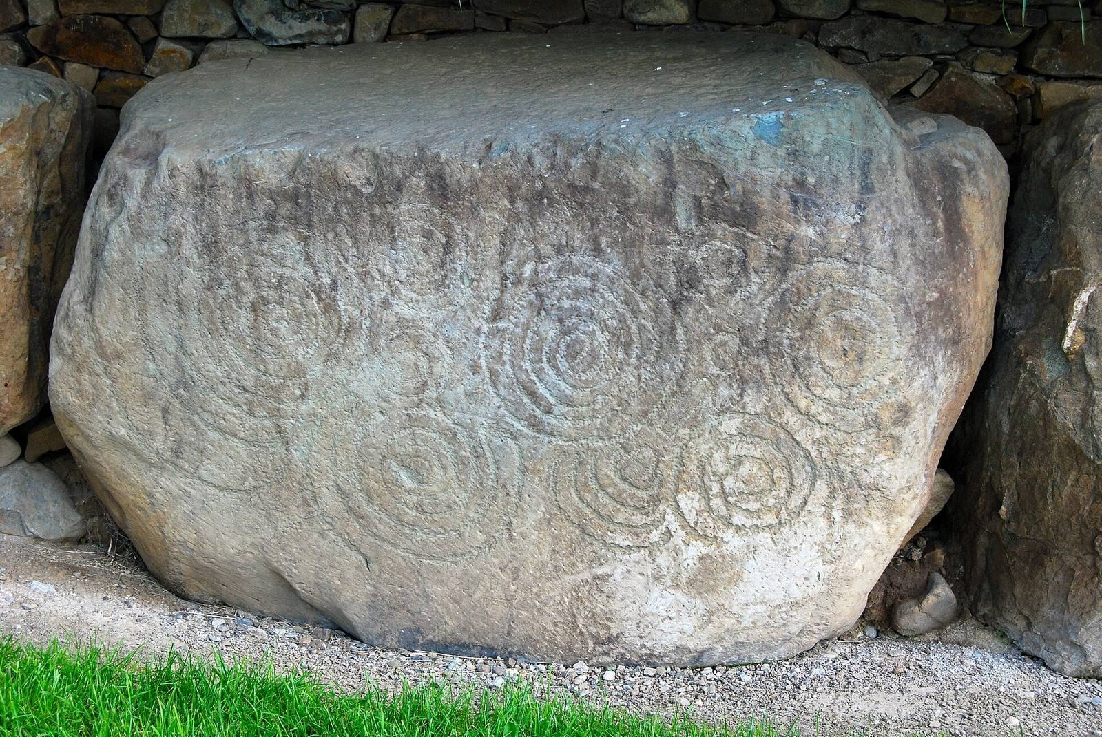
Excavation brought to light more than 200 decorated stones. Knowth contains over a third of the recorded examples of megalithic art in Western Europe and is described as having Europe’s largest assemblage. Much of the carving appears on kerbstones near the passage entrances. Motifs include spirals, lozenges, curved serpent-like patterns, and crescents. One carving has been identified as the oldest known depiction of the Moon. Many designs are on the backs of stones, a practice called “hidden art.” It remains uncertain whether the carvings were deliberately concealed or whether decorated stones were reused with their carved faces turned inward.
Quartz at the entrances
A layer of white quartz was found at the entrances to the main mound. Eogan considered that most or all of it had been spread on the ground and left in place. Other archaeologists have argued that it formed a white stone facing that later slipped down the mound. They point to the quartz being thickest near the kerbstones and to near-vertical dry-stone fronts at passage tombs in Brittany, including Gavrinis and Barnenez.
Later archaeological features
Timber circle and offerings
Near the eastern passage, a timber circle associated with grooved ware, a style of Neolithic pottery, appears to have served as a ritual or sacred area. Numerous offerings deposited as part of religious acts were found among and around the timbers.
Stone-lined burials
Excavation uncovered about 35 cist graves, stone-lined burial boxes. Their association with Celtic burials has been suggested.
Hillfort and medieval structures
The fortified settlement included two ditches, one around the mound’s base behind the kerbstones and another at its summit, as well as underground passages. Later, stone walls were built over the mound, with stone buildings inside them, during the period when the site appears to have been used as a monastic farm.