Newgrange: A Neolithic Passage Tomb in Ireland
Site at a Glance
- Popularity
- Very High
- Country
- Ireland
- Primary era
- Stone Age
- Eras represented
- Stone Age, Bronze Age, Modern
- Civilizations
- Unclassified
- Site type
- Burial
- Remains
- Tomb
On this page22 sections
History
Newgrange is a Neolithic passage tomb, a burial monument reached through a passage to a chamber, in County Meath, Ireland. Farming communities of the later Stone Age built it around 3100 BC. It is the principal monument in the Brú na Bóinne landscape and predates the present form of Stonehenge and the Great Pyramid of Giza by roughly five centuries. Radiocarbon dating commonly places construction around 3200-3100 BC, although a later date of 3000-2500 BC has also been proposed.
Neolithic construction and use
Estimates of the building period vary. Archaeologist Frank Mitchell proposed that construction might have taken five years, while Michael J. O’Kelly and his excavation team argued that it required at least thirty. Newgrange remained in use for about a thousand years. Human remains and other evidence show that people were placed within the monument, but its exact purpose is uncertain. Suggested interpretations include a place connected with the dead, a setting for solar or other astronomical observances, or a structure whose uses changed over time. Ceremonial activity also continued in the surrounding area during much of the Neolithic.
DNA analysis of a man’s remains from the monument’s most elaborate chamber showed that his parents were close relatives, possibly siblings. He was also distantly related to people buried at Carrowkeel and Carrowmore. Some archaeologists have taken the prominent burial and close family relationship as evidence for an elite group that built Newgrange, perhaps as a royal tomb. Alasdair Whittle instead suggested that it could have served the community at some times and been used temporarily as an individual tomb. Other archaeologists have cautioned that one burial cannot establish a rigid social hierarchy.
Later prehistoric activity
By about 2000 BC, the monument was declining and local people no longer used it for burials. Beaker communities, identified in part through their bell-shaped pottery, settled beside the deteriorating mound and constructed timber settings, other buildings, and hearths. Some ritual importance appears to have continued into the Iron Age, a later period marked by widespread use of iron.
Myth, names, and medieval landholding
Irish stories later imagined Newgrange as a dwelling of supernatural beings, especially the god Dagda and his son Aengus. In one tale, Dagda halts time while Boann gives birth to Aengus. Aengus then claims the Brú for ‘a day and a night’, reasoning that all time consists of day and night. Other traditions connected the mound with the Tuatha Dé Danann, a supernatural people, and the Otherworld. These stories reflect later belief, not proof of Newgrange’s original purpose. Folklore also made the Brú a burial place for legendary kings of Tara. In one account, Cormac mac Airt refused burial there; as his attendants tried to carry him across the Boyne, the river rose three times, and they buried him on the opposite bank.
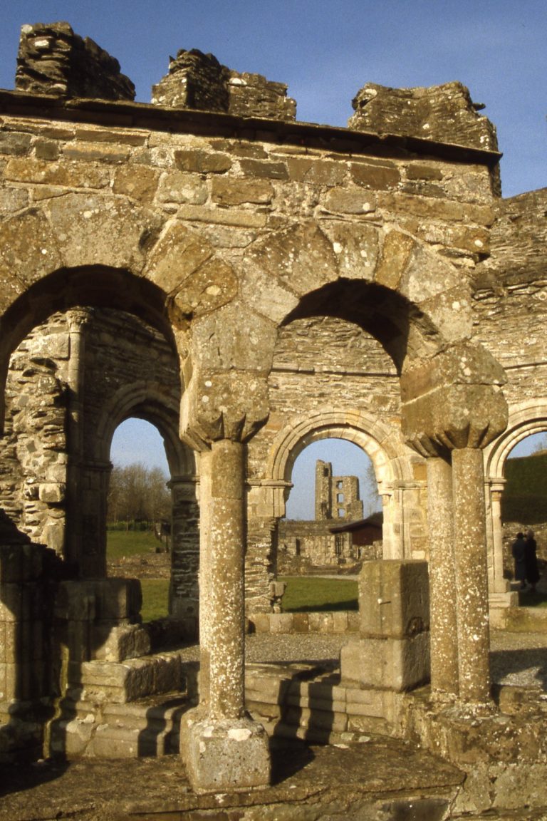
Early Irish literary names for the monument include Sí an Bhrú and Síd in Broga. The modern name came from a nearby farm or estate called New Grange, on land associated with Mellifont Abbey. The abbey’s Cistercian monks, members of a monastic order, held the monument as farmland from after 1142. A document issued by Edward III in 1348 lists a ‘Nova Grangia’ among the abbey’s lands. After Henry VIII’s dissolution of the monasteries, the abbey and its property passed in 1539 to the English soldier of fortune Edward Moore. Alice Moore, Dowager Countess of Drogheda, leased the estate to Charles Campbell for 99 years in 1699. Antiquarian writers adopted the estate’s name during the seventeenth and eighteenth centuries.
Discovery and antiquarian study
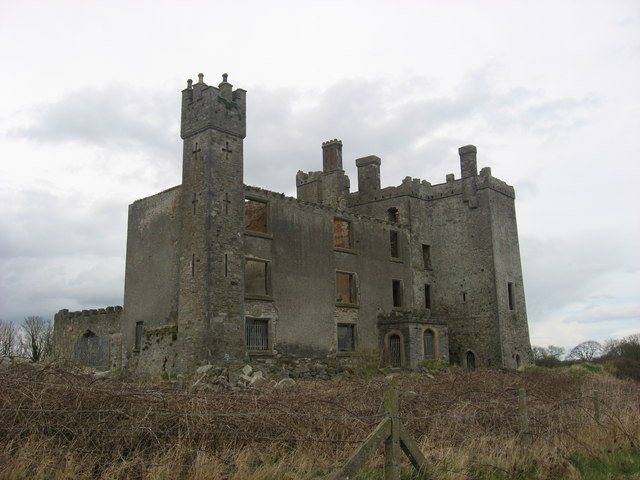
In 1699, Campbell instructed farm workers to remove stone from the mound. Their digging uncovered the entrance and brought the monument to the attention of Welsh antiquarian Edward Lhuyd, who described it and its carvings. Campbell also told Thomas Molyneux that two human bodies had been found inside. Stone was taken from the mound for nearby roadworks in 1699-1700. Later antiquarian visitors included Thomas Pownall, whose 1769 survey recorded stones and carvings. A folly built with stone taken from Newgrange was erected nearby in the early nineteenth century; it has two circular windows.
Protection, excavation, and reconstruction
Newgrange, Knowth, and Dowth came under state control in 1882 through the Ancient Monuments Protection Act. Conservation began in 1890 to address deterioration and vandalism, including names carved by visitors into the stones. The land remained privately owned until 1962, when the Irish Tourist Association acquired it and gave it to the state. Nineteenth- and early twentieth-century investigations added to knowledge of the monument, though it was then incorrectly dated to the Bronze Age.
O’Kelly directed the most extensive excavation from 1962 to 1975. Reconstruction followed, including the rebuilding of the white-stone facing, a decision that remains controversial. Trees were removed because their roots damaged the mound. Blocked drainage openings in the concrete support behind the reconstructed facing later allowed water pressure to build, contributing to the collapse of parts of the nineteenth-century retaining structure on the north side in the early 1980s. The rear of the mound was closed, and workers reinforced the structure with concrete and metal baskets filled with stones. Further excavation and conservation took place under Ann Lynch from 1984 to 1988.
In 2016, archaeologist Michael Gibbons argued that O’Kelly’s team had fabricated the roofbox. Other archaeologists disputed this, pointing to early twentieth-century photographs and detailed excavation drawings that show the feature. Newgrange is part of the Brú na Bóinne complex, which includes Knowth, Dowth, and other archaeological sites. UNESCO inscribed the wider landscape as a World Heritage Site in 1993.
Remains
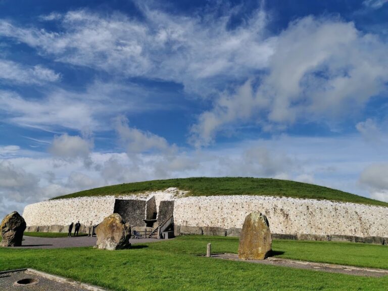
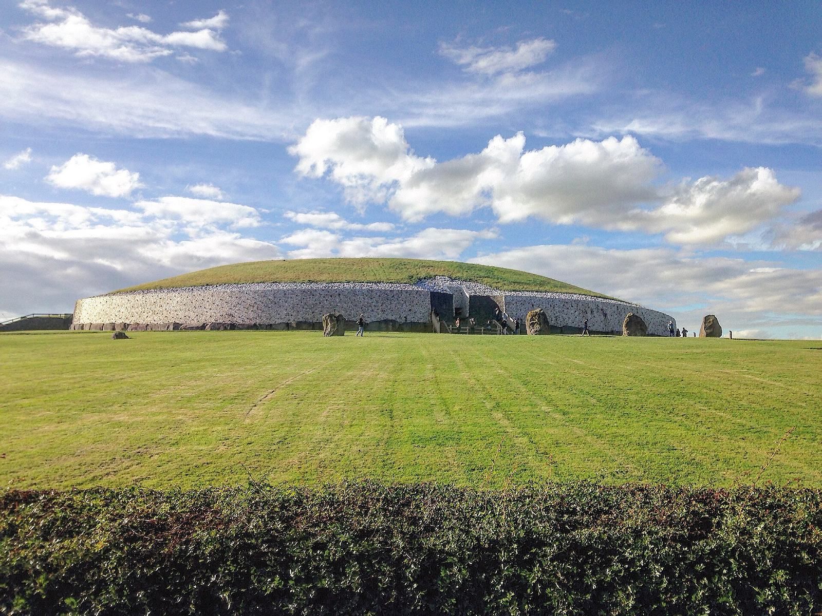
The monument occupies a rise above the River Boyne, on the river’s north side, and is surrounded by smaller mounds within a broader prehistoric landscape. Its main feature is a grass-topped circular mound made from alternating layers of earth and stone. The mound measures about 85 metres across at its widest point, stands around 12 metres high, and covers approximately 4,500 square metres. Its materials are estimated to weigh about 200,000 tonnes.
Mound and outer setting
Mound facing and building materials
The reconstructed facing covers part of the mound’s circumference. It consists mainly of white quartz cobbles mixed with larger rounded stones, set against a concrete support wall. Excavation evidence was interpreted as showing that the quartz had fallen from a facing that once stood above the perimeter stones. Civil engineer John Fogarty calculated that this original face may have reached about three metres high. Some archaeologists support the interpretation, while others question whether Neolithic builders could have constructed a facing at that angle. A thin layer of crushed stone found on the mound came from a quarry about 80 kilometres away. Dark, inward-curving walls beside the entrance are modern additions intended to ease access, rather than a reconstruction of the original design.
The mound’s pebbles are thought to have come from terraces beside the Boyne, possibly from a nearby pond. Most of the 547 structural slabs used in the passage, chambers, and perimeter are greywacke, a type of rock, perhaps brought from sources about five kilometres away or from Clogherhead, roughly 20 kilometres northeast. White quartz came from the Wicklow Mountains, about 50 kilometres south; dark granodiorite cobbles came from the Mourne Mountains, about 50 kilometres north. Dark gabbro came from the Cooley Mountains, while banded siltstone, another rock type, came from the shore at Carlingford Lough. Granite basins in the chambers also originated in the Mournes. The slabs show natural weathering rather than quarrying. They were gathered and transported, often uphill; some may have been carried by sea and then up the Boyne, secured beneath boats at low tide.
Perimeter stones and outer circle
A basal ring of 97 large kerbstones, stones that define a mound’s perimeter, forms a retaining edge around the base. The slabs measure about 1.5 to 4.2 metres long and were laid on their sides in prepared beds, giving their upper edges a relatively even line. Some are carved.
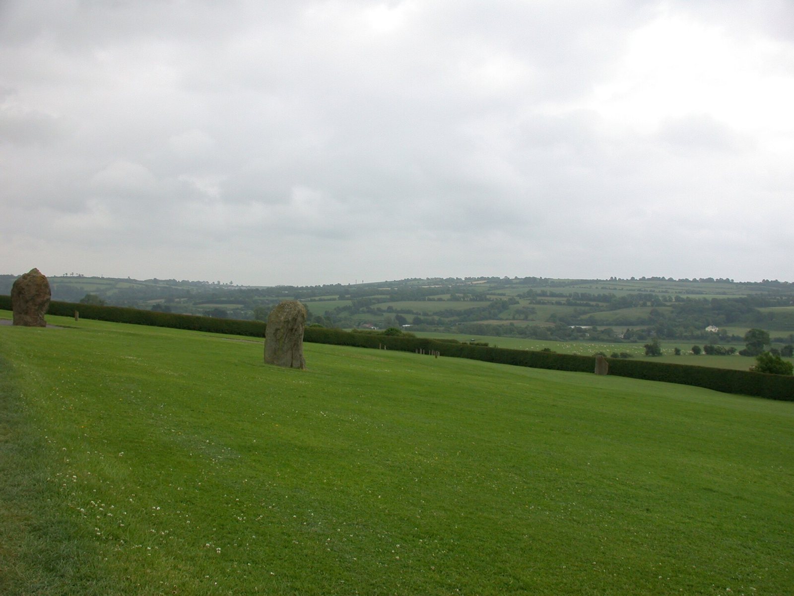
Farther out, an outer ring of standing stones encircles the mound. Twelve stones survive, while estimates of the original number range from about 35 to 38. They rise roughly two metres above the surrounding ground and follow a circle more than 100 metres across, about 11 to 14 metres above the mound’s base. Most archaeologists regard the ring as a later addition, probably from the Bronze Age, centuries after the mound’s original ritual use. Its dating remains uncertain because the carbon date relates to a stone setting crossed by a later timber circle, and the stone may have been moved and reset.
Passage and chamber
Entrance, passage, and upper chamber
The entrance lies on the mound’s southeastern side. From it, a passage about 19 to 20 metres long, 0.9 metres wide, and 1.5 metres high extends roughly a third of the way into the mound. Its side walls consist of 22 upright slabs on the west and 21 on the east. These average about 1.5 metres high and shorten farther inward as the passage rises slightly with the ground. Horizontal slabs cover the passage roof. Channels cut into their upper surfaces directed water towards the sides, while clay filled the joints between slabs.
A small chamber-like feature above the entrance was identified during the 1963 excavation. It opens outwards and has a floor opening about 0.30 metres wide, which may have been closed with river stones. One interpretation proposes that, after the main entrance had been sealed, offerings could be passed or dropped through this opening into the passage.
Cross-shaped chamber
At the passage’s inner end, three side niches open from a larger central space, forming a cross-shaped chamber. Its high vaulted roof is built from successive stone courses that project inward until they meet overhead. The chamber rises a little over six metres. Opposing niche walls are about 6.5 metres apart, while the full distance from the entrance to the back wall of the central niche is about 24 metres. An outer covering of river stones and sand helped protect the vault from rainwater.
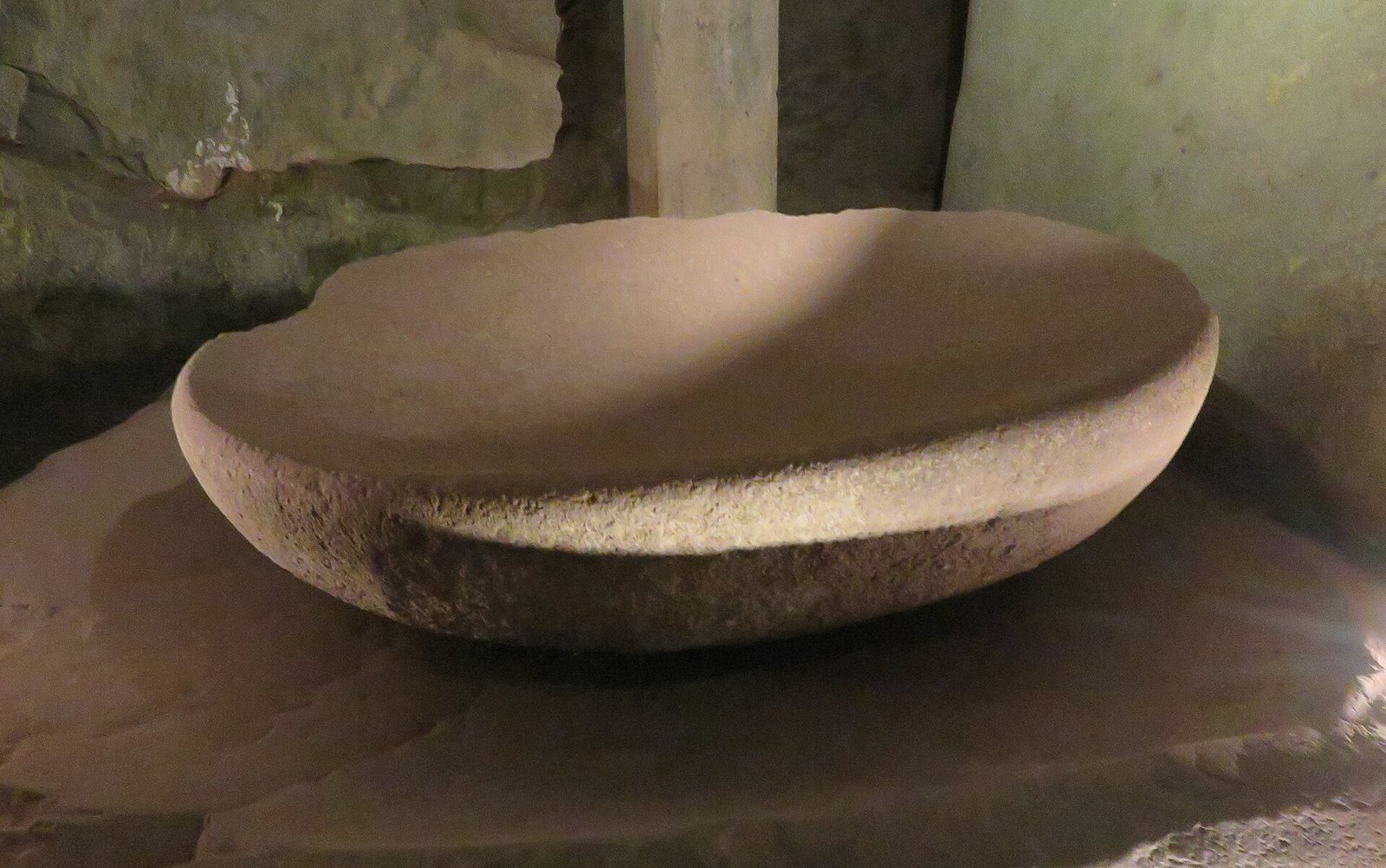
Each niche has a large, flat basin stone. The northeastern niche contains two basins, and each of the other niches has one. These basins were used, or may have been used, to hold human remains. Large worked stones pave the niche floors.
Carvings and winter-solstice light
Carved stones
Neolithic carvings appear on many stones, including some that were later hidden below ground. Their patterns include circles, spirals, arcs, wavy lines, and dots within circles, as well as chevrons, diamond shapes, radiating designs, parallel lines, and offsets. The marks differ in depth, style, and execution. The entrance stone, about three metres long and 1.2 metres high, weighs roughly five tonnes and bears a prominent three-part spiral motif. It was carved before the neighboring perimeter stones were set in place. Other notable designs include a triple spiral on the front wall of the inner chamber and a three-part spiral on an upright slab in the terminal chamber. A decorated roof slab in the eastern niche is cracked. George Coffey and other archaeologists regarded the designs as decoration; O’Kelly thought some might have carried symbolic meaning, partly because certain carvings became concealed after construction.
Roofbox and sunlight
An opening above the main entrance, called a roofbox, admits the winter-solstice sunrise into the passage. Sunlight reaches the chamber floor and illuminates its carvings, especially the triple spiral, for about 17 minutes. Today, the first light enters roughly four minutes after sunrise. Calculations that account for precession, the slow change in the direction of Earth’s rotational axis, suggest that about 5,000 years ago the beam entered at sunrise and reached the back wall of the chamber. O’Kelly first observed the modern illumination on 21 December 1967.
Surrounding prehistoric features
Timber circles and earthworks
Excavation revealed a large timber circle southeast of the mound and a smaller one to the west. The eastern circle had five concentric rows of pits. Wooden posts occupied the outer row; the next row had clay linings and was used to burn animal remains; the three inner rows contained animal remains. Postholes and stakeholes within the circle were associated with Beaker pottery and flint flakes. The western circle, about 20 metres across, comprised two concentric rows of parallel postholes and pits. A clay mound on its southern and western sides covered two parallel lines of posts and ditches that had been partly burned. These structures are generally considered contemporary with other Boyne Valley henges, roughly circular prehistoric enclosures marked by earthworks and sometimes timber or stone settings.
Entrance feature and hearths
Outside the stone circle, in front of the entrance, excavators found an oval feature measuring about four by 3.5 metres. It was made from flint pieces mixed with rubble and rounded granite, enclosed by small upright slabs, and paved with stone at its base. Its purpose is uncertain. Seventeen hearths were also found near the entrance.
Human remains and other finds
Burial evidence and objects
Excavations recovered burnt and unburnt human bones from the passage. The unburnt material came from at least two people, but much of their skeletons was missing and the surviving bones were scattered. Cremated human remains were also found; the number of people represented is uncertain. Work in the late 1960s and early 1970s recovered seven small stone balls, four pendants, two beads, a used flint flake, a bone chisel, and fragments of bone pins and points. Earlier visitors found further objects, including beads and glass fragments, many of which were removed and are now lost or privately held.
Later deposits and animal remains
Two pendants made from Roman gold coins dated 320-337 AD were deposited around the mound in a later period. Two gold bracelets, two finger rings, and a necklace are held by the British Museum; the coin pendants are in the National Museum of Ireland. Animal remains found at Newgrange include hares, rabbits, dogs, bats, sheep, goats, cattle, song thrushes, molluscs, and frogs. Many animals probably entered the chamber and died there long after the monument was built. Rabbits, for example, were introduced to Ireland only in the thirteenth century.