Kitora Tomb: An Asuka-Period Burial Mound in Japan


Site at a Glance
- Rating
- 4.3
- Popularity
- Low
- Country
- Japan
- Primary era
- Medieval
- External website
- Open
- Eras represented
- Medieval
- Civilizations
- Yamato
- Site type
- Burial
- Remains
- Burial Mound
On this page13 sections
History
Kitora Tomb is a late-period kofun, or elite Japanese burial mound, in Asuka, Japan, probably built between the end of the seventh century and the beginning of the eighth century during the Asuka period. Its murals, whose cultural connections reach into the Tang world, the sphere shaped by China’s Tang dynasty between AD 618 and 907, support a date probably before AD 704. The burial belonged to a high-ranking person, probably an aristocratic man, although the individual’s identity remains unresolved.
Construction and Burial
The tomb lies in the Abe-yama area of Asuka. The buried person has been identified variously as Prince Takechi, an imperial prince and son of Emperor Tenmu; Abe no Miushi, a senior court official who became Right Minister in 703 and died at 69; and Changseong, a figure connected with Baekje, the ancient Korean kingdom that maintained close cultural and political ties with Japan. The bones and burial objects have been interpreted as belonging to a middle-aged or older man. The decorated coffin and grave goods indicate an occupant of considerable status.
The name may derive from the local place-name Kitaura, from the tortoise and tiger associated with the northern and western directions, or from a view into the chamber in which those two animals could be seen. The modern katakana form “Kitora Tomb” is now commonly used. The mound was not preserved in historical documents or local oral tradition, and accounts of its earlier discovery differ. Local residents may have known of it before archaeological investigation, while another tradition connects wider local attention with the discovery of the murals at nearby Takamatsuzuka Tomb in 1972. The Agency for Cultural Affairs dates general awareness of Kitora Tomb to 1978.
Investigation and Conservation
In 1978, archaeologists studying nearby Marukoyama Tomb were alerted to a possible tomb near Abe-yama. They recognized a stone feature resembling the cross-section of a ditch. Residents said it had appeared roughly two decades earlier, when a hill was cut down during an expansion project. The tomb was mentioned in an archaeological journal in 1981 and surveyed with its surrounding terrain by Kansai University in 1982. It received the formal name Kitora Tomb in 1995.
An endoscopic investigation in 1983 revealed the Black Tortoise mural through a robbers’ opening. Ground-penetrating radar, a fiberscope, and electromagnetic methods were used without opening the chamber. This was the first internal investigation of a Japanese kofun carried out while preserving the tomb’s original condition, although the fiberscope malfunctioned before the examination was complete. A live television broadcast that November brought the tomb to much wider public and academic attention, and later processing of the data permitted the mural to be reconstructed.
Emergency work began in 1996 after landslides threatened the mound and a possible collapse was considered. A road below the slope was diverted southward, a retaining wall was planned, and additional earth was placed to strengthen the mound. Excavation established its dimensions, with further measurement and excavation following in 1997. The Azure Dragon, White Tiger, and astronomical chart were discovered in 1998. The Red Phoenix and animal-human zodiac figures, which have human bodies and the heads of the twelve zodiac animals, were identified in 2001.
Between 2002 and 2004, the Nara National Research Institute for Cultural Properties, the Nara Prefectural Archaeological Institute of Kashihara, and Asuka Village investigated the approach passage, robbers’ pits, the southwestern mound, the chamber’s southern side, and the chamber interior. Non-invasive investigations continued from 2011 to 2013. The chamber was closed in October 2013 and later backfilled during restoration and environmental improvement of the mound.
Moisture after excavation caused mold and progressive flaking of the paintings. The Agency for Cultural Affairs therefore began removing the most damaged murals in 2004. The paintings were divided into 1,143 pieces, removed, and reassembled over several years. A protective building erected over the tomb in 2003 controlled the investigation environment and was removed in 2014 after the mural-removal work had fulfilled its purpose. Conservation was reported as nearly complete in 2016 at the Four Divine Guardians Hall in Asuka Historical National Government Park, where the paintings are conserved and a replica of the chamber is exhibited.
Kitora Tomb became a national Historic Site on July 31, 2000, and a Special Historic Site on November 24 of that year. Its protected area covers approximately 4,381 square meters, and the tomb forms part of the World Heritage property “Ancient Capitals of Asuka and Fujiwara.” The murals and excavated objects became Important Cultural Properties on October 31, 2018. The murals were elevated to National Treasure status on July 23, 2019.
Remains
Mound and Burial Chamber
Two-Tiered Mound
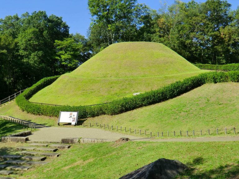
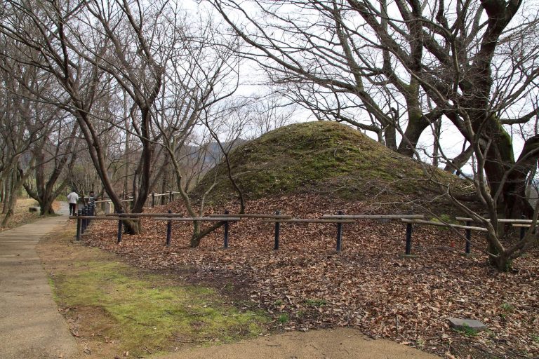
Kitora Tomb is a two-tiered circular mound built with rammed earth, or soil compacted into successive layers. The upper tier is 9.4 metres in diameter and 2.4 metres high. A lower, terrace-like tier measures 13.8 metres across and approximately 0.9 metres high. Soil erosion has reduced the mound somewhat. It stands on the southern slope of an east-west ridge in southwestern Asuka, between two ridge lines, with a small hill behind it. The mound’s lowest point lies approximately 4.5 metres from the northern hill, and the site overlooks the Tsubosaka mountain range to the south. Takamatsuzuka Tomb is approximately 1.5 kilometres to the north.
Stone Chamber
The burial facility is a side-entrance stone chamber, meaning that it is entered through an opening in one side rather than through a vertical shaft. It has a house-shaped ceiling and is made from cut welded tuff, volcanic rock formed when hot ash deposits fused together. Eighteen slabs from Mount Nijo form the chamber: four floor slabs, two northern wall slabs, four eastern wall slabs, three western wall slabs, four ceiling slabs, and one southern slab closing the entrance.
The interior measures approximately 2.4 to 2.6 metres long, about 1 metre wide, and 1.24 to 1.3 metres high. Measured from the upper surface of the floor slabs, its height is approximately 1.82 metres, and its estimated external width is 1.96 metres. The floor slabs lie horizontally beside one another and rise about 3 centimetres above ground level. Vertically aligned slabs form the north and west walls, while the east wall combines side slabs with additional stones above and below its central section.
Four horizontal ceiling slabs slope inward to form the roof. The flat central portion is approximately 0.6 metres wide. At the southern edge, the ceiling measures 1.82 to 1.85 metres across, and its slabs are about 0.68 metres thick and 0.82 metres long. The southern closing slab is approximately 1.15 metres high, 1.2 metres wide, and 0.495 metres thick, with a gap of about 1 centimetre beneath the ceiling. The chamber was originally covered by roughly 2 metres of additional earth above the ceiling stones.
Passage and Openings
The approach passage is approximately 2.35 to 2.65 metres wide and is estimated to have been about 5 metres long. Its section adjoining the chamber extends for 1.8 metres and slopes southward. Four channels in this area were used to move timber. A robbers’ opening in the upper western part of the chamber measures approximately 0.47 metres wide and 0.7 metres high. A separate opening in the south wall, used for investigation, was about 0.65 metres high, 0.25 to 0.4 metres wide, and 0.49 metres deep. After the investigations, it was sealed with two pieces of Mount Nijo tuff.
Painted Chamber
The walls and ceiling were coated with plaster, and the joints between the stone slabs were plastered as well. Murals covered all four walls and the ceiling. Red construction lines beneath the plaster appear at numerous points. They are generally 1 to 3 millimetres thick, sometimes reaching 6 millimetres, and probably served as measurement baselines while the stones were being prepared. Recorded lines range from 1 millimetre to 41.2 centimetres in length.
Directional Guardians
The four central wall images represent the Four Divine Guardians, directional protective beings in East Asian cosmology. The Black Tortoise represents the north, the Azure Dragon the east, the Red Phoenix the south, and the White Tiger the west. On the north wall, a snake coils around a tortoise and the two creatures face one another. The image is approximately 23 centimetres wide and 14 centimetres high. Its composition may ultimately derive from an image-brick tomb made in Zhenjiang in 398, although the arrangement is uncommon in mainland China.
The Azure Dragon on the east wall leaps through the air with a red tongue. When it was found, soil covered most of the painting, leaving the head, feet, and a small part of the abdomen visible. The mural is estimated at 25 centimetres high and 40 centimetres wide. The White Tiger on the west wall has an elongated body, open jaws, a red tongue, and a striped head turned northward. It measures approximately 45 centimetres high and 25 centimetres wide. The tiger faces the Black Tortoise, unlike the corresponding arrangement at Takamatsuzuka Tomb.
The Red Phoenix on the south wall is shown in flight and measures approximately 15 centimetres high and 39 centimetres wide. Its tail came within 21.5 centimetres of the east wall. It is regarded as the first identified polychrome Red Phoenix mural in a Japanese kofun. The Azure Dragon and White Tiger both face rightward, so the dragon faces the Red Phoenix while the tiger faces the Black Tortoise. This differs from the usual Chinese arrangement, in which both figures face the Red Phoenix.
Animal-Human Zodiac Figures
Three animal-human zodiac figures were intended for each wall. Confirmed figures include the Rat and Ox on the north wall, the Tiger on the east wall, the Dog on the west wall, and the Horse and Boar on the south wall. A possible Dragon was detected beneath soil in 2019, while pigment analysis in 2021 found mercury in the clothing of a possible Snake figure, suggesting vermilion coloring.
The Rat wears a red-collared, red-sleeved half-length robe and holds a hooked weapon or bow. The Boar is dressed in a similar manner. The Ox wears a robe that crosses right over left and holds a bow-shaped object. The Tiger wears a V-neck robe with red sleeve decoration, a belt, and a banner-like object. The Horse and Dog also hold banner-like objects, while the Dog has a red V-shaped collar and red cuffs.
Astronomical Chart
The ceiling carries an astronomical chart, a representation of the sky used in the study of ancient observation and celestial knowledge known as archaeoastronomy. Three concentric circles mark the inner circle, celestial equator, and outer circle, with a separate ecliptic circle. Stars, including the Twenty-Eight Lunar Mansions, divisions of the traditional East Asian lunar sky, were drawn between the circles using gold leaf and red lines. The circles measure approximately 168, 403, 606, and 405 millimetres in diameter for the inner, equatorial, outer, and ecliptic circles respectively.
A gold-leaf sun appears on the eastern sloping surface of the ceiling, while a silver-leaf moon occupies the western slope. Each is approximately 53 millimetres across. The chart probably showed about 350 celestial bodies and 68 constellations originally. Photographs or surviving gold leaf confirm 179 stars, while another 98 survive only as traces, producing 277 identifiable stars or star traces.
The chart was detached from the ceiling in 22 operations between July 2007 and November 2008 and divided into 113 pieces, including the sun and moon. Its observation date has been estimated at approximately AD 300, with an uncertainty of plus or minus 90 years. Its resemblance to the chart in the tomb of Prince Zhanghuai, who died in AD 684, has also been noted. The estimated observation latitude is 33.9 degrees plus or minus 0.7 degrees. Asuka falls within that range, although Xi’an and Luoyang have also been proposed as possible observation locations. The chart’s knowledge probably came through China or the Korean peninsula, while its precise model and observation location remain uncertain.
Burial Goods and Coffin Remains
Excavation recovered a fragmentary gold-and-silver belt fitting, 16 metal objects, six amber beads, glass objects, six additional metal fragments, 27 lacquer-work fragments, lacquer, pieces of gold leaf, one fragment of chamber stone, and three Haji pottery vessels. The belt fitting consists of an iron ring lined with silver. Fine and coarse lines and S-shaped motifs were worked into its surface with gold inlay, a technique in which gold is set into prepared grooves in another material.
Silver sword fittings, including a scabbard mouth and fittings from the sword’s lower end, are rare late Asuka-period objects associated with a sword. The lead-glass beads average approximately 1.2 millimetres in length and have no established function; their form is distinctive to Kitora Tomb. Lacquer-work remains include gilt-bronze openwork fittings from the coffin, silver rings with gilt-bronze six-petaled ornaments, and fragments of a vermilion-lacquered wooden coffin. Lacquer is a hard, glossy protective coating commonly applied to wood and crafted objects in East Asian funerary traditions.
Coffin fragments formed a layer approximately 5 centimetres thick on the chamber floor, mixed with human bones and grave goods. A gilt-bronze fitting and sword decorations carried finely executed inlaid patterns. The coffin had been broken apart when the tomb was robbed, but the surviving pieces have helped reconstruct its form and the chamber’s original appearance. The mural sections and astronomical chart were conserved away from the chamber, while the mound and burial facility were restored and placed under environmental management.