Keszthely-Fenékpuszta (Castellum): A Roman Fort and Early Medieval Settlement in Hungary
Site at a Glance
- Popularity
- Low
- Country
- Hungary
- Primary era
- Classical
- Eras represented
- Classical, Medieval
- Civilizations
- Carolingian, Roman
- Site type
- Military
- Remains
- Fort
On this page21 sections
History
Keszthely-Fenékpuszta (Castellum) is a Roman fort at Fenékpuszta, in Keszthely, Hungary. The Roman army probably built it in the fourth century over an earlier settlement, and many researchers favor a date around the century’s middle. It formed part of the defenses of Pannonia, a Roman province along the middle Danube, although it stood inland rather than on the river frontier. As one of four large inland forts in Pannonia, it was part of a defensive network set back from the frontier.
Construction and Roman defense
Proposed foundation dates range from the First Tetrarchy, the initial period of rule by four Roman emperors, through 330–340 and the middle of the fourth century. Its provincial assignment is also uncertain: the boundary between Pannonia I and Valeria is not precisely known. The fort likely supported mobile field armies and helped supply forts on the frontier. During wartime, it may have offered shelter to both soldiers and civilians from the surrounding region. It may also have served as a regional administrative and economic center, though its precise role remains debated. Interpretations include a cohort fort, a supply depot, or a combination of the two.
The size and identity of the garrison are unknown. The Notitia Dignitatum, a late Roman administrative and military register, indicates that tribunes commonly commanded inland forts but does not name the unit at Fenékpuszta. A relatively small local garrison may have managed routine duties, though it would probably have needed reinforcements to defend the fort. The site probably suffered a fire around 374 and was repaired toward the end of the fourth century, when a basilica, a large hall-like building often used as a church, was constructed. Christianity had by then become widespread among Pannonia’s population.
Withdrawal and shifting control, 406–473
Between 406 and 433, the Western Roman government transferred Pannonia I and Valeria to the Huns by treaty, and the Roman army evacuated the forts. Fenékpuszta then became a refuge for the remaining provincial Roman population and developed into a civilian settlement. Around 440, the Huns assigned land near Lake Balaton to the Ostrogoths. After the Huns were driven from Pannonia following the Battle of Nedao in 453–454, Western Roman emperor Avitus tried to restore Roman control in western Pannonia in 455. Roman troops probably returned to Fenékpuszta and stored supplies there.
In 456, Eastern Roman emperor Marcian confirmed the settlement rights of Ostrogothic groups bound to Rome by treaty, led by the brothers Valamer, Thiudimir, and Vidimer. The Goths then stormed and badly damaged the fort, and local civilians were compelled to help rebuild it. Thiudimir established a residence on the shore of Lake Balaton, probably using the fort. When the Ostrogoths left for Moesia, a Roman region in the Balkans, under Theoderic in 473, Romans resettled the site. They appear to have lived through the upheavals of the Migration Period, an era of large-scale movements of peoples across Europe in Late Antiquity and the early Middle Ages, under the protection of the fort’s walls.
Lombard and Avar rule
The Lombards entered Pannonia in 536. Cemeteries nearby suggest that the fort remained largely intact and functioned as a protected settlement and local economic center, although finds do not securely establish Lombard occupation within it. The Lombards may have controlled the southern end of the lake crossing. After making a treaty with the Avars, they left for Italy in 568. Some Roman inhabitants went with them; others stayed and later plundered a Lombard cemetery at Vörs.
Under Avar rule, the Roman community at Fenékpuszta retained substantial autonomy in return for agricultural and craft goods. It apparently maintained connections with Italy and the Eastern Roman Empire, and newcomers from Byzantine and Germanic regions may have joined it. Finds suggest a degree of prosperity and the emergence of a local elite. After an Avar defeat at Constantinople in 626 and the civil war that followed, Avars attacked and burned the fort. Members of the Roman elite fled or were killed, graves beside Basilica II were plundered, and survivors were resettled at Keszthely. The Avars apparently did not establish a lasting occupation there. Archaeologist Károly Sági proposed that Basilica II was rebuilt after 630 and that some inhabitants remained inside the fort.
From the late sixth century, the Christian Roman community under Avar rule developed the archaeological culture known as the Keszthely culture, whose later phase continued through the seventh and eighth centuries. The community apparently maintained its Christian faith and language. As the Avar realm’s borders moved farther west and southwest after 630, Pannonia’s Christian Roman population became more isolated from Italy and the Eastern Roman Empire. Around 796, Pannonian Christians lived among the Avars under the leadership of their priests.
Frankish rule, decline, and archaeological study
In the early ninth century, Charlemagne’s conquest of the Avar realm brought western Pannonia into the Frankish Empire as the Avar March, a frontier territory in the Frankish administrative system. The fort was rebuilt and resettled by surviving Avars and, especially, South Slavs who had arrived early in the century. Fenékpuszta had lost its regional importance as power shifted to nearby Zalavár, where a settlement with a manor and several churches developed, probably as the seat of the Slavic duke Pribina, who had fled from Nitra. Magyars destroyed the fort in the tenth century, and later inhabitants dismantled much of it for building materials. Settlement at Fenékpuszta nevertheless continued into the ninth century.
The fort’s identification with the ancient place-name Valcum remains disputed, as do proposed matches with other names in written records. The present name Keszthely may derive from the fort through the Slavic form Kostel, itself related to the Latin castellum, meaning a fort or stronghold. The settlement was recorded as Kesztel in 1247; the Hungarian element hely later meant “place” or “site.”
Excavation began in the mid-nineteenth century and has continued since, though only parts of the site had been explored after roughly 125 years of research. Arpas Csak’s 1899 work identified Building 25, and Basilica I was discovered near the north gate in 1906. Károly Sági opened exploratory trenches in 1969, while investigations by Róbert Müller in 2002 included geophysical survey that indicated more stone buildings survived within the fort than previously recognized. A research project combined earlier results with further geophysical work from 2006 to 2009. A German-Hungarian excavation project began in 2009 and was continuing in 2019. Hungary’s 2001 heritage law protects the archaeological sites at Fenékpuszta and their surroundings as nationally valuable cultural property; archaeological finds are state property regardless of where they are found.
Remains
The surviving site centers on a multi-phase Roman enclosure, with buildings and two principal roads within its walls. Its successive defensive works and varied interior structures reflect both the fort’s military purpose and its later use as a settlement.
Enclosure and defenses
Setting and circuit
The fort covered about 13.4 hectares and measured 377 by 358 metres. Its nearly square plan followed the cardinal directions with a slight westward skew. In antiquity it occupied a loess rise, a landform of fine wind-deposited silt, at the southern end of a peninsula projecting into Lake Balaton. Marsh and water surrounded much of the rise, helping protect the position and allowing supplies to arrive by water. As parts of the ancient lake later dried, Fenékpuszta came to lie on the western shore rather than on a peninsula.
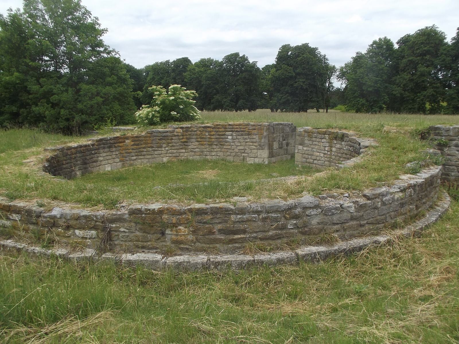
The walls required an estimated 85,000 cubic metres of stone. An earth bank lay about 800 metres beyond the north wall, and a defensive ditch probably surrounded most of the fort, with remains identified at the northwest corner. Lake Balaton washed away the northeast corner between the sixteenth and seventeenth centuries. The enclosure changed through several building phases. In the first, horseshoe-shaped intermediate towers and fan-shaped corner towers strengthened the walls; later rebuilding replaced these forms with round towers. Excavations in the 1970s showed that the walls were taken down to their foundations before the second-phase towers were built. Near the towers, the walls were removed completely and then rebuilt 2.0–2.7 metres wide. The round towers measured 14–15 metres across, with walls 2.7 metres thick, and larger corner towers were added. Overall dimensions changed only slightly. Rebuilding at Fenékpuszta and Alsóhetény is dated to the reign of Valentinian I.
Gates and possible harbor
A single-passage gate stood in each of the north, south, east, and west walls, and the four entrances remained in their original positions through rebuilding. Each had two external round towers, about 12 metres in diameter, flanking the passage, as well as an internal square tower with an upper-storey guardroom. The location of the harbor is uncertain. It may have been on the east side beside a gate, or, more probably, on the south side where the road leaving the fort ended. A ferry landing may have stood there, possibly linking the site to Vörs or Balatonszentgyörgy.
Interior buildings and roads
Roads and service buildings
Investigations have located 29 stone buildings inside the walls, arranged along two principal roads that met at a four-gateway monument called a tetrapylon. The complex included a possible main or command building, barracks, stables or animal pens, a bath building, and a 102-metre-long service structure along the east wall. Some buildings were constructed with the fort, including the granary near the west gate, the north wing of Building 25, and Building 4. Columned porches on Buildings 25 and 4 faced the main roads. Some floors were raised during the second building phase.
Building 25
Building 25, once called Building A, was a multi-phase complex about 100 by 50 metres, comprising a northern villa with a courtyard surrounded by columns and a southern villa with a covered porch. Their relative dates remain debated. Excavation in 2002 suggested that the southern villa may predate the fort and could have been one of Pannonia’s rural villas, while the northern wing probably belonged to the fort’s construction phase. The complex included a columned courtyard and a hall ending in an apse, a rounded end to a building, perhaps used as a dining room. Some rooms had heating and simple leveled or terrazzo floors, the latter made from stone fragments set in a binder. In the southern wing, the eastern apse was removed and a small bath took its place. The complex was probably rebuilt after a fire around the middle of the fifth century and may have remained in use into the eighth. Fire debris included painted wall plaster imitating marble and plant forms, charred beams, and melted metal and glass.
Basilica I
Basilica I stood near the north gate. It was a five-aisled building aligned east to west, with distinct western and eastern sections and an apse at its west end. The rectangular eastern section had a roof supported by five rows of five pillars and resembled a granary. A portico, a covered colonnade or porch, may have stood at its eastern end beside the main road. The building’s purpose remains uncertain. Interpretations include a secular or representative structure, a granary, a commandant’s residence, and an early Christian church. It may have remained unfinished, and the evidence leaves open whether it ever functioned as a church. By the ninth century it was probably in ruins; a hut dug partly below ground and a smelting furnace from that period were found within it.
Basilica II
Basilica II occupied the northwest corner of the fort. Its six identified building phases, labeled A to F, suggest that the first two served secular purposes and that phases C and D involved conversion to a church. From the middle of the fourth century, a hall with an eastern apse and a terrazzo floor was added, with a heating channel running north to south beneath it. The building was later extended westward. Its main entrance was on the west, where a step descended into the lower hall. In its final form, it had three aisles, each ending in an eastern apse, along with a narthex, an entrance area at the west end of a church, and a portico. The final phase is dated to the sixth or seventh century. Pillars along the north wall, a chapel on the south, and a small western apse may belong to it; these features were probably built of basalt and dolomite, like the rest of the structure. The building may have begun as a late Roman secular structure, become a church toward the end of the fourth century, and remained in use until the tenth. Its identification and use as a church remain debated.
Granary and workshops
The granary beside the west gate was aligned east to west and had four rows of pillars and a portico. It was probably built with the fort. Nearby ovens suggest that grain was its principal store, and charred grain was found at several places within the fort, including material used to level a principal road. The building burned twice and was rebuilt in altered form after each fire. Following the first fire, only its two central rows of pillars were rebuilt, and it probably continued mainly as a storehouse. Ovens east of the granary may date to either the first or second building phase. A proposal that the granary was a late-sixth-century predecessor of Basilica II is generally rejected.
A goldsmith’s workshop occupied the round tower west of the north gate. Its finds indicate that local metalworkers mainly repaired items rather than making new ones, including bronze vessels, boxes, and tools. Agricultural equipment included parts of a technically elaborate plough: its ploughshare, the cutting blade fitted ahead of it, and a plough chain. Local pottery included jugs and vessels decorated by smoothing their surfaces.
Early medieval huts
Huts with floors set partly below ground, dating to the Frankish period, were also identified within the fort. These remains show that its interior continued to be occupied after its Roman military role had ended.
Burials and archaeological finds
Cemeteries
More than 1,000 burials inside and outside the fort have been recorded since the late nineteenth century. Late Roman graves were mostly simple earth graves or brick-built graves, sometimes covered with roof tiles or reused sarcophagus lids. Finds included beads, bracelets, coins, and late Roman brooches with bulb-shaped ends. These burials ceased in the fifth century. Sixth- and seventh-century graves were simple earth graves or had stones packed along their sides; some of the dead were laid on wooden boards. Women’s grave goods included basket earrings, stylus-shaped pins, open-ended bracelets, and disc brooches, while some men’s graves contained belt fittings. Other finds are associated with the Keszthely culture.
Frankish-period cemeteries lay west and east of the south gate. The dead were usually placed in coffins, and some graves contained weapons, equipment, or food despite the general practice of Christian burial without grave goods. Finds included bucket-rim fittings decorated with human faces and Eastern Roman lead seals. These objects indicate connections between the Roman Christian community, the earlier Merovingian Frankish realm, and the Mediterranean.
Memorial chapel
About 1.5 kilometres from the south gate stood a stone building probably used as a multi-phase memorial chapel. It had a table and five burials and may have developed from a family tomb.
Ovens and human remains
A large group of ovens stood east of the granary. Excavators found the remains of children and adults of both sexes in the larger ovens, with cut and stab wounds. The ovens had been leveled after the bodies were deposited, and new ovens were built farther north. The deaths were probably violent, perhaps during an attack, but their date and circumstances remain uncertain.
Surviving fabric
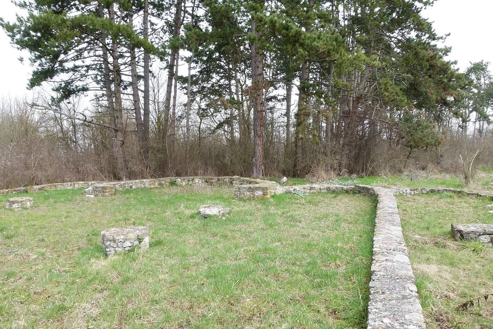
Some ancient wall remains have been conserved and partly reconstructed. Construction of a railway line removed part of the fort.