Ise Kokubun-ji Temple: The Provincial Buddhist Temple of Ancient Ise
Site at a Glance
- Rating
- 3.9
- Popularity
- Very Low
- Country
- Japan
- Primary era
- Medieval
- External website
- Open
- Eras represented
- Medieval
- Civilizations
- Unclassified
- Site type
- Religious
- Remains
- Monastery
On this page13 sections
History
Ise Kokubun-ji Temple in Suzuka, Japan, was the provincial Buddhist monastery of ancient Ise Province, established under the Nara-period government around 741. It belonged to the network of state-supported monasteries and nunneries created after Emperor Shomu’s decree, which ordered one monastery and one nunnery in every province. The policy followed a major smallpox epidemic and aimed to promote Buddhist orthodoxy in the provinces while strengthening the centralized Ritsuryo system, an ancient government organized through written legal and administrative codes.
Foundation in the Nara period
The exact foundation date remains uncertain, although the temple is generally understood to have been established soon after the 741 decree. Its position formed part of a wider early historical landscape in northern Mie. The surrounding Kawawa district is associated with the ancient Oshika clan, whose influence is reflected in the many burial mounds nearby. The monastery stood in Suzuka District, while the presumed Ise provincial capital lay about 7 kilometers to the southwest in Kawawa District.
The temple’s location also placed it near the presumed route of the ancient Tokaido, the major road linking the political capital with Japan’s eastern provinces. A station facility along the route provided official transport and logistical services. Nearby archaeological remains include Yayoi- and Kofun-period sites, the presumed Kawawa District government site at Kitsunezuka, and the Hakuho-period Minamiura temple remains. The Hakuho period covered the later seventh and early eighth centuries, before the Nara period.
Administration and later history
In 809, monks and nuns from the two provincial temples of neighboring Shima Province were transferred to Ise Kokubun-ji. The tenth-century Engishiki, a compilation of legal and administrative regulations, allocated 40,000 bundles of tax rice to Ise Kokubun-ji and 3,000 bundles to Shima Kokubun-ji. These provisions show the place of the monastery within the financial administration of the provincial temple system.
The later history of Ise Kokubun-ji is less clear. Like many provincial temples, it appears to have declined after the Heian period, and its name disappears from the historical record after the Engishiki reference. In 1186, Minamoto no Yoritomo ordered the military governors along the Tokaido to repair provincial chief shrines and kokubunji temples. The order does not establish what happened at Ise Kokubun-ji.
The South Gate may have survived into the Sengoku period, an era of widespread political and military conflict in Japan. During the Edo period, maps continued to identify the place as “Kokubunji.” The Kansei-period Map of Famous Places of the Tokaido also marked it, while an account from the Horeki period described roof tiles scattered across the area. These references preserve the memory of the temple after its institutional history had faded.
Protection and archaeological investigation
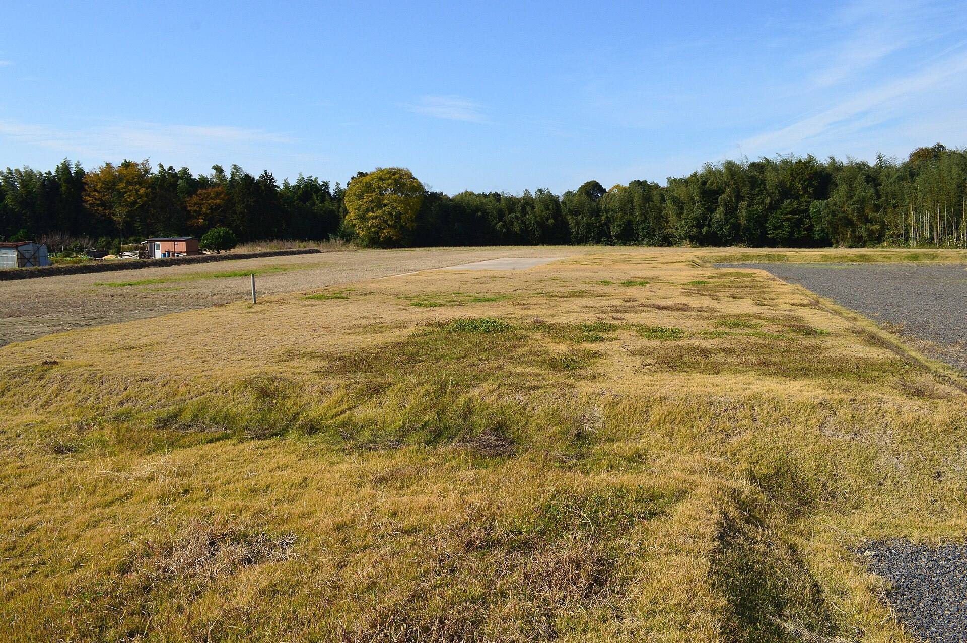
The precinct became a National Historic Site on October 12, 1922. Archaeological investigations began in 1988 and continued through 2009, comprising 35 excavation campaigns. Confirmation surveys connected with site development took place from 1999 to 2008, followed by continuing improvements to the site. Between 1995 and 1997, the precinct was acquired for public ownership. Parts of an earthen rampart along the western and southern edges were destroyed before or during the modern period despite the site’s protected status. The Suzuka Municipal Archaeological Museum opened beside the ruins in 1998.
The provincial nunnery
The presumed Ise Provincial Nunnery lay around the Kokubuncho settlement east of the monastery. A stone monument erected in 1802 called the monastery and nunnery the “South Compound” and “North Compound,” respectively. Later investigation associated the supposed South Compound with the earlier Hakuho-period Oshika abandoned temple site, while large quantities of roof tiles from the presumed North Compound support its identification as the nunnery area. The nunnery’s precinct and internal arrangement remain unknown. Three middle-Nara-period roof-tile kilns at Kawarai in Kasado are thought to have supplied tiles for it.
Remains
Precinct and principal buildings
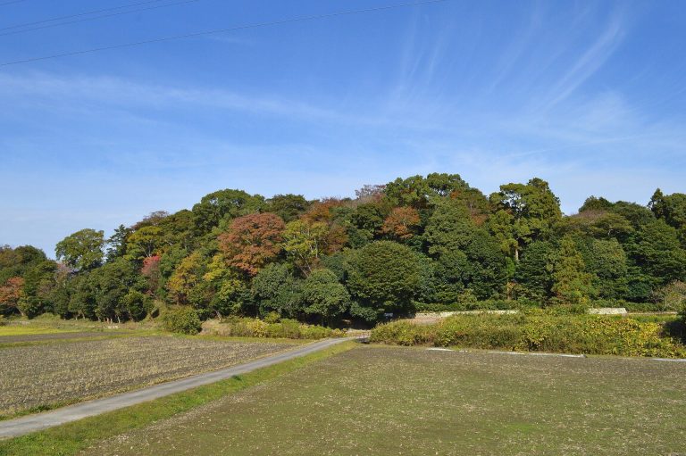
The monastery occupied a roughly square precinct measuring about 180 meters on each side. Earthen walls enclosed the compound, which stood on a fluvial terrace beside the Suzuka River at approximately 43 meters above sea level. The main buildings followed a south-to-north axis angled slightly westward. The sequence consisted of the South Gate, Middle Gate, principal hall, Lecture Hall, and monks’ quarters. A covered cloister, or corridor enclosing and connecting part of a temple compound, extended from both sides of the principal hall toward the Middle Gate. This arrangement resembles the plan of Todai-ji and is understood as a Todai-ji-style layout.
Principal hall and Lecture Hall
Excavation has revealed substantial remains of the Kondo, the principal Buddhist hall that generally housed the main sacred image, and of the Lecture Hall behind it. Their foundations form part of the central sequence of buildings. Much of the archaeological fabric was later cut down into the deeper portions of the foundations, so the approximate dimensions of buildings can often be reconstructed from surrounding ditches, while the dimensions above the platform surfaces remain uncertain.
Gates, cloister, and monks’ quarters
The South Gate, Middle Gate, cloister, and monks’ quarters have also been identified through excavation. Together they define the principal approach and central arrangement of the monastery. Their surviving evidence consists chiefly of foundation remains and related ground features, allowing the broad plan of the precinct to be reconstructed even where the upper structures have disappeared.
Eastern compounds
Northeastern compound
A separately enclosed compound occupied the northeastern part of the monastery. It measured approximately 64 meters from east to west and 90 meters from north to south, and included a southern gate, several buildings, and refuse middens. Its function has not been resolved. The arrangement may have supported food preparation or possibly served as a hospital, but its precise role remains uncertain.
Smaller secondary compound
A second enclosed area measured about 45 by 30 meters. Its position and size have led to a proposal that it may have accommodated the pagoda, since the standard provincial-temple plan expected a seven-story pagoda in addition to a sutra repository and belfry. The proposal remains provisional because excavation has not covered the entire site. Two further buildings supported by postholes were identified at the southeastern corner of the precinct.
Presumed nunnery area
The presumed nunnery area lies east of the monastery around the Kokubuncho settlement. Large quantities of roof tiles recovered there support its identification as the North Compound named by the 1802 stone monument. Its structural layout has not been established, and the relationship between its buildings cannot yet be reconstructed. The tile evidence nevertheless connects the area with the Nara-period religious complex associated with Ise Kokubun-ji.