Iptuci: An Ancient Hilltop Settlement in Spain
Site at a Glance
- Popularity
- Medium
- Country
- Spain
- Primary era
- Medieval
- Eras represented
- Bronze Age, Classical, Medieval
- Civilizations
- Roman, Tartessian, Umayyad
- Site type
- Settlement
- Remains
- City
On this page16 sections
History
Early occupation and coinage
Iptuci is an ancient hilltop settlement on Cabezo de Hortales in Spain, occupied from the late Neolithic into the medieval period. Settlement on the hill probably began in the Bronze Age. By the late second millennium BCE, Iptuci was occupied as Tartessian culture, an ancient culture of southwestern Iberia, developed. Painted Iberian-Punic pottery, reflecting local Iberian culture in contact with Punic traditions, points to a later phase, probably dating from the fifth to third centuries BCE.
The city reached a peak during the Turdetan period, named for an ancient people of southwestern Iberia, and minted its own coins. Seventeen known examples date to about 100–40 BCE. Their designs and inscriptions have been interpreted as evidence that the territory around Iptuci lay within the economic interests of Punic Gadir, the ancient Phoenician and Punic city at present-day Cádiz.
Roman city
Under Roman rule, Iptuci became the colony Ituci Virtus Iulia, whose foundation is attributed either to Julius Caesar, a Roman general and statesman, or to Augustus, Rome’s first emperor. It was initially a community liable for tribute within an administrative district associated with Gades. During the first century CE, under Emperor Vespasian, it acquired the status of a municipium, a community with recognized standing in the Roman civic system.
The city reached its greatest prosperity in the late second century. Material remains indicate Roman occupation from the first century BCE into the third and fourth centuries CE, while its defenses point to an important military role.
Medieval destruction and continuing salt production
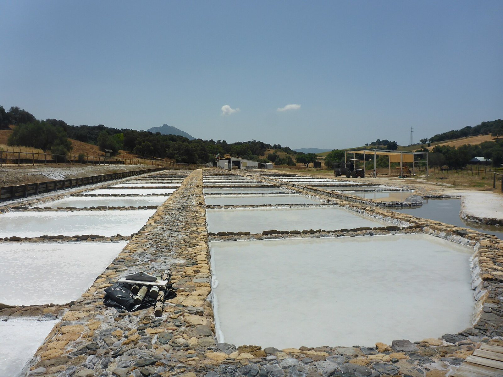
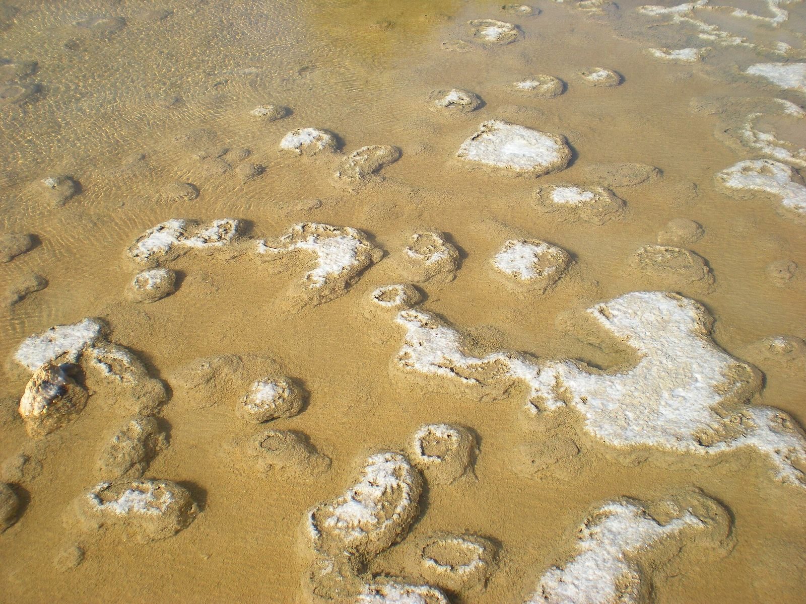
In 1133, the forces of Alfonso VII, king of León and Castile, attacked Iptuci and destroyed the city and its fortress. Nearby salt production is considered Phoenician in origin. Saltmaking continued from pre-Roman antiquity to the present, and the salterns remain in artisanal production, yielding about 500–600 tonnes annually.
Excavations in 1993 brought the southeastern burial ground to light. Iptuci’s archaeological zone became an Asset of Cultural Interest in 2000; its protected area was extended in 2002 to include land in neighboring Arcos de la Frontera.
Remains
Settlement and landscape
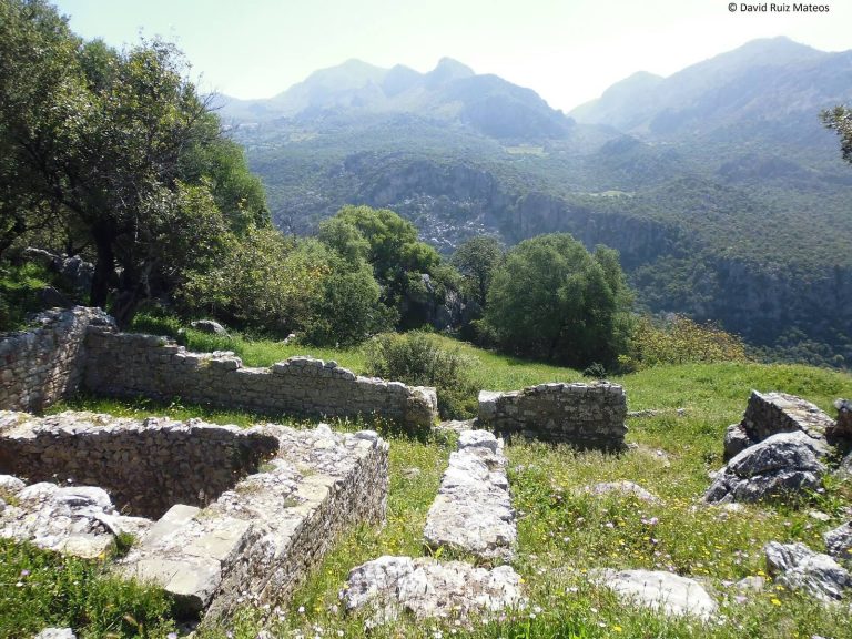
The archaeological area covers about 13 hectares on Cabezo de Hortales, a hill rising to 472 metres. Iptuci occupied the summit and slopes, with burial grounds and industrial areas on the hillsides. The remains include rough-finished paving, domestic structures, walls built of roughly dressed stone, and circular towers.
Settlement finds and pottery
Roman-period pottery includes Campanian black-gloss ware, ancient pottery with a glossy black surface, and sigillata, fine Roman tableware commonly finished with a smooth red slip. Other finds include a bronze object. At least one coin bears a bilingual inscription in Latin and Neo-Punic, a later form of the Punic language and script. The coins use Phoenician-style imagery, including a figure resembling Baal, a West Semitic deity, or Melqart, a Phoenician deity especially associated with Tyre.
Necropolises
North-slope burial ground
On the northern slope, a necropolis includes tower-shaped mausoleums in poor condition. Abundant surface pottery from different periods and of different types is scattered across this area.
Southeastern burial ground
The southeastern necropolis covers about 15,000 square metres. Its tombs include underground chambers cut into sandstone, with interior benches probably used to hold cremated remains and their offerings. A mausoleum stands in the necropolis’s northwestern area.
Andalusi fortress
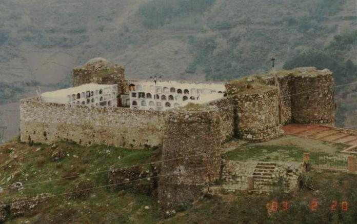
Defenses and entrance
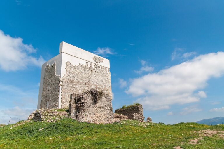
A square-plan fortress occupies the hilltop plateau. Its surviving defenses include massive semicircular towers at the southwestern and southeastern corners. On the eastern side, a bent approach leads to an entrance flanked by two square towers and one rectangular tower. The portal incorporates reused material from earlier buildings, possibly Roman, and parts of an outer defensive work protecting the entrance, called a barbican, can still be seen. The fortress’s construction technique has been compared with eastern models from the eighth to tenth centuries.
Pottery associated with the fortress
Pottery associated with the fortress includes pieces dating from the mid-eleventh to the first half of the twelfth century, as well as three jars from the thirteenth-century Almohad period. Other Hispano-Muslim wares span from the late Caliphate, the Córdoba-centered Muslim polity before its fragmentation in the early eleventh century, to an uncertain point in the thirteenth century. The finds include common wares, painted and glazed ceramics in honey, manganese, and green finishes, and pieces decorated with stamping, inscriptions, or cuerda seca, a technique that uses resist lines to separate areas of colored glaze.
Waterworks and salt landscape
Cisterns and reservoirs
Large cisterns and reservoirs lie beyond the Roman and medieval urban perimeter and help define the archaeological area. They may relate to industrial sectors, possibly including furnaces or halls.
Salterns and the Hondo stream
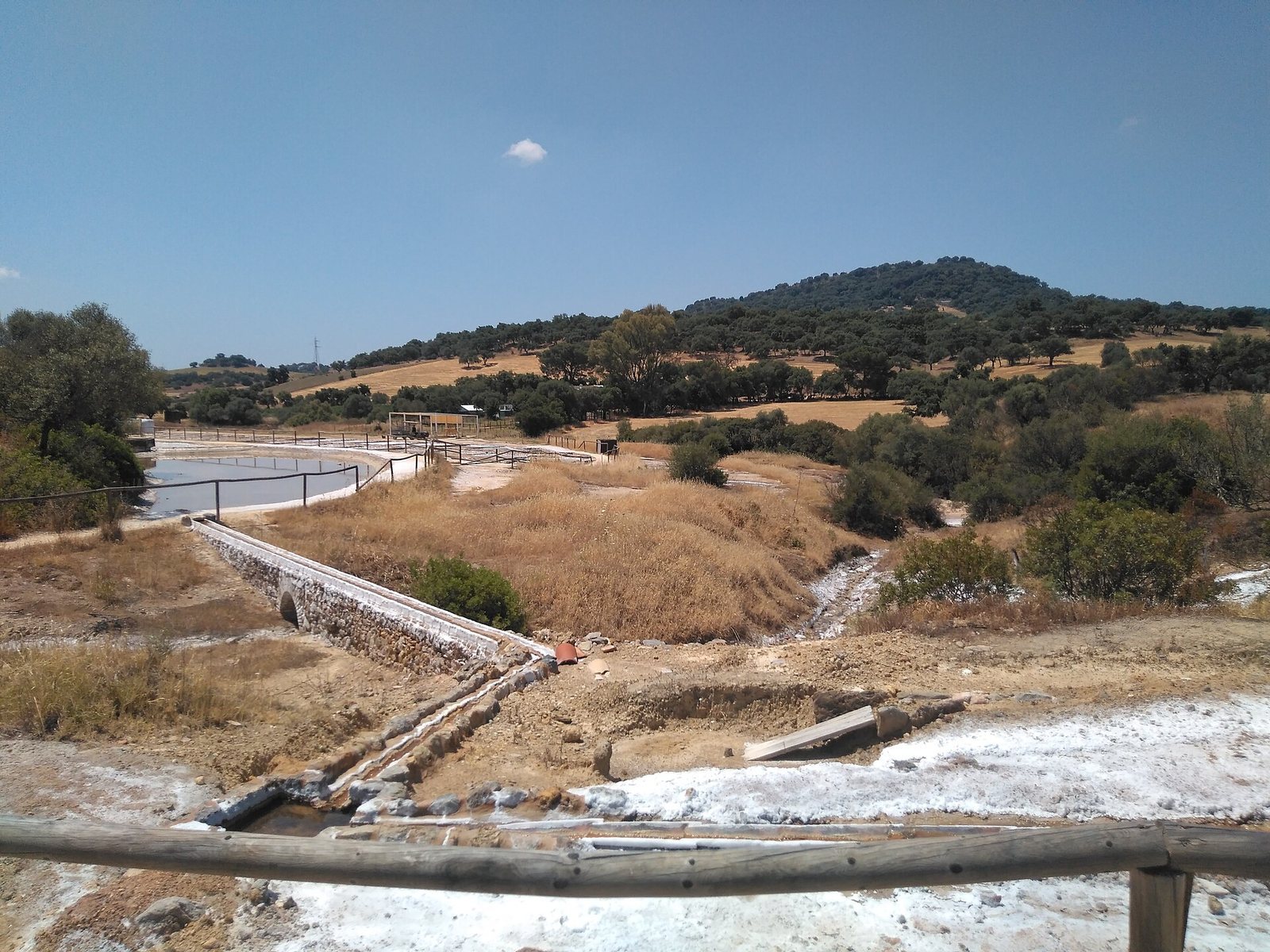
Nearby saltworks include Salina del Carmen, also called Salina del Chicha; San Ambrosio, also known as Salina de Ambrosio or Salinas de Cabeza de Hortales; and the abandoned saltern of Los Molinos. Five salterns have been identified in the area, some in El Bosque and several in Prado del Rey. The Hondo, a small tributary of the Salado, rises at Salina del Carmen, where excess brackish water draining from the basins forms its headwaters. Its flow varies by season. The stream runs east to west for about 650 metres beside remains of the old Seville–Ubrique livestock road before reaching the Salado.