Ichijōdani Asakura Family Historic Ruins: Headquarters and Castle Town of the Asakura Clan


Site at a Glance
- Rating
- 4.2
- Popularity
- Medium
- Country
- Japan
- Primary era
- Medieval
- External website
- Open
- Eras represented
- Medieval
- Civilizations
- Ashikaga shogunate
- Site type
- City
On this page16 sections
History
Ichijōdani Asakura Family Historic Ruins in Japan preserve the former headquarters and castle town of the Asakura clan, which controlled Echizen Province for 103 years during the Sengoku period, an era of prolonged warfare and political fragmentation from the fifteenth to the late sixteenth century. The complex developed around Ichijōdani Castle and included the Asakura lord’s residence, retainers’ compounds, temples, and the quarters of merchants and artisans.
Formation of the Asakura Headquarters
The Asakura appear to have used Ichijōdani as their base by the Nanboku-chō period. The military chronicle Asakura Shimatsuki records that Asakura Toshikage moved his headquarters there from Kuromaru in 1471, although other Asakura records indicate that the clan was already established at Ichijōdani earlier. The castle-town fortifications and settlement were substantially developed during the fifteenth century.
During the Bunmei era, senior retainers increasingly settled in the valley. Members of the Kuratani kubo, a branch of the Ashikaga family, were also present. Aristocrats, senior Buddhist clergy, writers, and scholars fleeing Kyoto during the Ōnin War found refuge at Ichijōdani, helping the settlement become a major cultural, military, and population center. At its height, its population exceeded 10,000, particularly during the period associated with Asakura Takakage, the fourth Asakura lord. The town became known as “Northern Kyoto.”
Strategic and Cultural Center
Ichijōdani’s position gave the Asakura control over several important routes. These included the Hokuriku Road, the Mino Road toward the Ono Basin, the route through Kanamata Pass toward Echizen-Fuchu, and the Asakura Road, which connected with the Hokuriku Road. River ports north of the Lower Gate linked the settlement with Mikuni harbor through the Asuwa River. Markets handled rice, imported goods, and other supplies, while also determining prices for major commodities.
The Asakura maintained close relations with the Ashikaga shogunate, the military government that ruled Japan during the Muromachi period. In 1499, Ashikaga Yoshitane, an Ashikaga shogun, visited Ichijōdani after seeking protection from Asakura lord Sadakage. In 1567 and 1568, the fifth Asakura lord, Yoshikage, received Ashikaga Yoshiaki at Anyoji and treated him hospitably. Yoshiaki, the final Ashikaga shogun, later left for Mino to seek Oda Nobunaga’s help in reaching Kyoto. These relations eventually brought the Asakura into conflict with Nobunaga, a warlord whose expansion threatened their position.
Destruction and Later Decline
The Asakura defeat at the Battle of Tonezaka in August 1573 forced Yoshikage to abandon Ichijōdani and flee to Ono. Nobunaga’s forces set fire to the valley the following day, destroying the town. The disaster followed Nobunaga’s successes at the Siege of Kanegasaki and the Battle of Anegawa in 1570, which had left the Asakura domain vulnerable.
Nobunaga appointed Katsurada Nagatoshi, also known as Maeba Yoshitsugu and formerly an Asakura retainer, as military deputy governor of Echizen. Nagatoshi established his residence at Ichijōdani, but local warriors led by Tomita Nagashige opposed him. An uprising began in January 1575, and approximately 33,000 insurgents attacked Ichijōdani. Nagatoshi and his family were killed. After Nobunaga suppressed the Echizen Ikko uprising, Oda commander Shibata Katsuie established his headquarters at the more conveniently located Kitanosho. Ichijōdani then became peripheral, and the abandoned settlement was gradually buried beneath fields and accumulated sediment.
Excavation and Protection
The gardens, some of which had become overgrown and buried, began receiving archaeological attention in 1967. Excavation and environmental restoration exposed the lord’s residence, retainers’ residences, temples, workshops, merchants’ houses, roads, gardens, and other parts of the former town. A prefectural research institute was established in 1972 for systematic investigation and park development, and a site museum opened in 1981.
The entire 278-hectare archaeological area, including the mountain castle, became a Special Historic Site in 1971. This is a high-level Japanese designation for archaeological or historical sites of exceptional national importance. The four principal gardens, Suwa Yakata-ato, Yudono-ato, Asakura Yakata-ato, and Nanyōji-ato, received Special Place of Scenic Beauty designation in 1991. In June 2007, 2,343 excavated objects were designated Important Cultural Properties, a national category protecting important cultural objects and works.
Flooding of the Ichijōdani River damaged part of the archaeological remains and inundated the site museum in 2004. Excavation and restoration continued into the twenty-first century, and the recovered evidence allowed approximately 200 meters of the former townscape to be reconstructed.
Remains
Ichijōdani lies in a narrow valley along the Ichijōdani River, a tributary of the Asuwa River. The valley measures approximately 500 meters from east to west and three kilometers from north to south. Mountains enclose it on the east, west, and south, while the river forms its northern boundary and contributed to the area’s natural defensibility. The principal settlement extended for approximately 1.7 kilometers between the Upper Gate in the south and the Lower Gate in the north. Earthen ramparts and gates protected both ends.
Settlement Layout and Fortifications
Within the enclosure, a planned street system organized the Asakura residence, samurai compounds, temples, merchants’ houses, and artisans’ dwellings. The town plan used a 100-shaku module, approximately 30 meters, and was considered orderly like Kyoto. Densely packed residential districts occupied much of the settlement. Areas also developed outside the gates, especially at Awaga and Maeba north of the Lower Gate, where river-port activity and road connections supported the movement and exchange of goods.
Mountain Castle
Ichijōdani Castle occupied Mount Ichijōshiroyama behind and east of the Asakura residence. Thought to have been built by the Asakura in the first half of the fifteenth century, it overlooked the Fukui Plain from an elevation of 473 meters. Its fortified zone extended approximately 1.5 kilometers in length and 200 meters in width, while its principal area measured about 600 by 200 meters.
The castle’s main enclosure, Senjōshiki, lies at an elevation of 416 meters. Along the ridge to the southeast are the First Enclosure at 443 meters, the Second Enclosure at 463 meters, and the Third Enclosure at 473 meters. Crosswise trenches divide these compartments and form a linked defensive plan. Surviving earthworks include enclosures, dry moats, ridge-cut trenches, vertical moats, earthen ramparts, and pits interpreted as ambush positions. The castle was never used in a battle before its abandonment. During the Genki era, approximately 140 rows of patterned vertical moats were probably added in preparation for an invasion by Nobunaga.
Outlying Forts
A detached fort called Omi Castle occupied lower ground to the northwest and included a horse sortie enclosure. Other forts stood on surrounding peaks, including Togo Makiyama Castle to the east, Joganji Castle to the north, and Mitsumine Castle to the south. Together with the mountain positions around the valley, these works formed an extensive defensive system.
Residences and Gardens
Asakura Residence
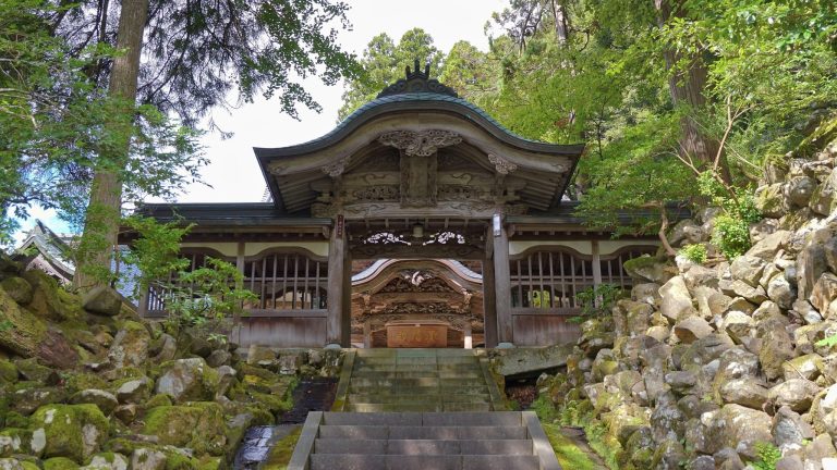
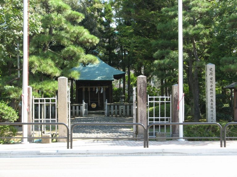
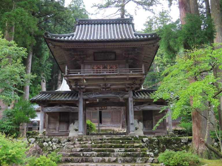
The Asakura Residence stood at the center of the medieval town, at the western foot of the castle. Earthen ramparts between 1.2 and 3 meters high enclosed its west, south, and north sides. An outer moat was approximately eight meters wide and three meters deep, and corner towers and gates stood along the ramparts. The western gate served as the formal entrance. The Chinese-style gate now standing there is not an Asakura-period structure.
The residence covered approximately 6,400 square meters and contained 17 buildings. The Main Residence, the largest building, measured approximately 21.4 meters from east to west and 14.2 meters from north to south. Reception facilities on the south side included the main audience hall, meeting hall, tea room, garden, and flowerbeds. Domestic facilities to the north included the kitchen, private Buddhist chapel, bathhouse, storehouses, and stable.
The buildings stood on square posts set on foundation stones, and their roofs probably used shingles or similar thin boards. Excavations recovered roof-end tiles and ridge stones. Sliding doors, including lattice-panel doors and translucent-paper screens, were widely used, and many rooms were probably covered with tatami mats. Residences of Asakura family members stood behind the main residence, while outer compounds, including the Inu Horse Ground and Willow Horse Ground, lay to the west. A reconstructed model of the residence is displayed at the site museum.
Landscape Gardens
The surviving gardens include pond-and-stone landscapes with substantial stone arrangements and restrained dry-landscape gardens using gravel, upright stones, and recumbent stones. Their lack of later alteration preserves garden forms associated with the late Muromachi period. Except for the Yudono-ato Garden, the similarity of the stone arrangements has led to their attribution to the period of Asakura Yoshikage.
The Yudono-ato, Nanyōji-ato, and Suwa Yakata-ato gardens had stones visible above ground and received Places of Scenic Beauty designation in 1930. Later restoration removed surface soil and cleared trees in 1967. Stone-lined channels carrying spring water and underground drains were excavated at Yudono-ato and Suwa Yakata-ato in 1987. Yudono-ato includes a pond feature called a tortoise island, an arrangement also found at the former Shūrinji Garden in Shiga Prefecture.
Town Buildings and Religious Sites
Reconstructed Townscape
The town’s residential districts consisted of closely packed small buildings. Reconstructed Townscape contains ten reconstructed merchant houses, together with their rear gardens, wells, and privies. One large residence has also been reconstructed with a gate, garden, storehouse, shed, well, privy, and principal hall. The hall measures 30 tsubo, approximately 99 square meters, and stands at the center of the compound.
Temples and Temple Gate
Approximately 40 temples are thought to have existed at Ichijōdani. A temple gate standing in front of the Asakura Residence spans 2.3 meters and carries a karahafu, a curved gable associated with traditional Japanese architecture. It is traditionally regarded as a later gate of Shōun-in, built to commemorate Yoshikage, rather than as part of the Asakura Residence. The present gate was rebuilt around the middle of the Edo period and bears the Asakura crest.
Archaeological Evidence
Archaeological work has exposed much of the Sengoku-period town in near-complete form and identified approximately 5,000 structural features. More than 1.7 million finds have been recovered, including architectural materials, domestic objects, craft objects, and other remains. Many of the 2,343 nationally designated objects are displayed at the Ichijōdani Asakura Family Site Museum.
In 2008, excavators reported 37 molds for sword fittings, including menuki and kogai, types of sword-fitting components. Believed to date from the Sengoku period, these molds provide physical evidence for craft production within the settlement.