Herdonia: A Daunian Settlement and Roman Town in Italy



Site at a Glance
- Rating
- 4
- Popularity
- Low
- Country
- Italy
- Primary era
- Classical
- Eras represented
- Classical, Medieval
- Civilizations
- Roman
- Site type
- City
On this page13 sections
History
Herdonia is an archaeological site in Italy, preserving a Daunian settlement and later Roman town on a hill southwest of modern Ordona. Its history extends from prehistoric occupation through Roman rule, medieval reuse, and the abandonment and rediscovery of the ancient city. The site is sometimes called “the Pompeii of Apulia,” while its ancient names included Herdonia and Herdoniae, alongside forms such as Herdona, Ardona, Erdonias, and Serdonis. The origin of the name remains uncertain.
Daunian Origins and Roman Conquest
Activity in the territory began in the Neolithic period, followed by Bronze Age huts and a wider settlement with houses and tombs from the Early Iron Age through the Archaic period. The Dauni were an ancient population of northern Apulia, known through their settlements, cemeteries, pottery, and distinctive material culture. Their settlement at Herdonia covered an estimated 600 hectares before the later Roman town occupied a more compact area with a denser concentration of monumental buildings.
Herdonia came under Greek influence before entering the Roman sphere. After Rome’s defeat at the Battle of Cannae in 216 BC, a major Roman defeat by Hannibal during the Second Punic War, the city joined the Carthaginian side. It then became the scene of two Roman defeats. In 212 BC, Hannibal defeated the Roman force commanded by the praetor Gnaeus Fulvius Flaccus. In 210 BC, he defeated the proconsul Gnaeus Fulvius Centumalus Maximus.
Hannibal destroyed Herdonia in 210 BC because he distrusted its loyalty. Its inhabitants were transferred to Metapontum and Thurii. The city was later rebuilt and continued after the Second Punic War, although it did not regain major importance until the imperial period.
Roman Development
Herdonia became a Roman municipium, a town incorporated into Rome’s civic and administrative system while retaining local institutions. Its position at the junction of important roads supported renewed prosperity, especially after the construction of the Via Traiana under Emperor Trajan. This imperial road connected Beneventum with Brundisium through Apulia. Herdonia was also linked with the Via Appia by the Via Aurelia Aeclanensis, known as the Via ad Herdoniam, while the Via Minucia was later rebuilt and renamed the Via Traiana.
From the age of Augustus, Herdonia underwent monumental expansion and flourished particularly from the first to the third century AD. The city reached its imperial-period peak after the Via Traiana was built. Its prosperity ended during the third century, when numerous public buildings were abandoned or rebuilt. The city included civic, commercial, residential, craft, and military spaces, reflecting its place within the Roman road network and regional administration.
Medieval Transformation and Abandonment
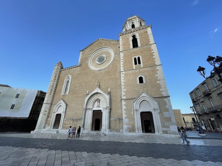
Herdonia survived the transition from late antiquity into the early Middle Ages. An early-medieval church stood at the northern end of the site, and during the Swabian-Angevin period it was transformed into a castle surrounded by a moat. The city also reportedly hosted one of Frederick II’s castles in the thirteenth century.
An early-medieval destruction affected the settlement, although its date remains uncertain. Depopulation continued during the late medieval period, and Herdonia was abandoned around the fourteenth or fifteenth century. Archaeological evidence has also been interpreted as indicating habitation into the seventeenth century. The remaining families eventually moved to nearby Ordona.
Resettlement near the ancient city began in the seventeenth or eighteenth century. A Jesuit agricultural estate was established first, followed by one of five new royal agricultural settlements promoted in the eighteenth century by Ferdinand IV of Bourbon. These settlements were intended to repopulate and improve the southern Tavoliere.
Rediscovery and Conservation
The ancient city was rediscovered archaeologically in 1962, when excavations began under the direction of the Belgian archaeologist Joseph Mertens. The first campaign continued for about thirty years and exposed an estimated 20 percent of the Roman settlement. Researchers from the Universities of Bari and Foggia later joined the Belgian team.
Excavations were interrupted in 2000 because of a legal dispute between state authorities and the landowners. The Ministry acquired part of the property in 2014 and the remainder in May 2022, allowing planning for a new excavation campaign. A field-school project involving the Universities of Bari, Foggia, and Leuven and the municipality of Ordona combined excavation, territorial investigation, conservation, education, and the creation of interpretive routes and visual information.
Some monuments were reburied after the interruption because restoration and conservation could not be guaranteed. Other exposed remains deteriorated through neglect, with vegetation covering parts of the site and previously restored frescoes requiring renewed intervention. Public heritage campaigns, together with efforts by local residents and associations, have promoted the protection of Herdonia and the proposed creation of an archaeological park.
Remains
Urban Setting and Defenses
The archaeological area lies on a hill southwest of modern Ordona, near the ancient course of the Carapelle River. The Roman city had an elongated rectangular plan that narrowed toward the north. Its walls formed a circuit about 1,980 metres long around nearly 20 hectares, measuring approximately 730 metres from north to south and 300 metres across. The enclosure incorporated three low, flattened hills separated by shallow valleys, where the city gates were located.
Several stretches of the city walls remain visible. On the western side, the principal gate was flanked by square towers and faced with opus reticulatum, a Roman technique that arranged small wall-facing units diagonally in a net-like pattern. An earlier fortification is described as approximately 13 metres high, with an earth-and-brick wall. The Roman circuit was strengthened in the early first century BC. From the acropolis, the remains of a Roman bridge can be seen near the railway beside the former channel of the Carapelle.
Public Center
Forum and Civic Basilica
The central public area contained the forum, a basilica, two temples, a market building known as a macellum, and a bath complex. The forum square remains visible and was bordered by shops on three sides. The public complex also includes remains identified as the Capitolium, a recently discovered rustic villa, and structures interpreted as a tribunal, treasury, and council house.
The basilica opened onto the forum as a rectangular hall measuring approximately 42 by 26 metres. Twenty columns divided the interior and left a broad central space. The surviving elements include column bases and limestone capitals in an Ionicizing style. The original columns were about 7 metres high, made of brick covered with stucco. The walls used opus incertum, a roughly irregular Roman wall construction, with almost reticulated facing, tile courses, and brick pilasters. Painted plaster covered the walls, and fragments remain.
A rectangular room opened on the side opposite the forum and contained a statue base. An underground room in this area may initially have served as the civic treasury. Built in the late first century BC or early first century AD, the basilica was abandoned, possibly after an earthquake, in the fourth century. It was then divided into houses and shops, while an apsidal room was used between the fourth and sixth centuries. Tombs occupied parts of the building in the sixth or seventh centuries, and medieval houses reused the area between the twelfth and fourteenth centuries.
Baths and Market Area
The bath complex included hot and cold rooms and was richly decorated. Its excavated remains are visible within the archaeological area, together with the remains of the macellum, the Roman market building associated with the sale of foodstuffs and other goods.
Amphitheatre
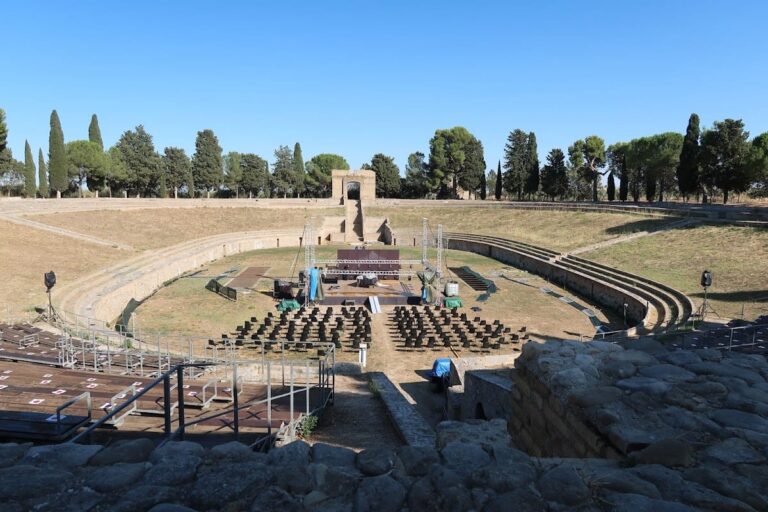
The small amphitheatre occupied the northeastern part of the city near the Roman walls. It was created by using the ditch of an earlier defensive structure and is now represented mainly by a large hollow that eighteenth-century travellers noticed and later excavations partly explored. The building had an elliptical plan measuring approximately 74 by 59 metres. Its outer wall, about 215 metres long, used opus reticulatum, portions of which remain visible.
Built in the first century AD, the amphitheatre was restored, enlarged, and embellished in the second century. Two entrances on the main axis led toward the seating area. The building hosted gladiatorial games and animal combats for spectators from Herdonia and the surrounding countryside. In late antiquity, between the fourth and sixth centuries, it was dismantled, and its entrances were converted into dwellings.
A hoard was buried among the amphitheatre ruins around 1020–1030. It consisted of 147 gold tari and one Byzantine solidus placed in a small jug. Excavators recovered the coins in 1965, and they are held in the storerooms of the Museum of Taranto.
Roads, Settlement Areas, and Medieval Structures
Roman residential and craft buildings have been identified across the site, together with a campus used for military activities. Visible remains also include parts of the Via Traiana and sections of other ancient roads. Brick and opus reticulatum construction appears among the excavated areas, alongside portions of the forum, basilica, market, baths, amphitheatre, city walls, and main gate.
At the northern end of Herdonia, the early-medieval church was later incorporated into a castle during the Swabian-Angevin period. The castle was surrounded by a moat, preserving evidence of the settlement’s transformation from an ancient urban center into a medieval fortified complex.
Daunian Necropolis
A large necropolis extended outside the city walls and began in the pre-Roman period. Excavations produced Daunian pottery now preserved in museums in Foggia, Bari, and Taranto. In 2012, two early-fourth-century-BC pit graves were excavated in the Daunian cemetery at Contrada Cavallerizza.
One grave belonged to a woman and contained very few objects. The other held the remains of a high-status male warrior aged about 30–35, together with coloured geometric Daunian pottery, a panoply, and several weapons. The grave also yielded 70 textile fragments, 29 wooden fragments, 250 bronze-sheet fragments, and four turned objects. After a year of conservation, a woollen cloth was found to preserve a parade panoply with a border embroidered in linen thread. These embroideries are regarded as the oldest recovered in Italy.