Habitancum: A Roman Auxiliary Fort in Northumberland
Site at a Glance
- Popularity
- Medium
- Country
- United Kingdom
- Primary era
- Classical
- Eras represented
- Classical
- Civilizations
- Roman
- Site type
- Military
- Remains
- Fort
On this page19 sections
History
Frontier foundation and first fort
Habitancum was a Roman auxiliary fort at Risingham in Northumberland, United Kingdom, established around AD 139–140 under Emperor Antoninus Pius. It formed part of a chain of northern outposts associated with Hadrian’s Wall and stood on Dere Street, the Roman road from York through Corbridge toward Melrose. Its garrison helped monitor routes beyond the Wall, and the fort may also have supported campaigns farther north.
Hadrian ordered the construction of his Wall in AD 122. Under Antoninus Pius, Roman control advanced north to the Antonine Wall, a frontier barrier across central Scotland. Habitancum was established during this northern advance, though there is no evidence that its construction coincided with Hadrian’s Wall. When Roman forces later withdrew toward Hadrian’s Wall, the garrison remained at Habitancum for a time.
The first fort was probably built from timber and earth around AD 139–140 by a construction detachment of Legio VI Victrix, a Roman legion serving in Britain. It may have helped support Roman occupation of the Central Lowlands as far as the Antonine frontier. Repairs to a wall and gate took place during the second century. Around AD 197, the fort was burned and destroyed, probably during an incursion from the north. Its own garrison may instead have cleared it deliberately before withdrawing temporarily.
The first garrison is uncertain. It may have included the Fourth Cohort of the Gauls, an auxiliary unit of about 500 men that may have had mounted troops; the Second Cohort of the Nervii is another possible early unit. The fort’s name appears as Habitanci on one altar and Habitancum on another, dedicated to Septimius Severus, his wife Julia Domna, and the spirits of their ancestors. It also appears in the seventh-century Ravenna Cosmography, a compilation of place-names. The name’s origin is uncertain. One proposal combines Habitus with the Latin place-name ending -ium, giving a possible meaning of “place of the people of Habitus” and suggesting a possible connection to a Romano-British group or landholder.
Severan rebuilding and frontier service
After Roman control of the region was restored, Emperor Septimius Severus had Habitancum rebuilt in stone, probably around AD 205–208, in preparation for a northern campaign with his sons. From the reign of Caracalla, Severus’s son, the fort served as a forward post. The First Cohort of the Vangiones, nominally 1,000 men, is associated with the stone rebuilding.
Other units may also have served at Habitancum, perhaps temporarily, including a scout unit and a detachment of Raeti Gaesati, an auxiliary force of spearmen. By the mid-third century, scouts were present at Habitancum and nearby Bremenium as frontier conditions became more unsettled. A later label linking the scouts to Habitancum was added, but no inscription assigning that unit to the fort has been found; the scouts may instead have been regular Roman soldiers assigned to reconnaissance.
Late Roman destruction and abandonment
The fort was destroyed again in the late third century, possibly during an attack by the Caledonians and Maeatae around AD 296. The attack may have followed the defeat of Allectus, a Roman usurper in Britain. A substantial fire layer above floors in the Severan buildings is consistent with the fort being overrun. Habitancum was rebuilt around AD 306.
Its final destruction came around AD 367–369, and Roman occupation had ended by the close of the fourth century. The destruction may have coincided with a withdrawal of the army behind Hadrian’s Wall, which possibly began around AD 312, or with a peace agreement with northern peoples. Roman commanders may have judged that the troops and supplies needed to maintain such a distant post outweighed its value. The other northern outposts were also abandoned by the end of the century.
People, settlement, and later history
A civilian settlement and cemetery developed outside the fort. Julius Victor’s gravestone identifies him as a standard-bearer but does not name his unit. Marcus Gavius Secundinus, a consular beneficiary, described Habitancum as his first posting in that administrative role under a provincial governor. Officials in the governor’s staff collected dues and regulated traffic on Dere Street. Seven tombstones from the cemetery commemorate both civilians and soldiers.
A settlement grew among the fort’s ruins during the Middle Ages, and stone robbing probably removed much of the Roman structure. Elizabeth Swan recorded a later settlement at Risingham in 1604; its last known resident left in 1826. In the seventeenth century, the English antiquary Robert Bruce Cotton took Roman finds from Risingham first to Conington, then bequeathed them to Jesus College, Cambridge.
Excavations by Richard Shanks between 1839 and 1842 revealed the bathhouse and central headquarters building. Further work on the headquarters in 1840, 1849, and 1935 recovered its stone-phase building inscription, dated AD 213. John Bell copied an inscription found near the bathhouse in 1844. Aerial photography by John Kenneth Sinclair St. Joseph in the 1960s and geophysical surveys from 2009 to 2012 added evidence of dense building remains; the surveys were accompanied by further aerial photography. Building work in 2004 also yielded a fragment of Roman black coarseware pottery.
Remains
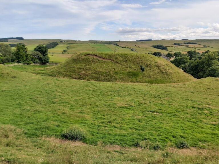
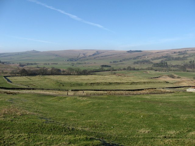
The surviving remains are arranged around a long rectangular Roman fort, with defensive walls enclosing internal buildings and traces of settlement beyond the perimeter. The later fort’s sandstone-faced defences replaced an earlier timber-and-earth enclosure on a different alignment. The site occupies a low rise overlooking the River Rede.
Setting and plan
In Roman times, the fort stood about 45 metres from the Rede. The river has since shifted northwest, leaving it roughly 200 metres from the present bank. The Chesterhope Burn runs southwest of the fort and joins the Rede just northwest of the site. The river may have carried supplies in flat-bottomed boats from stores at Corbridge. Dere Street diverged west from the modern A68 near the fort and rejoined it about three kilometres farther north.
The first fort covered about 1.2 hectares. Its identified traces include an ash layer and charred timber beneath the western wall of the later fort, along with early second-century pottery recovered beside that wall. The later fort measured approximately 140 metres from north to south and 120 metres from east to west, covering about 1.6 hectares. It had a long rectangular shape with rounded corners and a different alignment from the earlier enclosure.
Defences and entrances
Walls and ditches
The stone walls had a core of rubble and earth faced with carefully dressed sandstone. Their masonry base used blocks cut to slope along their outer faces. A clay bank or rampart, about nine to ten metres wide, reinforced the inside of the walls and provided a raised path along the defences. Some walling survives to about 1.2 metres above ground. At the northeast corner, two courses of masonry remain, reaching 0.5–1.2 metres high on the inner side and 2.5–3.5 metres on the outer side.
Four ditches encircled the fort. Their traces are clearest on the west and south, with sections also visible on the east; agricultural activity has damaged parts of them. The Rede washed away the northwestern portion of the north wall.
Gates and approach roads
Gaps about eight metres wide in the walls identify the north, south, and west gates. A gap in the middle of the north wall marks the likely position of that entrance. Earthen causeways crossed the ditches. The west gate had a single passage flanked by projecting towers. Its eastern tower appears to have collapsed and been rebuilt, and the passage was later narrowed to pedestrian width. A road from this gate crossed the Chesterhope Burn toward Dere Street.
Towers
Rectangular towers built against the inside of the corners strengthened the fort’s defences; grass-covered mounds mark their positions. The northwest corner tower was lost when the Rede changed course. Slight rises along the inner wall indicate further rectangular towers between the corner towers. Near the central tower on the east wall, a roughly worked stone has two small square cuttings that may have held a pivot or dowel.
Buildings inside the fort
Interior buildings
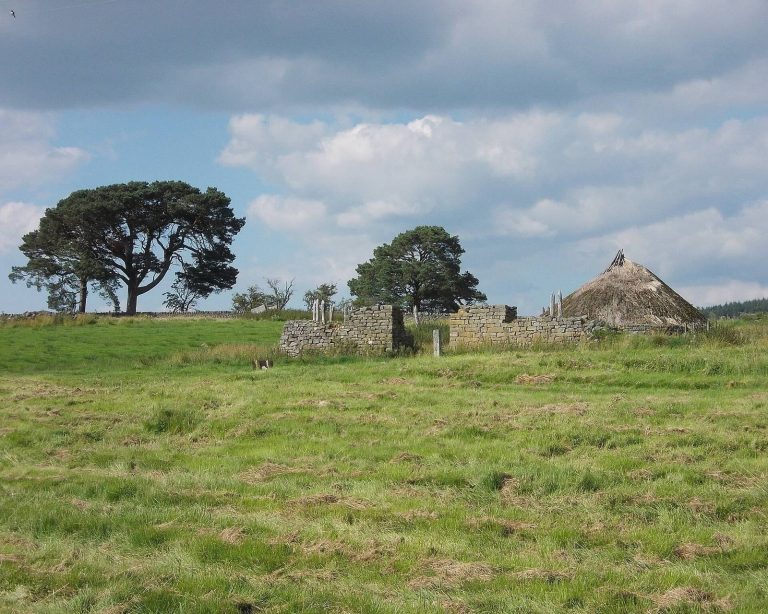
Outlines of buildings remain visible beneath the turf, although most probably belong to a post-Roman occupation and their dates are uncertain. The fort probably contained one or two granaries, stables, workshops, and as many as 18 barrack blocks, as well as its headquarters and bathhouse.
Headquarters
The headquarters stood near the centre of the fort. An identifiable, damaged stretch of wall belongs to the northern end of its large covered hall. A raised platform was reached by three steps, while a hollow in the floor marks the standard shrine. A pivot stone survives at the entrance. The building inscription dates the stone headquarters to around AD 213. After a probable fire around AD 343, the building was altered and remained in use; worn floors and thresholds show continued use.
Bathhouse
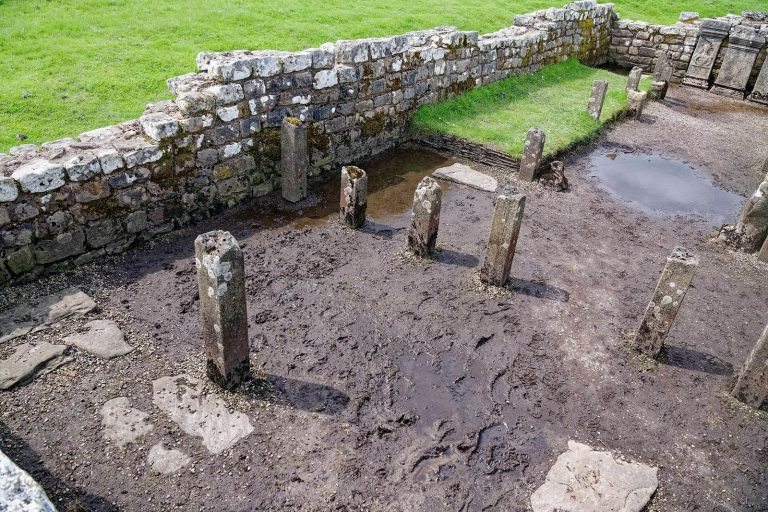
The bathhouse stood in the southeast corner of the fort, in an exposed position despite the fire risk. It was probably destroyed in the late third century and renovated around AD 305–306. Reused stone fragments formed part of its walls. Excavations in 1840 recovered a hoard of 15 coins, ranging from the reign of Gallienus in AD 254 to that of Claudius Gothicus in AD 269.
Community and religious evidence beyond the fort
Settlement and cemetery
The civilian settlement probably extended around the west, east, and south sides of the fort. Its cemetery is represented by seven recovered tombstones belonging to civilians and soldiers. Three temporary Roman marching camps are also known in the surrounding area, including two at Swine Hill and Four Laws.
Altars and dedications
Eighteen altars and seven dedicatory inscriptions are known from Risingham and its vicinity. Five altars honor Jupiter Optimus Maximus, Rome’s chief state god, and two honor Jupiter Dolichenus, a form of Jupiter worshipped in a military cult. Three each are dedicated to Fortuna, who personified fortune, and Hercules; two each name Mars and Mogon. Other dedications invoke Diana, associated with hunting, Cocidius, a local deity, the Mother Goddesses, the Nymphs, and the reigning emperor’s Genius, or divine spirit.
The Robin of Risingham
A sandstone relief about 1.2 metres high, carved directly from rock, is locally called the ‘Robin of Risingham’ or ‘Robin of Redesdale’. It shows a figure who may represent a local hunting god, Silvanus, or Cocidius, probably beside an altar. The figure wears a belted tunic, a quiver, and a cloak over both shoulders, holding a bow above its head in the left hand and a small animal in the right. It is the only known Roman-era sculpture in Northumberland carved from rock.
After the antiquary John Horsley described the relief in the eighteenth century, the landowner, angered by the number of visitors, used gunpowder to destroy its upper part. The lower portion, including the figure’s legs, survives. In 1983, the Redesdale Society placed a replica of the destroyed upper section in front of the original.