Bremenium: A Roman Frontier Fort in Northern Britain
Site at a Glance
- Popularity
- Medium
- Country
- United Kingdom
- Primary era
- Classical
- Eras represented
- Classical, Early Modern
- Civilizations
- English, Roman
- Site type
- Military
- Remains
- Fort
On this page22 sections
History
Bremenium was a Roman fort at Rochester in the United Kingdom, founded during Agricola’s campaigns around AD 80. Built on territory associated with the Votadini, a people of ancient northern Britain, it watched Dere Street, the Roman road linking northern England with southern Scotland, and helped monitor the local population. The surrounding area also served as a staging ground for military operations. For more than two centuries, Bremenium was one of Rome’s northernmost military bases.
Foundation and frontier changes
The fort’s founding phase dates to AD 78–85, and indications point to an earlier settlement on the site. After Agricola was recalled in AD 84, Roman forces withdrew to a more defensible position around the Forth–Clyde isthmus. Hadrian established a frontier farther south in the 120s, and Bremenium was temporarily left unoccupied. It later operated as an outpost beyond Hadrian’s Wall, the frontier fortification begun in AD 122 between the Tyne and Solway.
Reoccupation and rebuilding
Under the provincial governor Quintus Lollius Urbicus, Roman forces returned and rebuilt Bremenium in stone around AD 139–142, during the advance associated with the construction of the Antonine Wall, a frontier farther north across central Scotland. The fort remained garrisoned after Rome abandoned that wall in the early 160s and restored Hadrian’s Wall as the frontier.
Bremenium was destroyed or badly damaged around AD 197. In the early third century, during repairs to Hadrian’s Wall under Septimius Severus, it was renovated and strengthened as a forward defense. Roman military and economic interests north of the Wall continued to make the outpost useful. Inscriptions record further building work during the reigns of Caracalla, Elagabalus, and Severus Alexander.
Later occupation and abandonment
By the middle of the third century, Bremenium and nearby Habitancum had garrisons of scouts, a change associated with increasingly unsettled conditions. Inscriptions connect the fort with the First Cohort of the Loyal Vardulians, a partly mounted unit of about 1,000 men, and the Numerus Exploratorum Bremeniensium, a unit of scouts. Other forces associated with Bremenium at different times included a construction detachment of Legio XX, the First Cohort of the Lingones, and either the First Cohort of the Dalmatians or the First Aelian Cohort of the Dacians. The Lingones unit was partly mounted and about 500 strong.
The fort was destroyed again late in the third century and subsequently rebuilt. From AD 312, Constantine I withdrew much of the Roman force stationed north of Hadrian’s Wall. This may have been connected with a peace agreement with the Caledonians and Maeatae, peoples of northern Britain. Around the middle of the fourth century, the Picts burned Bremenium. The destruction is dated either to AD 343 or AD 360, after which the fort was abandoned. Its omission from the late-fourth-century Notitia Dignitatum is consistent with the fort no longer having a regular garrison by that time.
Ancient writings give the place several forms of its name, including Bremenium, Bremenio, Bremaenio, and Bremenion. The name may mean “place by the roaring stream,” perhaps referring to the Sills Burn west of the fort. Dere Street connected Bremenium with Risingham, Halton Chesters, Portgate, and the supply center at Corbridge. Another Roman road ran east to Learchild, where it joined the Devil’s Causeway toward Berwick-upon-Tweed.
Later use and investigation
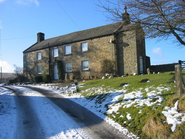
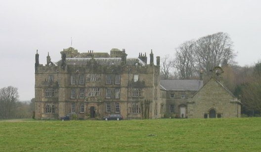
Around 1581, two fortified farmhouses were built within the Roman walls to protect against raids by the Border Reivers, raiding groups active along the English–Scottish border. One stood near Gallow Knowe. The fort’s interior was partly excavated in 1832, and its walls were exposed between 1852 and 1855. Work in 1935 identified the headquarters building, part of the inner perimeter road, and a 5.7-metre-long barrack block. Excavations in the 1970s examined part of the nearby Petty Knowes cemetery. The fort grounds now form part of the Brigantium Archaeological Reconstruction Centre, associated with Newcastle University’s Department of Archaeology.
Remains
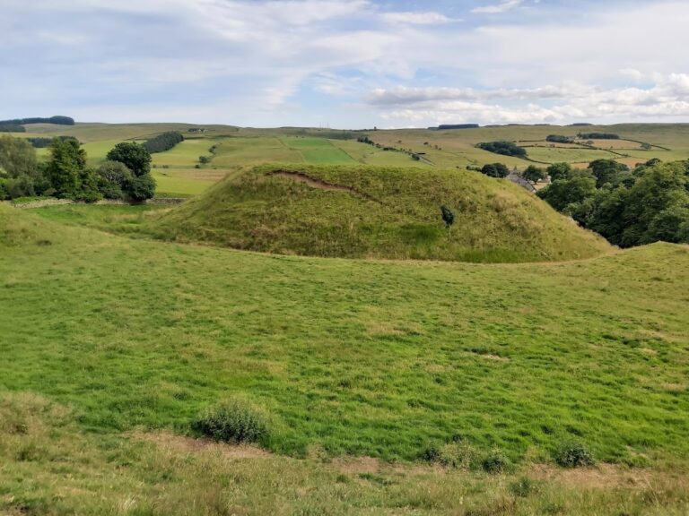
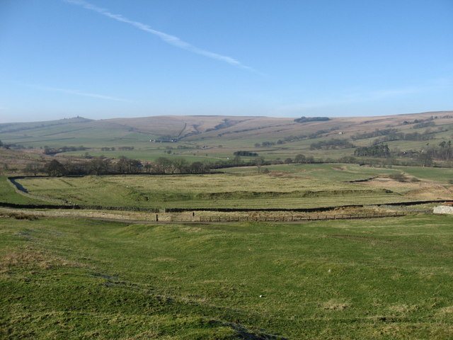
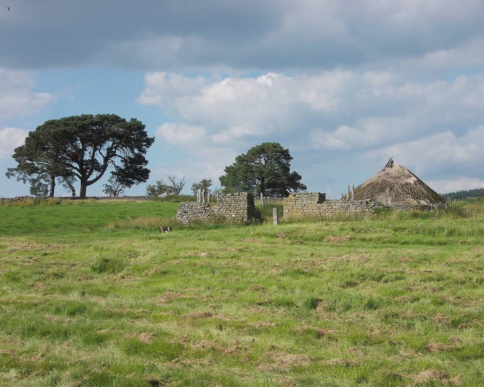
The fort occupies a ridge spur above the Rede valley, with steep slopes on its north and west sides. The Sills Burn curves around the northwest. The surrounding plateau is largely farmland and pasture, while farm buildings cluster near the northern and western ramparts. High Rochester developed over the former fort, and part of the site is now village green. The enclosure was oblong, with rounded corners in its Severan-period form. It measured about 148 metres north to south by 136 metres east to west, covering approximately two hectares.
Fort enclosure and defenses
Construction phases
The earliest enclosure, dated to AD 78–85, used timber and earth and was protected by a single ditch. A later fort of the Flavian–Trajanic period retained timber-and-earth construction, but had a higher rampart and a more extensive system of ditches. In the second, Antonine phase, a stone enclosure replaced the earlier defenses and was laid out on a northwest orientation. Its wall had a rubble-and-clay core faced with dressed stone on both sides. An earth bank against the inner face helped support the wall and provided a platform for defenders.
In the Severan phase, the fort was rebuilt with stronger defenses, and interior buildings were generally placed over the foundations of earlier structures. The later Constantinian-period walls were wider than those of most Roman forts of their time. Across these phases, the fort’s defensive circuit was backed by an earth bank and had a gate on each side.
Walls, gates, and towers
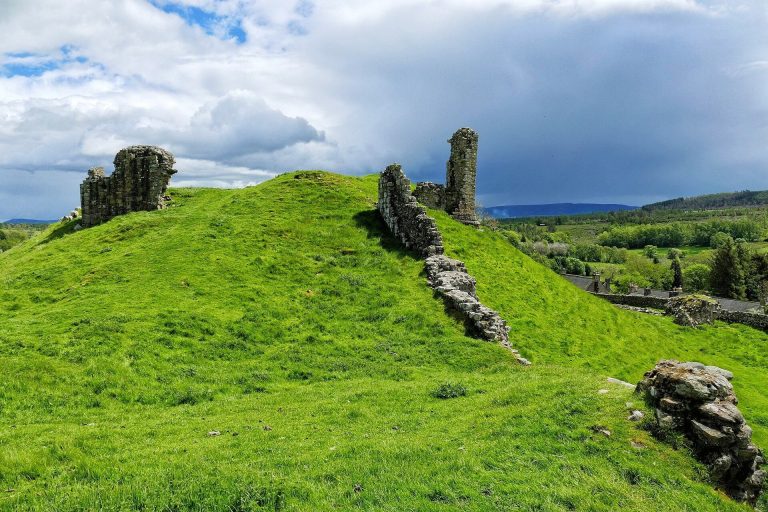
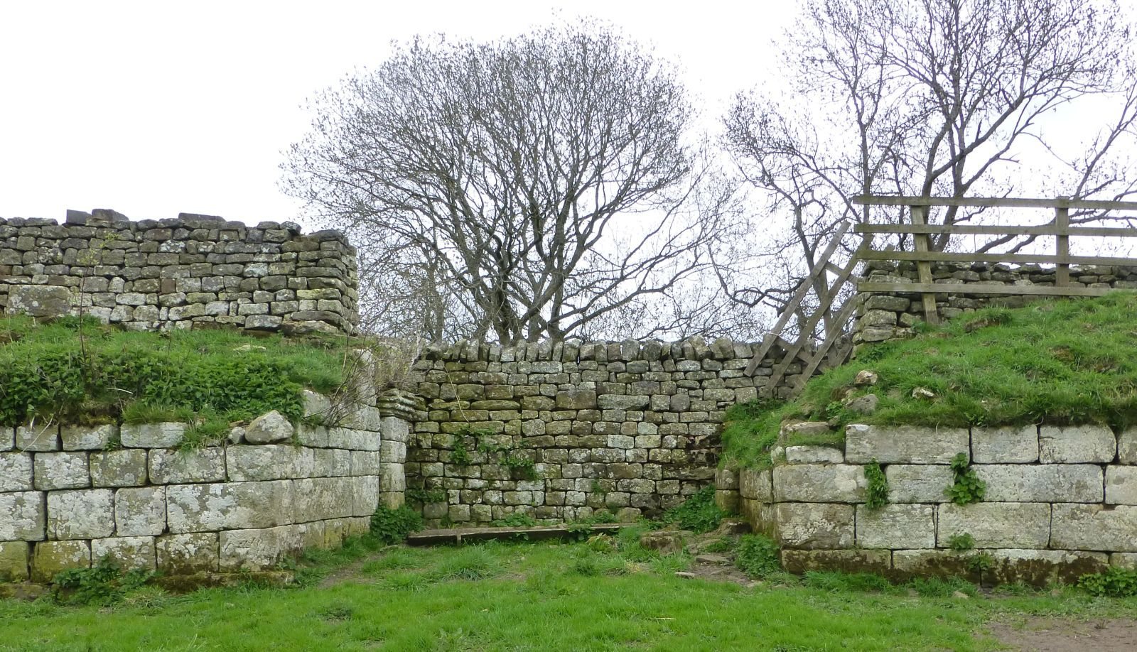
The west wall is the best-preserved stretch. Sections of the west and north walls survive, along with underlying remains of their gates. The west gate stands to the point where its arch begins to curve, with masonry about 2.7 metres high. Thresholds remain at the north and south gates; the south gate was levelled in the eighteenth century. Dere Street approached the south gate, while the road from the east gate ran toward the Sills Burn. Each gate was flanked by two towers.
Square towers were also attached to the inner face of the walls between the gates and corners. One between the south gate and southwest corner has lost its front, but its side and rear walls survive up to a blocked first-floor doorway. Its remains indicate several building phases. Another internally attached tower survives at the southeast corner.
Ditches and artillery defenses
Numerous ditches formed obstacles around the fort. Six can be made out from the air, and thirteen have been counted northwest of the enclosure; four more are recorded on its south and east sides. Six ditches north of the fort were identified in 1935, though their date is uncertain. Three larger ditches on the east and south were separate from those to the north. Further irregular ditches near Dere Street and the Sills Burn run both north–south and west–east. Their purpose is unclear, but they may have impeded access to the road, north gate, or watercourse.
Stone platforms, each about 9.8 metres square, were attached to the north wall. They could have supported Roman artillery aimed at attackers approaching along Dere Street from the north. Their installation may date either to the period after the Antonine Wall was abandoned or to the wars of the 170s and 180s. Two Roman projectile balls are built into the village school. Inscriptions credit the Vardulian cohort with constructing a ballistarium, an artillery-related structure whose precise form is uncertain. It may have been a platform beside or on the wall, or a building for storing weapons and ammunition.
Buildings and finds
Interior buildings
The fort’s excavated remains include a 21-metre-long headquarters building, a bath building in the southeast corner, barracks, stables, workshops, and granaries. Four granaries are recorded, two on either side of the headquarters. Some buildings had underfloor heating. Beneath the shrine within the headquarters was a cellar with a particularly heavy stone door that slid on iron rollers into a recess. A possible extension outside the west side of the fort may have been associated with an external bathhouse. In the late Roman period, smaller detached dwellings replaced the earlier barracks. The excavated stretch of inner perimeter road ran along the inside of the rampart.
Inscriptions and sculpture
Up to forty Roman inscriptions are known from Rochester and its immediate surroundings. Those linked to the fort include a Legio XX building inscription from the east gate, an inscription of the Lingones cohort from the headquarters, and inscriptions concerning the ballistarium. Other examples include an altar dedicated by the tribune Cassius Sabinianus and a tombstone fragment for Aurelius, a centurion of the First Cohort of the Dalmatians.
A 67-centimetre-high relief from Rochester, dated to the second or third century, depicts Venus bathing between two water nymphs. One nymph holds a water jug and the other a cloth as Venus washes her hair. The composition draws on the third-century BC statue of the Crouching Aphrodite by Doidalses.
Pottery and animal remains
The notable pottery finds include South Gaulish pottery dated to the AD 80s. Excavations also recovered bones of cattle, sheep, pigs, red deer, wild boar, hares, foxes, and badgers.
Nearby military camps
Camps close to Bremenium
A square marching camp measured 270 by 285 metres and enclosed 7.7 hectares. Its north side is partly covered by the south rampart of Camp III. The position of its gates is known only for one in the middle of the west wall. Dere Street passed close to the east side, though the camp was not aligned with the road. Another small enclosure, 52 by 40 metres, had a surrounding ditch but no identified rampart. Camp III occupied the ridge between March Sike and Chew Sike; its parallelogram-shaped earthwork enclosed 5.5 hectares.
Featherwood camps
About seven kilometres north of Bremenium, Featherwood West occupied a spur on 460-metre-high Foulplay Head. Its trapezoidal earthwork covered 15.6 hectares, with irregularly aligned long sides, a 3.6-metre-wide rear bank, and a surrounding ditch. Earthworks survive up to 1.7 metres high. Five gates are recorded, one each on the west, east, and south sides and two on the north. A planned additional south gate was abandoned because the ground was marshy. Dere Street crossed the camp through its west and east gates. All five entrances appear to have had inward-curving ramparts for protection.
Featherwood East, also about seven kilometres north of the fort, lies east of Dere Street on a spur between the upper Ridlees and Southhope Burns. Its 15.9-hectare enclosure occupied ground that slopes eastward, from about 430 metres above sea level at the northwest corner to about 380 metres at the southwest. The convex shape of the spur means no single point overlooks the whole interior. The surrounding ditch remains, and the rampart survives to about 1.5 metres in places on the north and south. The two Featherwood camps may have been contemporary or may have formed part of one construction.
Birdhope camps
Birdhope Camp I was a parallelogram-shaped earthwork enclosing 12.3 hectares. Remains of inward-curving entrance defenses survive on its west and south sides. Camp II lay 350 metres west of Bremenium in the deeply cut Sills Burn valley. Its rectangular enclosure covered 3.1 hectares, and external earth banks protected its gates. Camp III is known from an aerial photograph taken in 1937. Its north rampart extended 150 metres to the northwest corner, indicating an enclosed area of at least 2.1 hectares.
Sills Burn camps
Sills Burn North, east of Dere Street between Bremenium and the camp at Silloans, occupied a narrow hill above the stream. The rectangular enclosure covered about 1.9 hectares. Its north, west, and south sides measured 136.5, 128, and 147 metres respectively, and its rampart and ditch were each 3.5 metres wide. The gates on the north and south sides lay west of the camp’s long axis, while the west gate was central, suggesting an orientation toward Dere Street. Its best-preserved west rampart rises 0.9 metres above ground and about 1.1 metres above the base of a ditch approximately 0.4 metres deep. The entrances had inward-curving rampart defenses.
Sills Burn South covered 1.8 hectares. Its earth rampart is best preserved on the west, where it stands one metre high. There the U-shaped ditch is 0.6 metres deep, compared with an original depth of two metres. North and south gates were identified, each protected by an inward-curving section of rampart.
Petty Knowes cemetery
Burial mounds and stone tombs
More than one hundred burial places at Petty Knowes appear as low, round mounds. Some still rise three to four metres, and some have an enclosing ditch and bank. Most lie south of Dere Street, with others to its north. Excavation of part of the cemetery revealed central pits containing cremated remains. The buried included men, women, and children, probably people from the nearby fort or its settlement.
Four larger tombs were enclosed in stone and had circular, rectangular, or square plans. The circular tomb bore stone carvings of an animal’s head and a pine cone.
Bronze Age mound
One mound at Petty Knowes dates to the Bronze Age. Measuring eight by six metres, it consists of earth and stones and contains a central cremation pit. It was investigated in the nineteenth century.