Gournia: A Minoan Settlement on Crete
Site at a Glance
- Popularity
- High
- Country
- Greece
- Primary era
- Bronze Age
- Eras represented
- Bronze Age
- Civilizations
- Minoan, Mycenaean
- Site type
- City
On this page22 sections
History
Gournia is a Minoan settlement on the north coast of eastern Crete, Greece. The Minoans were the Bronze Age civilization of Crete, and Early, Middle, and Late Minoan are archaeological phases used to describe its history. Occupation began in Early Minoan I/II, and by Early Minoan II the settlement had grown into a sizable town. The modern name has been linked both to stone troughs found around the site and to a local word for a basin-shaped bay enclosed by hills.
Early settlement and burials
Burial activity began in Early Minoan II/III. People used rock shelters on the Sphoungaras and northern ridges, as well as nearby deposits where bodies were buried directly in the ground. House Tomb III remained in use until Middle Minoan IA. Five further house tombs, I, II, IV, VII, and VIII, were built during that period.
Construction, rebuilding, and destruction
Substantial building at Gournia began in Middle Minoan IB, dated to 1925–1875 BCE. The settlement was destroyed in Middle Minoan II, 1875–1700 BCE, and rebuilt during Middle Minoan III. This rebuilding included the central complex conventionally called the palace, a name whose suitability has been questioned. The town reached its greatest extent sometime between Middle Minoan III and Late Minoan II, approximately 1750–1470 BCE.
Gournia was destroyed in Late Minoan IB, around 1450 BCE, though the cause is uncertain. The site then remained abandoned for about 50 years before limited later Minoan and Mycenaean occupation. Mycenaean refers to the Bronze Age civilization centred on mainland Greece, which also occupied parts of Crete. During Late Minoan III, people returned and built a megaron, a principal room or building type associated with Mycenaean architecture. Gournia was destroyed and abandoned for the final time around 1200 BCE.
Excavation and interpretation
After farmer and antiquarian George Perakis directed Harriet Boyd-Hawes to the site, she visited in May 1901 and saw pottery and visible walls. She began trial excavations the next day, then travelled to Heraklion to seek permission for further work. In three campaigns, in 1901, 1903, and 1904, her team uncovered nearly the whole town, including about 60 houses, the cemetery, connecting streets, and the central complex she called the palace. She left the excavated remains unreconstructed and found Early Minoan graves at Sphoungaras in 1904.
Richard Seager returned to the cemetery in 1910, and Jeffrey Soles and Costis Davaras investigated the burials and town in the 1970s. A notebook by Boyd-Hawes, recovered in 1973 after it had been lost, contained detailed descriptions and find locations. Vance Watrous surveyed Gournia and its surroundings from 1992 to 1994. Cleaning in 2008 and 2009 preceded his excavations from 2010 to 2014. The term “palatial complex” is also used for comparable Cretan centres, although the interpretation of such complexes as palaces remains debated.
Remains
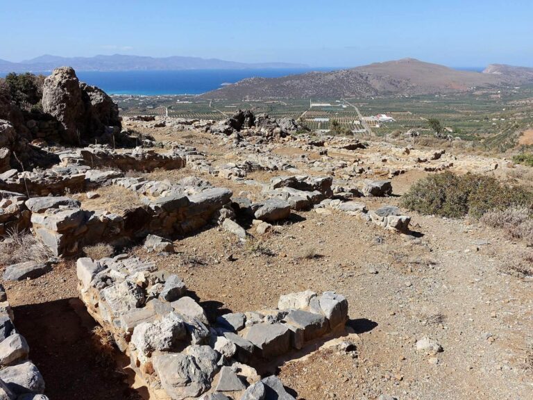
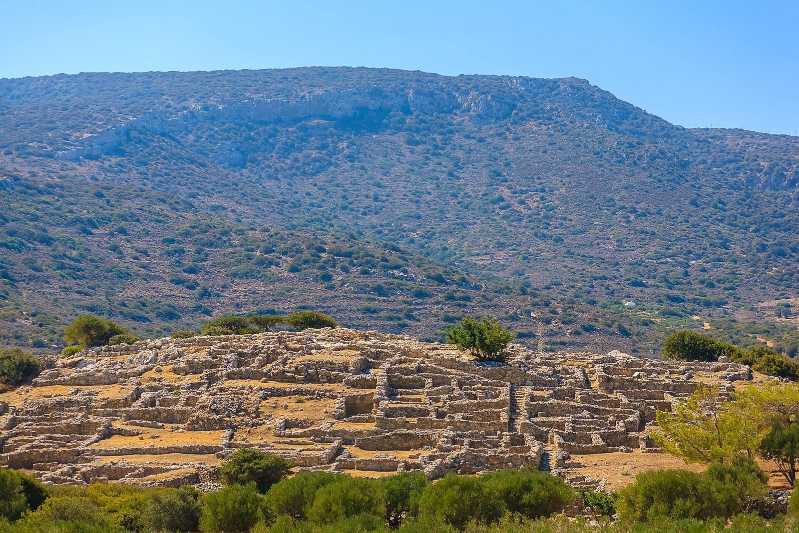
At its greatest extent, Gournia covered about 1.68 hectares and comprised around 64 houses, a central complex, streets, and a town square of approximately 500 square metres. The main town stood about 150–200 metres south of a coastal ridge, which lay roughly 100 metres from the northern coast of Crete. The Sphoungaras cemetery occupied the ridge.
Town plan and streets
Settlement layout
The central complex occupied the town’s central-western area. A public court lay to its south, while a trench on the north side separated the town from a northern cemetery about 80 metres beyond. Archaeologists use lettered plans to describe town sectors. One arrangement divides Gournia into quarters A–H; another uses A–F, H, and I. In the latter scheme, E, F, and I lie north of the centre but south of the trench, A–D are to the east, and H is to the southwest. Some sectors have been interpreted as residential areas, workshops, or an area connected with the ruler’s court.
Roads and squares
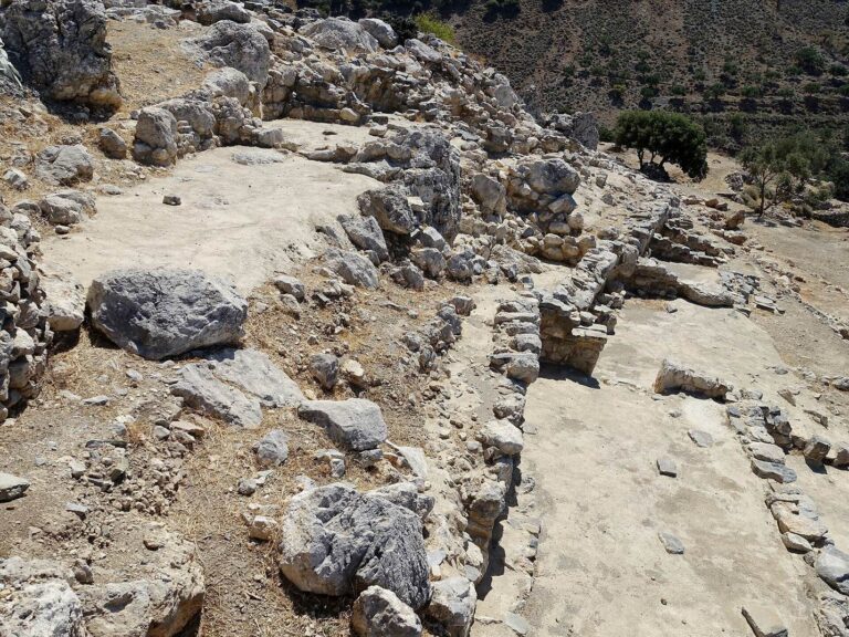
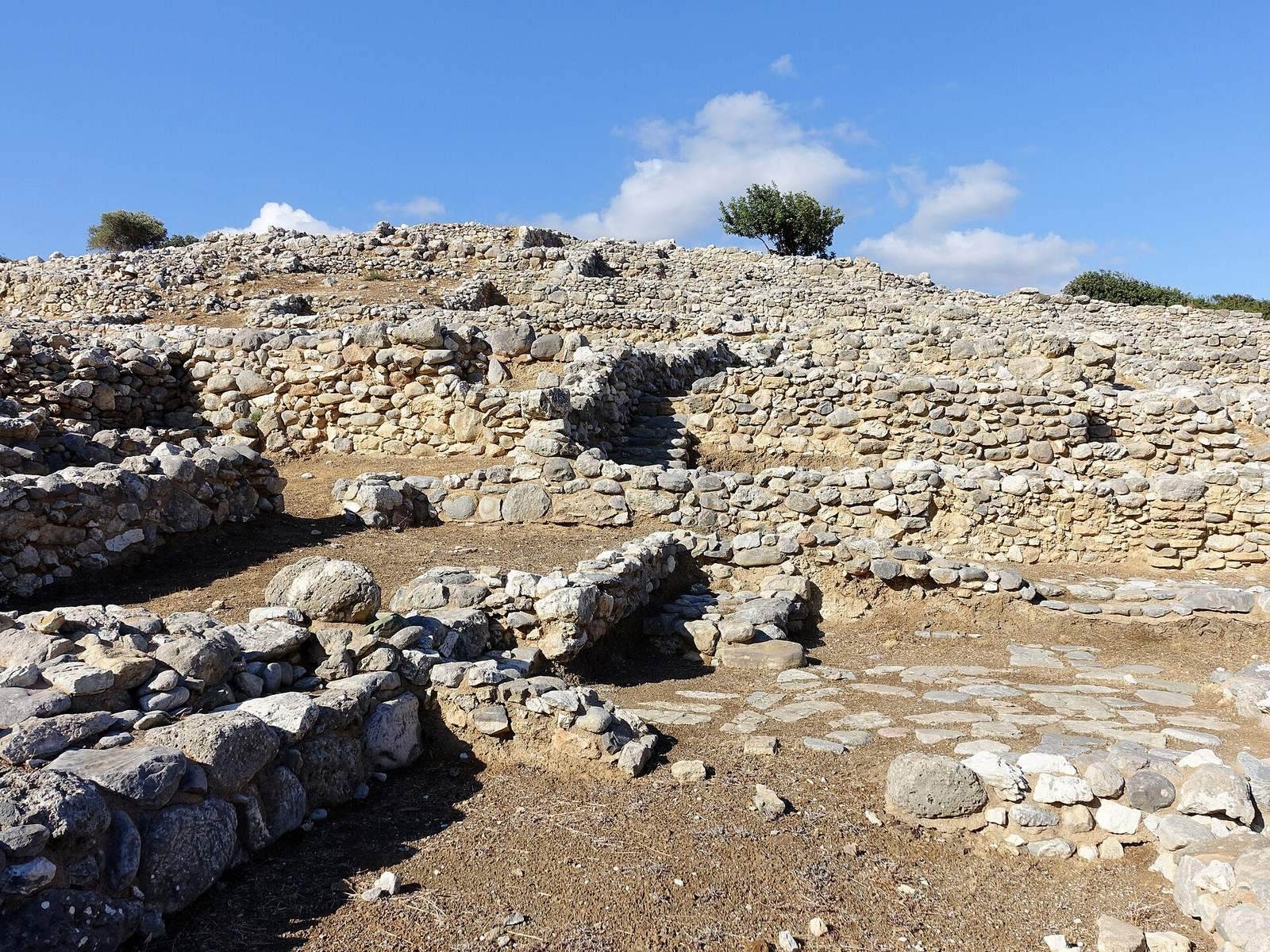
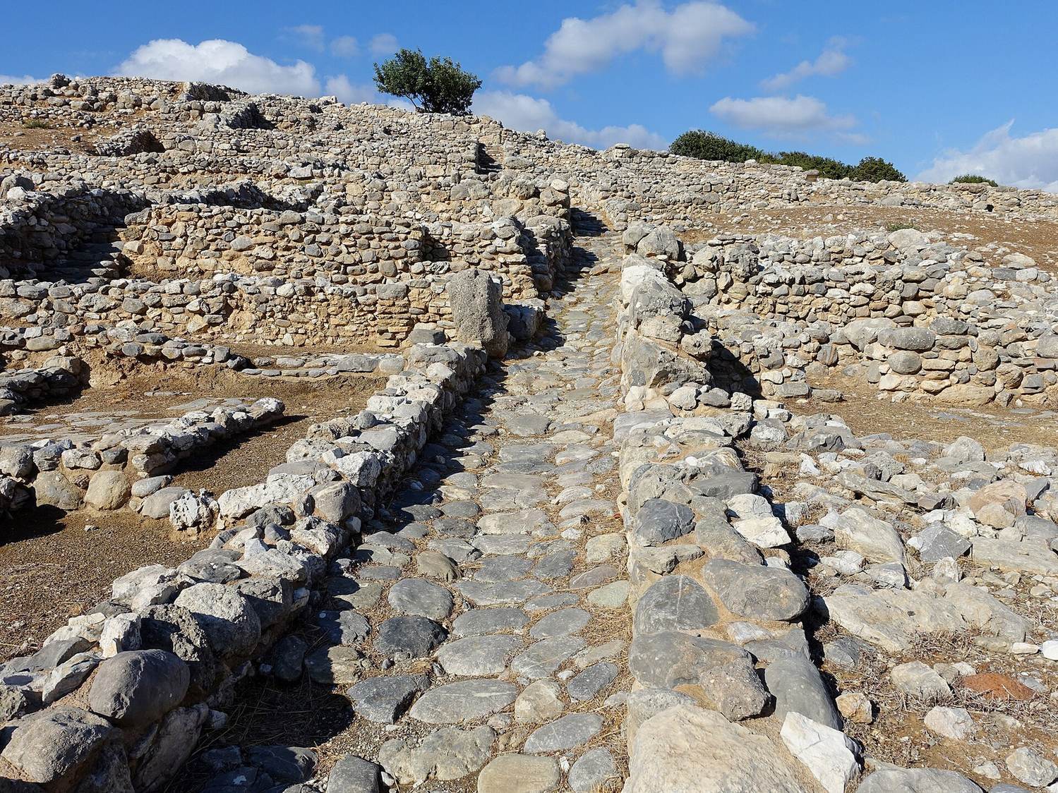
A stone-paved street network extended for more than half a kilometre and included a ring road. Three paved streets descended from the rise by stairs, linking houses and streets across the settlement. The ring road met a route that branched west toward the central complex. Farther along, another westbound street divided quarters C and D. On the road’s southern stretch, quarter B lay to the left and quarter C to the right. The ring road then turned west and climbed to a hilltop plateau and square.
Houses and domestic spaces
Construction and finishes
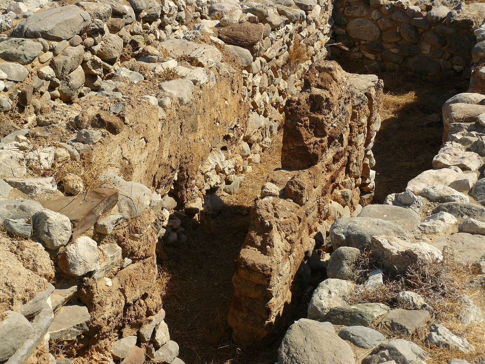
House lower storeys were built of stone or fired brick on stone foundations, with one or more brick upper storeys. Walls received either fine white plaster or coarser grey plaster, sometimes covered by a second, fine layer of light bluish-grey plaster. Painted plaster fragments include pieces with a red darker than the vivid color conventionally called Pompeian red, a name associated with Roman wall painting. Other painted pieces from a storage room were shaped like a lightning bolt and a swallow. Stone thresholds marked doorways; frames were made of clay or wood, and more rarely of stone.
Interiors and access
Floors were made from tamped earth, thin paving stones, or thicker stones of the kind also used in streets. Ground-floor windows are considered likely, and recesses interpreted as window openings survive in three cases. The standing walls reach only about hip height. Wooden-beam remains and reed impressions in plaster may indicate flat roofs, though they could instead relate to the construction of upper-storey floors. Houses also had drainage. A forecourt beside the street led to a ground-floor entrance, where workshops and shops were located. Stairs of wood or stone, inside a house or in its forecourt, led to upper-floor living rooms; stairs or ladders provided access to cellars. Trough-shaped vessels without pestles found near some entrances may have served different purposes, but their use is uncertain.
Workshops and individual houses
House CF, beside the ring road in quarter C, contained a jug, a clay disk bearing Linear A, and a stone crucible used to melt metal. The crucible points to bronze working on the ground floor, and the house also had a drainpipe. In house DD, a stone bench remains in place; Boyd-Hawes found a clay wine press on it, with a hole in front to collect grape juice. At house AC, a brick wall and plaster survive in the cellar, and a window recess can be seen in room 7. Finds from its rooms included a potter’s wheel, two ritual vessels, and a large storage jar.
The hilltop square and central complex
Square and associated features
House He, southwest of the square, is one of the few buildings assigned to Mycenaean occupation. It was built with larger, more carefully dressed stones. North of the square, a staircase of three steps turns around a corner. Beside it lay a circular stone offering slab, or kernos, with depressions for offerings. The square may have served as a public gathering place for social and cultural events, with the steps providing seating, as well as a setting for religious activity.
Rooms and circulation
A corridor north of the staircase led toward the central complex. It ran west before turning north into an open court. Long storage rooms stood west and north of the court, while the throne room lay to the south, with benches along three sides. A narrow passage and staircase connected the throne room to an upper floor. Another staircase stood north of the open court, beyond which was the complex’s west entrance. A small bathroom lay farther north.
Sacred features and nearby buildings
A path beside the complex’s outer wall ran from the square to a standing stone regarded as sacred, called a baetyl. A nearby stone block bears a double-axe symbol, a recurring motif in Minoan religious imagery. A paved street running north reached a small square at the west entrance, with remains of Middle Minoan buildings to its east. Near the complex’s northern end, a path led to a sanctuary about three metres by three metres, where clay religious figurines and other offerings were found.
Cemeteries and burials
Sphoungaras cemetery
Sphoungaras used natural rock shelters and openings rather than purpose-built tombs, and it served the settlement during its occupation. Burial of bodies directly in the ground was preferred from the Early Bronze Age until burial in large storage jars became usual around 1900–1800 BCE. Finds from the cemetery included complete vessels, jewellery, and ivory seals.
Northern cemetery
In the northern cemetery, graves occupied built structures, with human remains deposited collectively rather than in a fixed arrangement. The burials date mainly to the Early Minoan, Middle Minoan, and Mycenaean periods. Some lay under rock overhangs; built grave houses included an open-air sanctuary. Early Minoan II and Middle Minoan I graves there contained richer goods than contemporary Sphoungaras burials, leading to the interpretation that this cemetery served the town’s elite.
House Tomb I
House Tomb I, on the cemetery’s eastern slope, is approximately square, with sides about four metres long. Finds thought to be funerary offerings included two small vases, a miniature jug, and a handleless mug from Middle Minoan IA, dated to 2100–1925 BCE. Other objects included a silver handled cup, two bird’s-nest bowls, bronze tweezers, stone vases, seals, and jewellery. Fragmentary stone coffins contained remains of eight skulls and other unidentified bones.
House Tomb II
House Tomb II is rectangular and divided into two rooms; its altar sets it apart among Gournia’s tombs. Tombs I and II are the best-preserved funerary structures. Their construction and appearance resemble the town’s houses, apart from the shrine. Tomb II yielded stone seals, fruit stands, three bronze tweezers, terracotta vessels, cups, jugs, large storage jars, and small coffins. Human remains included bones and one skull that could be recovered. Their accumulation and arrangement suggest that fully skeletonized remains were shifted aside to make room for later burials.
Inscriptions and destruction deposits
Clay tablets bearing Linear A, the undeciphered writing system of Minoan Crete, came from the final destruction deposit. A clay sealing, an impression-bearing object used to secure or identify goods or documents, also bears Linear A and dates to Late Minoan IA. Near a house in the northern part of the ring road, a heap of Middle Minoan pottery sherds has been interpreted as refuse left at the town’s edge after a destruction, possibly by attackers.