Mochlos: A Minoan Harbor Settlement on Crete
Site at a Glance
- Popularity
- Low
- Country
- Greece
- Primary era
- Bronze Age
- Eras represented
- Bronze Age, Classical
- Civilizations
- Ancient Greek, Minoan, Mycenaean, Roman
- Site type
- City
On this page25 sections
History
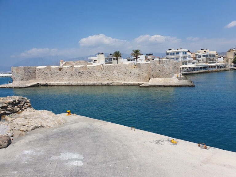
Mochlos is an ancient harbor settlement spread across Agios Nikolaos island and the adjacent coast near the modern village of Mochlos on Crete, Greece. Founded around 3000 BC during the Early Bronze Age, it developed within the Minoan civilization, the Bronze Age culture of Crete and nearby islands. Its harbors and coastal position supported a settlement that became an important center in eastern Crete and was occupied, with interruptions, through Byzantine times.
Early Minoan settlement and maritime economy
The earliest community formed on what was apparently a peninsula. Its first inhabitants may have arrived from the Cycladic island of Melos around 3000 BC. Obsidian, a volcanic glass brought from the Cyclades and worked at Mochlos, supports that possibility. Another migration, perhaps from central Crete, may have taken place during Early Minoan I B. The settlement expanded substantially in Early Minoan II, when it covered about 0.8 hectares. Its population has been estimated at 220 to 330 people, or up to 500 if communities south of the isthmus are included.
By about 2500 BC, Mochlos had a socially differentiated population. Family tombs associated with people of high status reflect divisions of status and control within the settlement, as well as access to goods through trade and seafaring. In Early Minoan II and III, Mochlos, Vassiliki, and Priniatikos Pyrgos were important centers of settlement and economic activity in eastern Crete. Mochlos drew on its two harbors and agricultural hinterland to support the making of gold jewelry, stone vessels, and faience, a glazed siliceous material. Raw materials and finished goods arrived from the Cyclades and possibly the Near East.
The cemetery began to be used around 2900 BC. Its tombs remained in use during Early Minoan III, especially from about 2300 to 2000 BC, and were used less frequently between 2000 and 1900 BC. Following a later gap in burial activity, burials in large storage jars resumed during the Neopalatial period, a palace-centered phase of Minoan society.
Palace-period transformations
During the Middle Minoan Old Palace period, about 1900 to 1700 BC, Mochlos maintained close ties with the palace at Mallia. The settlement may have lost its independence and become part of the Mallian state. The adoption of Mallian production methods, including the potter’s wheel, points to close connections between Mochlos’s elite and Mallian social structures. Widespread violent destruction is suspected during the transition from the Old Palace phase to the later New Palace phase.
After destruction attributed to seismic activity or internal conflict, Cretan communities rebuilt, and populations became more concentrated as Knossos emerged as a major center. Mochlos adopted aspects of Knossian religion and material culture. During the Neopalatial period, about 1700 to 1430 BC, its inhabitants also used a quarry at Vagia; stone from there was sent for construction at Gournia.
Mochlos reached its greatest extent in Late Minoan I. Building B.2 may have served as a ceremonial and administrative center. Stratigraphic evidence at buildings near the shore places the eruption of Thera between Late Minoan I A and Late Minoan I B. The Artisans’ Quarter on the Cretan coast also belongs to Late Minoan I B.
Mycenaean conquest and settlement
Around 1430 BC, Mycenaean Greeks, whose Bronze Age civilization originated on the Greek mainland and expanded into Crete, conquered the island. Mochlos was among the settlements burned during the invasions and remained uninhabited for several decades. A small Mycenaean community settled among its ruins around 1400 BC. Its harbor supported trade with other Cretan settlements, and evidence points to fishing both close to shore and in deeper waters. The community appears to have left around 1250 BC, near the time when other sites in eastern Crete were deserted.
Later occupation and changing shoreline
Mochlos remained uninhabited after the Bronze Age until the seventh century BC, when brief settlement followed. In the Hellenistic period, the era after Alexander the Great’s conquests, it probably came under the authority of Hierapytna, a Greek city-state. East Cretan Cream Ware made near Hierapytna in the late second to early first century BC has been found at Mochlos. Control of the settlement may have helped Hierapytna exert influence over Mirabello Bay as it competed with Praisos and Itanos for dominance in eastern Crete.
It is uncertain whether occupation continued after Rome conquered Crete in 67 BC. Coins recovered by the first excavator, Richard B. Seager, came from the reigns of Hadrian and Diocletian and from the time of Constantine the Great. The former land connection between Agios Nikolaos and Crete may have been submerged in the earthquake of AD 365. In Byzantine times, the medieval eastern Roman Empire, smaller settlements existed on the Cretan coast, while the island’s Hellenistic fortifications remained in use.
Excavation and interpretation
Seager learned of the island’s ancient remains in 1907 while excavating at Psira. After a brief trial excavation at Mochlos that July, he began systematic work on 13 April 1908. He excavated several areas on the island’s southern side and exposed most of a large house in Block D, along with parts of about twelve Late Minoan I houses. His work also included extensive investigation of the cemetery. Later research revised or refined his dating of settlement phases and supported his view that the island and coastal remains belonged to a connected settlement.
In the 1950s, Nikolaos Platon carried out rescue and trial excavations along the opposite coast. Underwater surveys by John Leatham and Sinclair Hood in 1955 found ancient fishponds east of Mochlos. Their position beneath today’s sea level, after a rise of about one to two metres since antiquity, supported the proposal that the island had once been joined to Crete. In 1971 and 1972, Jeffrey S. Soles and Costis Davaras re-examined 23 tombs excavated by Seager. New finds led them to revise the date of Tomb VI, and they identified the smaller southern tombs as collective-use grave houses rather than cist graves or open enclosures. Davaras completed cemetery cleaning in 1976.
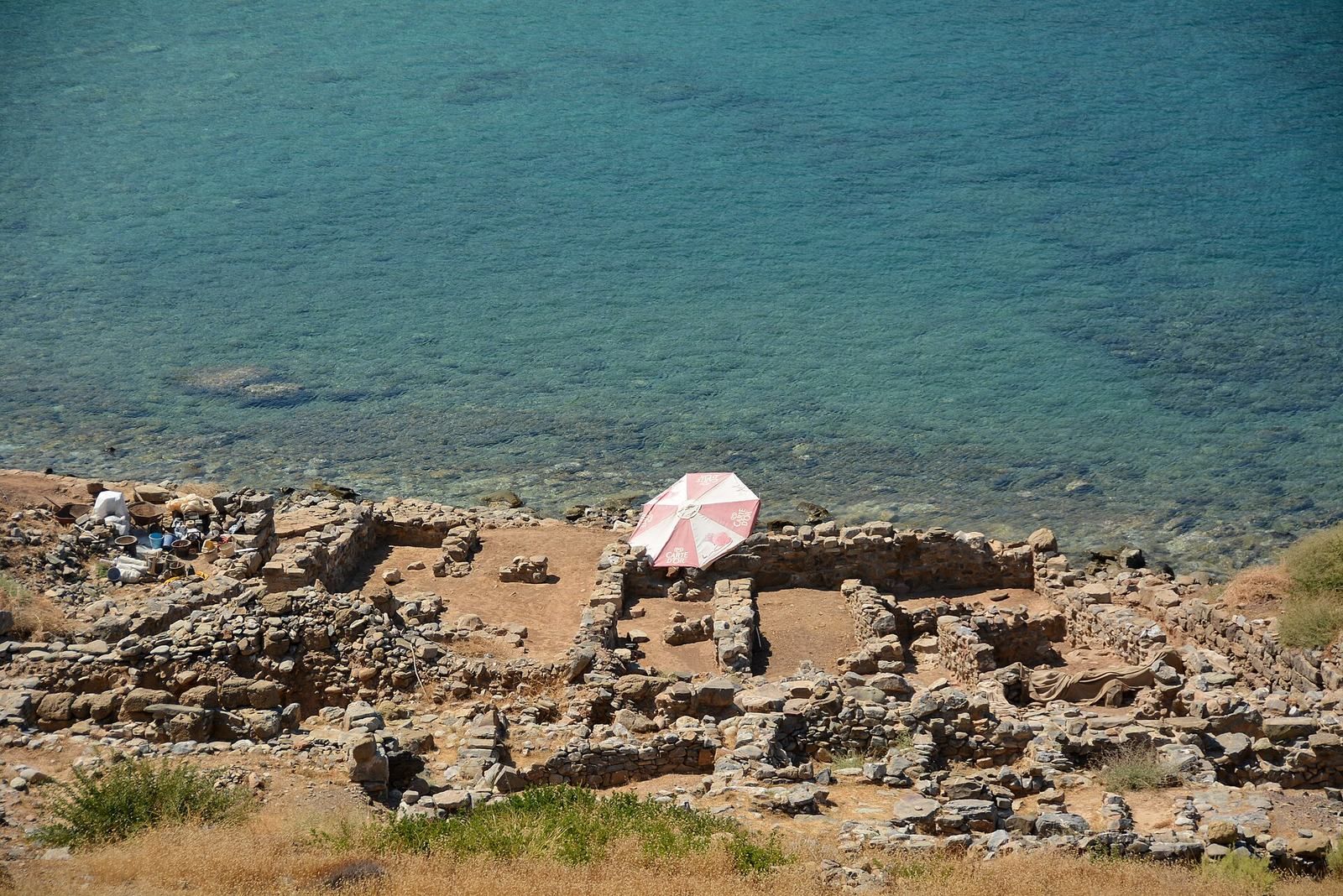
Systematic excavations resumed in 1989 under Soles and Davaras, the first at Mochlos since Seager’s work. The initial campaign identified seven settlement phases and found the volcanic ash layer that separates Late Minoan I A from I B. Work continued on the island and at related coastal sites from 1990 to 1994, with further campaigns in 2004 to 2006, 2009 to 2010, and 2012. Since 2013, the Mochlos Archaeological Project has concentrated on studying and publishing finds, especially from the Neopalatial settlement. Conservation has consolidated standing walls and filled unstable areas to protect them.
Remains
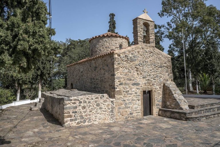
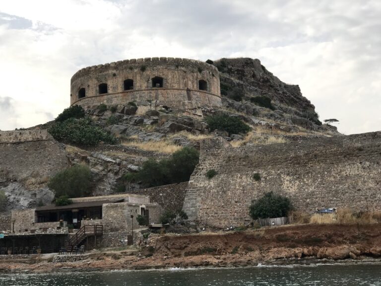
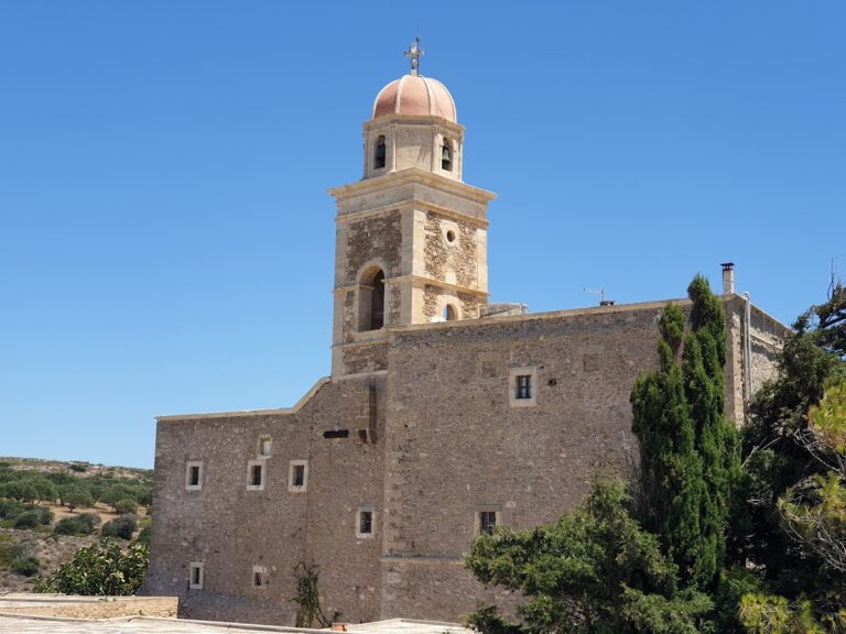
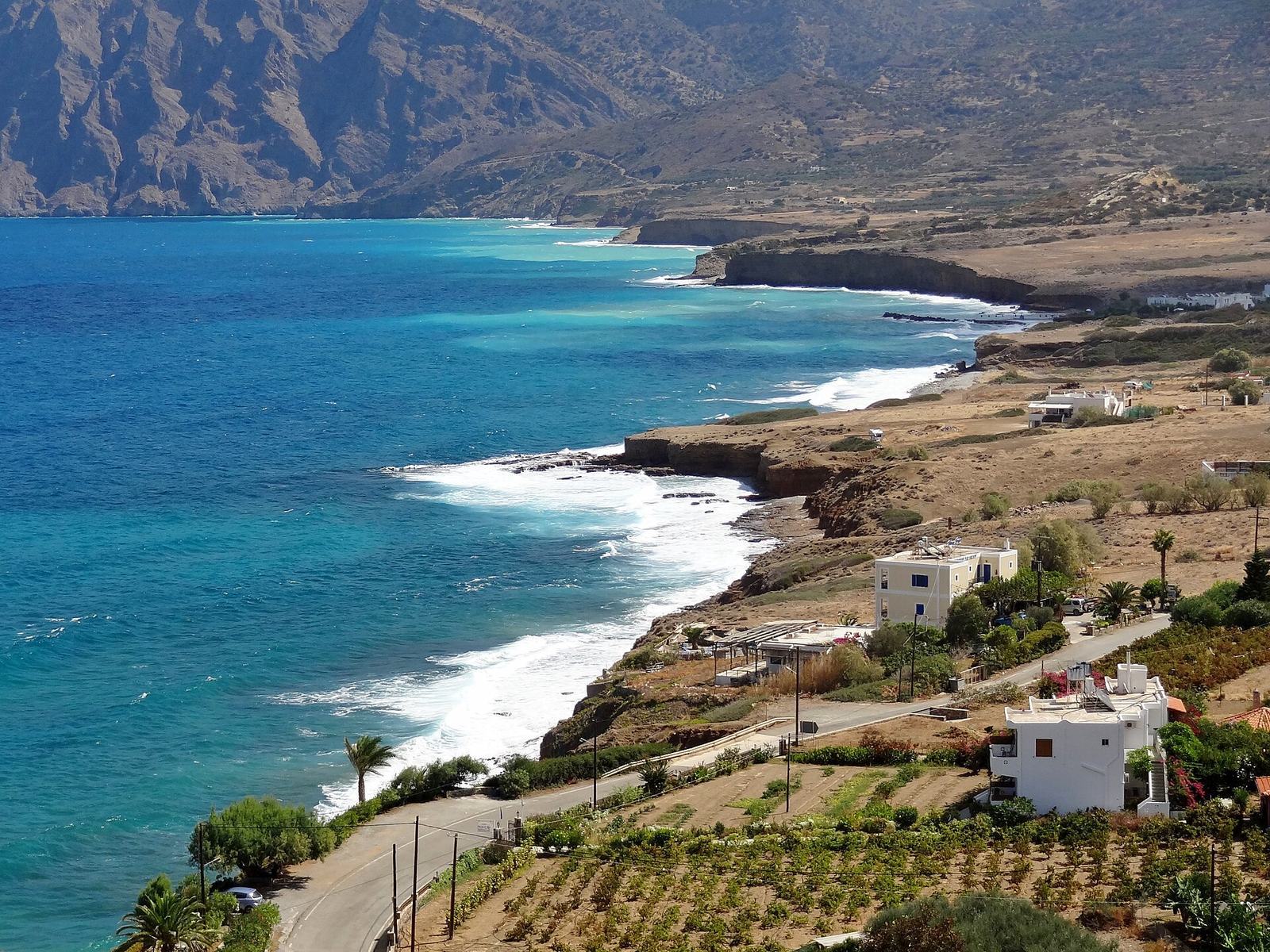
The archaeological landscape combines the rocky island of Agios Nikolaos with burial grounds, workshops, and settlement remains on the neighboring coast and coastal plain. The island measures about 300 by 250 metres and rises to 62 metres, about 180 metres offshore from Crete’s northern coast. A small church on its southern side, dedicated to Nicholas of Myra, gives the island its name. Excavated areas lie mainly around the church and on the southern slope, with tombs also found above the western shore. In the Bronze Age, a narrow isthmus apparently linked the island to Crete and left harbors on either side.
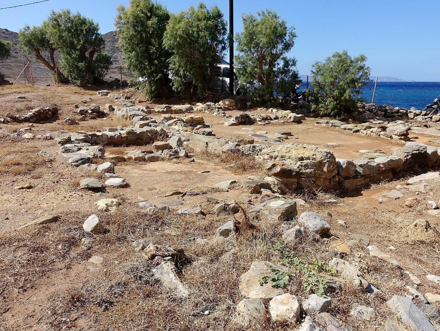
The site extends beyond the island. It includes a smaller excavation west of the modern village, coastal locations in the plain, and remains reaching east toward Chalinomouri. The plain runs about 4.2 kilometres along the Bay of Mochlos and is crossed by several small rivers. East of the village, the ancient fishponds are now underwater.
Early Minoan cemetery
Western terrace tombs
The early cemetery occupies a narrow terrace on the island’s western side. Family tombs were probably used by people of high status, and numerous gold diadems were recovered from them. In 1908, 23 well-preserved tombs yielded pottery, weapons, jewelry, and stone vessels, mostly dating to Early Minoan II and III. Six large chamber tombs, also described as ossuaries, lay along a narrow rock ledge in the northwest. Upright stone slabs closed their entrances, and erosion has damaged some of the tombs.
Re-examination of western Tombs IV, V, and VI in 1971 and 1972 revealed an approach formed by a ramp and terrace. Tomb VI contained Vassiliki Ware, a pottery type associated with eastern Crete, along with copper weapons, a one-handled silver cup, and gold jewelry. A hematite cylinder seal from northern Syria, dated to the nineteenth century BC, was also found in a tomb.
Southern and later burials
Smaller burials in large storage jars lay beneath rock shelters on the southern slope. Archaeologists identified the smaller southern tombs as grave houses used for primary and secondary collective burials; a group of seals came from them. Middle Minoan tombs and burials in large terracotta vessels were also found on the southwestern hill, including examples from Middle Minoan III and Late Minoan I.
Neopalatial buildings and finds
Late Minoan I houses on the island could have up to three storeys. Their basements served as workshops or storage spaces, where large jars were kept. Buildings and roads occupied the island’s southern slope, and construction followed its uneven ground.
Building B.2
Built into a slope, Building B.2 stood west of a paved road that climbed from south to north. It had two columned rooms and was the only building in that area partly constructed with ashlar masonry, carefully cut blocks laid in regular courses. Fourteen steps from the eastern columned room led to a room with two columns, an offering stone, and a basin against its north wall. Doors connected this main room with a kitchen, a dining area, and a passage to the street. Cups dating to Late Minoan I B were found in a drain beneath the floor, which led toward the street.
Finds from B.2 include a tin ingot, a bronze trident partly overlying it, and a complete oxhide ingot, a metal ingot shaped roughly like a stretched hide. The trident’s barbs suggest it may have been used for fishing. Nearby, a pair of undecorated terracotta boat models came from a stone-lined recess in an Early Minoan II B context below the building’s southwest wing. Their ritual use has been proposed.
Buildings C.1 and B.1
Building C.1 stood near the shore, about ten metres southwest and below the church. Its facade and staircase used ashlar masonry, and its northern part contained a kitchen. A deep layer of volcanic ash, or tephra, lay beneath the Late Minoan I B floor. The ash came from the eruption of Thera and helps distinguish Late Minoan I A from I B. Building B.1, also near the present coast, had a similar stratigraphic relationship.
Roads and a bench shrine
Excavations in 2012 traced a Neopalatial road between Blocks B and C that had remained in use for about 270 years and showed signs of repair. It ran north for 45 metres, turned east at a right angle, and continued for 20 metres toward the northeast. Near a further turn lay a terrace beside a bench shrine, a place used for religious observance. A second road, separating Blocks C and D, joined the main road from the south. At the junction, a paved terrace held pieces of mudbrick walls and large-jar sherds. Burnt olive leaves in ash led to the proposal that the area may have been a sacred precinct for cultivating olive trees.
Other Minoan finds
A small ivory container from Late Minoan I B was excavated in Block A in 2010. Measuring 11 by 14 centimetres and fitted with a wooden base, it has ivory sides and a lid carved in low relief with a seascape. The lid depicts the appearance of a Minoan goddess. Ten ivory hairpins and jewelry were found with the container, which held 80 amethyst beads, many still in place with traces of their string, as well as carnelian, glass-paste, and lapis-lazuli beads. One interpretation identifies an olive branch in the goddess’s hand and reads the scene as a ruler presenting a vessel to the goddess to bless a couple, perhaps at a dynastic marriage. The container and jewelry may have been bridal gifts.
In 2005, Building C.3 yielded a bronze sistrum, a frame rattle associated especially with ancient Egyptian religious practice. The Late Minoan I B object measures 28.5 centimetres high and 8.3 centimetres wide and is now in the Archaeological Museum of Agios Nikolaos. An earlier group of objects includes two terracotta boat models found together below Building B.2; a ritual purpose has been suggested for them.
Coastal workshops and other sites
Artisans’ Quarter
At the western edge of the modern village, the Late Minoan I B Artisans’ Quarter lies partly beneath the coastal road toward Limenaria beach and harbor, about 350 metres away. Two buildings have been excavated there. Their workshops were mainly used for metalworking, and copper objects were recovered. Other finds include stone vessels, a potter’s wheel 40 centimetres in diameter with concentric marks from use, and a large four-handled storage jar bearing a Linear A inscription. Linear A was an undeciphered writing system used in Minoan Crete. A rock-crystal lens resembles examples from Knossos and the Idaean Cave. A room with a built-in bench and a group of vessels has been interpreted as a shrine where offerings may have been presented.
Coastal tombs and settlement remains
A Late Minoan cemetery lay near Limenaria beach. At Galana Charakia, excavators found a circular, beehive-shaped tomb containing pottery from Late Minoan III and Middle Minoan I A and I B. Building remains of uncertain type have been reported at Palia Vardia and Chalinomouri. At Chalinomouri, a farmhouse stood near the mouth of the easternmost river, with a group of tombs nearby; the farmhouse remained in use until the end of the Neopalatial period. A Mycenaean chamber-tomb cemetery at Asprospilia yielded pottery dated to Late Minoan III A to C. Chamber tombs were also found at Plakalona and Keratidi.
Quarry
A quarry on the southeastern edge of the modern village produced local calcareous sandstone known as Ammoudha. Stone from the Vagia quarry was used at Gournia, while a smaller site area lies west of the village and further remains extend along the coastal plain.
Mycenaean settlement and cemetery
Island settlement
Thirteen Mycenaean buildings have been identified on Agios Nikolaos. They range from one- or two-room houses to the larger House A, which had its own street. The settlement occupied part of the earlier Minoan ruins.
Limenaria cemetery
The Mycenaean cemetery lay on Crete above the harbor at Limenaria, on the western side of the hill south of the modern village. Thirteen of its 16 small chamber tombs were aligned at one level; Tombs 1, 10, and 11 lay somewhat lower to the north and west. Most had stone-filled entrance passages. The two southernmost tombs, 15 and 16, were joined by a narrow tunnel. Tomb 16 held a woman buried in a large storage jar with relatively abundant jewelry. Tomb 15 held a man in a coffin identified as a telestas, a religious title that John Chadwick thought might also have indicated secular authority.
Hellenistic and underwater remains
Hellenistic settlement
The Hellenistic settlement covered the island’s southern side, across the area of earlier Minoan buildings. A circuit wall enclosed it on the north, east, and south, while cliffs protected the west. Alongside houses and production areas stood Building I, about 23.5 metres long, with eight rooms south of the wall. Rooms 1 and 6 contained beam-operated presses. The press in eastern Room 1 was probably used in textile production; Room 6, the building’s largest room, contained an oil press.
Fishponds
Ancient fishponds lie east of Mochlos beneath the present sea level. Leatham and Hood dated them to Roman times. Their submergence, after sea level rose by about one to two metres since antiquity, has also supported the proposal that a land connection once joined Agios Nikolaos to Crete.