Gökvelioğlu Kalesi: A Byzantine-Period Castle Ruin in Türkiye

Site at a Glance
- Rating
- 4
- Popularity
- Very Low
- Country
- Turkey
- Primary era
- Medieval
- Eras represented
- Medieval
- Civilizations
- Byzantine, Kingdom of Cilicia
- Site type
- Military
- Remains
- Castle
On this page7 sections
History
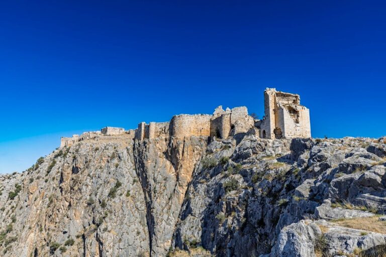
Gökvelioğlu Kalesi is a Byzantine-period castle ruin in Türkiye, on a promontory in Çelemli whose later building phase dates to the early thirteenth century. The fortress was built in two periods, using both small dressed stones and bossed masonry, in which the central faces of the blocks project outward from the walls. It may be identifiable with the Armenian fortress of Vaner, also called Vanerium in Latin, although that identification remains uncertain.
Byzantine and Armenian Phases
The date of the earlier phase cannot be established securely. Small dressed-stone masonry remained common in Armenian buildings into the twelfth century, while the later phase was constructed almost entirely with bossed stone blocks and belongs to the early thirteenth century. The site therefore reflects the overlapping Byzantine and Armenian political and architectural traditions of medieval Cilicia. The Byzantine period was the continuation of the Roman Empire centred on Constantinople after antiquity.
Vaner and Medieval Rule
Vaner appears in a list of feudal holdings from the time of Leon II, a ruler of the Armenian Kingdom of Cilicia. In a separate charter, Leon II transferred Vanerium, its surrounding territory, and a harbor to the Knights Hospitaller, a medieval religious-military order that held estates and fortifications in the eastern Mediterranean.
In 1337, the castle was surrendered with several other fortresses, including Lajazzo, to the Mamluk sultan Malik al-Nasir. The Mamluks were a military ruling elite whose sultanate governed Egypt, Syria, and neighboring regions during the later medieval period. The fortress’s name during Mamluk rule and its later history are unknown.
Control of the Cilician Plain
The fortress controlled the route between Yumurtalık and Yakapınar, corresponding to the historical connection between Aigeai, or Ayas, and Mopsuestia, or Misis. It also controlled the course of the Ceyhan River and extensive parts of the coastal plain. The castle stands at the southern end of the Celebinur mountain range, also called Nurdağı, while the settlement of Güveloğlu lies at the western foot of the promontory. From this position, the plain extends westward beyond Adana, and the Ceyhan can be followed southward toward its delta.
Remains
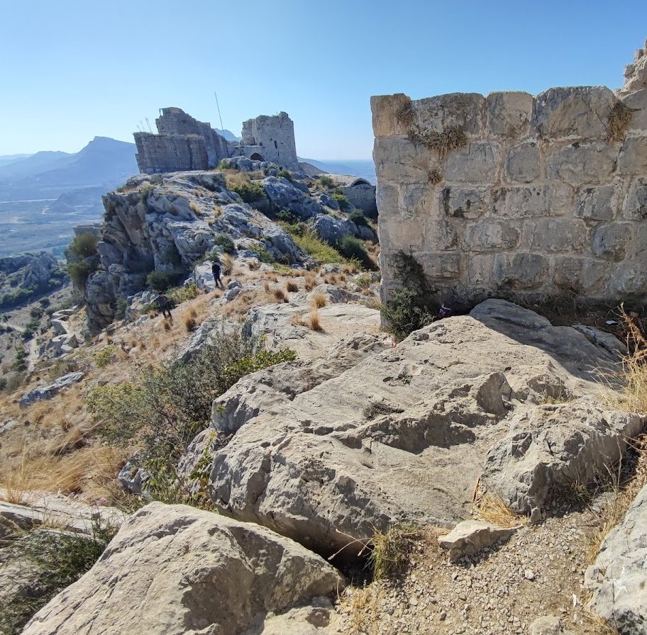
Gökvelioğlu Kalesi survives as a promontory fortress at an elevation of 215 metres. Its upper and lower castles are separated by approximately 80 metres of elevation and linked only by a steep rocky path. The two parts occupy distinct levels of the rocky promontory and retain walls built with small dressed stones and bossed stone blocks.
Upper Castle
The upper castle lies to the north and is reached by a ramp. Its partially preserved gate complex occupies the northwestern corner. Inside are a platform, a small antechamber, and a hall with a cross-vault, a ceiling formed where two barrel vaults intersect. The enclosing walls follow the rock faces as they descend steeply on every side. A round bastion, or projecting defensive platform, stands at the southern corner, where the path toward the lower castle begins. Two cisterns, which are constructed reservoirs for storing water, and several buildings of uncertain function also survive within the upper castle.
Lower Castle
The lower castle forms a triangle south of the upper level and is entered through a simple gate on its northeastern side. On the north, rising rock leads toward the upper castle and forms the boundary. The eastern and western walls run southward before converging at a small promontory containing an outpost. Another cistern stands in the northern part of the lower castle, while the functions of the remaining buildings there are unclear.
Nearby sites