Anavarza Ruins: The Ancient City and Fortress of Cilicia

Site at a Glance
- Rating
- 4.6
- Popularity
- Low
- Country
- Turkey
- Primary era
- Classical
- External website
- Open
- Eras represented
- Classical, Medieval
- Civilizations
- Byzantine, Crusader, Kingdom of Cilicia, Roman
- Site type
- City
On this page13 sections
History
Anavarza Ruins in Turkey are the remains of Anazarbus, an ancient city of Cilicia near modern Dilekkaya in Adana Province. Traditionally founded in the fifth century BC, the city developed through Greek, Roman, Byzantine, Arab, and Armenian periods around a limestone ridge and its fortified summit. Its position near the Sis Pass and the road emerging from the Cilician Gates helped make it a strategic and political center, while its later history connected it with Roman provincial administration, the Armenian Kingdom of Cilicia, and several important religious and intellectual figures.
Origins and Roman annexation
The founder of Anazarbus is unknown. Coins indicate settlement during the second and first centuries BC, although the city’s earlier history remains poorly understood. A proposed Assyrian foundation is conjectural. Before Roman annexation, Anazarbus belonged to the client kingdom of Tarcondimotus I, an autonomous kingdom whose ruler depended on a stronger imperial power. The city became associated with Augustus after the emperor visited in 19 BC. It was then known as Caesarea ad Anazarbum, probably to distinguish it from Caesarea near Mount Argaeus.
After the death of Tarcondimotus II Philopator in AD 17, the Roman general Germanicus incorporated eastern Cilicia, including Anazarbus, into the province of Syria. When Vespasian reorganized Cilicia as a Roman province in AD 72, Anazarbus came under the authority of the governor based at Tarsus. It initially remained less important than Tarsus, but its position on routes linking Malatya, Tarsus, and Antioch, together with the stationing of troops during eastern campaigns, supported its expansion.
Prosperity and late Roman transformation
Anazarbus supported the emperor Septimius Severus during his struggle against Pescennius Niger. After Severus defeated Niger at Issus in AD 194, the city entered a period of exceptional prosperity. In AD 204–205 it became the metropolis of Cilicia, Isauria, and Lycaonia, a senior administrative and ecclesiastical center. Imperial support extended to athletic games, including the pentathlon, chariot racing, boxing, and wrestling. These events helped offset the economic burden of winter military quarters and drew visitors and traders from neighboring cities and provinces.
The city’s late Roman importance was also religious. Anazarbus became the capital and metropolitan see of Cilicia Secunda, a late Roman province in southeastern Anatolia. A metropolitan see was a senior church jurisdiction supervising neighboring bishoprics. From 553 it was formally associated with the metropolitan administration of the province, with suffragan sees that included Epiphaneia, Alexandria Minor, Irenopolis, Flavias, Castabala, Aegeae, and, for a time, Rhosus.
Anazarbus was associated with several early Christian bishops, including Athanasius of Anazarbus, an exponent of Arian theology in the fourth century, and Maximin of Anazarbus, who attended the Council of Chalcedon. The city was also linked with the physician, pharmacologist, and botanist Pedanius Dioscorides. His Materia Medica, traditionally dated to AD 69, described medicinal plants and their uses and remained influential for roughly 1,500 years through Byzantine, Arabic, and Turkish manuscript traditions. The poet Oppian and the historian Asclepiades of Anazarba were also associated with the city, as were local traditions concerning Saint Domnina and Saint Theodula.
Destruction, rebuilding, and Byzantine rule
Shapur I of the Sasanian Empire captured Anazarbus in 260. The Sasanian Empire was the Iranian imperial state that ruled from the third to the seventh century AD. The city was reportedly devastated again in the fourth century by the Isaurian Balbinus. It was rebuilt and made capital of the reorganized province of Cilicia in 408 under Theodosius II.
A major earthquake in 525–526 damaged or destroyed much of Anazarbus. Justinian I ordered its reconstruction, and the city acquired the names Justinopolis and Justinianopolis, although Anazarbus continued in use. Another earthquake in 561 and a major plague weakened the settlement further. Its strategic position nevertheless remained important because the city controlled approaches near the Sis Pass and the major road through the Cilician Gates, a mountain route linking the Anatolian plateau with Cilicia.
Arab, Byzantine, and Armenian periods
Arab forces occupied Anazarbus in the seventh or eighth century. Harun al-Rashid rebuilt the city in 796 and brought settlers from Khorasan. Byzantine forces destroyed it in 804, 806, 835, and 855, taking many captives during these campaigns. In the mid-tenth century, the Hamdanid ruler Sayf al-Dawla repaired or strengthened the defenses. Repairs to the wall associated with him took place in 955–956. Nikephoros II Phokas besieged and recaptured the city around 962, returning it to Byzantine rule.
The Seljuk ruler Suleiman captured Anazarbus around 1084–1085. Crusader forces took it in late 1097 or early 1098, after which it became associated with the Principality of Antioch, a Crusader state founded during the First Crusade. Byzantine and Armenian forces then contested the city until it entered the Armenian Kingdom of Cilicia, a medieval Armenian state based in the Cilician region.
Thoros I captured Anazarbus around 1111 and made it a capital of the Armenian Kingdom of Cilicia. Except for Byzantine control between 1137 and approximately 1144, the city remained a capital for much of the following century. Under the Rubenid dynasty, the ruling house that established Armenian authority in Cilicia, Anazarbus Castle and Sis Castle served as the dynasty’s two principal residences. Anazarbus also became an important burial area for the ruling family.
John II Komnenos recaptured the city after a 37-day siege in 1137. Armenian control was later restored, and Leo II strengthened Armenian authority in Cilicia during his reign from 1189 to 1219. He was crowned king in 1199 and is associated with the construction or major rebuilding of the castle in 1188. Mamluk forces conquered and destroyed Anazarbus in 1374–1375, after the destruction of the Armenian Kingdom of Cilicia. The city was then abandoned and was not permanently reoccupied.
Later research and protection
From the fourteenth century, Varsak and Avshar Turkmen groups held power in the surrounding area. The Mamluk conquest was followed by the rule of the Ramazanid principality, while the Ottoman Empire established complete control over the region during the reign of Selim I. In the early twentieth century, the Ottoman government under Abdülhamid II placed approximately 36.2 hectares of Anavarza under state ownership to prevent the sale of land in Çukurova to foreigners.
Travelers and researchers studied the ruins from the nineteenth century onward, including Charles Texier, Theodore and Mabel Bent, Rudolf Heberdey, Adolf Wilhelm, Josef Keil, E. J. Davis, Gertrude Bell, Michael Gough, Paolo Verzone, Gilbert Dagron, and Denis Feissel. Bell visited on 19 April 1905 and left approximately fifty photographs and detailed diary descriptions. Excavations by the Adana Archaeological Museum in the early 1980s examined the Apostles’ Church, the western necropolis, and Roman villas. Research has identified approximately 1,000 ancient inscriptions in and around Anavarza, while Istanbul University carried out geophysical surveys and prepared a large-scale plan between 2004 and 2007 using geomagnetic and ground-penetrating-radar methods.
Excavations in 2006 reportedly identified mosque remains. If that interpretation is correct, the structure could represent the first known mosque in Anatolia and would date to the period of Abbasid control, although the identification remains uncertain. Anavarza was added to Turkey’s UNESCO World Heritage Tentative List in 2014. A Latin Catholic titular archbishopric was revived in the eighteenth century, and an Armenian Catholic titular bishopric was established in the nineteenth century before being suppressed in 1933.
Remains
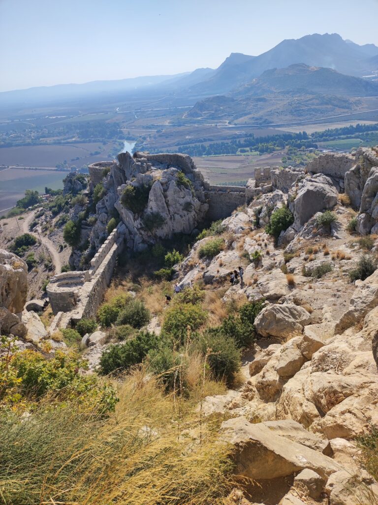
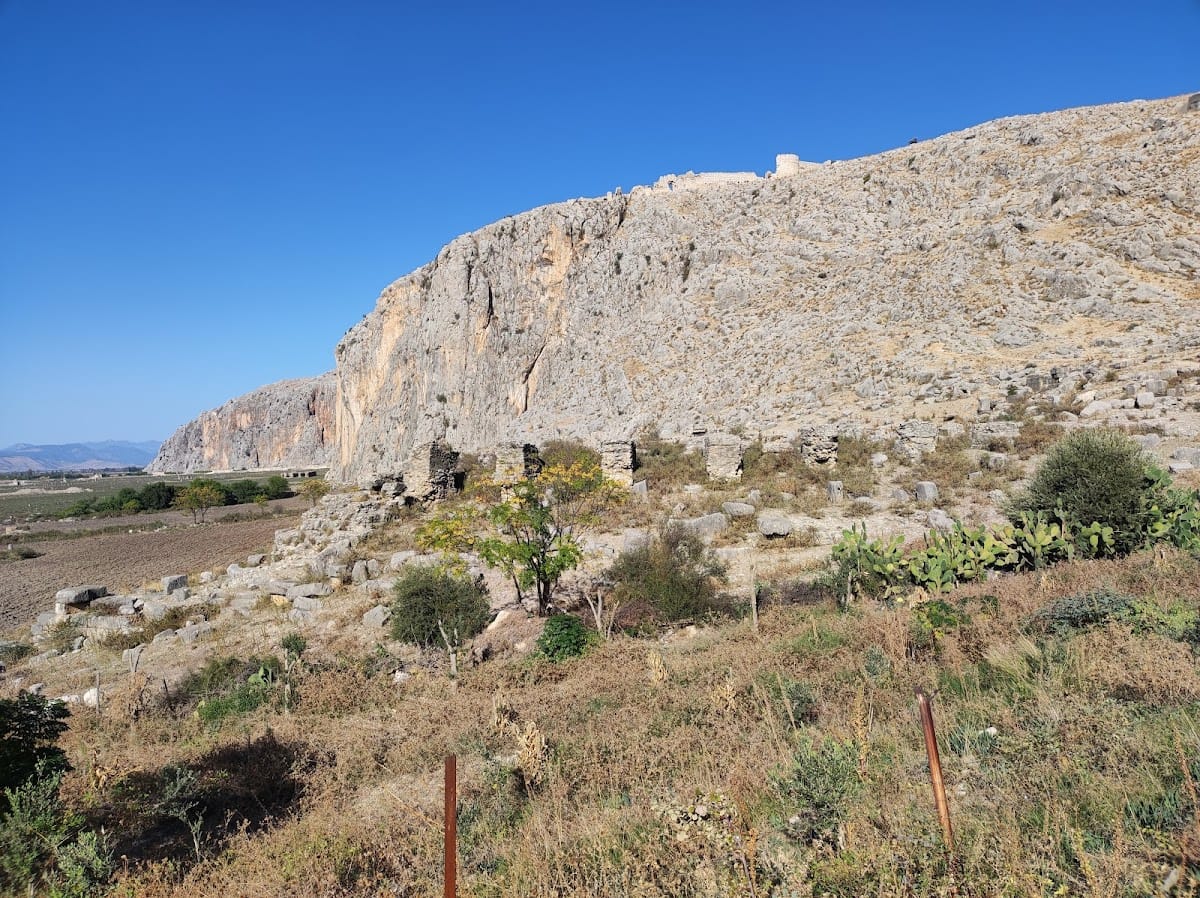
Anavarza occupies an isolated limestone ridge rising approximately 200 meters above the Cilician plain. The acropolis stood at the western end of the ancient city, while the lower city spread around the ridge and the plain near the Sempas or Sumbas River and approximately 15 kilometers west of the main course of the Ceyhan River. The lower settlement was enclosed by walls extending about 1,500 meters eastward. The surviving urban remains include fortifications, gates, colonnaded streets, shops, bathhouses, religious buildings, entertainment structures, waterworks, cemeteries, and villas.
City walls and gates
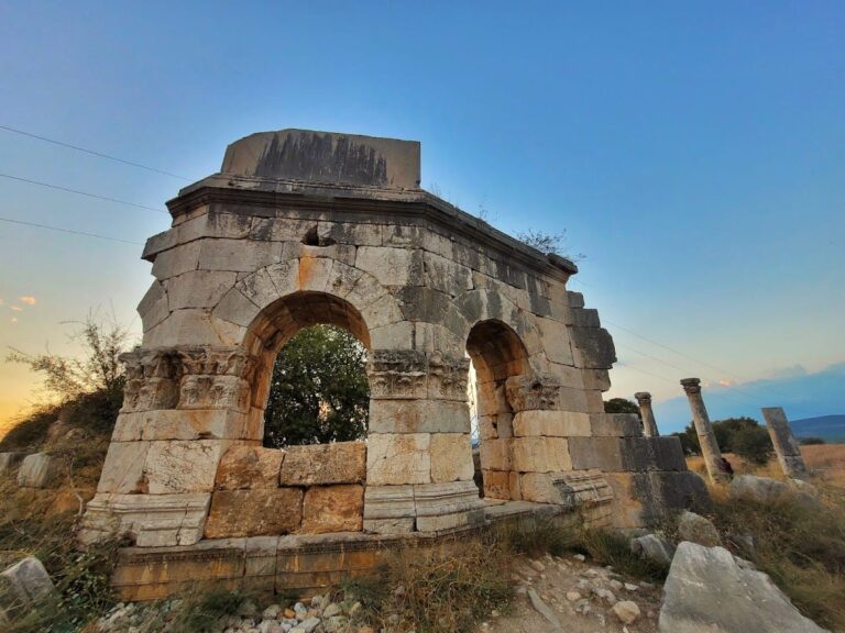
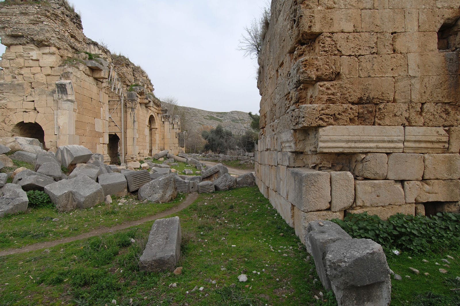
The lower-city walls survive to heights of approximately 8–10 meters in places. They originally included twenty towers set at roughly 70-meter intervals, and sections of the walls and several gates remain. Arab-period builders used stone dismantled from Roman buildings in parts of these defenses. A monumental Roman propylon, or entrance structure, survives beneath the medieval fortress on the acropolis. The major colonnaded street ended at a triumphal arch probably built during the Severan dynasty. Its southern facade had three openings, each flanked by a pair of black-granite columns, while the northern facade contained statue niches beside the central arch. The arch was later converted into the South Gate.
Alakapı, probably built in the middle of the second century AD and repaired during the first quarter of the third century, is another surviving ancient gate. Part of it collapsed in 1948, and the Ceyhan earthquake of 1998 caused additional damage. Strengthening work began in 2011.
Streets, civic buildings, and entertainment structures
The principal street was bordered by continuous colonnades. Excavations in 2013 revealed a double-lane colonnaded road approximately 34 meters wide and 2,700 meters long. It is described as the first known road of this type in the ancient world. The lower city also contained a gymnasium, shops, a bathhouse, and other colonnaded structures. East of the triumphal arch and farther south are the remains of a monumental ten-column Corinthian temple, possibly the building represented on coins issued under Marcus Aurelius and Lucius Verus.
South of the city walls are a rock-cut Roman theatre, an elliptical amphitheatre, and a stadium. The stadium was probably built in the late second century. It was partly cut into the bedrock, with a concrete central track and spectator seating carved into the rock. The amphitheatre is associated with the training of Roman soldiers and gladiators. Reliefs of wrestlers, a judge, and a victorious athlete holding a cup were found on walls. An inscription on a statue records the erection of a monument in the stadium for an athlete who repeatedly won pentathlon events at games in Ephesus, Tralleis, and Antioch. Coins commemorating the athletic games have also been found.
Acropolis and medieval fortress
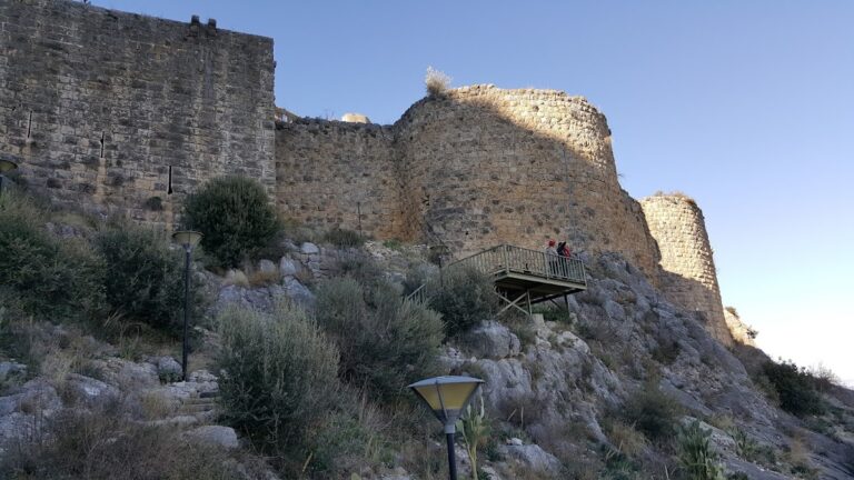
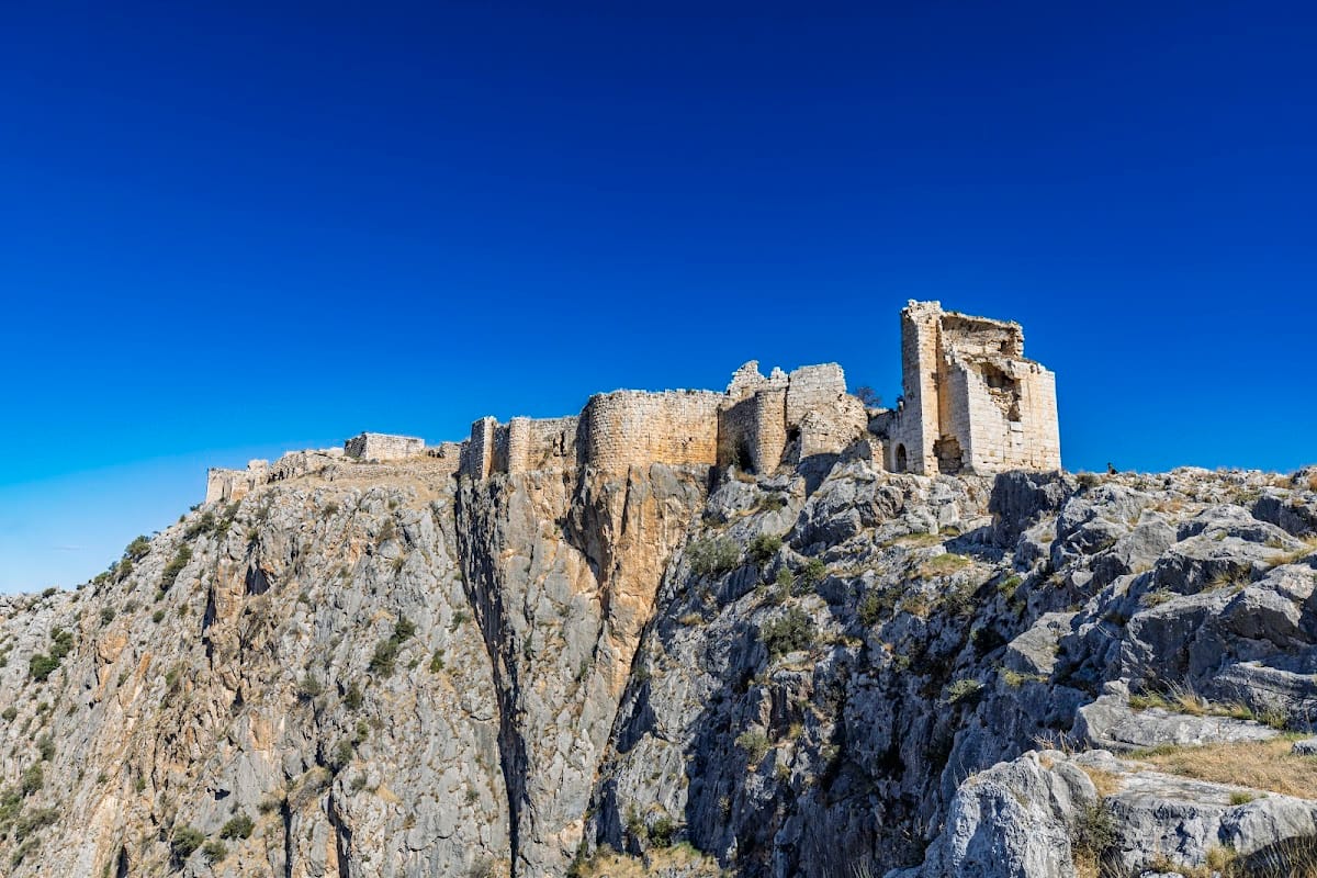
The medieval fortress occupies the summit of the ridge and extends for almost one kilometer from north to south. Its fortifications combine Roman foundations with Byzantine and Armenian additions, including curtain walls, massive horseshoe-shaped towers, undercrofts, cisterns, and other defensive structures. Most of the surviving fortifications date from the Armenian periods. Crusader construction is represented principally by a donjon, the principal defensive tower within a castle. The fortress also contains military installations and structures built partly over Roman foundations.
A rectangular structure approximately 13 by 9 meters on the northern high point is probably the tomb of Tarcondimotus I or Tarcondimotus II Philopator. Rock-cut stairways led from the city toward religious areas and the acropolis summit. Roads, ditches, and other military installations were cut into the rock, and an ancient passage east of the city was widened during the early Byzantine period to improve transport.
Churches and burial areas
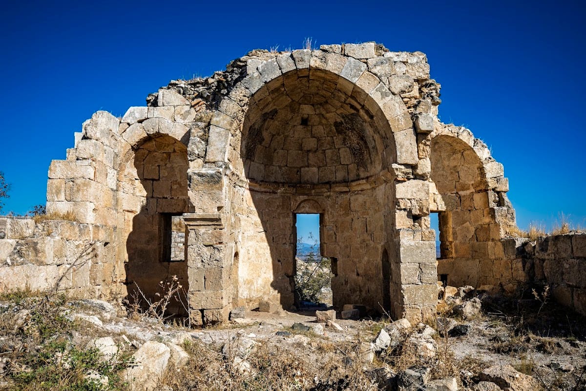
Four church ruins are identified at Anavarza. The central Apostles’ Church is now largely a heap of fallen stones, although its columns indicate an original height of approximately 15–20 meters. Within the fortress are two Armenian chapels and a severely damaged three-aisled Armenian church attributed to Thoros I. The church originally carried a continuous Armenian dedicatory inscription around its walls. Another Armenian church in the outer fortress survived until approximately the last century before collapsing, while a smaller church in the inner fortress survives better because of its strong stone construction and elevated position. Crosses stand immediately west of its gate. The Rock Church north of the city, beside the royal necropolis, is considered one of the oldest structures at Anavarza.
Cemeteries and rock-cut tombs extend west, east, and southwest of the city across approximately 2–3 square kilometers. A necropolis lies south of the fortress curtain wall, and the royal necropolis is beside the Rock Church. The northern Rock Tomb was cut directly into the mountain and carries Roman-period images and inscriptions on its upper section. Many tombs and grave monuments from the Roman and Armenian periods have been damaged, looted, or destroyed, while one substantially preserved tomb was displayed in the garden of the Tomb Museum House.
Aqueducts and fountain
Three major aqueduct systems supplied Anazarbus. An aqueduct is a water-supply structure that carries water from a spring or other source to a settlement. The systems drew from mountains near Bucak Acanmandash and Alapınar-Bekirce and from the area around Hamam village. One aqueduct, dedicated by the inhabitants to Domitian, dates to approximately AD 90 and crossed the plain northwest toward the Sumbas River.
The aqueducts are now represented by small isolated sections and rubble along their former routes. An earthquake in 1945 is considered a likely cause of much of their destruction. A monumental fountain distributed water brought into the city. North of the city, remains of a first-century aqueduct survive with the fountain, while a second aqueduct built during the first half of the second century survives to the northeast.
Villas, mosaics, and religious evidence
Villas west of the city contain important mosaics. One mosaic occupied a pool measuring 3.40 by 2.60 meters. Its geometric decoration surrounded a central male figure between nets with horned sea monsters, two representations of Eros, and two fishing children. One child is nude and seated on a dolphin, while the other is clothed. These mosaics are dated in the site tradition to the fourth century BC, although other descriptions associate the villas with the Roman period.
A second mosaic decorated a pool approximately 10.75 by 3.55 meters. It portrayed eighteen kinds of sea animals in black, light red, yellow, and turquoise on a white ground. Roughly half of the mosaic has been destroyed. Water formerly entered the pool, producing the impression of moving fish. The mosaics suffered severe damage during the 1998 Ceyhan earthquake. The Anavarza Girl mosaic was discovered in 1960 during work on a house foundation, together with a fish mosaic and a mosaic of the sea goddess Tethys. A limestone statue representing Hygieia, the Greek goddess associated with health and sanitation, and Eros was found in 2017 and is dated to the third or fourth century BC.
Evidence of the Roman cult of Mithras, a mystery religion associated with male initiates, ritual dining, and the god Mithras, has been identified or proposed at Anavarza. Roman-period remains throughout the site include pediments, metopes, cornice fragments, column members, inscriptions, and Corinthian capitals reused in later construction. Coins showing Jupiter before a fortress on a rock indicate that a fortified acropolis existed at least during the Roman period. Armenian coinage bearing images of Seljuk rulers has also been used to associate the Armenian period with Seljuk overlordship.