Forum of Timgad: Civic Center of a Roman Colony in Algeria
Site at a Glance
- Country
- Algeria
- Primary era
- Classical
- Eras represented
- Classical
- Civilizations
- Roman
- Site type
- Civic
- Remains
- Forum
On this page17 sections
History
Foundation and civic role
The Forum of Timgad was planned as the civic center of a Roman colony founded in AD 100 at Timgad, Algeria, under Emperor Trajan. A Roman colony was a community established under Roman law with formal civic standing. The settlement served as a second-line military position to help control the territory and secure communications between the plains and the Aurès Mountains. The forum formed part of the colony’s original plan and brought together municipal government, justice, religious activity, commerce, and social life.
The colony came under the authority of Legio III Augusta, a Roman legion stationed at Lambèse, and its commander, the legionary legate Lucius Munatius Gallus. Within the forum, statues and inscriptions honored emperors, municipal officials, and local benefactors. Monuments also recorded connections with military officials, including later legionary legates based at Lambèse.
Changes to the complex
The forum developed in stages rather than retaining a single unchanged layout. Its earlier arrangement was more regular and symmetrical, with the temple, council house, and shops forming its principal elements. During the second and third centuries, new construction and altered entrances and circulation changed how people moved through the complex. Some areas formerly occupied by streets were built over, and public latrines were added. Increased commercial activity along the Decumanus Maximus, Timgad’s principal east–west street, contributed to this reorganization.
Evidence dates particular parts of the complex, but does not establish one completion date for the entire forum. Two statue bases still in place indicate that the council house, or curia, existed before AD 117. A dedication bearing Trajan’s imperial titles places completion of the western sector no later than late AD 116 or early AD 117. The forum continued in use from Trajan’s reign through the third century. Later changes to the city and partial deterioration point to a decline in civic activity.
Excavation and preservation
Excavations beginning in the late nineteenth century exposed nearly all of the forum and brought its principal buildings, architectural fragments, and inscriptions to light. Later consolidation stabilized parts of the complex and made its layout easier to recognize. Several metres of earth covered the city after its destruction, helping preserve portions of the forum. Collapse and the reuse of building stone reduced the height of its surviving structures. The forum belongs to the archaeological site of Timgad, added to UNESCO’s World Heritage List in 1982.
Remains
Layout and construction
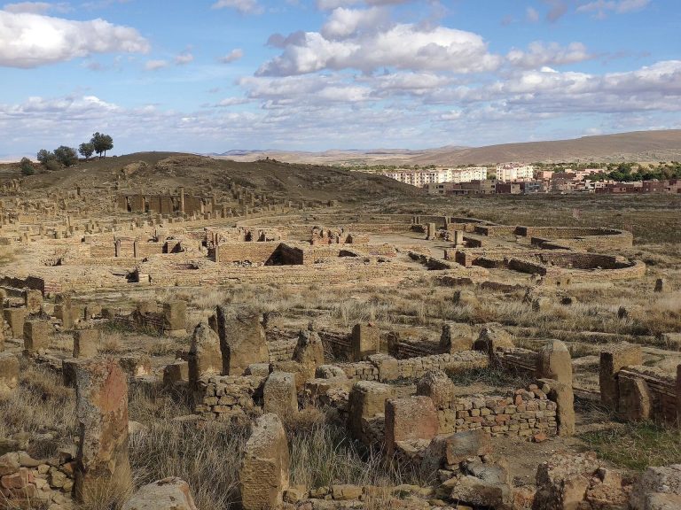
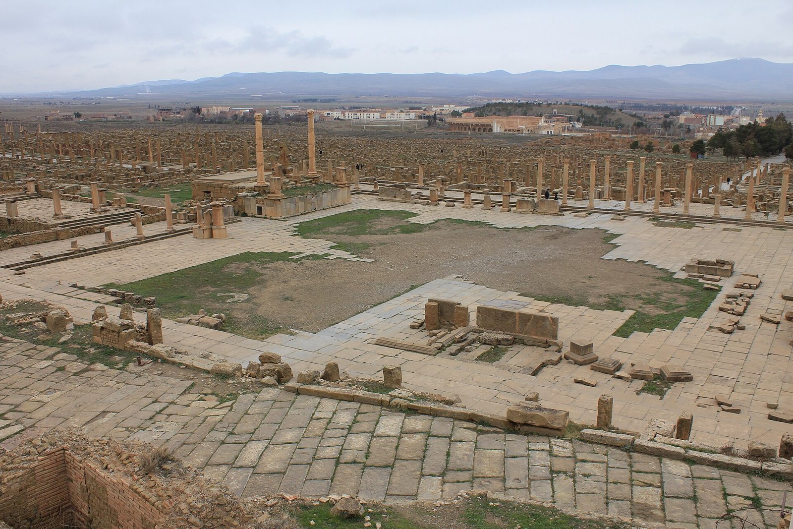
The forum occupies the center of Timgad’s ordered street plan, where the north–south Cardo Maximus and the east–west Decumanus Maximus, the city’s principal streets, meet. The surrounding complex measures about 100 by 60 metres and has a cut-out at its northeast corner, roughly 24 metres square. Its central square is approximately 50 by 43 metres. The basilica and covered walkways, or porticoes, are aligned about three degrees south of the street grid. The whole complex stands more than 1.5 metres above the Decumanus Maximus, allowing vaulted shops and storerooms to fit beneath the forum level.
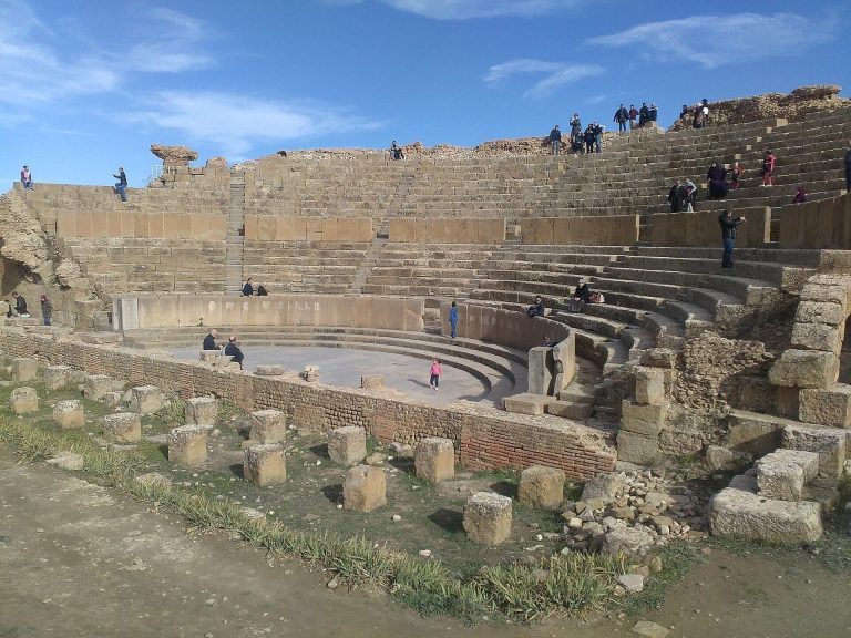
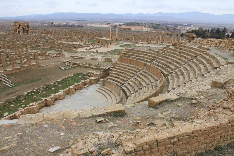
The square is bordered by porticoes and shops, especially along its northern side, while the basilica and temple stand opposite each other on its long sides. The surviving remains preserve a discernible three-part arrangement, although the principal components do not all align on a single axis. A likely three-sided portico and the temple’s position between the curia and shops suggest an earlier, more balanced plan. Nearby public buildings included a theatre, a market built after the colony’s foundation, and a Capitoline temple.
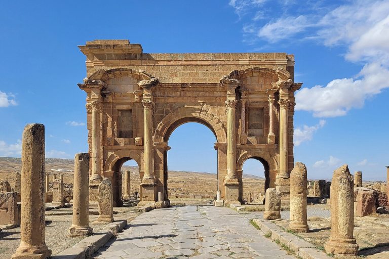
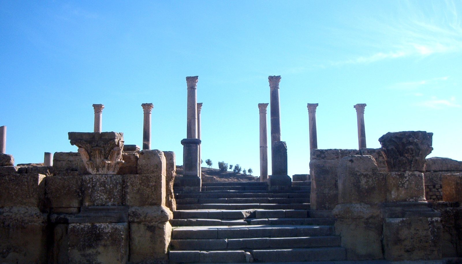
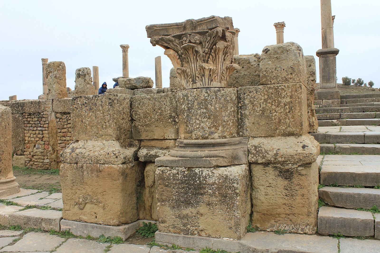
Local stone was the main building material. Rubble walls reinforced with larger cut stones were used for shops and other buildings, while hard blue limestone paved the public spaces and the two main streets. Some architectural pieces were made from regional white and grey marble, including marble from Filfila. The porticoes had columns and capitals, among them Corinthian examples. Marble and decorative stucco fragments from the monumental entrance area were recovered during excavation.
Civic buildings
Basilica
The Roman basilica, a large public hall commonly used for legal and commercial business, occupies one long side of the square and faces the temple. Its paved central hall measures about 38 by 20 metres and opens broadly onto the forum. Smaller rooms open off the hall. Games played with nuts were incised into its paving.
Temple
The temple stands opposite the basilica. A dedication to the goddess Victory has been proposed because two statues of her stood on either side of the temple platform, but the identification remains uncertain. In front of the building, a raised platform probably served as a speakers’ stand. Deep cuts along its upper edge were likely sockets for a stone or iron railing. An underground chamber beneath the temple may have served as a religious annex, public treasury, or municipal archive.
Curia
The curia was the municipal council house, where the decurions, or council members, met. A dedication to Concordia ordinis, the Roman personification of harmony within the council, helps identify the building. Its principal rectangular room measures about 16 by 9 metres and follows an entrance area. A raised platform at the far end provided space for magistrates or the council’s presiding members. The room sits slightly off the square’s axis and connects with the surrounding portico. Lists of decurions were found inside.
Public latrines
Public latrines occupied a room about 8 by 5.5 metres at the forum’s western corner. Their fittings included a water channel designed to carry away waste continuously.
Shops and water features
Northern entrance and fountains
The entrance facing the Decumanus Maximus is flanked by fountains at its northwest and northeast ends. The northwest fountain has a rectangular basin about 2 by 1 metres, made from three interlocking stone slabs and backed by a higher wall. The fountain at the northeast end has a similar arrangement.
Shops and service passage
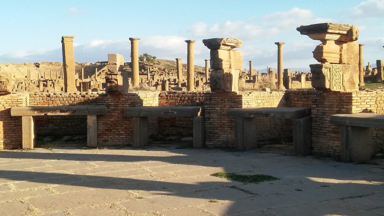
The shops differ in plan and use. Shop 1 has two unequal rooms: the front room opens onto the street and connects to the rear room through a small doorway. A niche in a door jamb may have held a lamp or protective statuette. Stone rings were used to tether animals, and a trough in the front room suggests that pack animals waited there while the merchant worked in the rear room. Shops 5–7 also have two rooms, with vaulted rear spaces beneath the forum made from hollow, bottle-shaped pottery tubes fitted together.
Shops 8 and 9 each consist of one room; a mortar was found in shop 9. Shops 10 and 11 formed a single unit with one street entrance, and their rear rooms probably served as cellars or storerooms. Most shops could be closed to the street, and traces of bolts and latches remain on their door jambs. The walls were built from small stones reinforced with larger stones set on edge. Letters and numerals cut into some blocks are understood as marks related to construction or assembly.
A paved passage separates groups of shops and preserves remains of stairs leading to the forum terraces. A water channel was later cut into the passage. The elevation change between the street and forum also made it possible to place vaulted shops and storerooms below the square.
Paving, inscriptions, and sculpture
Games, sundial, and graffito
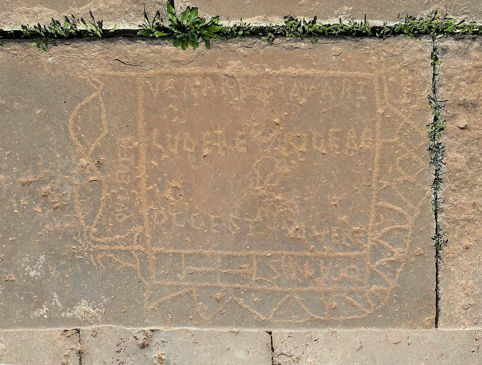
Incised game boards survive on the paving, including a carefully cut example beneath the northern portico near the entrance. Other markings include games of marbles on the basilica paving and the south side of the square, as well as circles, radiating lines, and geometric patterns whose purposes are uncertain. A sundial was cut into the stone, with lines radiating from the point intended for its projecting marker. A nearby Latin graffito reads, “To hunt, bathe, play, laugh, that is life.”
Honorific monuments and inscriptions
Inscriptions on statue bases, pedestals, architectural pieces, and the steps into the square record honors paid to emperors, municipal officials, and local notables. Two inscriptions concern Trajan. One uses the victory title Dacicus, associated with Dacia, but not Optimus, meaning “best”; it dates to AD 102–114. Another uses Parthicus, a title received in AD 116, but not Divus, which designated a deified emperor. It therefore belongs to the final years of Trajan’s reign.
A dedication naming C. Publicius Celer records his gift of a statue and base after he paid the required sum into the colony’s public funds. Celer was a designated quinquennial duumvir, a chief municipal magistrate with a census-related civic role. Other inscriptions honor military officials, including legionary legates. Many statue bases and honorific pedestals were arranged along the porticoes, near the basilica, and on stair landings. Some inscribed bases were later moved or reused, making their original positions difficult to establish.
A statue of the satyr Marsyas, a figure from Greek mythology, was found in the forum with an inscription dedicated to Trajan’s health and victory. Marsyas was associated with the privileged legal status known as Italic law, held by Timgad by the early second century.