Forte de São João Baptista de Esposende: A Coastal Fort and Lighthouse in Portugal


Site at a Glance
- Rating
- 4.3
- Popularity
- Low
- Country
- Portugal
- Primary era
- Early Modern
- External website
- Open
- Eras represented
- Early Modern, Modern
- Civilizations
- Portuguese
- Site type
- Military
- Remains
- Fort
On this page8 sections
History
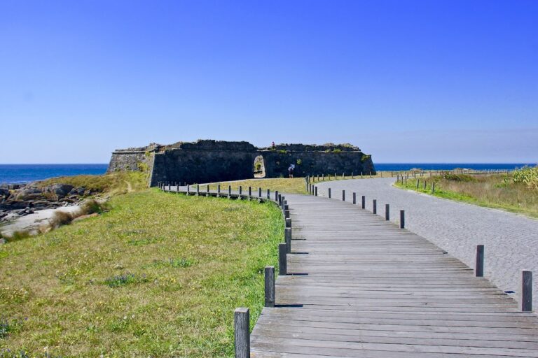
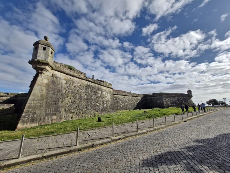
Forte de São João Baptista de Esposende is a coastal fort in Portugal, constructed by the Portuguese crown between 1699 and 1704 during the reign of Peter II. Designed as a bastion fort, a defensive structure built around projecting angular points, it protected the mouth of the Cávado River.
Construction and defensive purpose
The fort originally had an irregular star-shaped plan, with a bastion at each vertex. A bastion was a projecting defensive point that allowed defenders to cover the walls and the ground alongside them. Each bastion included a hexagonal sentry box, a small shelter for a guard. Service buildings were placed on the embankment, including a chapel dating from the eighteenth century.
Transformation for lighthouse use
The fort’s defensive form changed after lighthouse installations required parts of its structure to be cut away. Its plan became rectangular, with two surviving bastions and a guardhouse at each angle. A lenticular light, which uses lenses to project illumination over a greater distance, was installed in 1866. In 1925, a taller lighthouse was commissioned from Barbier, Bénard & Turenne and installed on 10 April that year.
Modern protection and planned rehabilitation
Forte de São João Baptista de Esposende has been classified as a Property of Public Interest since 1982. By 2019, its four ancillary buildings were in ruins, including two structures created during the twentieth century for lighthouse-support services. In September 2020, Esposende City Council acquired rights over the fort from the Portuguese government for 50 years. Cleaning and work on two former support buildings enabled exhibitions and cultural activities to take place there. The municipality launched a tender in March 2022 for architectural and specialist rehabilitation connected with the proposed North Coast Interpretive Center. In April 2026, it approved a further rehabilitation tender for a planned scientific and cultural center focused on maritime and underwater heritage, including material associated with the Belinho shipwreck.
Remains
The fort stands beside Praia do Farol and occupies approximately 1,510 square meters. Its present complex contains about 1,300 square meters of constructed area. The surviving layout combines part of the defensive wall, a principal building, four ancillary buildings, and the lighthouse on the southwestern side.
Defensive structures
The original star-shaped fortification was altered into a rectangular enclosure when the lighthouse was introduced. Two bastions remain, accompanied by a guardhouse at each angle. These surviving elements form the principal defensive framework, together with the remaining section of the wall.
Ancillary buildings
The four ancillary buildings have rectangular or quadrangular plans, single-storey forms, and hipped roofs. A hipped roof slopes down on all sides rather than ending in vertical gables. The buildings were in ruins by 2019, although interventions to two former lighthouse-support structures later enabled the area to accommodate exhibitions and cultural activities.
Lighthouse complex
On the southwestern side, the lighthouse consists of a red-painted cylindrical iron tower set on a circular cement base. It has a lantern and a service balcony. Attached to the tower is a two-storey rectangular building painted yellow, intended for the lighthouse keepers.
Nearby sites