Castro de São Lourenço: A Fortified Archaeological Settlement in Portugal
Site at a Glance
- Rating
- 4.6
- Popularity
- Medium
- Country
- Portugal
- Primary era
- Classical
- Eras represented
- Iron Age, Classical, Medieval, Modern
- Civilizations
- Portuguese, Roman
- Site type
- Military
- Remains
- Fortified Town
On this page16 sections
History
Castro de São Lourenço is a fortified archaeological settlement in Vila Chã, Portugal, whose occupation began in the early first millennium BC during the Late Bronze Age. The settlement may have been founded between the eighth and fifth centuries BC, and its elevated position later supported observation and control of the coast and the mouth of the Cávado River.
Early settlement and Romanization
Between the fifth and second centuries BC, the community consisted mainly of small stone buildings with roofs made from perishable materials. The settlement changed gradually from the second century BC to the fourth century AD, during a process of Romanization lasting about six centuries. Romanization brought the adaptation of local communities to Roman administration, building forms, materials, and economic practices.
At Castro de São Lourenço, this transformation included the rebuilding of structures damaged by fire and the development of a small administrative system, trading facilities, and services. The settlement acquired a political and economic role that extended beyond its own inhabitants to the surrounding population. Metallurgy may have encouraged improvements in construction and contributed to the wider use of stone. Round buildings were progressively replaced by square and rectangular structures roofed with flat tegulae and curved imbrices, the two standard forms of Roman roof tile.
Abandonment and medieval reuse
The settlement was abandoned around the fifth century, when its inhabitants dispersed their homes during the early medieval period. The ruins later served as a refuge during Viking raids and attacks by Muslim forces. During the ninth to twelfth centuries, the site was reoccupied in the context of the Reconquista, the long Christian military and political expansion that reduced Muslim-ruled territories in medieval Iberia.
In the twelfth and thirteenth centuries, a stone wall was built on the hill as a small castle-like defensive work. The name Castro de São Lourenço comes from a chapel dedicated to Saint Lawrence, a Christian martyr and saint whose cult was widespread in medieval Europe. The chapel was built within the settlement around the fourteenth century. The earliest known document mentioning it dates from 1549, while the present chapel was constructed in 1929 after an earlier building had been demolished.
Excavation and protection
Archaeological excavations began in 1985 and continue today under the direction of Carlos Alberto Brochado de Almeida of the Faculty of Arts of the University of Porto. Students from Esposende schools and from Portuguese and European universities have assisted with the work, while the municipality has provided logistical support through its cultural department.
The excavated areas are divided into sectors because different parts of the hill were occupied at different times and in different ways. The sectors are identified as A, C, CV, D, E, N, M1, M2, and T. They include the acropolis, chapel access routes, defensive structures, stairs, the sea-facing area, and the treasury area. Castro de São Lourenço was classified as a Property of Public Interest under Decree 1/86, published on 3 January 1986. An archaeological park now occupies the site, and excavated material is held by the Esposende municipal archaeological services, with important finds displayed in the Esposende Municipal Museum.
Remains
Hilltop setting and defences
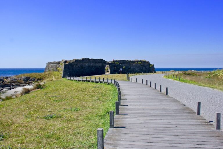
The settlement occupies São Lourenço hill at about 200 metres above sea level, on a granite spur of a fossil cliff extending from Monte Faro to São Paio de Antas. Its position overlooks the coast and the mouth of the Cávado River. Three lines of defensive walls and ditches protected the settlement, while a watchtower on the northern side watched the northern coast.
Defensive walls
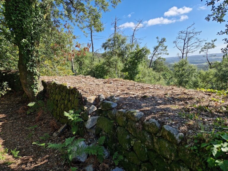
The largest wall, probably built during the Roman period, survives to about three metres high. Its outer and inner faces remain clearly identifiable. The defensive area in sector D lies at the entrance to the settlement, at the beginning of the path leading to the chapel. The medieval outer fortification reused stone from earlier structures. Part of the Roman wall has been reconstructed to its greatest known height, while its height decreases beside the access road to show that this was not the original entrance.
Acropolis
Sector A forms the acropolis, the highest point of the settlement. During the Iron Age and the period of Romanization, it served as a coastal observation point and as a place from which the mouth of the Cávado River could be controlled. A stone wall enclosed its seaward slope and provided a platform for a defensive observation group. Part of this wall has been restored. The fortification was later altered when the chapel of Saint Lawrence was built.
Stairway and viewpoint area
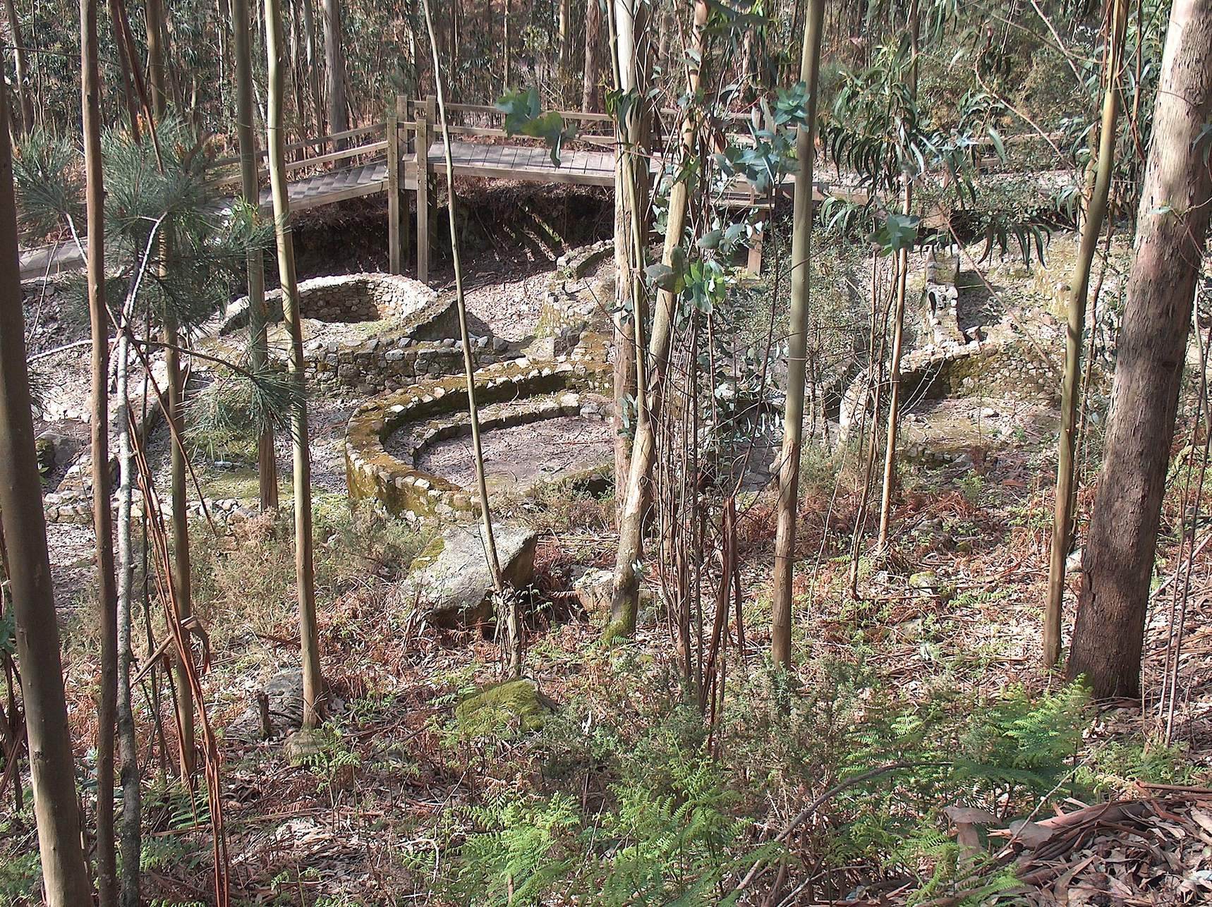
Sector E, the stairway and viewpoint area, was used for coastal observation between the first century BC and the first century AD. Later reinforcement and rebuilding associated with the chapel destroyed some of its earlier structures, either partly or completely. The surviving settlement remains include three or four round houses with gravel floors. One has a projecting, crab-shaped veranda made with slate slabs set into the floor and continued outside the building to drain rainwater. Stones and slate slabs cover the ground around the houses.
Chapel-access settlement
Sector C lies along the area leading to the chapel and was occupied from the third or second century BC. Later occupation continued into the first century AD and may have lasted as late as the fourth century. The houses were round or subrectangular, with floors of compacted earth or gravel. Some interior walls were plastered and painted white or yellow above a grey lower band.
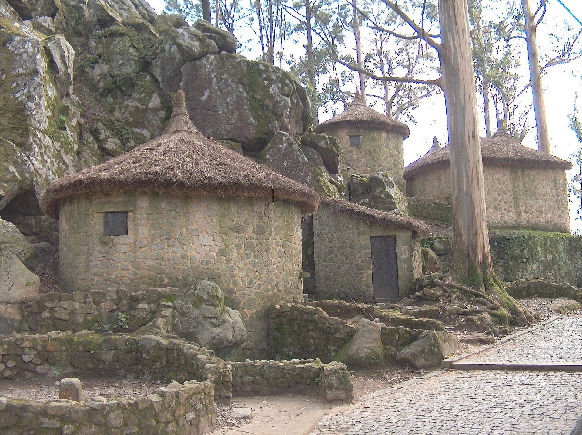
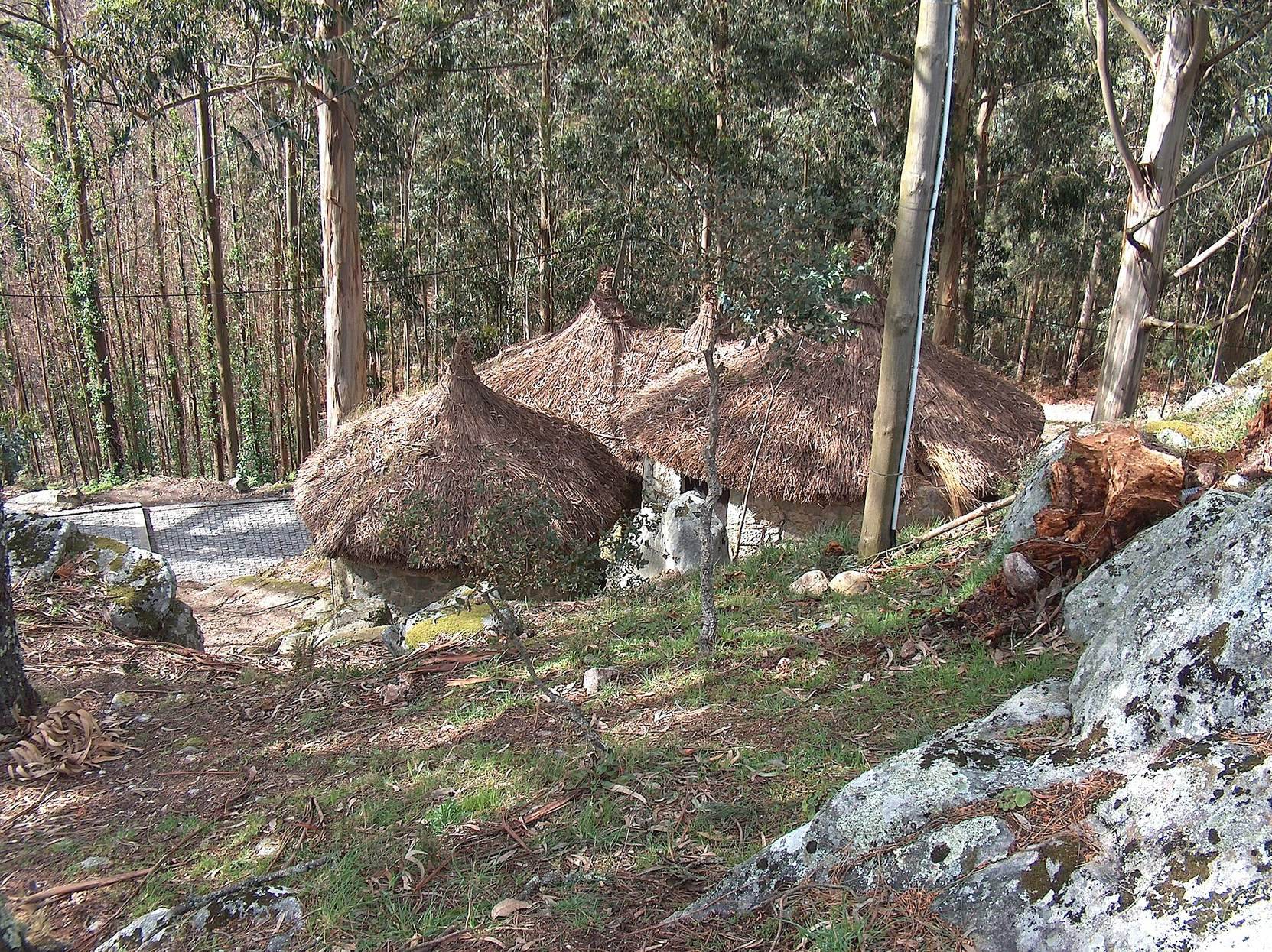
Round houses had conical roofs made from plant material, while elongated buildings had roofs with one or two slopes. Each house contained a central hearth and a wooden post that supported the roof. Slate slabs helped secure the thatching. During Romanization, flat and curved Roman roof tiles replaced these earlier organic coverings.
Some houses acquired projecting vestibules, known archaeologically as “crab” additions, which enlarged the living area and could contain installations such as bread ovens. Walls divided neighbouring family houses into residential groups. Paved spaces between the buildings were used for drying grain and fruit and also formed narrow passageways.
Fires in the middle of the first century BC and the middle of the first century AD led to rebuilding in sector C. The replacement houses were arranged on several terraces along the slope in a staggered pattern, allowing the buildings to avoid obstructing one another.
Old-path settlement
Sector CV occupies the northern slope near the present chapel and was inhabited from the fourth century BC to the middle of the first century AD. It contains family houses, annexes, service buildings, and storage structures. The houses stood on terraces at different elevations, supported by retaining walls.
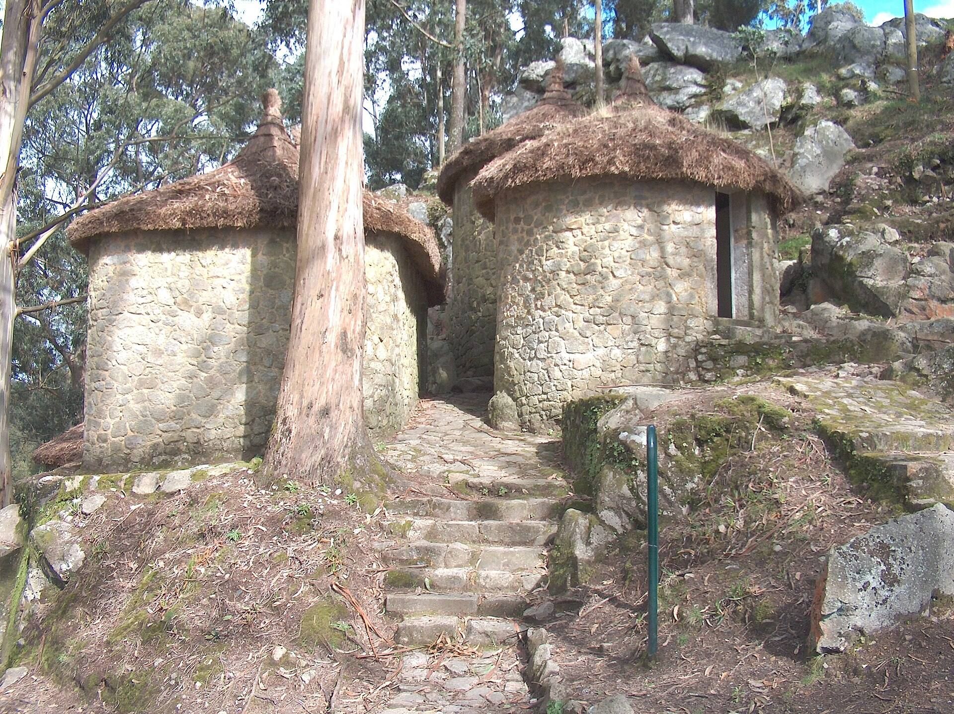
The roofs in this sector were probably made from organic materials such as straw. Slate slabs reinforced the eaves, and vertically embedded slabs placed between a storage building and the rock protected the foundations of a rectangular structure from rainwater. The partially restored settlement consists of two round houses and one rectangular house with rounded corners, representing the appearance of this part of the site around the transition from the first century BC to the first century AD.
Sea-facing residential area
The M, or M1-M2, sectors lie halfway down the slope in the area known as the sea area. Two residential groups of round and subrectangular houses were connected by paved paths. The area was occupied from the sixth century BC to the first century AD and preserves evidence of domestic life, storage, food processing, and skilled stoneworking.
Upper platform
The upper platform contains two round structures and a rectangular building. One round house has a slate threshold and a stone with a long groove in the centre of its vestibule, probably connected with a lock. The rectangular building was accessible only by an outside stairway and served as a storage structure.
Lower platform
The lower platform contains three round buildings and one rectangular building. The rectangular structure had a gravel-and-slate floor, with millstones beneath it. A slate drain ran perpendicularly under the floor and carried water outside, while exterior drains removed rainwater from the building. The roofs probably used organic materials, including straw and small branches, reinforced with slate slabs. Many of those slabs may have been reused from earlier salt-evaporation installations.
The substantial architecture and construction materials of the M-sector buildings indicate that wealthy families lived there. Stoneworkers produced millstones and stone pendants, while the area was used to process wheat, barley, and acorn flour. One round building contained a deposit of 32 denarii, Roman silver coins used from the Roman Republic through the imperial period. The coins date from the second half of the first century BC. A separate group of silver Roman coins from the same general sector belongs to the period of the Roman Republic.
Treasury area and later workshops
Sector T lies in a small valley leading to an old quarry halfway up the slope. The quarry access path destroyed part of the area. Occupation lasted from the fifth century BC to the fourth century AD, and the sector underwent repeated changes because its gentler topography provided more room for construction.
The earliest buildings were small and round. Between the end of the first century BC and the first half of the first century AD, the area was reorganized and additional structures were fitted into the available spaces. One house contained denarii dating from 2 BC to AD 37, while another group of silver Roman coins is associated with the reigns of Augustus and Tiberius, the first two Roman emperors.
From the second half of the first century AD, sector T was repeatedly rebuilt, repaired, and enlarged. Round and elongated structures gradually gave way to square and rectangular buildings. At the end of the first century AD, a paved street and stone boundary walls organized an area that had previously followed a less regular arrangement.
The sector also preserves evidence of specialized metalworking and later pottery production. Finds include anvils, nails, and ironworking tools. Blades, hammers, and tongs connect this activity with the development of the buildings and their construction.
Archaeological finds
The oldest material identified at the settlement consists of Chalcolithic, or Copper Age, fragments from open vessels decorated with incised Penha-type designs. The Copper Age was a transitional period between the Neolithic and Bronze Age, when stone tools continued to be used alongside early copper metallurgy.
Excavations have yielded thousands of indigenous ceramic fragments, many richly decorated, together with locally made and imported Roman pottery. The Roman material includes terra sigillata and Haltern 70 amphorae. Glass, coins, iron and bronze tools, spearheads, sickles, knives, clappers, fibulae, and hairpins are also among the recovered objects. These materials are displayed in the Esposende Municipal Museum.