Fort van Lier: A Belgian Fort in the Antwerp Defence Line


Site at a Glance
- Rating
- 4.1
- Popularity
- Low
- Country
- Belgium
- Primary era
- Modern
- External website
- Open
- Eras represented
- Modern
- Civilizations
- Belgian
- Site type
- Military
- Remains
- Fort
On this page10 sections
History
Fort van Lier is a Belgian military fort in Lier, Belgium, built between 1877 and 1890 as part of the Antwerp Defence Line. It formed part of the National Redoubt, Belgium’s final fortified position if its field armies had to withdraw, and was designed within the nineteenth-century expansion of Antwerp’s defensive system.
Creation of the Antwerp Defence Line
Antwerp was selected in 1859 as Belgium’s National Redoubt, a fortified defensive system intended to hold out until allied assistance arrived. The network combined a siege wall around the city, a belt of forts, and inundation zones, which were areas deliberately flooded to slow an attacking force. Its first defensive belt comprised eight forts designed under the influence of the military engineer Henri Alexis Brialmont, arranged in an arc of about 18 kilometres from Wijnegem to Hoboken.
In 1870, the defensive system was enlarged so that Antwerp could be protected from a greater distance. Fort van Lier was constructed during this second phase, together with the forts of Walem, Steendorp, and Schoten. The wider defensive belt was completed under the 1906 law, which also brought further improvements to several forts.
Reinforcement and the First World War
In 1906, Fort van Lier was strengthened with unreinforced concrete, particularly around its main caponniere. A caponniere is a fortified structure projecting into or controlling a moat, allowing defenders to fire along the ditch and protect the perimeter. New gun turrets accommodated weapons of 15 centimetres, 12 centimetres, and 5.7 centimetres. The improvements were soon challenged by the development of heavy German artillery, whose shells could defeat the concrete used in the reinforcement.
During the First World War, Lieutenant-Colonel Doneux commanded the fort, whose garrison included cavalrymen from the Beveren depot. After German forces captured Fort Koningshooikt, they turned their attention to Fort van Lier. On 29 September 1914, a German battery of two 42-centimetre mortars was placed at Heist-op-den-Berg, about 7.8 kilometres away. The guns first used smaller-calibre fire to establish their range.
The heavy bombardment began on the afternoon of 30 September. The two mortars fired 62 shells, 57 of which struck the fort, followed by another 32 shells on 1 October. During the night of 1 to 2 October, the fort’s light guns fired on the German 26th Reserve Infantry Regiment as it approached from the south. On 2 October, German artillery shelled the position with 21-centimetre weapons.
The garrison left the fort on 2 October and returned later that day to inspect it. The guns had been disabled or made inaccessible, leading the commander to order a final withdrawal. The soldiers crossed the Nete during the early morning of 3 October. At least four members of the garrison were killed, although the total may have reached ten. The German 35th Reserve Infantry Regiment occupied Fort van Lier that morning. The retreat was hurried, and dynamite placed under the bridge was not detonated. The fall of Fort van Lier, together with the loss of the forts at Walem, Sint-Katelijne-Waver, Koningshooikt, Kessel, and Broechem, contributed to the collapse of the Antwerp fortress.
Later use and preservation
Between the two world wars, Fort van Lier was partly repaired and rearmed with machine guns. It did not participate in combat during the Second World War. The city of Lier has owned the fort since 1950. From 1989, the Fort Lier shooting club has used parts of the site for shooting, archery, and fishing, while radio amateurs have also occupied the premises.
The fort belongs to the historic Antwerp fort belts included in a Natura 2000 area for bats under the Habitats Directive. The protected area covers 3.585 square kilometres and is managed by the Agency for Nature and Forests, Natuurpunt, a Belgian nature-conservation organization, and private owners. In 2021, the city administration prepared a restoration master plan through the European Reclaim the Fortified Towns project, which focuses on preserving military heritage.
Remains
Layout and defensive setting
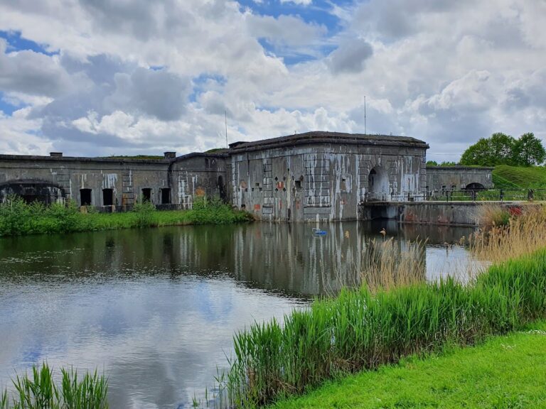
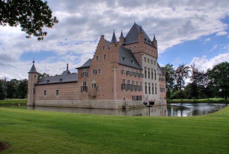
Fort van Lier has a trapezoidal plan enclosed by a wet moat between 40 and 50 metres wide. The entire defensive property, including the moat and glacis, covered about 37 hectares. A glacis is a gently sloping outer embankment that shields fortifications from direct fire. The area within the moat measured approximately 7.5 hectares. The fort was built mainly in brick and included a main front building, internal rooms, living quarters for military personnel, an entrance to those quarters, and a passage connecting them with the main front building.
Armament and bombardment damage
Concrete defenses and gun positions
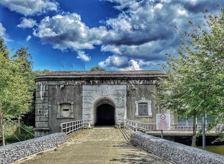
The 1906 modernization introduced unreinforced concrete, especially in the main caponniere, and added armored positions for 15-centimetre, 12-centimetre, and 5.7-centimetre guns. The long-range armament included 12- and 15-centimetre guns, with eight placed on the main caponniere, as well as 21-centimetre mortars. Radio-amateur transmission masts now stand on the main front building.
Barracks and shell evidence
The 1914 bombardment struck the barracks twice, destroying them with direct hits. A base from a 42-centimetre shell was found in the commander’s room beside a measuring rod used to determine the calibre of the projectile. A 5.7-centimetre armored gun turret was torn from its fittings and fell downward, preserving physical evidence of the force of the attack.
Moat water and surviving use
Water in the fort contains 391 micrograms per litre of lead ions and 114 micrograms per litre of cadmium ions. These concentrations exceed the stated drinking-water limits of 15 and 5 micrograms per litre respectively, and the heavy metals accumulate partly in fish. The combination of surviving military structures, the wet moat, and later installed equipment reflects the fort’s changing physical use after its wartime capture and partial interwar repair.
Nearby sites