Fort de Giromagny: A Séré de Rivières Fortification in France


Site at a Glance
- Rating
- 4.5
- Popularity
- Low
- Country
- France
- Primary era
- Modern
- External website
- Open
- Eras represented
- Modern
- Civilizations
- French
- Site type
- Military
- Remains
- Fort
On this page16 sections
History
Fort de Giromagny is a French detached fort in the fortified belt around Belfort, built between 15 June 1875 and 1 July 1879 as part of the Séré de Rivières system. This network of forts and defensive positions was constructed mainly after the Franco-Prussian War of 1870–71 to protect France’s eastern frontier. The fort formed the southern end of the defensive curtain of the Haute Moselle, a connected line of fortified works linking the fortified camps of Épinal and Belfort.
Construction and defensive role
The fort guarded the northern approaches to Belfort and helped prevent an invading force from occupying the area between Belfort and the Vosges. Together with Fort de Roppe, it controlled roads leading toward Colmar and Basel. It also protected the flank of Fort de Bessoncourt and supported Fort du Salbert. The planned garrison numbered about 650 men, while the 1885 establishment comprised 17 officers, 20 non-commissioned officers, and 608 other ranks.
Fort de Giromagny was among the most heavily armed works in the Haute Moselle and northeastern France. In 1879, it became the first French land fortification equipped with two rotating armored gun turrets. For several months it was known as Fort Dorsner, honoring General Jean Philippe Raymond Dorsner, who had served during the French Revolutionary and Napoleonic Wars. A presidential decree of 21 January 1887 introduced commanders’ names for forts, fortified artillery positions, and barracks in the Séré de Rivières system. The policy was reversed on 13 October of the same year, and the original name, Fort de Giromagny, returned.
Modernization before 1914
The fort was modernized in 1888, when two underground magazines were built and the caponiers, covered defensive structures projecting into the ditch, were strengthened with concrete. Electrical lighting, armored observation posts, and other improvements were also introduced. The electrical system installed for the magazines failed frequently, so the army replaced it with oil lamps. The 1885 crisis caused by the development of powerful explosive shells prompted the construction of the magazines, which together held 102 tonnes of black powder.
A more extensive modernization was proposed, including a turret for a 75 mm gun and the replacement of the caponiers with counterscarp galleries, protected passages on the far side of the ditch. Lack of funds prevented this scheme, and the existing caponiers were reinforced instead. Five searchlights were planned for the ditches under the supplementary program of 1908. The original open gun positions were gradually reduced as exposed fixed artillery became more vulnerable, while three armored observation posts and other defensive works were added.
World wars and military abandonment
Fort de Giromagny did not take part in combat during the First World War. It nevertheless received concrete reinforcement, additional observation works, and a cave shelter in 1915. This underground chamber was intended to protect the garrison from possible destruction by aerial attack.
In 1940 the fort belonged to the fortified region of Belfort, initially under the French Eighth Army and Army Group 3. On 16 March, the fortified region became the 44th Fortress Corps. The garrison included the 7th Battery of the 159th Position Artillery Regiment. Its guns fired on advancing German forces on 18 June, after which the garrison abandoned the fort.
From 1941, German labor-service workers removed the principal surviving metal components, including both armored turrets, for scrap. One turret had appeared the previous year in a German propaganda film that falsely portrayed the capture of a Maginot Line fortification by flamethrower attack followed by demolition with dynamite. German forces also reinforced the fort during the war, but destroyed its entrance while retreating in 1944. After German forces were driven from the area, a detachment of the 411th Territorial Artillery Regiment used the fort as an observation post in November 1944. It then ceased to have a military function.
Preservation
The fort remained unused until the municipality of Giromagny acquired it and the adjoining land in 1988 and began restoration. Since that year, the Association du Fort Dorsner has directed its restoration, maintenance, and preservation. Fort de Giromagny was registered as a historic monument in 1995.
Remains
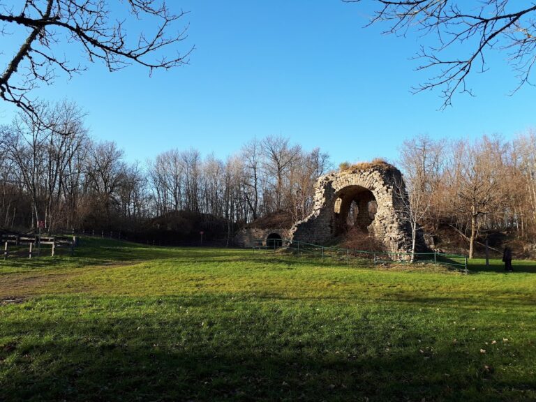
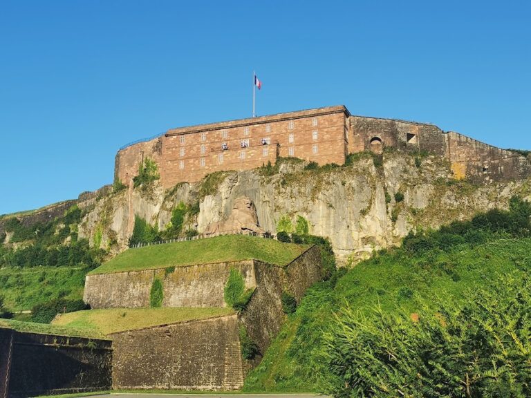
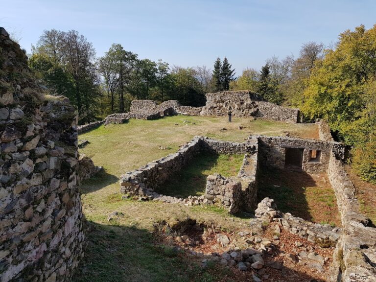
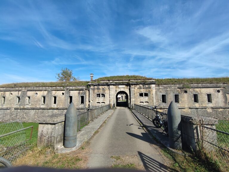
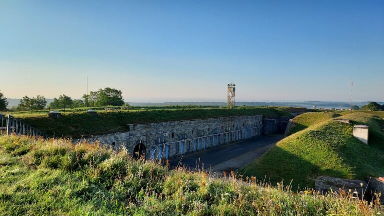
Fort de Giromagny occupies a summit at about 636 metres above sea level on the territory of Giromagny and Auxelles-Bas, northeast of Belfort. Its trapezoidal plan is oriented approximately north, with the entrance on the southern side, and a dry ditch surrounds the work. Sandstone masonry forms the structure, while an earth covering protected it from artillery fire. The central mass contains barracks, magazines, and covered gun positions arranged around an octagonal courtyard. Except for the rear portion, this central complex has two storeys.
Central fort and ditch defenses
Courtyard and internal passages
The octagonal courtyard gives access to the barracks and the other defensive areas. Vaulted passageways, casemates, covered corridors, and posterns, protected passages connecting the interior with outer defensive works, allowed movement through the fort while providing shelter from fire. Four posterns lead from the central block to the rampart road, where individual artillery positions were separated by traverses, raised barriers that shielded guns from lateral fire and shell fragments.
Caponier defenses
The front and flank ditches were defended by a single caponier at the left shoulder and a double caponier at the right shoulder. Each was reached from the rampart road through a postern. A further barracks block closes the gorge, the rear side of the fort. Built into the inner ditch wall at ditch-floor level, it was arranged for defense. Advanced ditch defenses at both ends covered the gorge ditch, which was set at a re-entrant angle, and exposed approaches to crossfire.
Artillery and communication works
Gun positions and turrets
The fort originally included six mortar casemates for indirect fire and two external artillery batteries. Its principal armament was formed by two 155 mm guns installed in armored rotating turrets. Turret A initially used a St. Chamond mounting, while turret B first had a Mougin mounting and received a St. Chamond mounting in 1881. Later descriptions identify the pair as Mougin model 1876 turrets. Both turrets were removed for scrap during the Second World War.
The 1880 inventory listed two 155 mm long guns, seven 138 mm guns, six 85 mm guns, ten 75 mm guns, five 150 mm smooth-bore mortars, four 155 mm short guns, two 220 mm mortars, and five additional 85 mm guns. The 1884 inventory retained the same listed totals. By 1912 and 1914, the armament comprised eight 80 mm field guns adapted for fortress use, five 15 mortars, four machine-gun positions, and five 120 mm breech-loading guns.
Signal station
A light-signal station provided optical communication with Fort du Salbert. Its position formed part of the fort’s wider defensive and communications network within the Haute Moselle line.
Magazines, food supply, and shelter
Underground magazines
The two underground magazines were constructed in 1888 in response to the threat posed by the explosive shells associated with the 1885 crisis. Their stated combined capacity was 102 tonnes of black powder. Battery-powered electric lighting was installed during construction, but repeated failures resulted in its replacement by oil-lamp lighting.
Bakery
The bakery contained a Lespinasse oven capable of producing 200 portions each day. A portable Lespinasse oven provided a further capacity of 180 portions per day.
Cave shelter
The cave shelter built in 1915 had a metal framework designed to carry a sheet-metal lining. The lining directed condensation and seepage water toward a small underground passage leading outside the fort. The shelter formed part of the First World War improvements intended to protect personnel from aerial attack.
The fort survives as a preserved military structure under the care of the Association du Fort Dorsner. Its entrance was destroyed during the German retreat in 1944, and the principal armored metalwork was removed during the Second World War, while the sandstone fort, earth-covered central complex, ditches, internal passages, and defensive works remain part of the preserved site.
Nearby sites