Fort du Salbert: A Séré de Rivières Fortress at Belfort

Site at a Glance
- Rating
- 4.5
- Popularity
- Very Low
- Country
- France
- Primary era
- Modern
- Eras represented
- Modern
- Civilizations
- French
- Site type
- Military
- Remains
- Fort
On this page10 sections
History
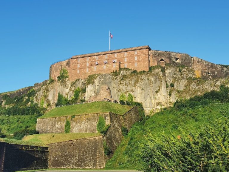
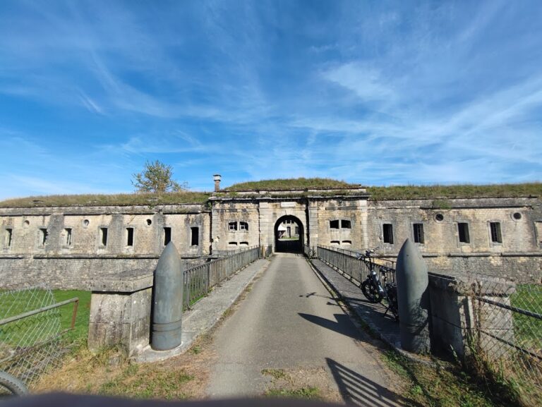
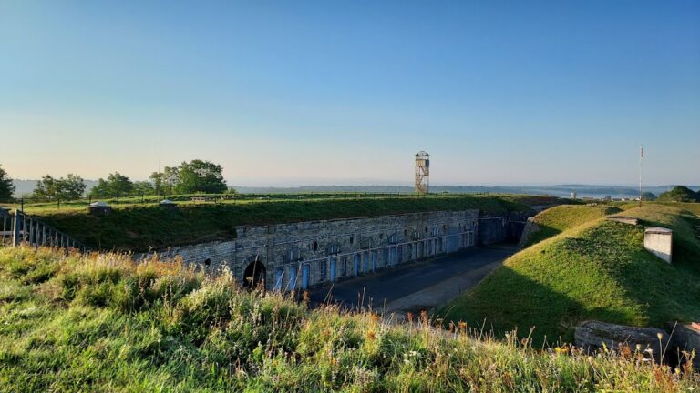
Fort du Salbert is a French military fortress at Belfort, France, built between 1874 and 1877 as part of the Séré de Rivières system and Belfort’s fortified region. The Séré de Rivières system was a network of forts, batteries, and defensive positions developed after the Franco-Prussian War to protect France’s eastern frontier. Built in the late nineteenth century with low, earth-covered masses intended to reduce the effects of artillery fire, the fort formed part of Belfort’s second defensive ring, about 5 to 6 kilometres beyond the first ring of forts constructed between the 1820s and 1840s.
A Fort for Belfort’s Western Approaches
Built at the summit of Salbert hill, northwest of Belfort, the fort commanded the area of ponds around Malsaucy, a lake-and-pond district near the city. Its position also enabled it to control roads leading toward Lure and Giromagny, together with the Paris railway line. Its listed garrison was 684 men. Another personnel breakdown gives 460 men, 24 non-commissioned officers, and 13 officers.
The fort was briefly renamed Fort Lefebvre under a decree of 21 January 1887 that assigned forts, batteries, and barracks the names of former military leaders. The new name referred to General François Joseph Lefebvre, a French commander who served during the Revolutionary and Napoleonic periods. The original name, Fort du Salbert, was later restored.
Late-Nineteenth-Century Modernization
The artillery-shell crisis of 1885 prompted changes to many French fortifications. At Fort du Salbert, modernization took place principally between 1890 and 1895. Concrete reinforcement was added around the caponiers, fortified structures projecting into the ditch so defenders could fire along or across it, and an underground shelter was created for the troops. The fort did not receive the extensive concrete covering applied to some other forts of the same system.
From 1893, a strategic railway connected Fort du Salbert with positions at Servance, Giromagny, Roppe, Mont Vaudois, Mont Bart, and Le Lomont, as well as with Chailluz near Besançon. Two optical communication posts also linked it with the citadel of Belfort and other nearby forts. An optical semaphore was a visual signaling apparatus used to transmit messages between fortified positions before and alongside later electrical communication systems.
A major programme planned for 1900 was not carried out. It would have added an armored twin-gun turret, an armored observation post, a machine-gun turret, and a turret for a 75 mm gun. A further programme proposed in 1908 also remained unfinished. During the First World War, a rock-cut underground gallery was excavated in 1917 to connect the fort’s caponiers with its barracks.
The Capture of 1944
On 19 November 1944, German forces occupied Fort du Salbert and used it to block Allied access to Belfort. That night, approximately 1,500 men of the Commandos d’Afrique approached through the Salbert forest. They silently removed German guard posts, descended the ditches by rope, and climbed the ramparts using detachable ladders. After five hours, they surprised and rapidly overran the garrison.
On 20 November, the commandos descended toward Belfort, followed by tanks. Fighting continued in the city for two days, and Belfort was liberated on 22 November 1944.
Cold War Conversion
During the 1950s, the creation of Ouvrage G, a Territorial Air Defense installation, led to major extensions and alterations in the fort’s underground areas. Ouvrage G was a Cold War air-defense facility created within the earlier fort. Fort du Salbert temporarily served as an air-defense coordination center during the early Cold War, and military use continued until 1972. In June 2016, a Belfort association began rehabilitating Ouvrage G.
Remains
Fortress Layout and Armament
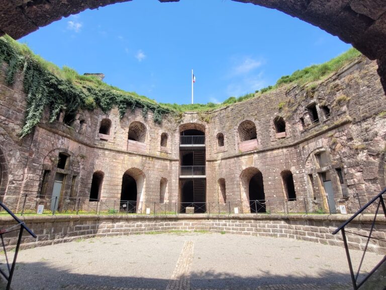
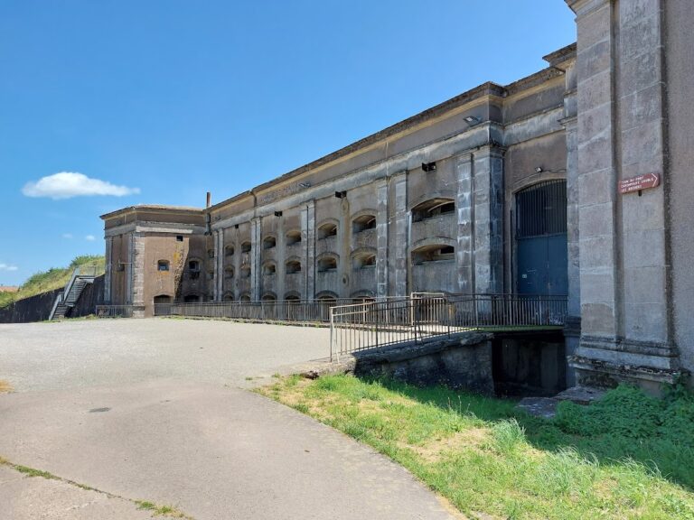
Fort du Salbert is a central-mass fort occupying the summit of Salbert hill. Its design belongs to a generation of fortifications that replaced high, exposed walls and bastions with low masses covered by earth. This arrangement was intended to improve resistance to artillery fire. The main casern, or barracks building, formed the principal accommodation block. A well and a cistern supplied the garrison with water.
The listed armament comprised 25 rampart guns and seven mortars, supported by 12 additional flanking pieces. An inventory from 1882 specifies five long 155 mm guns, eight long 120 mm guns, and a variety of small mortars and small-caliber guns for close defense. These weapons formed part of the fort’s system for controlling the approaches around Belfort.
Caponiers and the Gallery of 17
The fort retains a simple western caponier and a double northern caponier. These projecting structures occupied the ditch defenses and allowed fire to be directed along or across the surrounding ditch. Their concrete reinforcement belongs to the modernization works carried out between 1890 and 1895.
The 1917 Gallery of 17 was cut directly through natural rock without a lining. It connected the simple caponier at salient II with the double caponier at salient III, then continued to the corridor serving the barracks. A concrete airlock with a metal door could close the passage. The gallery therefore joined separate defensive and accommodation areas beneath the fort.
Communications and Ouvrage G
Two optical communication posts formed part of the fort’s signaling network. One of them includes a communication tube. Together, the posts supported visual links with the citadel of Belfort and other fortified positions before later systems altered military communications.
The underground areas were substantially extended and modified for Ouvrage G. The surviving infrastructure includes underground corridors, airlocks, a supply entrance, a central electrical installation, and other shelter facilities. A metal ventilation duct above the barracks corridor was installed during the 1950s conversion. These Cold War changes have altered much of the fort’s late-nineteenth-century appearance, particularly below ground.
Cravanche Caves
Quarrying stone for the fort’s construction led to the discovery of the Cravanche caves on 2 March 1876. The caves are therefore directly connected with the building work at Fort du Salbert and form part of the archaeological setting created by its construction.