Fort de Brescou: A Coastal Fortress and Prison off Agde
Site at a Glance
- Popularity
- High
- Country
- France
- Primary era
- Early Modern
- Eras represented
- Early Modern, Modern
- Civilizations
- French
- Site type
- Military
- Remains
- Fort
On this page13 sections
History
Fort de Brescou is a French coastal fortress on Brescou Island, off Agde, first built in 1586 during the French Wars of Religion, the sixteenth-century conflict between Catholics and Protestants in France. Guillaume de Joyeuse had it constructed to prevent Spain from using the rock as a foothold. The fort was enlarged in 1604–1605 and again in 1610, and could house 60 men.
Demolition and reconstruction
During Henri II de Montmorency’s revolt against Cardinal Richelieu, a leading royal minister, the duke’s men continued to hold the fort after his capture at Castelnaudary on 1 September 1632. On 1 October, Louis XIII ordered its complete demolition. Work proceeded slowly and stopped in 1634.
In that same year, a port and protective sea barrier project associated with Richelieu began, but it was only partly completed; the plans were set aside by 1652. The fort was rebuilt from 1680 and enlarged. Its surviving form is usually dated to the last quarter of the seventeenth century and attributed to Vauban, a French military engineer, or his engineers, though later alterations also changed it. The fort was intended to defend the approaches to a planned port west of Cap d’Agde. As the port project remained incomplete, the fort’s military importance declined.
Garrison and prison
The fort nevertheless kept a garrison to discourage surprise landings, watch English ships, and protect local fishing. From early May to late September, a signal post used fires to announce approaching vessels. Other signal posts stood at the mouth of the Hérault, on Mont Saint-Loup, and at Cap d’Agde, each staffed by a signal sailor and two soldiers.
In peacetime, the garrison was generally an understrength company of invalids, soldiers considered unfit for ordinary active service, averaging about 40 men. Desertions were frequent. In troubled periods, locally raised militia companies from towns including Saumur and Bourg-en-Bresse reinforced or replaced the garrison. Its command included a governor, a royal lieutenant, a major, and other staff; Agde also had a full staff. In the eighteenth century, the island was known for lobsters, sea bream, and shellfish prized by collectors.
The fort also served as a state prison, though the date when this use began is uncertain. In 1687, two years after Louis XIV revoked the Edict of Nantes, the 1598 decree that had granted French Protestants religious rights, royal administrator Nicolas de Lamoignon de Basville sent 22 Huguenots, or French Protestants, from the Cévennes to the fort. They were held for three weeks, then transported to the Italian coast near Genoa before continuing to Switzerland. Protestants from the Vivarais were imprisoned there in the early eighteenth century as well, including Étienne Durand, father of Marie Durand, who became known for her imprisonment in the Tower of Constance at Aigues-Mortes.
Those confined at Brescou included state prisoners, common criminals, and people whose families sought to have them removed from the household. Over one recorded 16-year span, there were 11 state prisoners; over a 20-year period, there were three common criminals. Other detainees faced charges such as fraud, theft, violence, or libertinism, a broad accusation associated with gambling, heavy drinking, duelling, pursuing women, and debt.
Conditions were difficult for inmates and soldiers alike, particularly because of crowding and poor hygiene. Prisoners were usually secured at night, while those placed in underground cells faced tighter confinement, sometimes after attempted escapes or minor offences. Except for state prisoners supported at the king’s expense, inmates paid for food, winter heating, beds, and other necessities. Costs could vary according to conduct and family means, and unpaid bills could hold up release even after a royal order.
A chaplain and a canteen keeper also lived at the fort; the keeper’s wife and children shared his quarters. He prepared separate meals for soldiers and poorer prisoners on one side, and officers and wealthier inmates on the other. Escape attempts required a swim or boat journey across roughly 1,500 metres of water and generally depended on help from people inside. Those using boats also needed arrangements with local fishers. About 25 successful and unsuccessful attempts are known from 1757–1773.
Later military and public uses
An 1841 order from Marshal Soult, then minister of war, authorized the fort’s use for Algerian prisoners of war. After the Duke of Aumale captured the smala, the mobile camp and community associated with Algerian leader Abd el-Kader, on 16 May 1843, Brescou held Algerian prisoners. It also detained opponents of the coup d’état of 2 December 1851, a seizure of political power by force. The fort’s use as a prison continued into the mid-nineteenth century.
Brescou remained military territory until 1889, when it was decommissioned and transferred to the French Bridges and Roads Service. The island now belongs to the municipality of Agde. German troops occupied the fort from late 1942 to mid-1944 and incorporated it into the Southern Wall, Germany’s coastal-defense system during the Second World War. The fort has been protected as a French historic monument since 19 May 1996, recognized as an example of Languedoc coastal fortification. Repairs to extensive storm damage began in 1998 and continued afterward, including work on a rampart section at risk of collapsing into the sea.
Remains
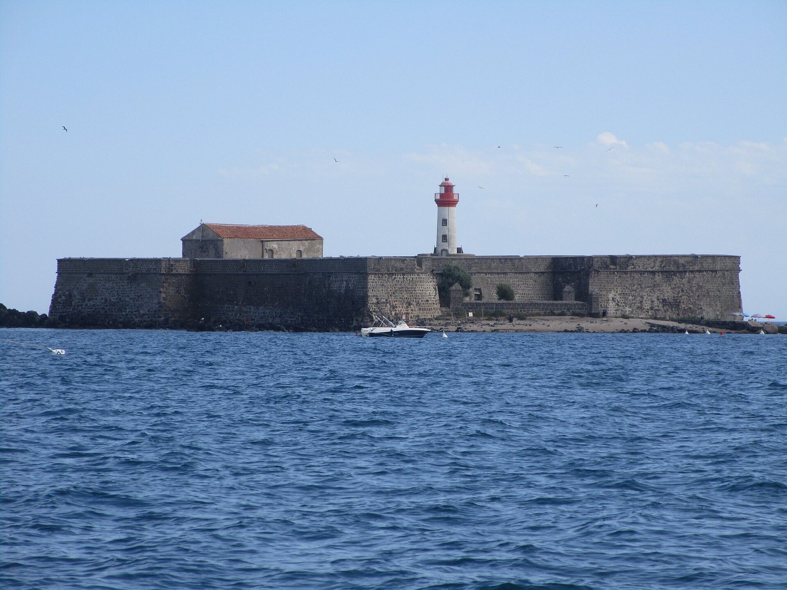
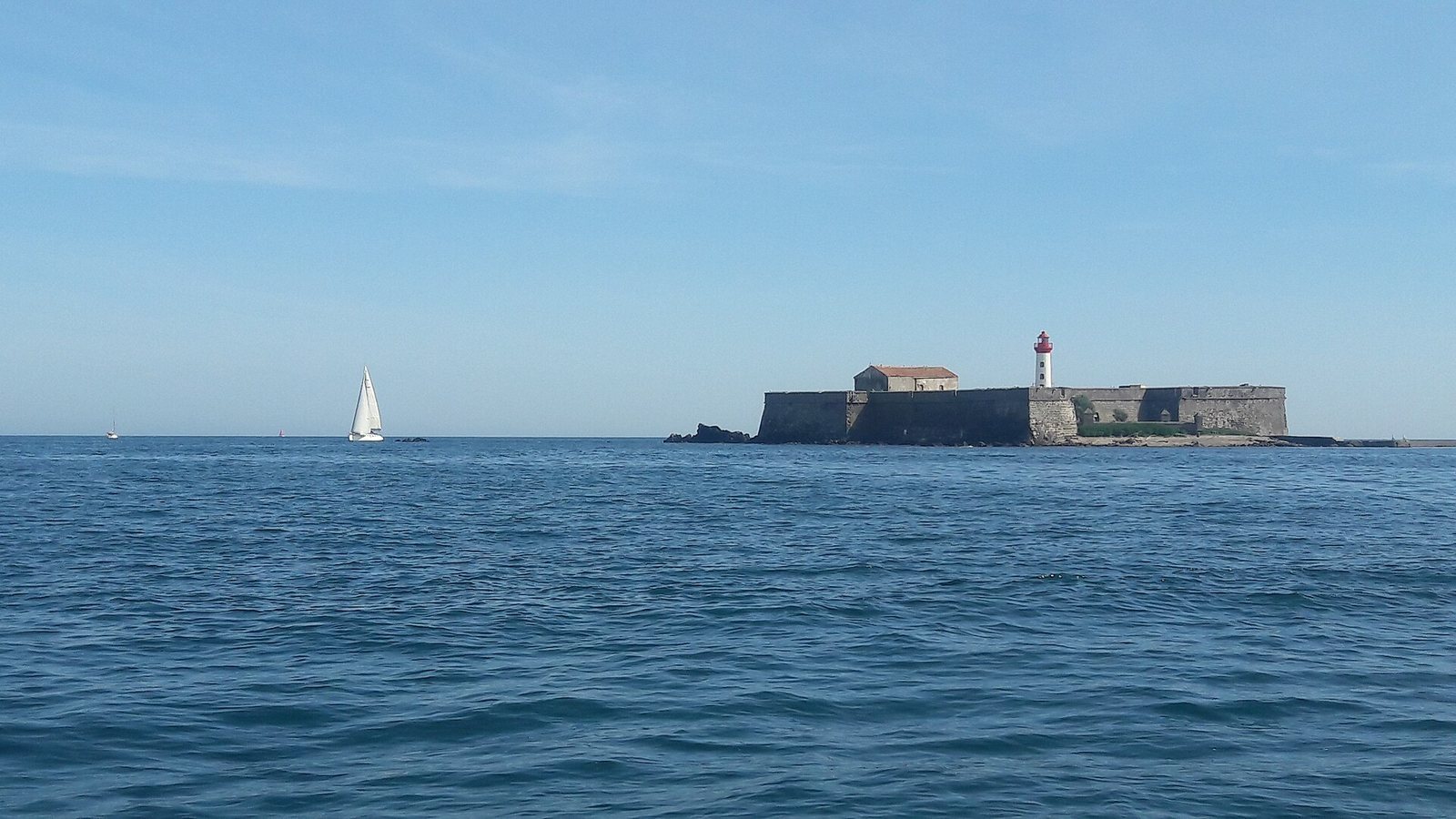
The surviving fortification follows the uneven outline of the rock, with four bastions linked by defensive walls and buildings largely screened behind the ramparts. A small outwork protects the entrance, while a beach provides the island’s only possible landing point.
Island and defenses
Ramparts and bastions
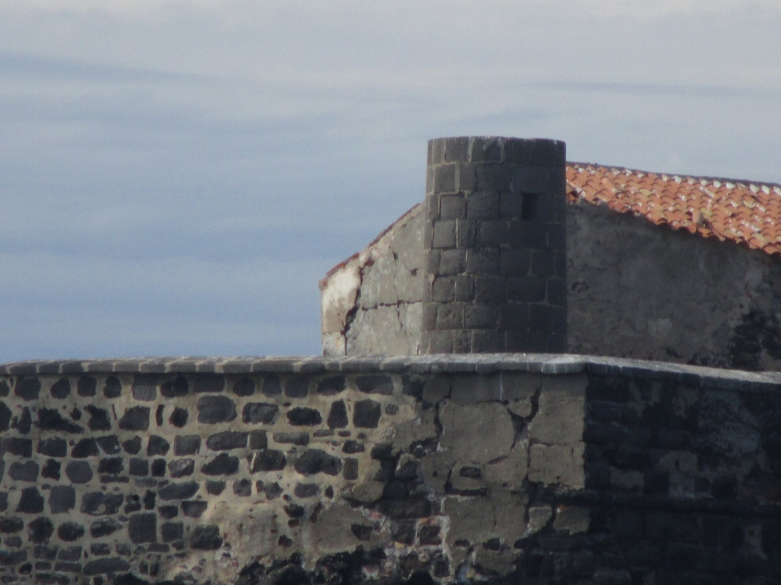
The volcanic island covers about 0.5 hectares and consists of lava that solidified roughly 740,000 years ago. It lies about half a nautical mile from the entrance to Port Richelieu and slightly less than three nautical miles from the mouth of the Hérault. It is the only island in Languedoc-Roussillon, the former administrative region of southern France. The earliest fort appears to have consisted of several towers partly enclosed by walls. The later fortification has four irregularly spaced bastions: Royal, Sainte-Anne, Saint-Antoine, and Saint-André, named in order from the left of the entrance. A curtain wall, the defensive wall joining projecting sections, connects the Saint-Antoine and Saint-André bastions. At the seaward end, it rests on a large round tower that appears to belong to the earlier fort.
Entrance and landing place
A small half-moon outwork, a defensive structure set in front of a fort, shields the entrance. A short jetty reaches it, and the small beach between the outwork and the Saint-André bastion forms the landing place. Traces of an old mole, a substantial structure projecting into the water, remain on the beach and beneath the Saint-André bastion. Its purpose is uncertain, though it may have served as a protective breakwater. A path around the ramparts provided a promenade for prisoners permitted to take the air.
Internal buildings
Courtyard and service buildings
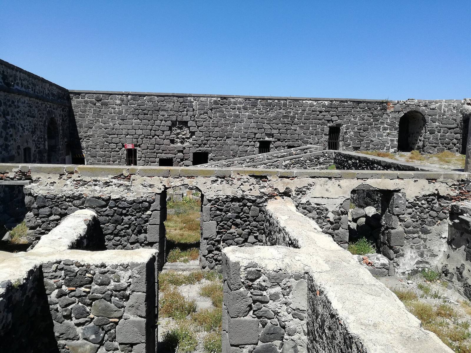
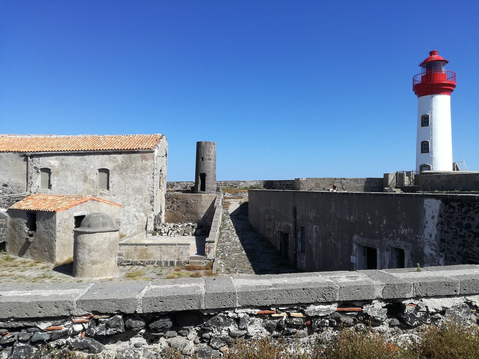
Beyond the vaulted entrance, the governor’s house once faced the courtyard; the former lighthouse keeper’s residence later occupied its place. Behind it stood the arsenal and Beacon Tower. The Beacon Tower’s base supports the old lighthouse. On the left of the entrance were the guard officer’s post, bakery, cellar, canteen, and chapel, with a very small cemetery. A covered cistern also formed part of the fort’s structures.
Prison and barracks
On the right of the entrance stood the guardhouse and the building used to hold prisoners. A long, low barracks building lay behind them. The fort’s buildings apparently once rose one or two storeys, with their upper parts later removed. A large tower may have stood behind the chapel on the Sainte-Anne bastion and contained the dungeons.
Lighthouses
The island has two lighthouses. The older, probably dating from the late sixteenth century, is a simple black-stone tower where an open fire was once lit to guide ships; it remains visible on the seaward ramparts. The modern lighthouse was built in 1836 on the remains of the large tower at the island’s western end. Initially 9 metres high, it was raised to 11.20 metres in 1901 to extend the lantern’s range and now stands 12 metres tall. Its lower section is white and its upper section red. The light is 22 metres above sea level and has a maximum range of 13 nautical miles.
Underwater remains
Divers have identified an underwater area between the island and the coast associated with the unloading of merchant ships. The wreck of the Brescou 2 also lies in these waters.