Ebisuyama Kofun: A Fourth-Century Keyhole Burial Mound in Japan

Site at a Glance
- Rating
- 4.3
- Popularity
- Very Low
- Country
- Japan
- Primary era
- Classical
- External website
- Open
- Eras represented
- Classical
- Civilizations
- Yamato
- Site type
- Burial
- Remains
- Burial Mound
On this page8 sections
History
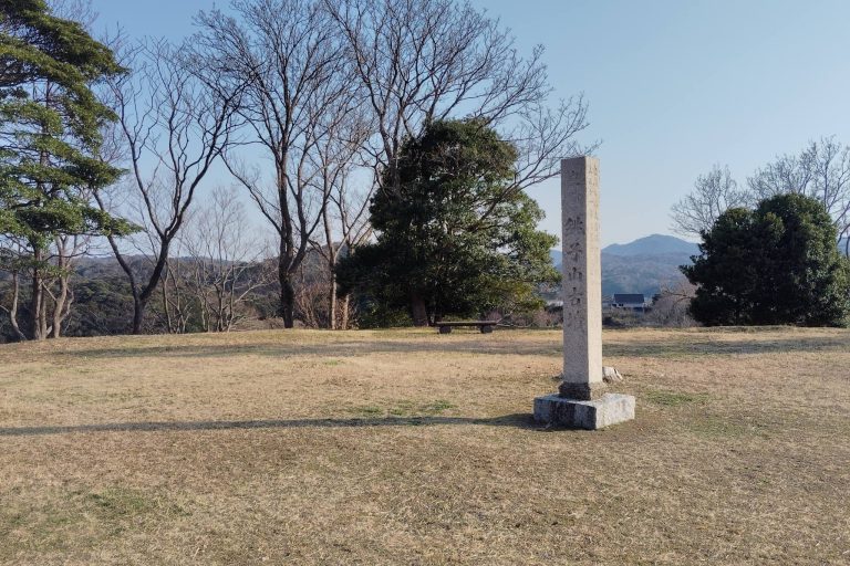
Ebisuyama Kofun, also called Ebisuyama No. 1 Kofun, is a large burial mound in Yosano, Kyoto, Japan. Built around the middle of the fourth century during the latter part of the early Kofun period, it has the keyhole-shaped form associated with ancient Japanese burial mounds of this era. The mound stands in the eastern part of the Kayo Valley on the Tango Peninsula and is the largest of eight tumuli on the same terrace.
Construction and Regional Power
The Kofun period, broadly dated from the third to the sixth centuries, saw the construction of monumental burial mounds across the Japanese archipelago. From the end of the preceding Yayoi period into the early Kofun period, a regional power is thought to have developed on the Tango Peninsula through trade across the Sea of Japan. Ebisuyama No. 1 and two other great mounds in the region are regarded as evidence of that development.
This regional polity is sometimes described as the “Tango Kingdom.” The keyhole form of Ebisuyama Kofun, however, is characteristic of the Yamato polity, the early political authority associated with the spread of this mound tradition. Its shape is therefore interpreted as evidence of strong subordination to Yamato after the emergence of the Kofun period. Ebisuyama, Shimmeiyama, and Amino Choshiyama are collectively known as the Three Great Kofun of the Japan Sea. Ebisuyama is the smallest of the three but is considered the earliest to have been built. At the time of its construction, it was the largest mound in the Tango Peninsula.
Later Development and Related Mounds
Eight tumuli occupied the same terrace as Ebisuyama Kofun and are known collectively as the Ebisuyama Kofun Group. Ebisuyama Nos. 1–3 lie within the nationally designated historic-site area. Nos. 4–8 are generally regarded as small round mounds measuring about 10 meters in diameter, although the nature of Nos. 4–7 remains unclear and they may include graves from the Yayoi period.
A group of five small and medium-sized mounds called the Tsukuriyama Kofun Group lies about 50 meters south of Ebisuyama across a valley. Tsukuriyama No. 1 is specifically regarded as related to Ebisuyama No. 1. In the fifth century, the main center of regional power shifted southward to Kumobe Kurumazuka Kofun, after which large kofun were no longer constructed in the Tango region.
Discovery and Preservation
The North Tango Earthquake of 1927 caused a fissure through the center of the rear section and exposed rows of haniwa, clay objects placed on and around burial mounds. Further haniwa were found during reconstruction of Ebisuyama Shrine at the summit in 1929. The same work revealed a boat-shaped stone coffin, which was opened and removed. Investigations followed in November by Nishida Naojiro and Sato Toru of the Kyoto Prefectural Investigation Committee, and in December by Umehara Sueji, who carried out an archaeological investigation.
Five excavation campaigns have taken place. An investigation in 1984, connected with replacement of the shelter over the stone coffin, identified burial facilities besides the coffin. Excavation in 1988 confirmed the extent of Mound 1, while work in 1990 accompanied preparation of the historic-site area. Ebisuyama Kofun was designated a National Historic Site in 1930 together with Mounds 2 and 3. The mound and the Tsukuriyama Kofun Group were later restored and developed together, and Kayo Town Kofun Park, now Yosano Municipal Kofun Park, opened in 1992. The boat-shaped stone coffin became a Kyoto Prefecture Tangible Cultural Property in 2019, and a Tango-type cylindrical haniwa received provisional registration as a Kyoto Prefecture cultural property in 2025.
Remains
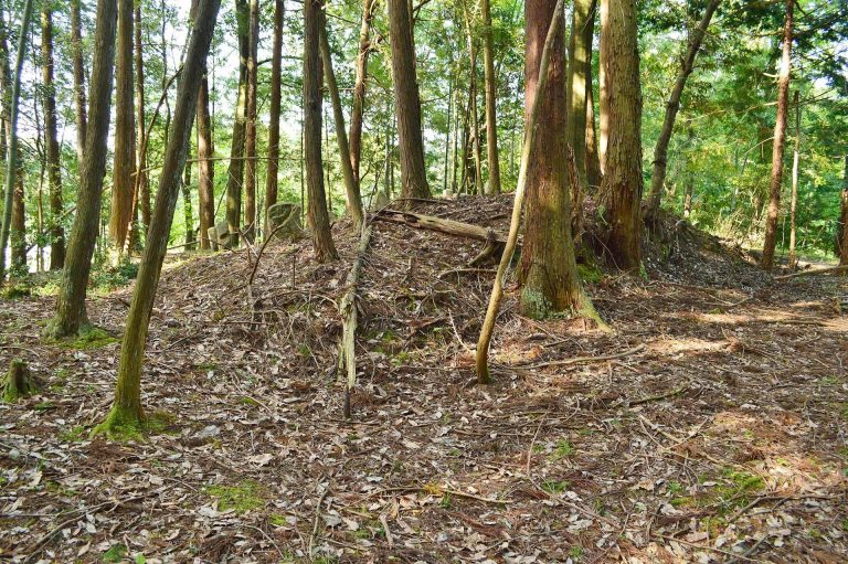
Ebisuyama Kofun is a three-tiered keyhole mound, a form that combines a circular rear section with a rectangular projecting front section. Its measured length is about 145 meters, while its apparent length is about 170 meters. The rear section, slightly elliptical across the mound’s main axis, is about 100 meters in diameter and 16 meters high. The front section is also arranged in three tiers and measures approximately 62 meters wide and 11 meters high.
Mound Form and Surface
Rows of haniwa encircled each level of the mound. The examples include Tango-type cylindrical forms, morning-glory-shaped pieces, and figurative haniwa representing armor, a chicken, and a house. River stones called fukiishi, which protect the earthwork and give its slopes a finished covering, were laid across the exterior surfaces. An animal-shaped clay object was found at the top of the rear section.
Burial Facilities
Three burial facilities were identified at the center of the rear section. The first contained a boat-shaped stone coffin set directly into the ground. A second consisted of a pit-style stone burial chamber, while the third is presumed to have been a wooden coffin placed directly in the ground.
The first facility produced the boat-shaped stone coffin, bronze mirrors, a sword, and other grave goods. Iron weapons, including spears and spearheads, were also excavated from the mound. The coffin remains a specifically identified archaeological find from Ebisuyama No. 1.
Haniwa and Excavated Objects
Excavated haniwa, an iron spear, groups of haniwa, and the animal-shaped clay object are displayed at the Haniwa Museum attached to Yosano Municipal Kofun Park. Together with the stone coffin and the other burial goods, these finds provide the principal material evidence for the mound’s construction, burial use, and ritual setting.