Despoblat de les Tombetes: A Fortified Medieval Settlement in Spain


Site at a Glance
- Rating
- 4.9
- Popularity
- Very Low
- Country
- Spain
- Primary era
- Medieval
- Eras represented
- Classical, Medieval
- Civilizations
- Roman, Visigothic
- Site type
- Military
- Remains
- Fortified Town
On this page9 sections
History
Despoblat de les Tombetes is a vanished medieval settlement in Spain, near Moror in the municipality of Sant Esteve de la Sarga, Catalonia. Established in the tenth century, it was a fortified hilltop community with a church and cemetery, reflecting the type of settlement founded before the year 1000.
Earlier occupation and medieval foundation
The site’s wider historical sequence includes the Iron Age, the Iberian and Roman periods, Visigothic Hispania, medieval Catalonia, and the expansion of Islam in the Iberian Peninsula. Visigothic Hispania was the part of the peninsula ruled by the Visigothic kingdom before the Muslim conquest, while the expansion of Islam began in the early eighth century and reshaped the region’s medieval political setting.
Archaeological work in 2017 uncovered the remains of a nobleman’s house dated to the fourth through sixth centuries. This building belongs to an earlier phase represented at the site and provides evidence of occupation before the medieval settlement associated with Despoblat de les Tombetes.
Abandonment and changing identity
The settlement may have been abandoned in the fourteenth century. Moror’s proximity may have reduced the defensive value of the hilltop and contributed to the community’s decline. The settlement’s original name is unknown. Its present name refers to the rock-cut tombs found there, while the association with Saint Martin remains uncertain. If that dedication was original, it may point to Frankish origins.
Despoblat de les Tombetes is included in the Inventory of the Archaeological and Paleontological Heritage of Catalonia and is recognized as a cultural asset within Catalonia’s cultural heritage. The site also lies inside the protected area of the Serra del Montsec.
Remains
The settlement occupies a ridge about 80 metres long and between 10 and 20 metres wide, at an elevation of 775 metres. Its surviving remains combine a defensive enclosure, structures on the ridge, a church, burial areas, and storage features. The arrangement follows the narrow elevated ground and uses the ridge edge and adjacent cliff as part of the settlement’s physical setting.
Defensive enclosure
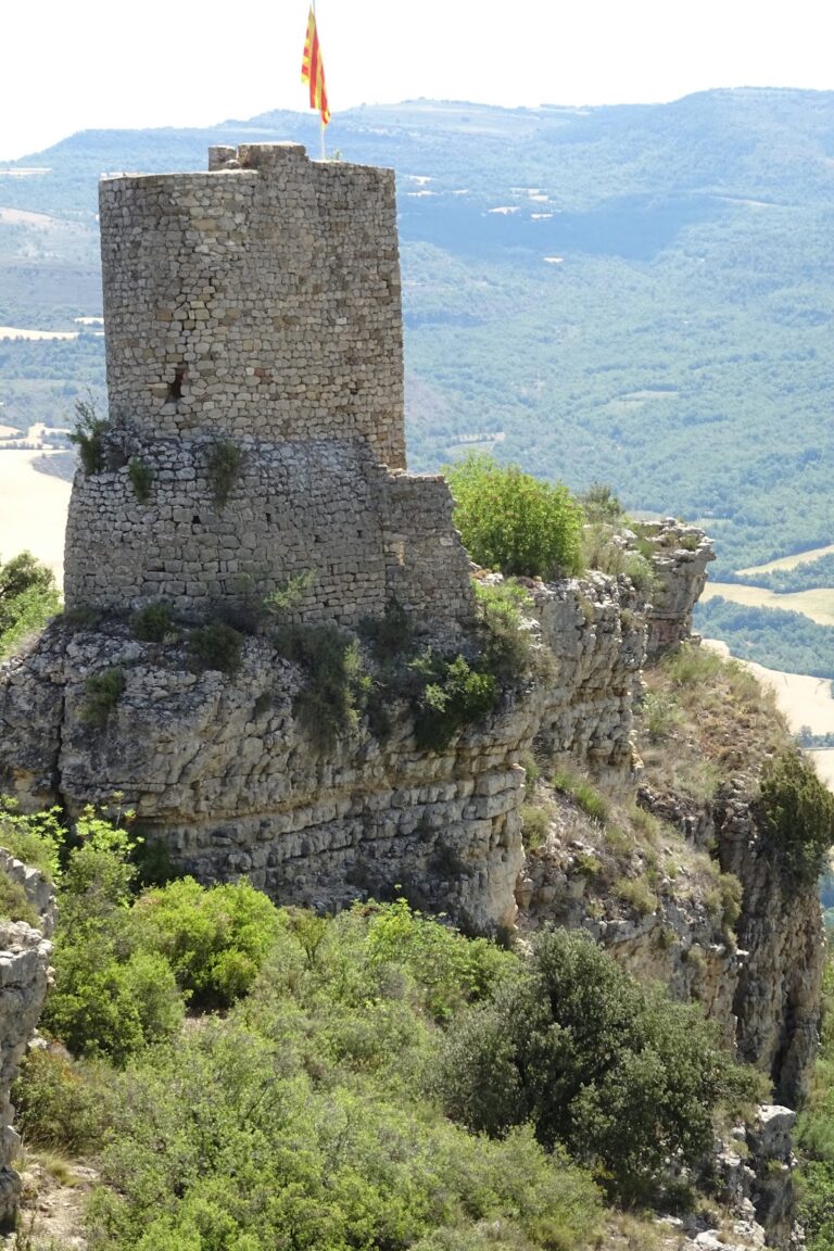
At the western approach, a ditch approximately 2 metres deep cuts across the ridge. The ridge narrows to about 8 metres at this point, and a wall beside the ditch formed a barrier across the route into the settlement. The entrance was reinforced by a rounded tower, while the surviving defensive walls are about 70 centimetres thick.
Sockets along the southern cliff edge mark the position of the enclosure’s perimeter wall. On the opposite side, a surviving wall section measures about 6 metres long and is built from large, carefully squared stone blocks. Farther east, the remains include additional structures, a large hollow, and a silo, an enclosed or underground storage pit likely used for supplies.
Church and burial areas
Former church
Rows of stones define the ground plan of the former church. The church formed part of the settlement’s organized communal and religious space, alongside the cemetery and the houses on the ridge.
Rock-cut and stone graves
A group of nine tombs was cut directly into the rock farther east. These graves gave the settlement its modern name, since a rock-cut tomb is a burial place excavated into bedrock. Work carried out in 2017 also identified an area with ten stone graves containing children who had died before reaching one year of age. These burials belonged to the settlement’s final phase, before its abandonment.
Houses and eastern structures
Beyond the church, at the tip of the ridge above the cliff, are remains attributed to the houses of Sant Martí de les Tombetes. They appear to have been oriented southward. The 2017 investigation also revealed the remains of the nobleman’s house dated to the fourth through sixth centuries, adding an earlier residential feature to the physical remains of the medieval settlement.