Coity Castle: A Norman Frontier Stronghold in Wales


Site at a Glance
- Rating
- 4.5
- Popularity
- Low
- Country
- United Kingdom
- Primary era
- Medieval
- External website
- Open
- Eras represented
- Medieval, Early Modern
- Civilizations
- Norman
- Site type
- Military
- Remains
- Castle
On this page14 sections
History
Coity Castle is a Norman castle in Coity, United Kingdom, about 2 kilometres northeast of Bridgend in South Wales. It originated as a defended earthwork during the late eleventh or early twelfth century and became a stone castle during the medieval period. Built by the Normans, it served as a frontier stronghold and became the principal centre of the Turberville family and the Lordship of Coity, one of the wealthiest lordships in Glamorgan.
Norman foundation and Turberville rule
The first castle was probably established as a ringwork, a defended enclosure formed from an earth bank and ditch and often reinforced with a timber palisade. Its foundation is placed variously in 1092 and before 1106. Payn I de Turberville, a Norman from Normandy, is traditionally credited with building it. He was associated with the Twelve Knights of Glamorgan, a traditional group of Norman conquerors linked with Robert FitzHamon’s establishment of Norman lordship in Glamorgan.
Coity supported Norman settlement in western Glamorgan and controlled several early routes through the area. The site may have occupied an earlier structure, possibly a Roman military fort. Heol Spencer, an unusually straight route shown on early maps, has been proposed as a Roman road, although this does not establish the nature of any earlier occupation at the castle itself.
During the 1180s, Payn II de Turberville replaced or expanded the earth-and-timber defence with a stone keep and curtain wall. A keep was the principal fortified tower of a castle, while a curtain wall enclosed the defended area. Further building phases followed during the fourteenth, fifteenth, and sixteenth centuries. The castle remained the Turbervilles’ principal seat until the family line ended around 1367 with the death of Richard II de Turberville.
Berkerolles inheritance and the siege of 1404–1405
The inheritance passed to Lawrence Berkerolles through his father Roger’s marriage to Catherine, the Turberville heiress. Lawrence lived at Coity from the late fourteenth century and strengthened and furnished the castle. His tenure coincided with the Welsh rebellion led by Owain Glyndwr, the Welsh prince who headed the major uprising against English rule from 1400.
Coity endured a prolonged siege in 1404 and 1405. The attack caused heavy damage, including a major breach in the northern wall. Evidence of bombardment or projectile engines has been found north of the castle, and the siege may have involved Welsh use of gunpowder artillery, perhaps with French assistance. A bombard was a medieval gunpowder weapon used to fire heavy missiles against fortifications. The precise outcome remains uncertain: the garrison may have surrendered, or a later English relief attempt may have lifted the siege. The siege was briefly raised in November 1404 and continued until the end of 1405.
Lawrence Berkerolles repaired the castle after the conflict, including a complete renewal of the northern section of the inner curtain wall. The northeast gate may also belong to this repair programme. After Lawrence died without an heir, competing claims to the castle and lordship resulted in a further seizure or siege by William Gamage, assisted by Sir Gilbert Denys. The action lasted about a month and enforced the Gamage claim. Gamage and Denys were imprisoned in the Tower of London for taking the law into their own hands, but they were released after the death of Henry IV.
Gamage alterations and Tudor remodelling
The Gamage family carried out extensive changes during the fifteenth century. They added and later raised a chapel, built a large stable in the outer ward, created a new western entrance, and converted the southern tower into the principal gate tower. These works altered the castle’s internal organization and strengthened its role as a residence as well as a fortified lordly centre.
During the Tudor period, probably in the sixteenth century and possibly under Sir Thomas Gamage, the residential buildings were remodelled for greater comfort. Larger windows, elaborate fireplaces, extra domestic accommodation, and a third storey for the keep and its northern extension were added. Part of the moat between the inner and outer wards was probably filled during this period.
Decline and preservation
In 1584, Barbara Gamage, the Gamage heiress, married Sir Robert Sidney, who later became 1st Earl of Leicester. The marriage brought the estate to Sidney. The couple lived at Penshurst Place in Kent, and Coity Castle ceased to function as a residence and gradually deteriorated. By the nineteenth century it was already being described as a ruin.
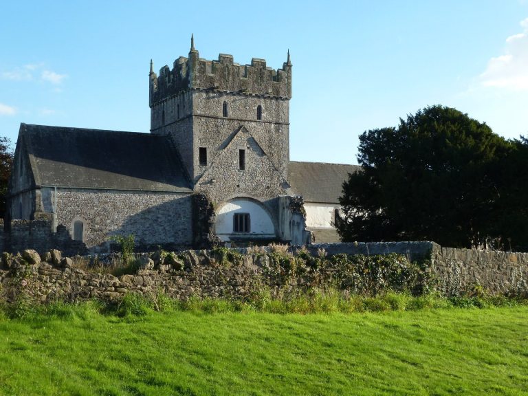
Later ownership was associated with the Sidney, Edwin, and Dunraven families. Thomas Wyndham of Dunraven Castle owned the property by 1811. In 1833 it passed through his daughter Caroline to her husband, Windham Quin, 2nd Earl of Dunraven and Mount-Earl. The castle has been in state care since 1929 and is now managed by Cadw, the Welsh government service responsible for historic monuments and buildings. It is protected as a Grade I listed building and a Scheduled Monument. The adjacent fortified parish Church of St Mary, dating from the fourteenth century, is a separate historic building closely associated with the castle’s setting.
Remains
Coity Castle is arranged as a circular inner ward and a northwestern outer ward, both built chiefly from locally available rubble stone. A dry moat surrounds the castle on the north, east, and south. It measures about 27.5 to 30.5 metres across, reaching approximately 4 metres deep on the north side and 6 metres on the south. The inner ward preserves the circular outline of the earlier ringwork, while the outer ward contains later domestic, agricultural, and defensive features.
Inner ward and keep
Keep and northern curtain wall
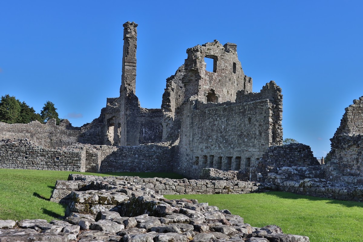
The four-storey keep stands in the northwestern part of the inner ward. Most of its surviving fabric dates from the fourteenth century. It measures approximately 12.2 by 10.2 metres, has walls about 2 metres thick, and remains up to 16.5 metres high. Its ground floor is a single room with a vaulted ceiling carried by a central octagonal pillar. A pillar in the same central position survives on the first floor. The keep and its northern extension later received a third storey during the Tudor period.
A rectangular fourteenth-century extension projects from the north side of the keep. The ruined keep, the extension, and the northern curtain wall form the most substantial surviving group in the inner ward. The northern wall also preserves physical evidence of the medieval siege, including the damage associated with the major breach of 1404–1405.
Northeast gate
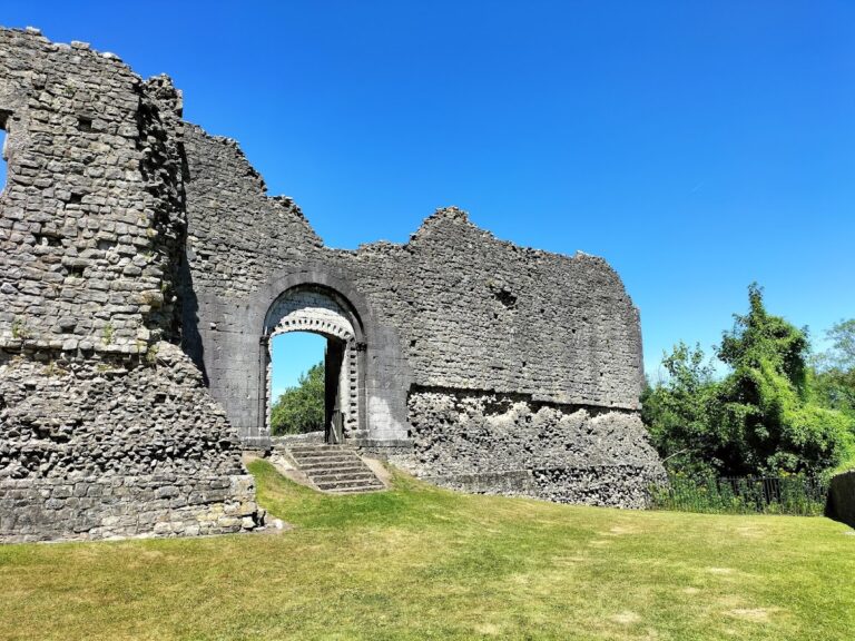
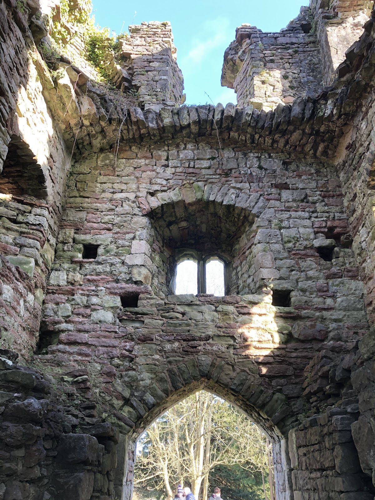
The northeast gate is set into the inner curtain wall and leads toward the churchyard of St Mary’s Church. Its gatehouse originally had three storeys and measured approximately 6.1 by 7.3 metres, although only part of the uppermost storey survives. A fixed timber bridge now occupies the position of the former drawbridge. The drawbridge chain holes and recess remain visible.
The gateway is approximately 1.8 metres wide and formerly contained a portcullis, a vertically sliding fortified gate operated from the single room on the first floor. That room is reached by a stone spiral stair and retains a fireplace. The second upper floor survives only partially. The gateway may have been built or renewed during Lawrence Berkerolles’s repairs after the siege.
Southern residential range and latrine tower
A southern residential range, approximately 7.9 by 5.8 metres, stands against the inner face of the southern curtain wall. Its vaulted cellar supported a ground-floor hall whose vault rested on two pillars. The hall formerly contained elaborate stonework decoration. The upper floors provided living accommodation, while service rooms and servants’ quarters occupied the east side. Later domestic arrangements probably included a kitchen with ovens.
A four-storey sandstone latrine tower projects from the exterior of the southern curtain wall and connects with the southern range. Each floor contained a latrine. The tower is a projecting medieval sanitation structure, with toilets placed beyond the outer wall. Its surviving structure helps explain the relationship between the castle’s domestic accommodation and its defensive enclosure.
Outer ward
Enclosure and entrances
The outer ward lies northwest of the circular inner ward and measures approximately 55 metres from east to west and 36 to 39 metres from north to south. Its enclosing wall was strengthened by three square towers. A gatehouse in the southern part of the enclosure provides the present entrance, while the western curtain walls retain remains of internal buildings.
The former southern gateway to the outer ward adjoins the keep, and its surviving passage is approximately 2.7 metres wide. The western entrance and the conversion of the southern tower into the principal gate tower formed part of the fifteenth-century changes associated with the Gamage family.
Stable and malting kiln
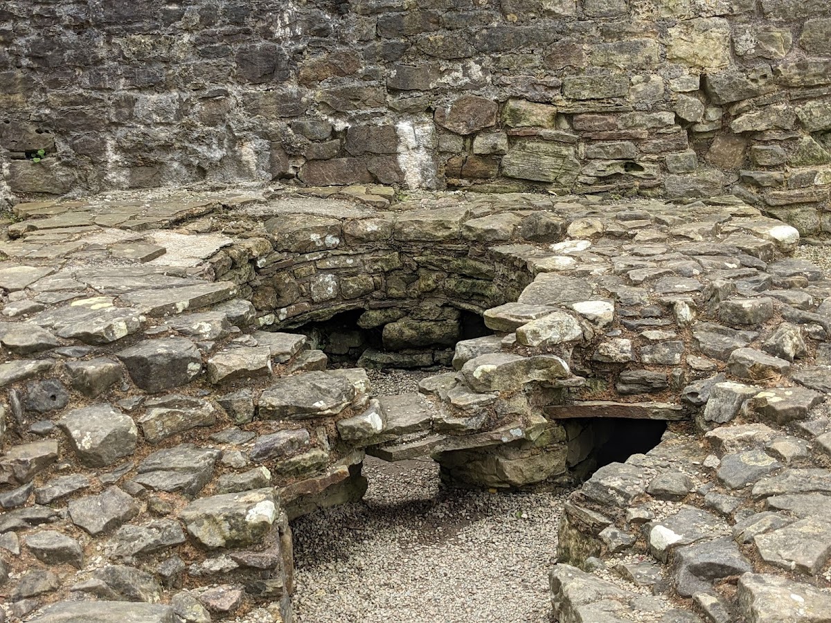
The outer ward contains the foundations of a large stable approximately 29 metres long. A large malting kiln also survives at its base. A malting kiln was a heated structure used to dry sprouted grain during the production of malt. These features belong to the castle’s wider domestic and economic organization, alongside the residential buildings and service areas of the inner ward.
Chapel foundations
Foundations on the western side of the southern range belong to the fifteenth-century chapel added by the Gamage family. The chapel formed part of the later residential complex within the castle, whose surviving remains also include the surrounding moat, the inner curtain wall, and the damaged northern defences.