Citânia de Sabroso: An Iron Age Fortified Settlement in Portugal
Site at a Glance
- Rating
- 4.4
- Popularity
- Very Low
- Country
- Portugal
- Primary era
- Iron Age
- External website
- Open
- Eras represented
- Stone Age, Iron Age, Classical
- Civilizations
- Roman
- Site type
- Military
- Remains
- Fortified Town
On this page17 sections
History
Citânia de Sabroso is an ancient fortified settlement in Portugal, on Monte do Coto de Sabroso in the municipality of Guimarães. Associated with communities of the Iron Age, it was probably founded between the fifth and third centuries BCE, although its precise chronology remains uncertain. The settlement stood in the territory of the Bracari, an ancient people of northwestern Iberia whose name was later preserved in Bracara Augusta, the Roman city established at modern Braga.
Earlier activity and Iron Age origins
Human activity on the hill began before the fortified settlement. A rock altar, cup-marks, and other engraved surfaces point to prehistoric use, with some motifs generally dated to the fourth or third millennia BCE. These earlier traces were later incorporated into a landscape occupied by an Iron Age hillfort, or castro, a fortified settlement commonly built on elevated ground in Portugal and northwestern Iberia.
Sabroso appears to have maintained strong social connections with the larger Citânia de Briteiros. The two settlements may have belonged to the same community, although they differed in size and in cultural, economic, and military importance. Sabroso may have served as an advanced position supporting territory controlled from Briteiros, but its exact role remains uncertain.
Expansion and changing defenses
The settlement underwent major development during the second and first centuries BCE. Its defensive circuit was extended southward, probably to protect the southern slope, and the original southern wall was demolished during the work. The enclosed area grew from about one hectare to nearly two hectares, while most habitation continued to occupy the earlier core.
Christopher Hawkes proposed that the original settlement was destroyed during the campaigns of Decimus Junius Brutus Galaico around 138 BCE. He interpreted the southern extension as part of a subsequent reconstruction. Other defensive changes may also have followed the campaign, but these interpretations remain hypotheses rather than established facts.
Roman-period occupation and abandonment
Occupation continued into the Roman period, although Roman influence at Sabroso was much less pronounced than at Briteiros. The settlement was probably abandoned after the Cantabrian Wars, the Roman campaigns completed in 19 BCE that brought much of northwestern Iberia under Roman control, and during or after the foundation of Bracara Augusta around 15 BCE.
One interpretation holds that the inhabitants moved toward Briteiros or another stronger settlement in response to Roman military pressure. Another places them nearby in the Ave valley. Sabroso was abandoned considerably earlier than Briteiros, which remained occupied until approximately the second century CE. After abandonment, local communities dismantled parts of the settlement to reuse its good-quality stone, a practice that continued into the nineteenth century.
Excavation and preservation
Francisco Martins Sarmento excavated Sabroso in 1877, 1878, and 1883. The objects recovered during these campaigns were assembled at the Martins Sarmento Archaeological Museum in Guimarães. His investigations at Sabroso and Briteiros formed part of the early study of hillforts and helped establish archaeology as a field of research in Portugal.
Sabroso became a National Monument by decree on 16 June 1910. In 1919, serious vandalism destroyed the rock supporting the geodetic marker and damaged some engraved surfaces. After the Sociedade Martins Sarmento requested responsibility for the land, the municipality transferred it to the institution in 1921. Maintenance followed in 1928 and 1929, and a plan of the remains was prepared in 1930.
Archaeological work resumed in 1958 under Christopher Hawkes, with assistance from Ilid Anthony, the Sociedade Martins Sarmento, and Mário de Vasconcelos Cardoso. The investigations focused on the defenses, recovered handmade pottery between the older walls, and demonstrated that the fortifications had been extended southward. The work introduced techniques considered innovative in Portuguese archaeology and supported the distinction between earlier and later Iron Age construction phases.
A rehabilitation and research programme by the Sociedade Martins Sarmento and the University of Porto led to cleaning and conservation in 1974, 1975, and 1977. Excavations resumed in 1981 under Teresa Soeiro, Rui Centeno, and Armando Coelho, revealing several occupation phases. Later maintenance declined, allowing dense vegetation, particularly mimosa, to spread and increase fire risk. Illegal earth removal affected the site in 2004, while a 2005 inventory of Iron Age hillforts in the Minho region supported further preservation efforts.
A rehabilitation plan was prepared in 2013, followed by archaeological work in 2015 and 2017 through cooperation between the University of Minho and the Sociedade Martins Sarmento. A forest fire that year caused trees to fall onto parts of the remains and overheated exposed rock surfaces, creating a risk of cracking. A 2020 campaign examined the engravings and identified a labyrinthiform motif. In 2021, attempted looting involved the opening of trenches and possible theft of Iron Age pottery, while the engraved rocks were particularly affected by vandalism.
Cleaning, conservation, and restoration in 2022 reduced damage caused by vegetation and fires. The work included protection for the second wall, geophysical and LIDAR surveys of the surrounding area, and measures against invasive plants. LIDAR uses laser pulses to measure ground surfaces and can help identify archaeological features beneath vegetation or shallow soil. Recent preservation and interpretation have remained closely associated with the Sociedade Martins Sarmento and the University of Minho.
Remains
Citânia de Sabroso occupies the summit of Monte do Coto de Sabroso, a hill approximately 270 to 278 metres high on the right bank of the River Ave. The archaeological area covers about three hectares, including roughly two hectares within the fortifications. Its position overlooks routes toward the lower lands and lies among streams belonging to the Ave basin. Two granite defensive circuits, domestic terraces, engraved outcrops, and other surviving features occupy the hilltop.
Defensive enclosure
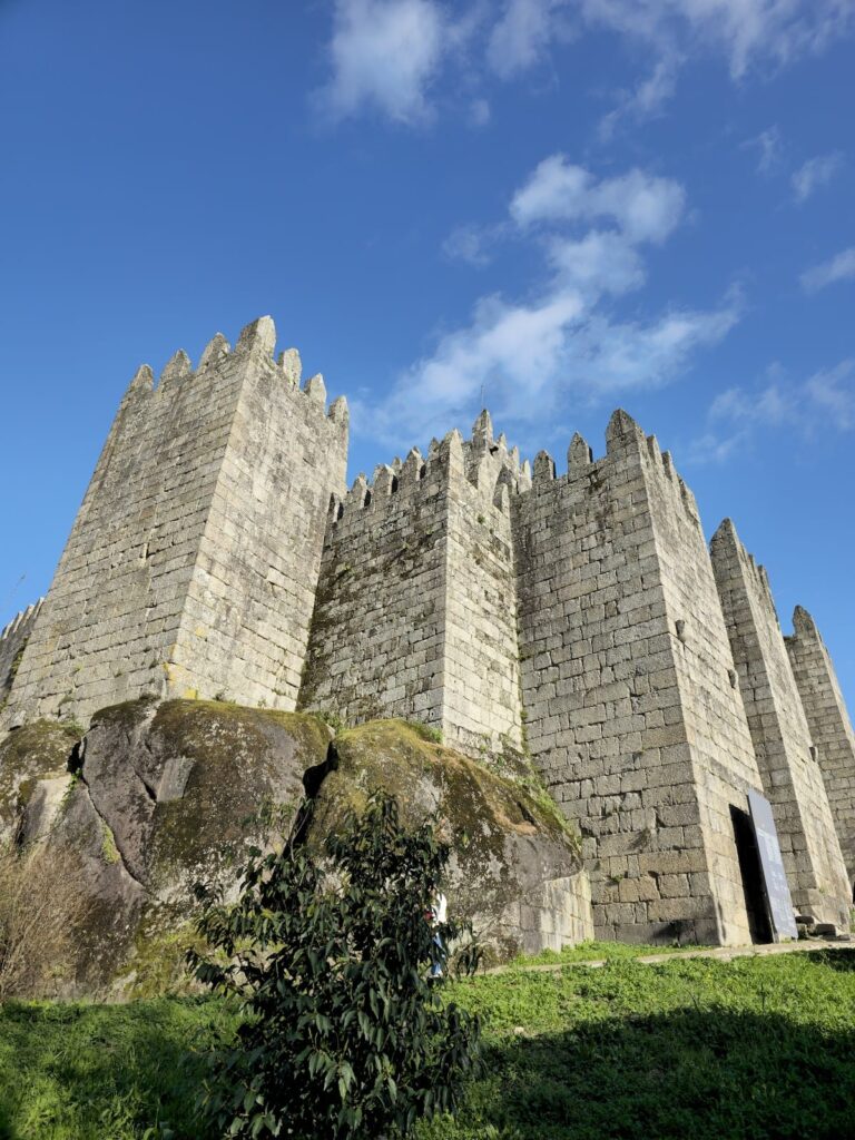
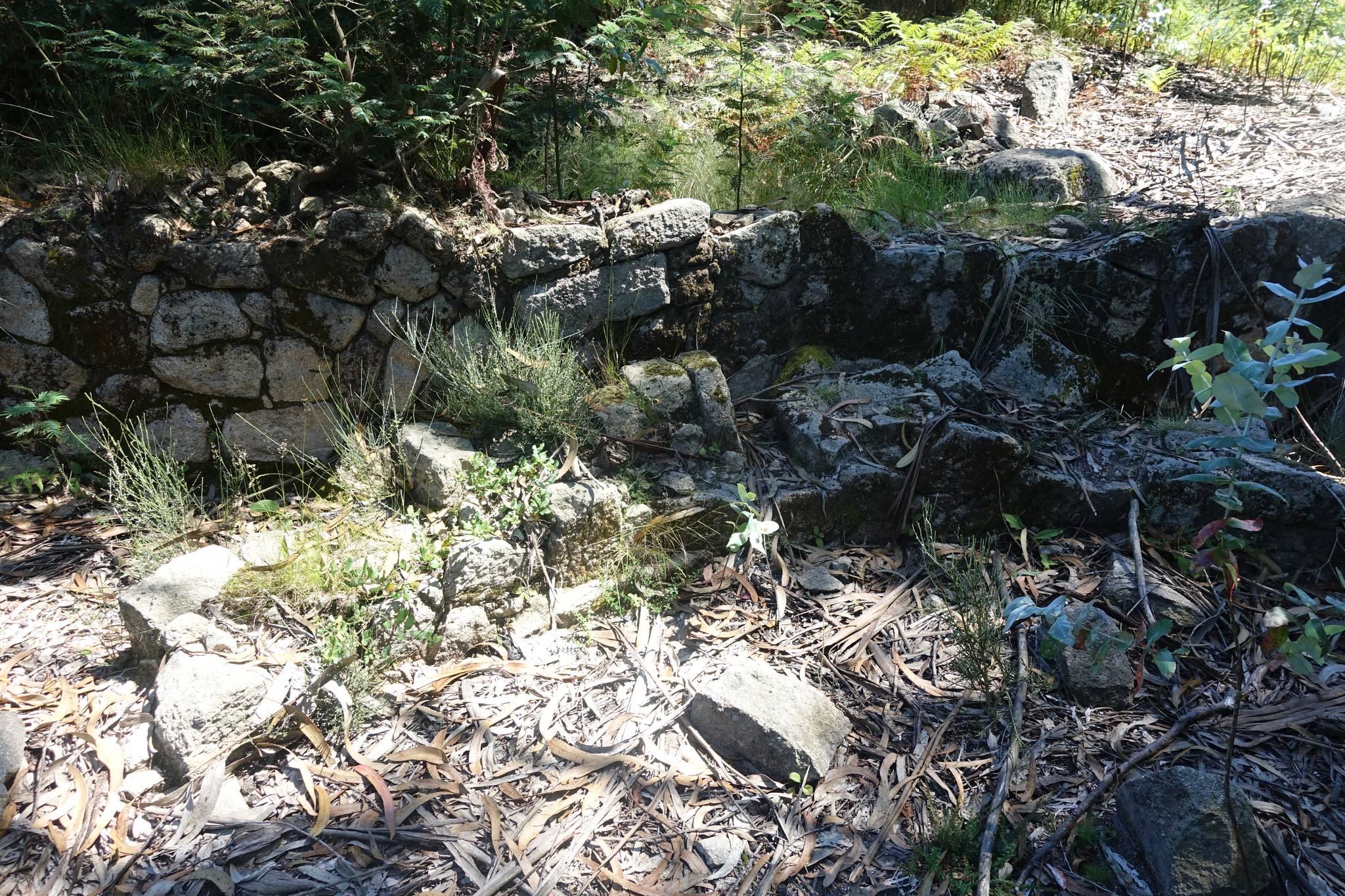
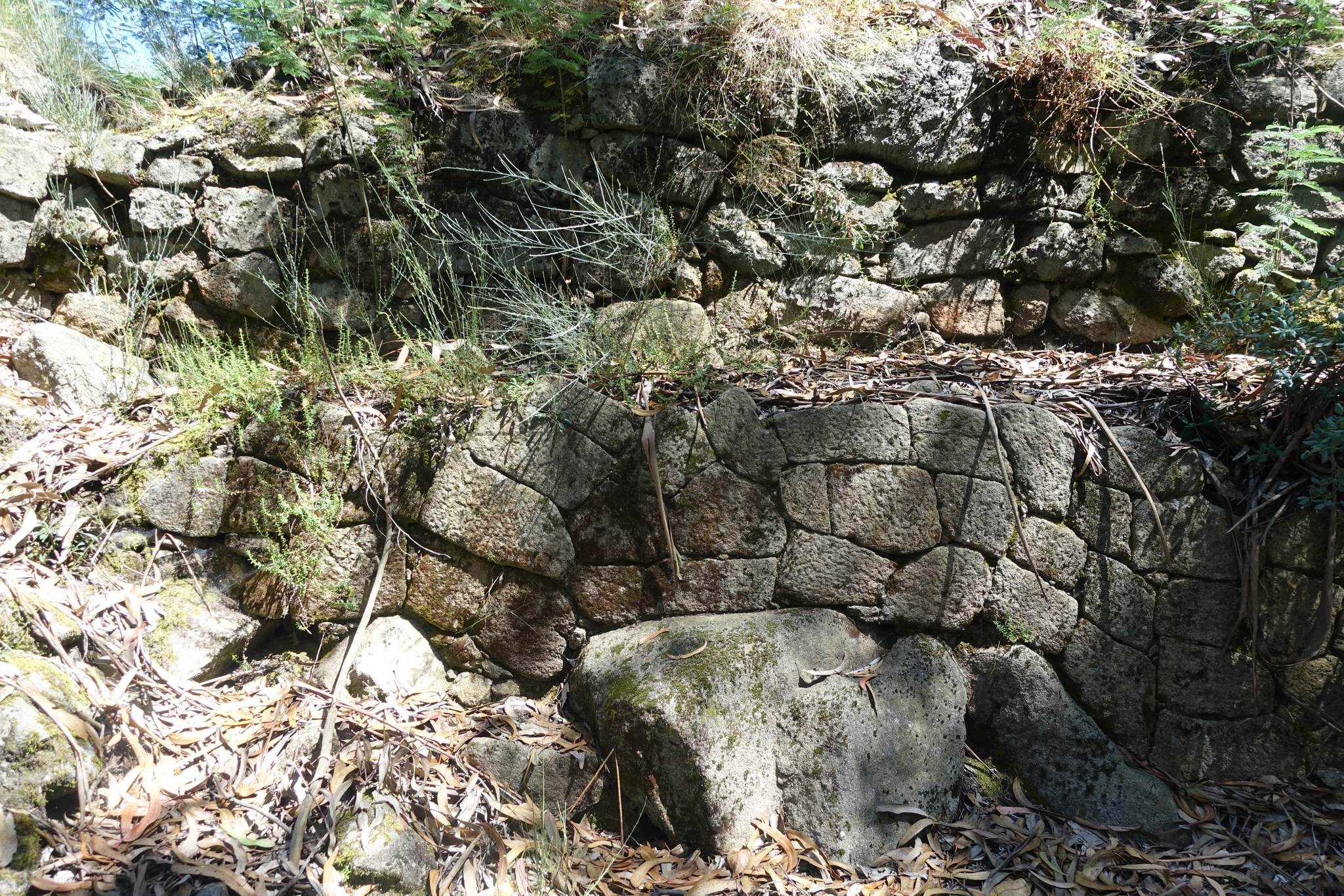
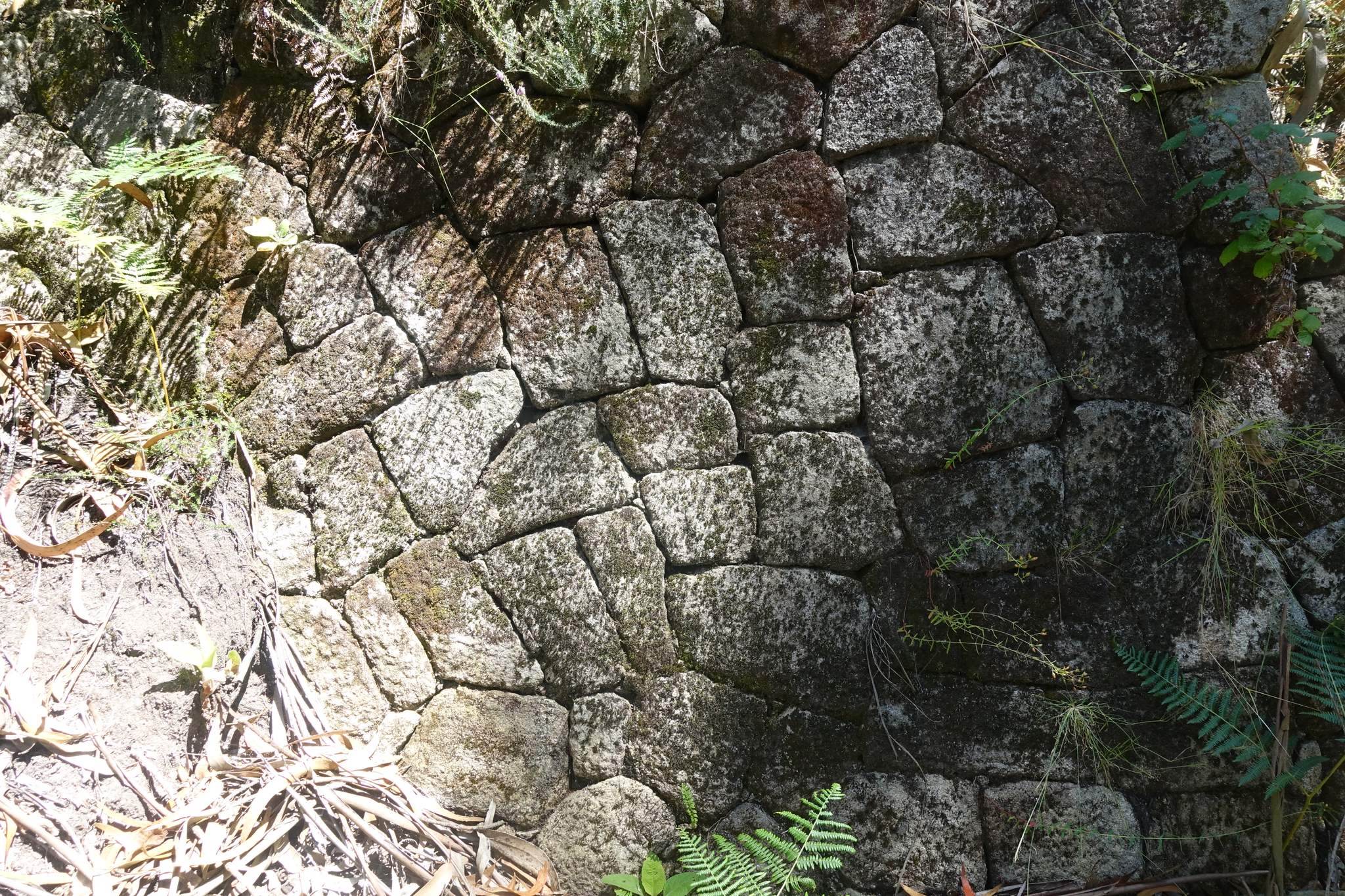
The hillfort was enclosed by two lines of granite walls and associated ditches. Together they enclosed an area measuring approximately 180 by 100 metres. The first circuit originally measured about 357 metres, with approximately 324 metres surviving, while the second added a further circuit of about 392 metres. The walls are battered structures built from dry-laid granite blocks in polygonal masonry. Several stretches reach three to five metres in height and about 4.5 metres in thickness. The largest sections of the first circuit are about 5.20 metres high and 4.20 metres thick.
Pottery fragments were placed within deeper wall layers, probably as packing in the foundations. At several points, later walls were built against the original defenses and reused their foundations. These reinforcement structures have carefully executed polygonal faces and may have raised the earlier walls while also supporting the plateau. The first circuit had a northern entrance, whereas the later circuit had a southern entrance. The northern entrance may have been blocked during the southern expansion. Much of the defensive system remains relatively intact, although some sections were demolished during the twentieth century.
Residential settlement
Houses and family groups
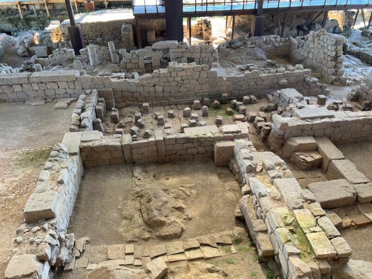
Thirty-nine residential units have been identified inside the walls. Thirty-five were circular, while three were rectangular with rounded corners. Two rectangular houses belonged to a group that also included a structure interpreted as a cistern. The buildings were made of stone, and some had roofs formed from slate slabs. At least two circular houses had paved stone floors, while other surviving walls may have supported houses or divided family units.
The houses stood on artificial terraces that compensated for the natural slope. Unlike the more formally planned arrangement at Briteiros, Sabroso had an irregular layout without clearly defined streets. Approximately twenty family groups may each have contained two or three houses arranged around a central paved courtyard. Some entrances were carefully sculpted, including a finely carved doorway with side elements decorated by concentric-circle incisions. The same motif occurs on pottery fragments and a bronze plaque.
Terraces and communal features
Small paved squares and at least one paved road or causeway have been identified among the residential remains. A possible bath building near the hillfort was recognized by Martins Sarmento, but the landowner destroyed it during the nineteenth century. Decorative architectural elements, including parts of a Pedra Formosa, are preserved or displayed at the Martins Sarmento Museum. A Pedra Formosa is a large decorated stone associated especially with Iron Age bathing or ritual structures in northwestern Iberia.
Some circular-house foundations retain a central stone block interpreted as a possible roof support. One circular house with relief decoration was reconstructed and displayed at the Martins Sarmento Museum. It may represent the settlement’s latest phase and could date to the Roman period.
Rock art and ritual features
Engraved outcrops within the hillfort
Numerous granite outcrops inside the hillfort bear prehistoric engravings, including concentric circles, spirals, labyrinths, and cup-marks. One important outcrop beside the geodetic marker also carries two probably later anthropomorphic figures, perhaps dating to the Iron Age. The engravings are generally associated with Atlantic rock art, a tradition of prehistoric motifs found along the Atlantic façade of western Europe. Their dates are not uniform. Some may belong to the transition from the Neolithic to the Chalcolithic, approximately the fourth to third millennia BCE, while the labyrinthiform design has parallels extending from Ireland to the Vouga region of Portugal.
Pegadinhas engravings
A separate group lies south of the hillfort at Pegadinhas, on a granite outcrop. It includes two symmetrical podomorphs, or representations of feet, surrounded by cup-marks of different sizes. These southern carvings may date to the Bronze Age or to the period when the hillfort was occupied.
Altar and funerary remains
A possible ritual altar survives inside the settlement as a rock with a cavity and surrounding decoration, apparently suitable for sacrificial activity. Known as the Penedo Gamela, it also bears aligned cup-marks. A destroyed funerary monument was associated with the settlement. Martins Sarmento recorded four tombs approximately 800 paces from the walls. One contained a small schist axe, while another contained three flint arrowheads.
Objects and archaeological material
Pottery and personal objects
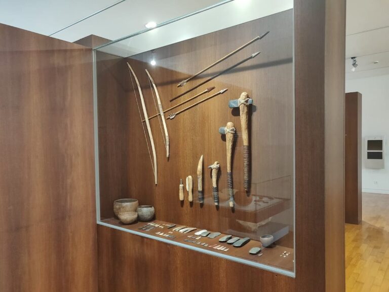
Excavated material includes handmade pottery produced without a potter’s wheel, wheel-made pottery, richly decorated sherds, stone axes, flint, bronze objects, circular fibulae, bracelets, rings, pins, brooches, at least one possible piece of jewellery, and coins. A fibula is an ancient brooch used to fasten clothing, and its form can help establish chronology and cultural connections. More than thirty decorative motifs are recorded on the handmade pottery, especially triangles or pyramids combined in different arrangements, together with single and paired circles.
Some pottery was placed in wall foundations. Micaceous decorated pottery and a fibula type associated with Sabroso are also known, with the latter dated from the fifth century BCE. Amphora fragments indicate the transport of products such as olive oil and wine. Wine vessels are of particular interest because vine cultivation was not practised in the surrounding region at that time. At least two Roman coins were found, including a silver coin minted at Rome in the second century BCE. Other Roman-period material includes amphora fragments, common pottery, a paved surface, and tiled areas.
Stone animal figures
Two fragmentary stone statues represent pigs or similar animals. One preserves only the snout, while the other retains the head and a square projection showing that a body was attached. The original statue may have been approximately six or seven palms long. These figures may have been idols or representations of deities associated with the possible altar, although their interpretation remains uncertain.
Roman material is considerably rarer at Sabroso than at Briteiros, and the houses show no clear Roman influence. Finds and architectural fragments from the settlement are preserved or displayed at the Martins Sarmento Museum in the former Monastery of Saint Dominic in Guimarães. Vegetation and fire continue to affect the remains, so conservation has included clearance, structural treatment, protective measures around the second wall, and efforts to control broom, mimosa, and other invasive plants.