Citânia de Briteiros: An Iron Age Hillfort in Portugal
Site at a Glance
- Popularity
- High
- Country
- Portugal
- Primary era
- Classical
- Eras represented
- Iron Age, Classical, Modern
- Civilizations
- Celtic, Portuguese, Roman
- Site type
- City
On this page27 sections
History
Citânia de Briteiros is a large fortified settlement on Monte de São Romão in Portugal, probably founded between the fifth and third centuries BCE. Its inhabitants were likely the Bracari, a Celtic people of northwest Iberia. The settlement later became a regional centre, and its occupation continued into the Roman period.
Origins and growth
People used the hill before the settlement took shape. Rock carvings there are prehistoric, but their age is uncertain: proposed dates range from the transition between the Neolithic and Copper Age to the Atlantic Bronze Age. Pottery points to occupation by the early Iron Age, when the hill was already fortified.
Briteiros expanded substantially from the second century BCE and may have reached its greatest extent in the first century BCE. Its growth may have reflected greater stability, the movement of people from smaller settlements, and access to farming, river, and pastoral resources. The community may have become an urban, cultural, and artistic centre for a territory that included smaller hillforts.
Francisco Martins Sarmento once argued that Briteiros’ growth caused nearby Castro de Sabroso to decline around 138 BCE, perhaps as people moved between the settlements. Later archaeological evidence instead indicates that Briteiros was older and remained occupied longer, although both sites probably flourished during the same broad period.
During the first century BCE, the settlement was reorganized with a street network and clearer divisions between public and residential space. Some buildings predated the streets. A dwelling near the later chapel was cleared in the second half of the century to make an open area, while the Casa de Auscus was built late in the century over traces of earlier occupation. The Casa da Espiral preserves evidence of several periods of use, especially from the late second and first centuries BCE.
Roman rule and decline
Roman forces brought the region under their control around 19 BCE. Briteiros may have entered Rome’s sphere through commerce and agreements rather than a major local military campaign. Its people had commercial ties with Roman-controlled areas before the conquest, and the settlement retained importance in the early Roman Empire, when trade, imported goods, and further street changes accompanied Roman rule. Roman influence on its visible architecture remained limited.
The settlement began to decline during the first century CE as Roman customs spread and measures under Augustus, Rome’s first emperor, strengthened imperial control. The change was gradual: permanent occupation probably ended in the second century, although activity may have continued into the fourth. Coins found at the site span the Roman period, including an issue from the reign of Constantine, a fourth-century emperor.
Medieval use and later memory
A chapel and Christian cemetery on the hilltop indicate medieval reuse. A hermitage dedicated to São Romão was built among the ruins in the tenth or eleventh century. The building later disappeared, and a cross was placed at its former site. The present Chapel of São Romão dates to 1853. Local people continued to remove stones from the fortifications as late as the eighteenth century, while some paths leading to the settlement remained in use as routes to rural properties into the nineteenth century.
Archaeology and preservation
The ruins were known by at least the sixteenth century. In the seventeenth century, canon Gaspar Estaço described walls and houses but wrongly identified who had built them. A parish account from 1758 also noted the enclosure, house foundations, and old roads.
Systematic study began in 1874, followed by excavations in 1875 led by Francisco Martins Sarmento. He continued work through the 1880s and returned for further excavations in 1891–92. His purchase of land at the site in 1874 helped protect the ruins. After his death, the Sociedade Martins Sarmento took responsibility for their management in 1900. Portugal designated Briteiros a National Monument in 1910.
Regular campaigns resumed in 1930 under Mário de Vasconcelos Cardoso and Ricardo de Freitas Ribeiro and continued into the 1960s. Work included rebuilding parts of the walls; a road built in 1930–32 also affected the ruins, and investigators examined the eastern bath in 1932. Later fieldwork included a test excavation using modern methods in 1977, as well as conservation and restoration between 1974 and 1982.
Excavations resumed in 2002, and a joint research and conservation project began in 2004. Work from 2005 to 2010 examined houses, baths, streets, and the chapel area, producing evidence of earlier occupation and establishing the Pedra Formosa’s connection with the eastern bath. Further campaigns took place in 2014 and 2016. A wildfire reached the ruins in July 2015, followed by cleanup the next month.
Remains
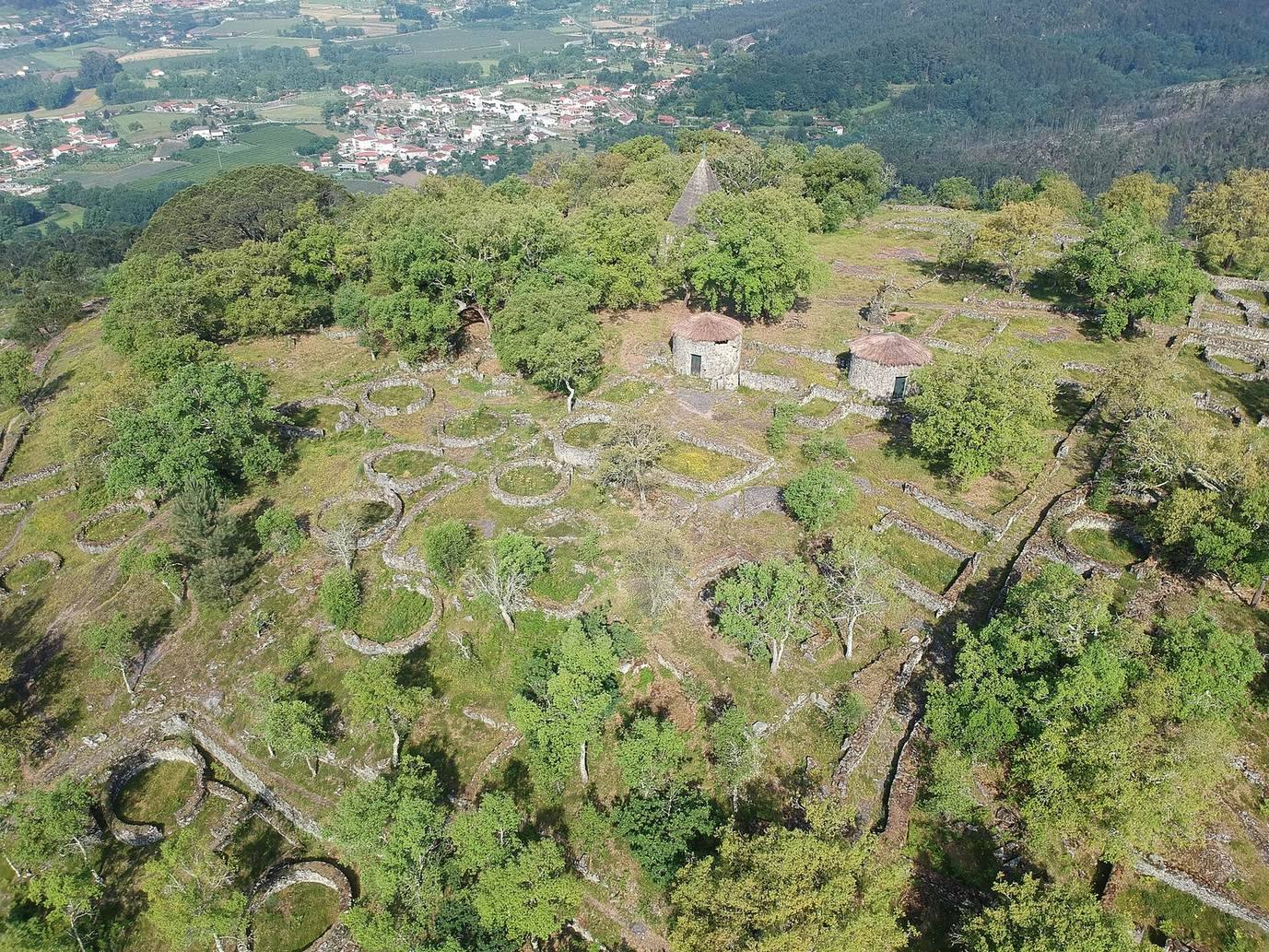
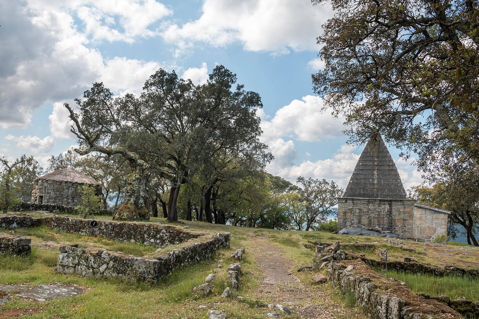
The settlement covers about 24 hectares on the summit of Monte de São Romão, which reaches 336 metres above sea level. Near the River Ave and within the Falperra-Sameiro mountain range, the elevated site overlooks the surrounding area and offers access to the river. Its central raised area, the acropolis, measures about 250 by 150 metres. Residential compounds and public buildings stood within it, linked by streets and surrounded by several defensive lines.
Defences and streets
Walls and ditches
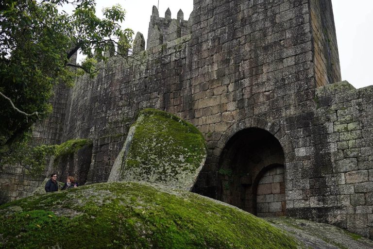
Three roughly concentric fortification lines enclosed the settlement, with a fourth, secondary line on the northeast side, where the terrain offered an easier approach. Ditches supplemented the walls; some were cut down to bedrock, and groups of ditches lay between the second and third lines and between the third and fourth. The walls were generally one to three metres thick. The innermost enclosure rested on bedrock and had foundations about a metre high, made from large fitted stones without mortar. Wall remains now stand under about two metres high, though the original height is unknown. Some sections also retained the ground behind them.
Gates and approaches
Gates, about 1.5 to 2.5 metres wide, pierced the defensive lines. Recesses in some preserved openings held wooden bars or barriers. Ramps and steps gave access to the top of the third line. Four routes linked the settlement to its surroundings, leading toward the River Febras in the northwest, the northern ridge, and valleys to the south and southwest. Twentieth-century rebuilding raised some wall stretches to about four metres, possibly above their original height.
Street network
Within the acropolis, a roughly rectangular street pattern divided residential blocks and public areas. Two main routes structured the network. The longest ran from the southwest toward the north, from near a bathhouse to the settlement’s highest area, with smaller streets branching off it. Another stone-paved road followed the eastern side of the acropolis beside its inner wall.
Houses and residential compounds
Residential blocks and houses
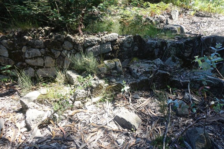
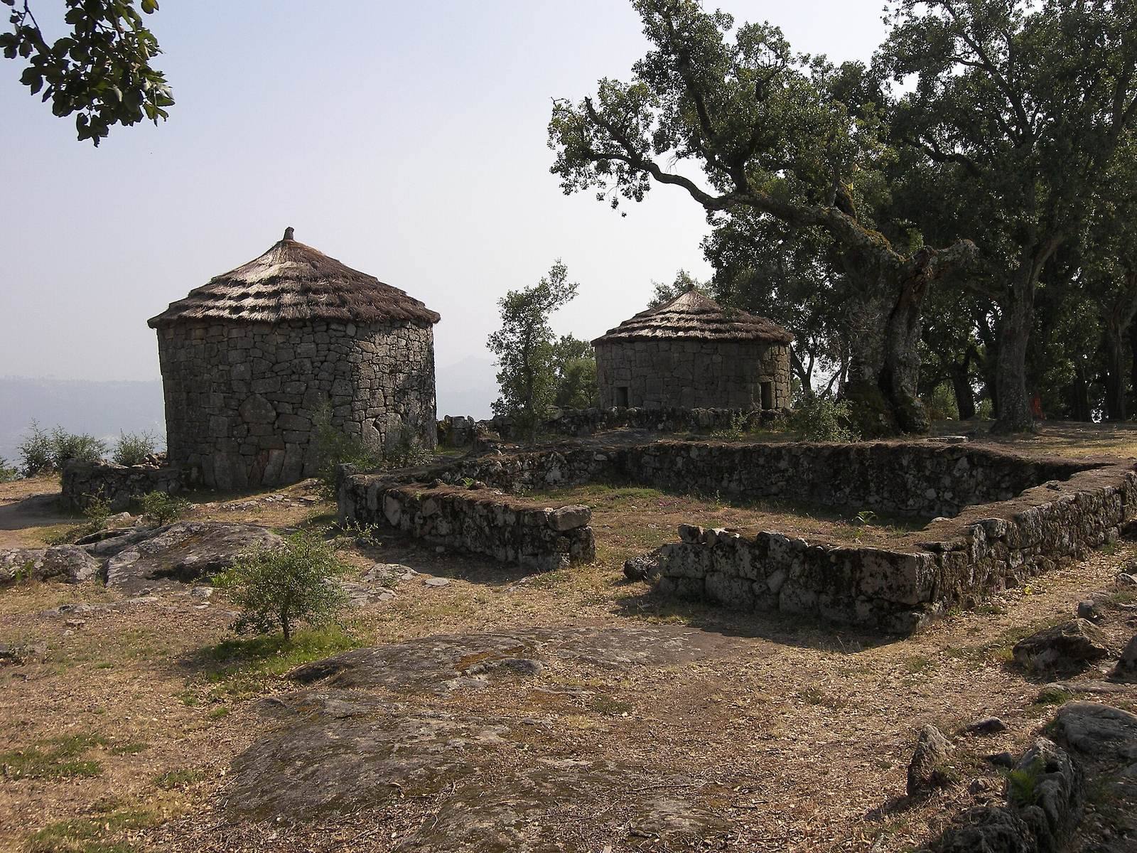
About 100 residential compounds have been identified in the acropolis. Masonry walls grouped them into small blocks, each providing living and working space for an extended family. Sarmento excavated more than 200 dwellings and estimated that these represented about half the settlement’s total. Most houses were circular and around five metres across; others were rectangular, sometimes with rounded interior corners. A compound could include several houses, work or storage areas, and a paved courtyard, at times with stone benches.
House walls were usually about half a metre thick, built of stone bonded with earth. Roofs were thatched, though some buildings gained tiles after the Roman conquest. Circular houses used a wooden roof post fixed in a buried stone, and floors were generally earth or compacted clay. Rectangular buildings may have stored tools, equipment, and food, while some compounds may also have had water tanks. Population calculations are approximate: one estimate places about 625 people in the acropolis and suggests a total of up to 1,500 for the settlement.
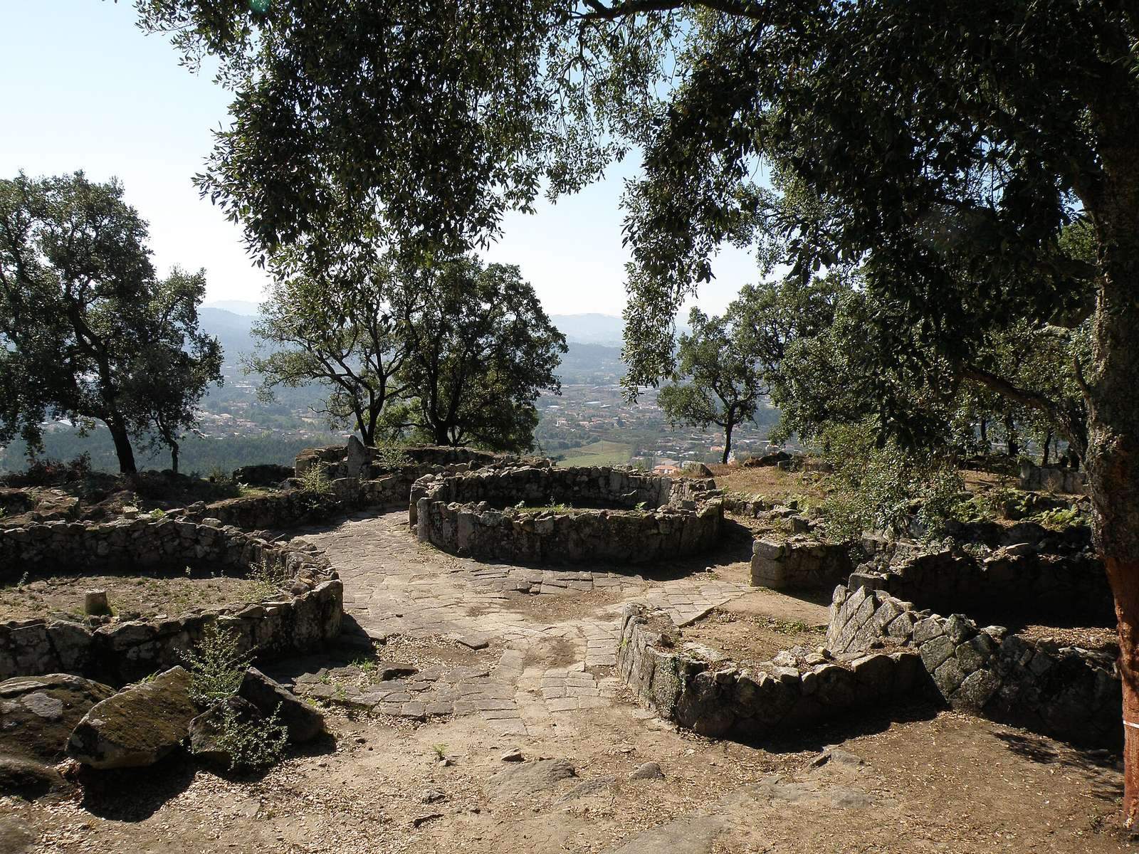
Casa da Espiral
This compound consists of three circular houses arranged around a paved central courtyard and enclosed by a wall. Its layout preserves the remains of a family residential group within the wider system of blocks.
Casa de Auscus and Casa de Coronero
The Casa de Auscus is a rectangular residence organized around a courtyard, in a form associated with Roman-style houses. A carved architectural piece bearing the name “Auscus” gave the house its modern name; the inscription may refer to an owner or family. Decorated door lintels from this house and the Casa da Espiral may point to residents of relatively high status. The Casa de Coronero lies among the compounds at the hill’s highest point and has a broad outlook over the Ave valley. It has been interpreted as the home of a wealthy or prominent family.
Meeting place and bathhouses
Casa do Conselho
At the settlement’s centre stands the circular Casa do Conselho, about 11 metres in diameter. A continuous stone bench runs around its interior. It has been interpreted as a meeting place for elders and may also have hosted banquets. A sword is carved on one of the granite bench blocks; the image may have been decorative or symbolic. A 1930 description divided the building into five spaces, unlike the single-room plan typical of most houses. Sarmento’s restoration work in 1956 limited investigation of its original form.
Southwestern bathhouse
One bath complex stood southwest of the residential area near a road. The better-preserved of the two, it includes an entrance hall with tanks, an antechamber, a chamber, and a furnace. The position of both baths outside the residential zones may have allowed wider access, although their use may have been restricted and could have included ritual purposes.
Eastern bathhouse and Pedra Formosa
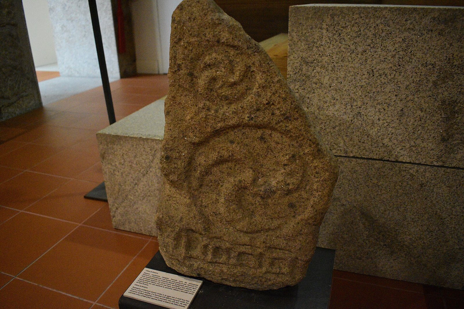
The larger bath complex stood east of the residential area. The richly carved granite slab known as the Pedra Formosa, nearly three square metres in area, came from this bath and was removed in the eighteenth century. It has been interpreted as part of a burial chamber, though earlier explanations connected it with sacrifices, offerings, or ceremonies.
Water, work, and storage
Other features include water channels from a spring, fountains, stables, storage spaces, workshops, and enclosures for cattle. A structure with a furnace stood on the southern side between the second and third defensive lines, and a stone channel carried water. Metal objects from the settlement have raised the possibility that metalworking took place there.
Medieval features
The present Chapel of São Romão is a small building made with stone taken from the surrounding settlement. The earlier hermitage stood among the ruins at the place later marked by a cross, near the remains of a Christian cemetery probably associated with the sanctuary. An excavated deposit of earth and rubble from the mid-nineteenth century probably relates to the chapel forecourt.
Rock engravings
Prehistoric carvings
Engravings occur on rock outcrops at at least nineteen locations on Monte de São Romão. Erosion and moss or lichen make many difficult to distinguish. The eastern-slope group called Penedo dos Sinais includes circles and at least one spiral. Its dating depends on how these carved forms are interpreted.
Inscriptions and later marks
Other carvings include Latin inscriptions, marks on building stones, and cross-shaped designs. In 2020, researchers recorded engravings at two newly identified places near the settlement. A carved sword on a bench block in the Casa do Conselho was identified in 2021. Some inscriptions and carvings lie beside access paths, in public areas, and in house courtyards. Courtyard examples may have served ritual or protective purposes. Inscriptions include “Auscus” on an architectural piece and “ATVRO VIRIATI,” interpreted as “Caturo, son of Viriatus.” A dedication on a large Roman storage jar found in 1951 presents the vessel as a gift from the potter Caturo to Maximino.
Archaeological finds
Pottery and glass
Finds include substantial quantities of pottery, glass, and metalwork. Pottery ranges from vessel fragments, including transport-jar bases and handles, to decorated wares. Painted pieces and fine red-gloss Roman ceramics carry geometric patterns or plant and animal designs; some were probably imported from Italy, Gaul, and elsewhere. A lamp was also found. Glass fragments include greenish, yellow, dark blue, pink, and purple pieces. A ribbed green glass cup found by Sarmento in 1877 is a table vessel of a type common in the early Roman Empire. Glass containers and beads may have been imported.
Metalwork, coins, and personal objects
Bronze, iron, and copper objects include tools, weapons, and personal ornaments. The latter include bracelets, rigid metal neck rings, simple rings, beads, and brooches used to fasten clothing. Other discoveries include hairpins, tweezers, spherical-headed pins possibly used in women’s hairstyles, agricultural tools, and cauldrons. Iron objects were often badly corroded, though at least one axe was identified. Coin finds include about thirty bronze and silver pieces noted by the early 1930s, spanning the Roman Republic to Constantine’s reign, and at least 81 coins minted between the reigns of Augustus and Hadrian. Gold earrings were found inside a vessel that may have served as a woman’s funerary urn.
Other finds and plant remains
A headless female statue, about 46 centimetres high, was found at the site. Plant remains include oats, millet, peas, barley, several kinds of wheat, acorns, blackberry and raspberry seeds, grape pips, and seeds from the vetch family other than fava beans. Much of Briteiros’ archaeological material is held at the National Museum Soares dos Reis and the Museum of Castro Culture.