Choquequirao: An Inca Ceremonial and Administrative Complex in Peru
Site at a Glance
- Rating
- 4.8
- Popularity
- Low
- Country
- Peru
- Primary era
- Medieval
- External website
- Open
- Eras represented
- Medieval, Early Modern
- Civilizations
- Chachapoya, Inca
- Site type
- City
On this page18 sections
History
Choquequirao is an Inca settlement and ceremonial complex in the Vilcabamba range of Peru, associated with the fifteenth and sixteenth centuries and with construction dated to 1536. Built within the Inca Empire, the Andean imperial state that incorporated much of western South America before the Spanish conquest, it occupied a strategic position above the Apurimac River. The site developed in two major stages and served as a ceremonial center, administrative hub, and checkpoint controlling access to the Vilcabamba region.
Inca development and functions
The earliest stage is traditionally associated with Pachacuti, the ruler credited with transforming the Cusco polity into an expanding empire. His estate included the regions around the Amaybamba, Urubamba, Vilcabamba, Vitcos, and Apurimac rivers. After Pachacuti, Tupac Inca Yupanqui, his successor and a continuing builder of the empire, may have remodeled and enlarged the settlement. Chachapoya workers, from an Andean society of northern Peru incorporated during Inca expansion, probably contributed to some of its construction.
Choquequirao connected Cusco with the Amazonian lowlands and combined political, social, economic, religious, and possibly commercial roles. Its spaces included places devoted to Inti, the Inca sun deity, as well as shrines for ancestors, the earth, water, and other divinities. Elite residences stood alongside houses for workers and artisans, food stores, dormitories, and extensive agricultural terraces.
Choquequirao during Inca resistance
After the Spanish conquest, Choquequirao became one of the last Inca refuges and strongholds of resistance. Manco Inca Yupanqui withdrew from Cusco after the failed siege of 1535, and the settlement formed part of the wider Vilcabamba region, where Inca resistance continued until Tupac Amaru I, the last ruler of the Vilcabamba Inca state, was captured and executed in 1572.
Choquequirao was abandoned during the late sixteenth century. Its abandonment is dated either to 1572 or to about 1590. Dense Andean forest later reclaimed the settlement, which does not appear in known sixteenth- or seventeenth-century colonial chronicles.
Rediscovery and archaeological work
A memorial written by the Spanish explorer Juan Arias Diaz in 1710 identified Choquequirao among the Inca cities of Vilcabamba. Cosme Bueno described the settlement in 1768, and Pablo Jose Oricain referred to it as abandoned in 1790. During the nineteenth century, legends of Inca treasure and of Choquequirao as a final refuge encouraged further investigation. Eugene de Sartiges and Leonce Angrand visited or investigated the area between 1834 and 1838. Charles Wiener and the Peruvian explorers Jose Samanez, Juan Manuel Rivas Plata, and Mariano Cisneros later contributed to exploration; Jose Maria Tejada visited in 1834, and Angrand mapped the site in 1837.
Hiram Bingham visited Choquequirao in 1909 while investigating whether it was Vilcabamba, the capital of the last four Incas. He recorded three groups of buildings, mummified bodies, and places where dynamite had been used in searches for treasure, but interpreted the settlement as a frontier fortress. Archaeological excavations began around 1970. Intensive studies and a restoration plan followed in 1986, with restoration work also dated to 1993. By the period described, only about 30 to 40 percent of the approximately 1,800-hectare complex had been excavated or cleared, and restoration and interpretation remained incomplete. Choquequirao is recognized as Cultural Heritage of the Nation of Peru and is described as an archaeological park.
The name is generally interpreted from Aymara and Quechua elements meaning “Cradle of Gold.” It may originally have referred to a nearby rocky peak before being extended to the settlement. The ancient name of the sanctuary is unknown.
Remains
Setting and overall layout
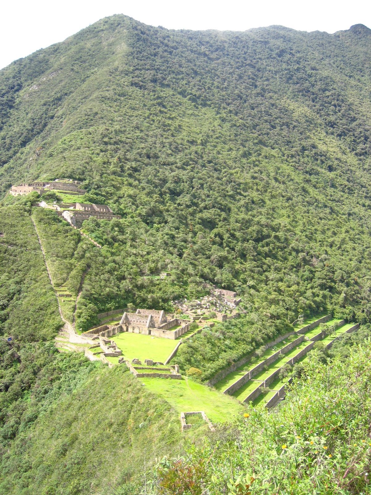
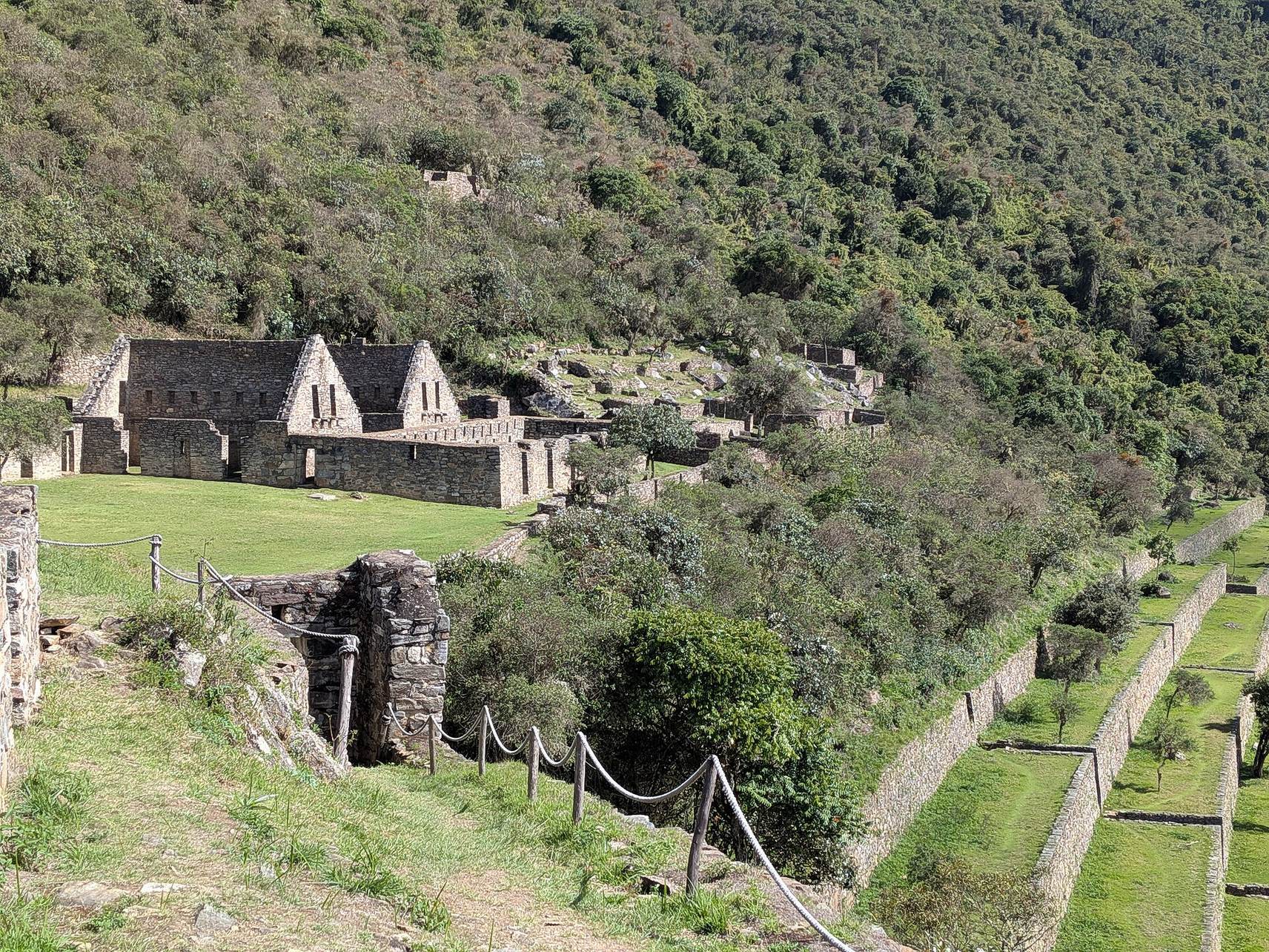
Choquequirao occupies a southwest-facing spur above the Apurimac River in the Vilcabamba range, near the Salkantay massif. The settlement lies approximately 3,000 to 3,050 meters above sea level, overlooking the Apurimac canyon, whose river level is about 1,450 meters. Buildings and terraces spread across steep slopes above and below the truncated hilltop of Sunch’u Pata, the leveled central hilltop that forms the main platform.
The central area was artificially leveled, while the surrounding slopes were terraced for cultivation, residences, support buildings, erosion control, and structural stabilization. The complex covers approximately 1,800 hectares, although its developed architectural core is also described as covering about 6 square kilometers. The ceremonial area extends for roughly 700 meters and descends as much as 65 meters from the upper areas to the main plaza. Principal buildings, temples, sacred places, elite residences, fountains, baths, and other ceremonial structures cluster around two plazas along the ridge, while common buildings lie farther from the plazas and paths connect the different sectors.
The central platform and ceremonial spaces
Sunch’u Pata and the main plazas
Sunch’u Pata was cut level and enclosed with stonework to create a platform approximately 30 by 50 meters. Surface finds and excavations indicate that it was used for workshops and food preparation. The main platform and the lower plaza formed the focus of the ceremonial center, together with water channels, shrines, baths, and structures aligned with solar events. The main platform was probably restricted to royalty and the ministerial class because its only entrance passed through a double-jamb doorway, a doorway with paired or stepped doorposts that controlled passage into an important space.
The Giant Staircase
The Giant Staircase measures approximately 25 meters in length and 4.4 meters in width. It faces the sunrise of the December solstice and ends abruptly partway down the slope, suggesting a ceremonial rather than practical purpose. Large boulders embedded in the steps are illuminated by the December-solstice sunrise. Their interpretation as an activated wak’a, a sacred place, object, or feature in the Andean religious landscape, remains a scholarly proposal.
Water shrines, baths, and the usnu
The lower plaza contains structures interpreted as water shrines and baths because of their form and the many channels leading toward them. Two unusual temple wak’a sites lie several hundred meters below the plazas. Each consists of carefully built stepped terraces organized around water. The usnu, a raised ceremonial platform or altar, occupies the summit of a leveled hill in Sector V. Its oval platform is enclosed by a small wall and overlooks the main plaza, snow-capped mountains, and the Apurimac River.
Sector VI contains Wasi Kancha, the priests’ quarters, south of the usnu in the lower, or Urin, zone. Four terraces served as ceremonial spaces, and their walls carry zigzag designs, including a white-stone serpent-like pattern. Together with the aqueduct, fountains, baths, and other channels, these installations show how water was incorporated into the ceremonial organization of the complex.
Sector organization and buildings
Upper and storage sectors
The highest and northernmost Sector I contains five buildings on terraces at different levels, a temple, a plaza, and a smaller upper plaza. Two buildings probably served as qullqas, or storage buildings, while three long kallankas, large elongated halls used for communal, administrative, residential, or ceremonial purposes, probably housed priests. Sector II contains most of the qullqanpatas, or storage and depository areas, together with 16 ceremonial platforms connected by canals branching from the main waterway.
Haucaypata and the lower ceremonial zone
Sector III lies between the high Hanan area and the low Urin area and contains the probable main plaza, Haucaypata. One- and two-story buildings surround it. A Sunturwasi and a single-level kallanka, probably used for ceremonies, stand on the northern side, while two-level buildings occupy the eastern side. Sector IV, in the southern Urin zone, contains a principal building with walls probably used for ceremonies. One of these walls is known as the wall of offerings to the ancestors.
Residential and agricultural sectors
Sector VII contains cultivation terraces that are markedly broader than those elsewhere in the complex. Sector IX is a residential area for workers and families, with structures placed on artificial circular and rectangular platforms connected by stairways and narrow alleys. Paraqtepata, or Sector X, contains 18 terraced platforms with irrigation canals running parallel to the stairs.
Phaqchayuq, or Sector XI, means “the one with a waterfall.” It contains 80 cultivation terraces, the most extensive group in the complex, along with small two-level quadrilateral enclosures used for ceremonial and residential purposes. Three fountains supplied drinking water and irrigation canals. About three hours on foot from the upper complex, Sector XII contains 57 platforms with permanent irrigation systems. Its upper terraces include ceremonial buildings and a spring-fed pool. Ceramic fragments, stone tools, and bone remains have been found in semicircular enclosures.
Terraces, water systems, and agricultural outposts
Canals and cultivated slopes
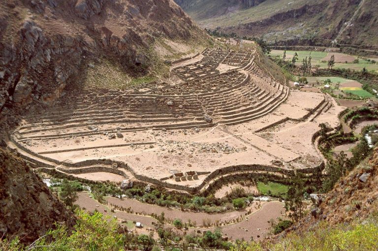
Choquequirao contains extensive agricultural terraces, residential platforms, ritual platforms, water channels, aqueducts, fountains, pools, and drainage systems. The water network supplied cultivated slopes and ritual installations while regulating water flow and reducing the risk of terrace flooding and collapse. Sector VIII on the western side contains about 80 cultivation terraces divided by canals descending from the main plaza. The terraces in the surrounding subsectors include agricultural outposts and construction phases believed to represent three different periods. Their lack of residential space suggests that they were farming outposts linked to Choquequirao rather than independent settlements.
The Llamas of the Sun
The terrace walls of Sector VIII contain at least 25 semi-naturalistic camelid figures made from white calcocuarcita, a quartz-and-carbonate sandstone, set against darker wall stone. The figures range from approximately 1.25 to 1.94 meters in height. One terrace scene shows white-quartzite llamas carrying loads beside their handlers, while a zigzag pattern made from the same material appears on the uppermost terrace wall.
The camelid figures are arranged on 15 terraces oriented toward the snow-covered mountain of Quory Hauyrachina. Another description identifies 22 stone engravings in the “Llamas of the Sun” group. In 2004, archaeologist Zenobio Valencia found several white-stone camelid figurines among a group of terraces. The imagery and zigzag design have been associated with Chachapoya artistic and construction traditions, which are otherwise uncommon at Inca sites.
Construction and preservation
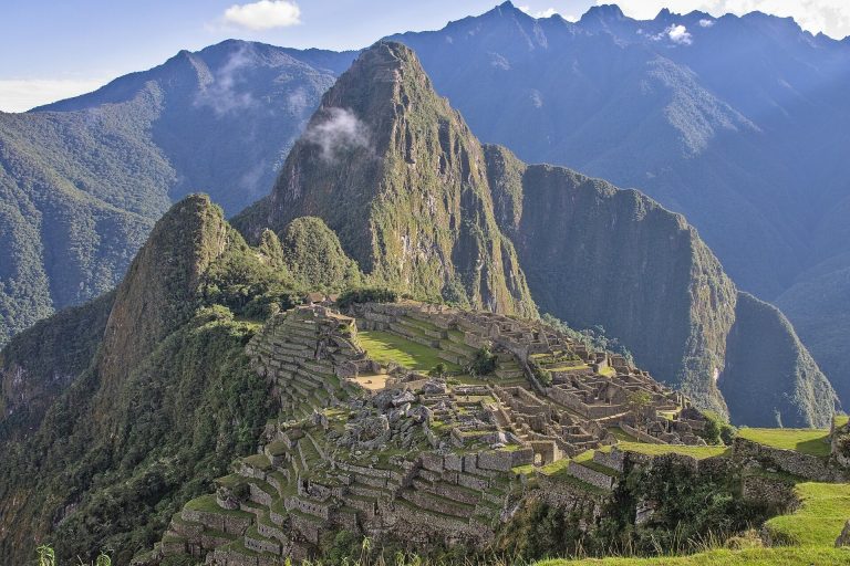
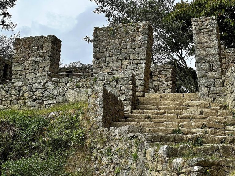
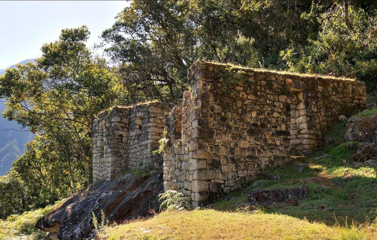
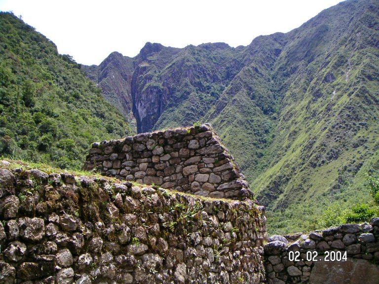
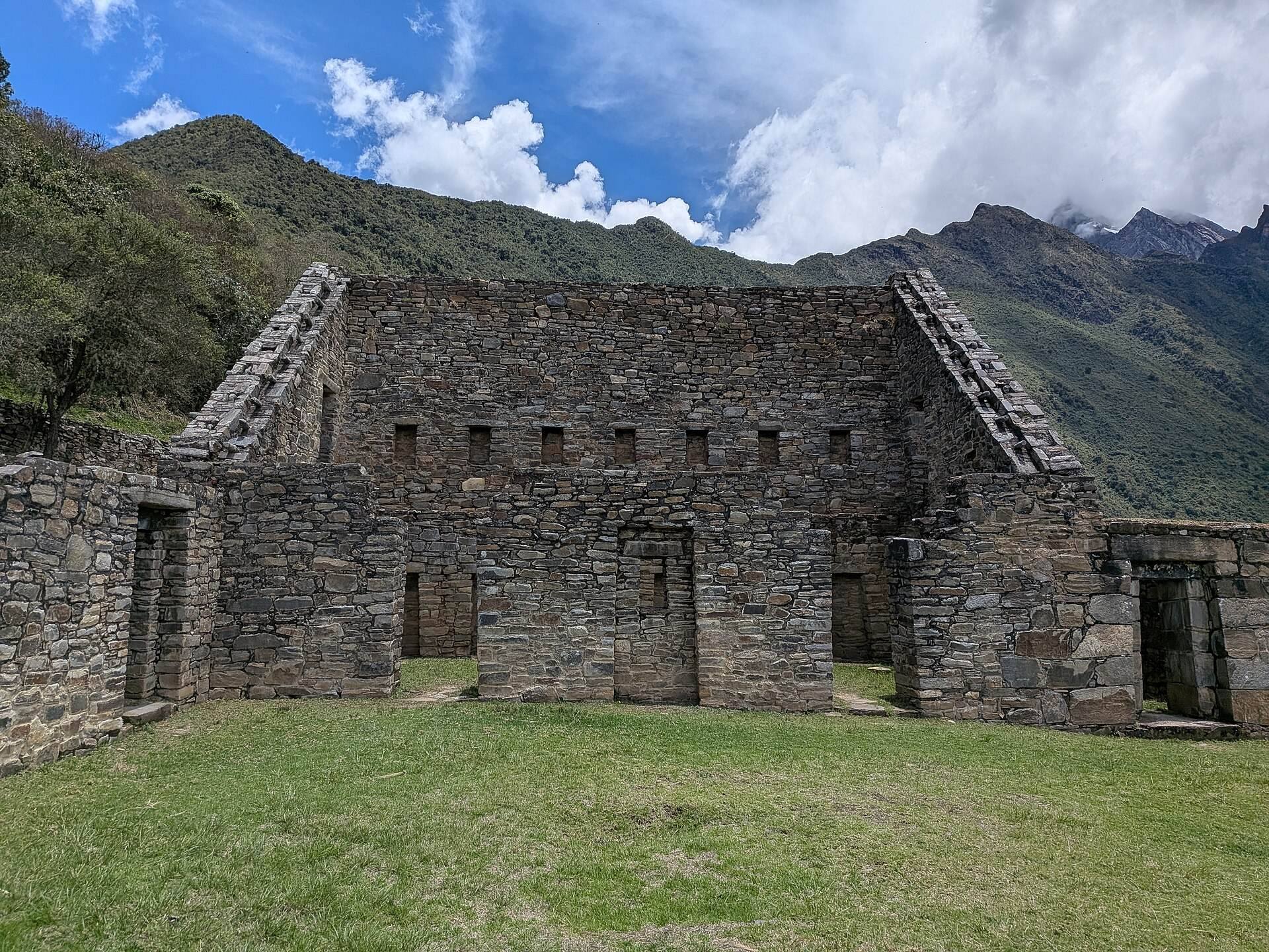
Buildings at Choquequirao used locally quarried stone, including quartzite for entrances and corners. Their walls were built with ashlar masonry, set with clay mortar, plastered with clay, and reportedly painted light orange. The local metamorphic stone was less suitable for the finest masonry than the stone used at Machu Picchu, and the surrounding sectors also relied on materials from nearby quarries. Two-story buildings, interior niches, double-jamb doorways, and wall recesses survive across the complex.
Most exposed buildings are described as well preserved and restored, although restoration continues. Other terraces, structures, and archaeological areas remain buried beneath vegetation or await excavation. The surviving layout brings together ceremonial architecture, residential compounds, storage buildings, agricultural platforms, water installations, and distinctive stone imagery across the steep slopes above the Apurimac canyon.