Machu Picchu: An Inca Royal Estate in Peru
Site at a Glance
- Rating
- 4.8
- Popularity
- Very High
- Country
- Peru
- Primary era
- Medieval
- External website
- Open
- Eras represented
- Medieval
- Civilizations
- Inca
- Site type
- Domestic
- Remains
- Palace
On this page18 sections
History
Machu Picchu is a fifteenth-century Inca settlement and royal estate in Peru’s Eastern Cordillera, built on a mountain ridge above the Urubamba Valley. Occupied from approximately 1420 to 1530, it belonged to the period of Inca expansion and combined residential, agricultural, administrative, and ceremonial functions. The estate is generally understood as a seasonal retreat associated with the Sapa Inca Pachacuti Inca Yupanqui, although its exact purpose and original name remain subjects of discussion.
Inca foundation and royal use
Construction traditionally began around 1450, during the reign of Pachacuti, who ruled from 1438 to 1471, and continued under Túpac Inca Yupanqui, who ruled from 1472 to 1493. Pachacuti was associated with the expansion of the Inca state and with the establishment of royal estates in the Cusco and Urubamba regions. Machu Picchu appears to have been created after his conquest of the middle and lower Urubamba, probably as a royal estate maintained for the ruler, his household, retainers, and ceremonial activities.
A royal estate was more than a palace. It included agricultural land, service buildings, administrative spaces, and areas for ritual use, but it was not necessarily a permanent capital. Machu Picchu occupied this kind of role for about 80 years. Around 750 people lived there at various times, most of them yanaconas, dependent workers permanently assigned to the service of a ruler, estate, temple, or elite household. Religious specialists and temporary skilled workers also served the estate, while the resident workforce became smaller during winter.
Skeletal and genetic evidence indicates that many residents came from different parts of the Andes, the coast, Ecuador, and the Amazonian regions. Their varied diets, exposure to parasites, and skeletal characteristics suggest that many had spent much of their lives elsewhere. The settlement therefore brought together people from across the Inca state rather than serving only a local population.
Abandonment and changing interpretations
Machu Picchu was abandoned around the time of the Spanish conquest. The collapse of Inca rule and diseases introduced through European contact probably contributed to its decline, and many inhabitants may have died from smallpox before Spanish forces reached the area. The Spanish did not attack or loot the settlement because its location remained unknown beyond the immediate region. Vegetation and forest later covered much of the site, while local people continued to know of or use the ruins.
The original name of the settlement is uncertain. A 2021 study proposed that it may have been called Huayna Picchu, after the smaller neighboring peak, or simply Picchu. The name Machu Picchu became associated with the ruins in the twentieth century, particularly through Hiram Bingham’s publications after 1911. The site has also been interpreted as a sacred center, administrative settlement, fortress, prison, place for controlling conquered territories, or location connected with the Inca sun maidens. The interpretation most widely supported here is that of a seasonal royal retreat whose position was also shaped by the sacred character of the surrounding mountains and landscape.
Late sixteenth-century Spanish records preserve Indigenous references to people returning to Huayna Picchu. The conquistador Baltasar de Ocampo described a mountain fortress called Pitcos with sumptuous buildings, carefully made structures, and carved stone door lintels. The identification of Pitcos with Machu Picchu remains an interpretation. Maps referred to the site by 1874, and a 1904 atlas labeled it Huayna Picchu. The German businessman Augusto Berns may have reached and exploited the ruins in the late nineteenth century, while a visit attributed to the engineer J. M. von Hassel remains uncertain.
Local knowledge and Bingham’s expeditions
Agustín Lizárraga, a Peruvian explorer, reached the ruins in 1902 after clearing vegetation. He left the charcoal inscription “Lizárraga 1902” on the central window of the Temple of the Three Windows. Hiram Bingham acknowledged Lizárraga in his early writings but later minimized his role while presenting himself as the site’s discoverer.
Bingham, an American historian and Yale lecturer who was not formally trained as an archaeologist, arrived on 24 July 1911 while searching for Vitcos, then believed to be the last Inca capital. The local farmer and innkeeper Melchor Arteaga guided him across the river and up the mountain with Sergeant Carrasco. Farmers named Richarte and Alvarez, who were working cleared terraces, and Richarte’s son Pablito helped direct him to the principal ruins.
The visit brought Machu Picchu to international attention. Bingham made notes, measurements, and photographs, and later popularized the description “Lost City of the Incas,” although he initially doubted that the site was Vitcos. His expedition subsequently identified Vitcos and examined Espíritu Pampa, now recognized as Vilcabamba Viejo, the refuge of the Incas after the Spanish conquest.
Bingham returned in 1912 with support from Yale University and the National Geographic Society. From July to November that year, workers cleared vegetation, mapped the settlement, burned some overgrowth, and excavated its buildings and deposits. Further excavations took place in 1914 and 1915, with assistance from local laborers and regional authorities, including the Prefect of Cusco. The expeditions removed thousands of objects, including ceramics, silver statues, jewelry, human remains, and fifteenth-century ceremonial knives made from bismuth bronze.
The removal of these materials led to disputes with Peruvian institutions and landowners over excavation practices, cultural ownership, and the legal status of archaeological finds. Yale retained the collections for decades while Peru asserted ownership. Some objects returned in 2006. Agreements in 2007 recognized Peru’s title and established plans for a joint exhibition, museum, and research center in Cusco. Yale agreed in 2010 to return the disputed material, and the final group arrived in November 2012. The returned artifacts are permanently exhibited at the Machu Picchu Museum–Casa Concha near Cusco.
Conservation and heritage protection
State and institutional projects restored parts of Machu Picchu and carried out limited excavation between 1929 and 1971. Targeted work from the 1970s through the 1990s recovered and recorded Inca ceramics, stone tools, metal objects, and layers that had been disturbed or reworked. Between 2014 and 2017, the Archaeological and Interdisciplinary Research Program in the Historic Sanctuary of Machupicchu combined excavation, pollen studies, and architectural analysis to clarify construction phases, record offerings, and refine interpretations of the settlement’s function and population.
Research from 2017 to 2019 examined the Principal Plaza through archaeology, remote sensing, and geophysical methods. The results suggested that the area began as a natural drainage basin, was later used as a quarry, and was then reshaped with underground drainage. The present plaza probably developed in at least two stages from a smaller sunken plaza.
In 1981, Peru declared 325.92 square kilometers around Machu Picchu a Historic Sanctuary. The protected area includes the ruins and surrounding landscapes of the Peruvian Yungas and Central Andean wet puna, a high-elevation grassland and wetland environment. UNESCO inscribed Machu Picchu as a mixed World Heritage Site in 1983, recognizing both the archaeological complex and its natural setting. The designation emphasized its art, urban planning, architecture, engineering, and testimony to Inca civilization. In 2007, Machu Picchu was selected as one of the New Seven Wonders of the World.
Later management has responded to pressure from tourism and nearby development. A rock was removed from the central plaza in the 1980s to create a helicopter landing area. Air-tour proposals were later rejected or withdrawn, and a no-fly zone was established above the area. Visitor limits and entrance controls introduced in 2011 and 2018 were followed by an official daily limit of 4,500 people in 2024, with up to 5,600 allowed during peak periods. Severe El Niño flooding in January 2010 disrupted access and trapped more than 4,000 people. The site also closed during the COVID-19 pandemic and during the Peruvian protests of 2022 and 2023.
Remains
Setting and overall layout
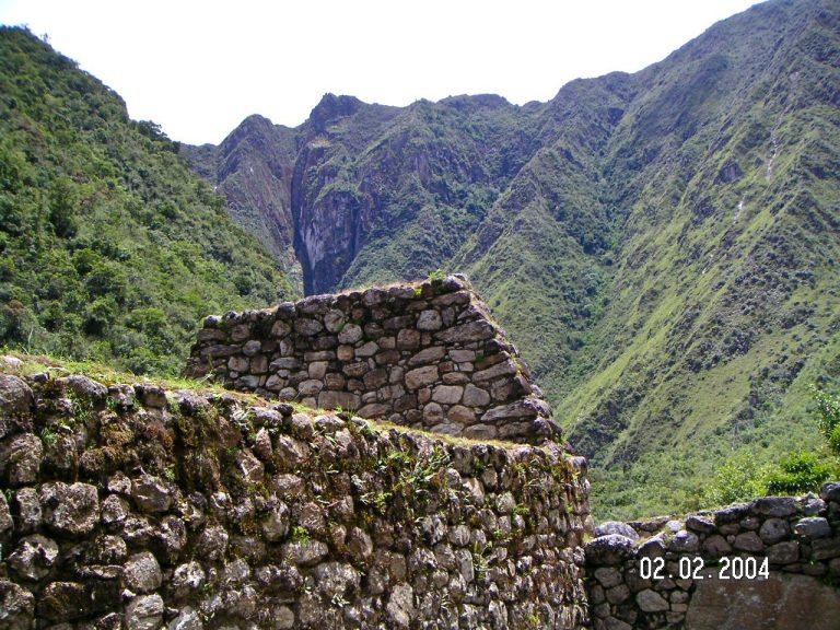
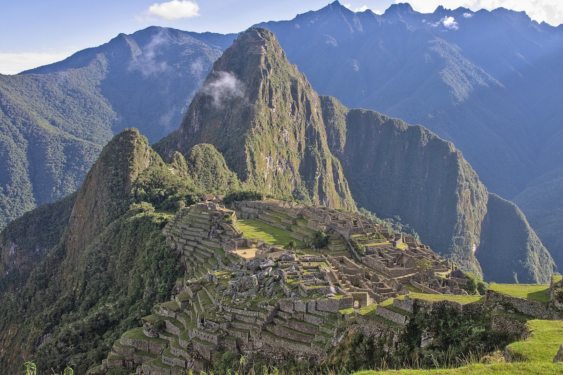
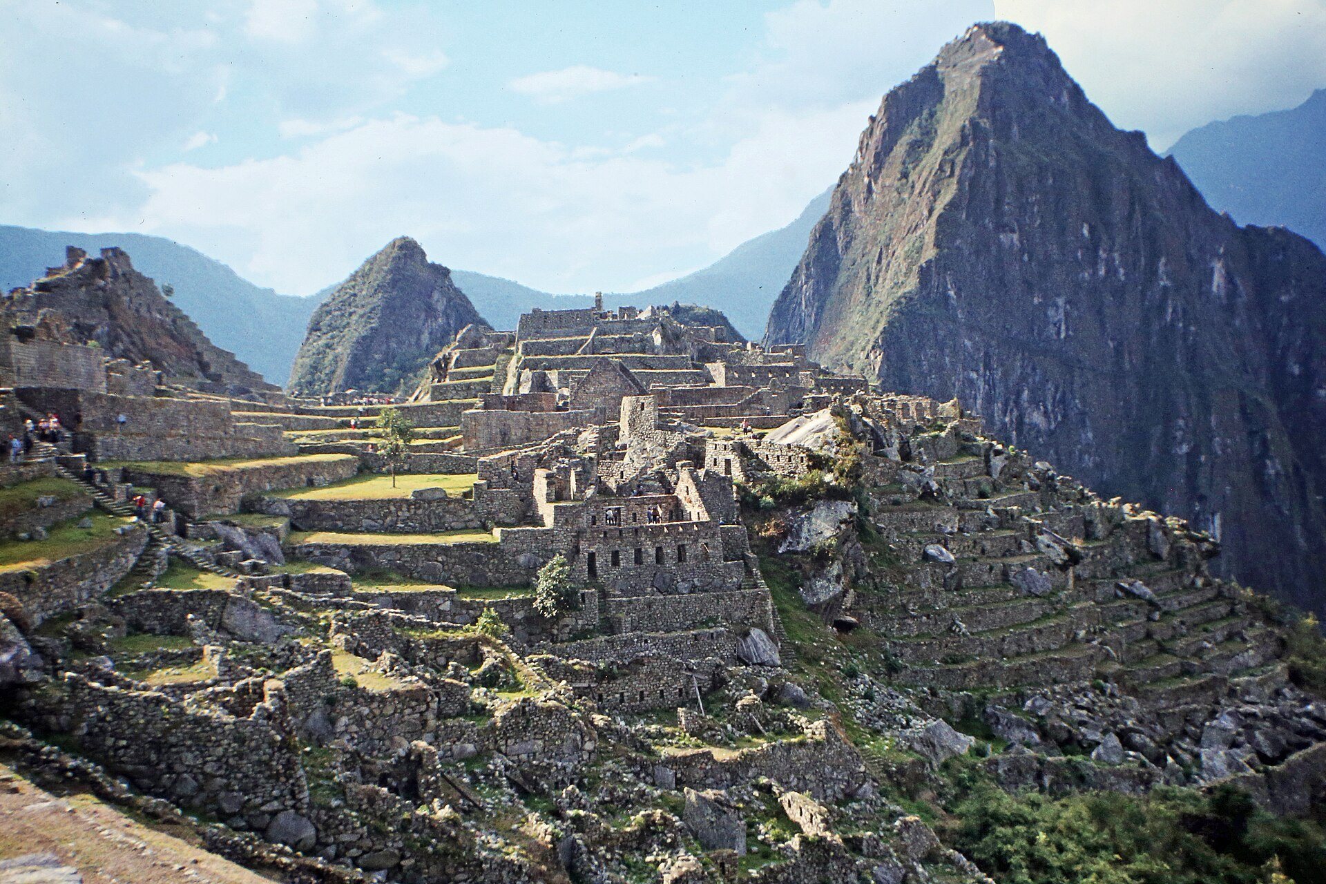
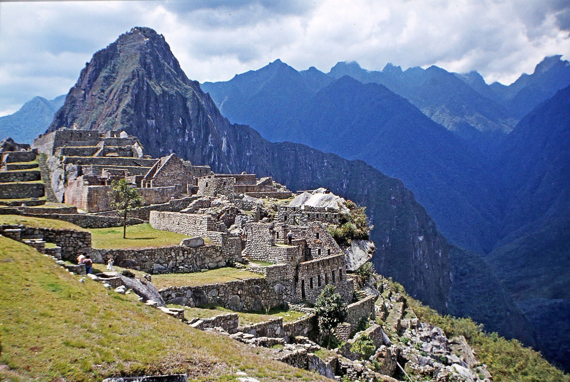
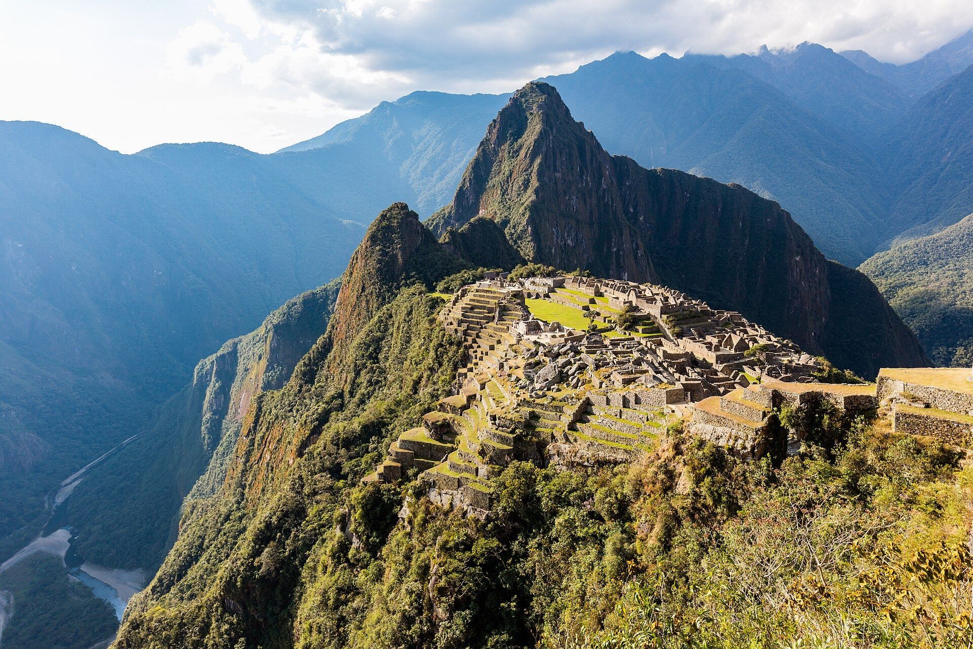
Machu Picchu stands at about 2,430 meters above sea level on a narrow saddle between the mountains Machu Picchu and Huayna Picchu, roughly 80 kilometers northwest of Cusco. The Urubamba River surrounds it on three sides, with cliffs descending approximately 450 to 600 meters toward the river. This steep setting shaped the settlement’s terraces, paths, retaining walls, buildings, and drainage systems.
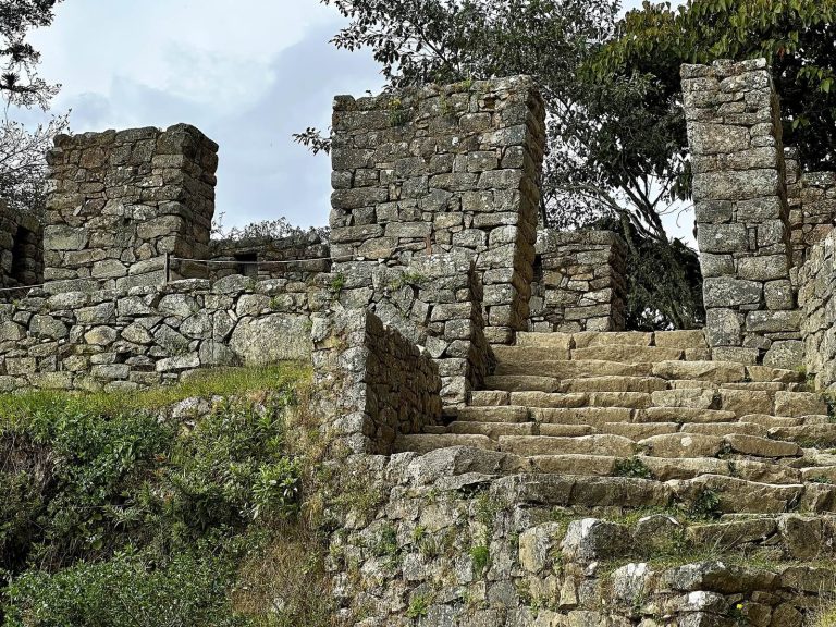
The site is divided into a southeastern agricultural sector and a northeastern urban sector. The urban area contains residences, religious buildings, and storehouses, and is further divided into an upper town, or Hanan, and a lower town, or Hurin. About 200 buildings are arranged around a central plaza on broad, parallel terraces. More than 100 stone stairways connect the different levels, including stairways carved from single granite blocks. Fountains, channels, retaining walls, and other water-management structures are integrated into the layout.
The central buildings use dry masonry, in which carefully cut granite blocks are fitted without mortar. Many joints are so precise that a thin blade cannot be inserted between the stones. Trapezoidal doors and windows, rounded corners, slightly inward-sloping internal corners, L-shaped corner blocks, and shifting wall courses helped buildings withstand frequent earthquakes. The local geology is dominated by granite, with smaller areas of granodiorite and dikes of peridotite and serpentine. Geological faults supplied naturally fractured stone and may also have aided drainage.
Agricultural terraces and water systems
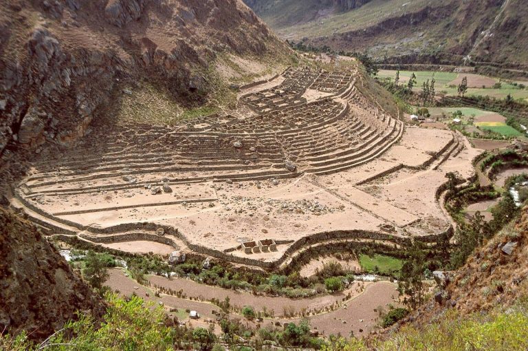
The agricultural terraces cover about 4.9 hectares on the southeastern side of the settlement. Their retaining walls and layered construction increased cultivable land while limiting erosion, landslides, runoff, and flooding. Large stones formed the lowest layer, followed by loose gravel, mixed sand and gravel, and rich topsoil probably brought from the valley floor. Soil studies indicate that maize and potatoes were cultivated.
Annual rainfall has been estimated at more than 1,800 millimeters since approximately 1450, so routine irrigation was unnecessary. The terraces and channels instead concentrated on removing excess water. Some terraces shifted during landslides associated with construction and were later stabilized by the Incas. The agricultural sector could not have fed the estimated population of about 750, so food also arrived from nearby valleys and more distant regions.
The settlement’s water system drew from a sacred spring and distributed water through channels, reservoirs, and fountains. Other drains supplied the terraces and reduced erosion and flooding. A quarry identified through remote sensing in 2023 probably lay between Hurin and Hanan before the formation of the present Principal Plaza covered it. The precise method used to move the largest stones remains uncertain; proposed methods include ramps, wooden rollers, levers, plant-fiber ropes, and the coordinated labor of hundreds of people. Some blocks retain knobs that may have helped workers position them.
Urban and residential areas
Hanan and the Sacred Plaza
The western part of the urban sector, separated from the eastern residential area by the central plaza, contains buildings associated with religious and ceremonial activities. The Sacred Plaza in Hanan contains the Main Temple and the Temple of the Three Windows. A pyramid-like stone platform rises within the plaza and supports the Intihuatana, a carved ritual stone whose name means “place where the sun is tied.”
Hurin and the residential districts
Hurin contains trapezoidal doorways and small rectangular kanchas, Inca compounds organized around enclosed courtyards. Three large, symmetrical kanchas facing the Main Plaza held residences and workshops. A large building with a single entrance is interpreted as an Acllahuasi, a structure associated with acllas, women selected for state or religious service.
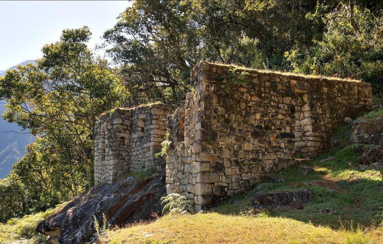
The Popular or Residential District contains simpler houses and storage buildings associated with lower-status residents. The Guardian’s House is a three-sided building whose long open side faces the Terrace of the Ceremonial Rock. Its form belongs to the wayrona style, characterized by a three-sided arrangement.
The Torreón
The Torreón is a semicircular, two-part structure in Hanan, built among large granite blocks above the rock associated with Bingham’s “Royal Mausoleum.” Its lower section occupies an irregular, cave-like space and contains fine ashlar masonry, meaning precisely cut and fitted stonework, along with trapezoidal niches, stepped ledges, and platforms.
The upper Torreón stands on an artificially shaped oblong rock surrounded by especially fine ashlar. Its upper surface has carved steps, horizontal platforms, and a Z-shaped edge commonly interpreted as an altar. Niches are set into the chamber wall, which also has openings to the east, southeast, and north. Stone pegs occupy the eastern and southeastern openings, while the northern opening is door-like and damaged. A trapezoidal opening known as the Serpent’s Door leads to a small platform overlooking pools and Huayna Picchu.
Sunlight entering the Torreón creates distinctive patterns, and some openings provide limited views toward star groups such as the Pleiades. Detailed analysis indicates that the structure was not a highly precise astronomical instrument. Its solar orientations were more likely incorporated into ritual activities.
Sacred and ceremonial structures
The Intihuatana
The Intihuatana stands on a terraced hill in the urban sector, above the Sacred Plaza on a pyramid-like platform. Its exact function remains debated. The stone was designed to point toward the Sun at the winter solstice and may have supported horizontal solar observations. It may also have been aligned with sacred mountains and the cardinal directions. Scholars generally reject the popular idea that it served simply as a solar-calendar marker.
At midday on 11 November and 30 January, the Sun stands almost directly above its pillar, producing very little shadow. On 21 June, the pillar casts its longest shadow toward the south, while on 21 December the shadow is much shorter and falls toward the north. Its position may also have symbolically aligned it with Veronica, Salcantay, and Huayna Picchu.
Inti Mach’ay
Inti Mach’ay is a cave on the eastern side of Machu Picchu, north of the Condor Stone. Its entrances, walls, steps, and windows use exceptionally fine masonry. One tunnel-like window is unique among the Inca structures described at the site. Sunlight enters through this opening for only several days around the December solstice, suggesting a solar observatory connected with Qhapaq Raymi, an Inca festival associated with the December solstice and rites of male initiation.
The Temple of the Three Windows
The Temple of the Three Windows stands on the eastern side of the Sacred Plaza, on a terrace measuring 16 by 16 meters. Its single trapezoidal wall is built from large, finely worked white-granite blocks whose joints have helical planes, a technique described as unique at Machu Picchu. Three large trapezoidal openings have lintels and jambs carved from single stones, and two smaller niches flank the windows. Four terraces support the exterior platform at the base of the wall.
The temple provided views of sunrise and sunset over the ruins and surrounding mountains. It probably carried a timber roof formed by a three-wall truss, with wooden beams and pilasters inserted into pockets in the masonry. Lizárraga’s charcoal inscription, “Lizárraga 1902,” was placed on the central window. Its position in early photographs preserves physical evidence of local knowledge of the ruins and of vegetation clearing before Bingham’s arrival.
The Temple of the Condor and burial caves
The Temple of the Condor contains ritual caves and a large carved stone commonly interpreted as a condor. Around Machu Picchu, approximately 104 caves and rock shelters served as burial chambers and contained the remains of about 174 people. Most of these individuals are interpreted as yanaconas rather than Inca elites. The Temple of the Condor and nearby caves have also been associated with animal offerings, especially camelids. Direct evidence for human sacrifice at the site is limited.
Roads, bridges, and archaeological finds
The principal routes formed part of the Inca road system. At least ten roads connected Machu Picchu with nearby monuments. Important routes passed through Inti Punku, or the Sun Gate, and across the Inca Bridge toward the Ahobamba basin and Llaqtapata. Possible pre-Hispanic crossings of the Urubamba included hanging rope bridges and simpler log-and-rope structures. Bridge abutments and road sections near the settlement indicate former crossing points, although floods damaged much of this evidence.
Obsidian nodules found near the entrance were traced in the 1970s to sources in the Titicaca or Chivay regions, linking Machu Picchu to long-distance exchange networks. Llama and alpaca remains probably represent animals brought from the higher Puna for meat and hides. Guinea pigs appear in funerary contexts, while six dogs placed among human remains have been interpreted as companions of the dead. Camelid remains also formed part of funerary and ceremonial offerings.
The Historic Sanctuary surrounding Machu Picchu contains more than 420 bird species and over 550 tree species belonging to 74 families. Its wider fauna includes the Andean fox, puma, vizcacha, spectacled bear, white-tailed deer, cock-of-the-rock, and Andean condor. These living environments form part of the protected landscape that surrounds the Inca settlement.