Château de la Hunaudaye: A Medieval Fortress in Brittany


Site at a Glance
- Rating
- 4.5
- Popularity
- Medium
- Country
- France
- Primary era
- Medieval
- External website
- Open
- Eras represented
- Medieval
- Civilizations
- Duchy of Brittany
- Site type
- Military
- Remains
- Castle
On this page15 sections
History
Château de la Hunaudaye is a medieval fortress in France, standing at Plédéliac in Brittany’s Côtes-d’Armor. The Tournemine family established it in the thirteenth century, on the edge of the Hunaudaye Forest and near the Arguenon, as a fortified position during a period of political rivalry in Brittany.
Foundation and Tournemine power
In 1214, Pierre de Dreux, Duke of Brittany, granted the Forest of Lanmur to Olivier Tournemine. Six years later, he authorized Tournemine to build the first fortified castle and granted him the Viscounty of Pléhérel. The forest, historically known as Lanmur, lay south of the present castle, on the right bank of the Hunaudaye stream, a tributary of the Arguenon.
The castle probably helped monitor the Poudouvre region around Dinan and the eastern boundary of Penthièvre near Lamballe. The Arguenon marked that boundary roughly two kilometres away. Henri I of Avaugour had taken refuge in the Poudouvre and may have sought to recover his lands, giving the new fortress a strategic purpose. The site occupied a marshy depression that may earlier have contained a fourth-century Gallo-Roman military camp. Nearby Saint-Jean predates the castle and was once known as the town of La Hunaudaye.
The origins of the Tournemine family remain disputed. Proposed explanations connect the family with an Edward Tournemine who supported Pierre de Dreux against the King of France, an English knight who aided Conan IV of Brittany, or the noble Tournemire family of the Cantal. The last of these possibilities is considered doubtful. The Tournemines retained La Hunaudaye for about three centuries, acquired another fief east of Lamballe during the thirteenth century, and rose into Brittany’s highest political circles.
Destruction and rebuilding
During the Breton War of Succession, a civil conflict over the ducal succession that lasted from 1341 to 1364, the Tournemines supported the Penthièvre and Blois faction against Jean de Montfort. Montfort’s claim was backed by English forces, while the opposing claim received French support. Montfort’s army and English troops attacked and destroyed La Hunaudaye, causing the Tournemines to lose their fief and three members of the family.
Pierre Tournemine, the younger surviving member of the family, began rebuilding the fortress in 1367. The work was entrusted to the architect La Hersadaye and continued until 1474, after the death of Gilles Tournemine. The reconstruction coincided with a prosperous period for Brittany and with the family’s growing influence at the ducal court. Tournemine men served on political, military, and diplomatic missions, while their wives became ladies-in-waiting to successive duchesses. Lands dependent on the castle eventually extended across more than 80 parishes.
La Hunaudaye became a banner lordship in 1354 because of its lord’s loyalty to the faction of Charles of Blois. In 1487, François Tournemine received the elevated status of barony in recognition of services against France during the War of the Mad. The fortress avoided attack during the Wars of the League, a conflict between rival royal and Catholic factions in France from 1592 to 1598, because both sides agreed to recognize its neutrality.
Decline, revolution, and conservation
The Tournemine line ended without a male heir at the close of the sixteenth century, and ownership passed by inheritance among other families. Later owners made improvements mainly for comfort and decoration, but the castle gradually fell into neglect. In 1783, it was sold to Joseph de Talhouët de Boishorand, Marquis of Talhouët and later mayor of Rennes.
In 1793, during the French Revolution, the Lamballe district administration ordered the castle dismantled because Chouan royalist insurgents might use it as a refuge. Revolutionaries from Lamballe then set it on fire. The destruction consumed furniture, archives, roofs, and wooden floors, while the drawbridge and curtain walls were demolished. From the Revolution until the beginning of the twentieth century, the ruins were also used as a stone quarry, causing much of the remaining fabric to disappear.
Château de la Hunaudaye became a historic monument in February 1922, and the surrounding parcels entered the protected area in November 1930. The collapse of the northern curtain wall and the icehouse tower that year led the state to purchase the site for conservation. Emergency restoration began in 1932 after the chapel tower collapsed. Fallen masonry was rebuilt, the walls received cement grouting, the courtyard was cleared, and the black tower was consolidated. Further work shored the military tower in 1949 and consolidated the masonry of all five towers between 1955 and 1962.
Safety measures began in 1968 after an accidental visitor fall, and the ditches were cleared during the same period. Since 1977, the Château de la Hunaudaye Association has managed and maintained the site. Ownership passed from the Ministry of Culture to the General Council of Côtes-d’Armor on 1 February 2008, following a restoration and development campaign carried out from 2005 to 2008.
Remains
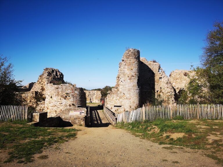
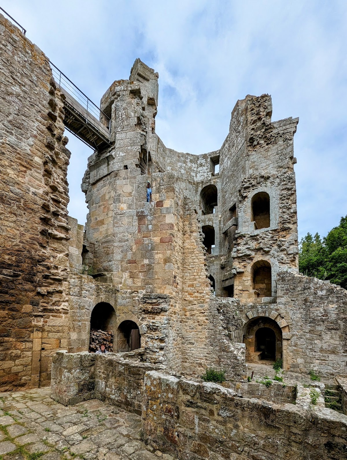
Château de la Hunaudaye survives as an irregular pentagonal fortress surrounded by broad, water-filled ditches. A drawbridge provides the approach, while five circular towers are linked by continuous curtain walls, the defensive walls joining separate towers. None of the towers functioned as a donjon, the principal fortified tower of a castle. The entire complex was built in granite, using both rubble masonry and dressed stone.
Fortifications and towers
Enclosure and defensive towers
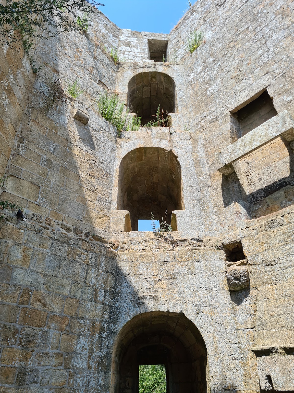
The western and southeastern corner towers originated in the thirteenth century. Three further towers were added during the rebuilding, at the southwest, northwest, and north, creating the present defensive plan. These later towers date broadly from the late fourteenth or early fifteenth century. They rise as high as four storeys, and some have walls nearly four metres thick. Stairs built into the wall thickness connect their upper levels. The newer curtain walls formed part of a coordinated plan that responded to changes in medieval warfare.
Ditches and drawbridge
The fortress is enclosed by wide water-filled ditches. The original drawbridge was destroyed during the French Revolution, and the later reconstruction did not restore its operating mechanism. The roofs lost in the same destruction were not rebuilt. Instead, the chapel tower received a reinforced-concrete covering as part of its protection.
Residential and service buildings
Western logis
Buildings for residence and service were attached to the inner faces of three sides of the enclosure, forming three wings whose remains can still be identified. Along the western curtain wall are the ruins of a logis, the residential range of a castle. It included a vaulted basement and an 18-metre-long hall with a monumental fireplace.
The ruins retain part of a winding stair with returns and a Renaissance stairway. The entrance to the latter carries elaborate sculptural decoration, including a relief of a column with an Ionic capital.
Kitchen buildings
The former kitchen area preserves a washbasin and a kitchen fireplace. A bread oven also survives among the service-building remains, helping identify the domestic functions once attached to the fortified enclosure.
Chapel tower and earlier occupation
Religious and defensive interpretations
The chapel is traditionally placed on the upper floor of the southeastern tower. Religious reliefs in the tower once supported that interpretation. The same space is now also understood as a possible dungeon, where monks may have produced the reliefs during captivity. This gives the surviving tower a contested religious and defensive interpretation.
Earlier fortifications
Excavations carried out between 1978 and 2002 suggested that an earlier motte, a raised defensive mound, may have stood within a fortified enclosure of wooden palisades and ditches. That fortification may have been extended twice, including one phase with polygonal towers. Parts of those structures may have provided the basis for the present castle before the earlier complex was possibly levelled in the fourteenth century and some elements reused.
Landscape evidence
Plant remains have helped reconstruct the landscape around the fortress through successive periods. During the Iron Age, forest dominated the environment, with alder, ash, and willow in wet ground and oak, hazel, and birch on better-drained land. Cereals, flax, and hemp appeared during the Gallo-Roman period. In the Middle Ages, woodland continued to decline while flax and hemp increased, apparently in connection with the regional textile industry. During the modern period, flax and hemp declined as meadow plants became more common, buckwheat appeared, and pine became detectable from the nineteenth century, when heathlands were developed.