Château de Guirbaden: A Medieval Hilltop Fortress in France


Site at a Glance
- Rating
- 4.6
- Popularity
- Low
- Country
- France
- Primary era
- Medieval
- External website
- Open
- Eras represented
- Medieval
- Civilizations
- Holy Roman Empire
- Site type
- Military
- Remains
- Castle
On this page13 sections
History
Château de Guirbaden, also called Girbaden, is a medieval hilltop castle near Mollkirch in France. Built in the eleventh century, it occupied a site used during the Roman period and became one of the largest castle-fortresses in Alsace by area. Its position helped protect the nearby Benedictine Abbey of Altdorf, the family monastery of the Counts of Dagsburg.
Foundation and Staufer rebuilding
A foundation tradition places the establishment of the castle in 1027 under Hugues III of Egisheim, during the rule of Ernest II, Duke of Swabia and Alsace. The castle first appears in written evidence under the name Girbadun in 1137. It was probably built under Count Hugo IX of Dagsburg-Egisheim as the successor to Burcberck, an earlier fortified site destroyed in the early eleventh century on the Purpurkopf, about 1.3 kilometres away.
Frederick I Barbarossa destroyed the castle in 1162. After a campaign against Duke Theobald I of Lorraine, his grandson Frederick II began an extensive rebuilding campaign in 1219. This work continued until 1226 and gave the complex a large, palatial character. The older eastern castle remained in the possession of the Counts of Dagsburg during this period.
In 1226, Frederick II and Henry VII transferred their share of Guirbaden to Berthold I of Teck, Bishop of Strasbourg. Berthold acquired the Dagsburg portion in 1241, bringing the entire castle under the Strasbourg bishopric, the ecclesiastical territory governed by the bishop of Strasbourg.
Episcopal lordship and destruction
The Strasbourg bishopric pledged Guirbaden to the Lords of Hohenstein in 1375. After their forcible expulsion, Bishop Ruprecht granted the castle to the Lords of Rathsamhausen in 1477. During the fourteenth and fifteenth centuries, the eastern part was strengthened with additional defensive walls and towers, while the approach was reorganized through a series of gates.
Guirbaden survived the German Peasants’ War without damage. During the Thirty Years’ War, the wider European conflict fought mainly between 1618 and 1648, Swedish forces captured and destroyed the castle in 1633 after two unsuccessful attempts. The property later passed to the Rohan family and was sold in 1790.
Ruins, protection, and conservation
The ruins received historic-monument protection in 1898 and remain privately owned. Extensive repairs and archaeological investigations took place between 1968 and 1973. During the first phase, a private owner dismantled a gate, cleared the eastern part with earthmoving machinery, and injected concrete into the palas facade facing the moat. Stone from the eastern ramparts was used to conceal the concrete. The work was abruptly halted in 1971.
Following a change of ownership in the 1990s, doors were installed to secure the keep and prevent access. Since 2015, an association devoted to saving Guirbaden has pursued conservation work. The inner castle was closed in 2016 because of the danger of collapse and falling stones, while other parts of the site remained accessible.
Tradition and religious memory
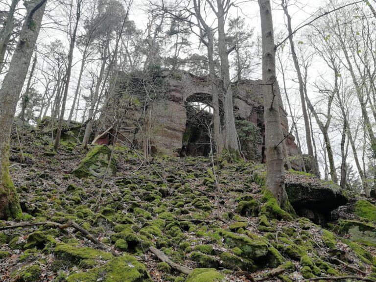
A local legend claims that crusaders returning from the eastern Mediterranean brought Knights Templar to Guirbaden, where they concealed a great treasure. The Knights Templar were a medieval military-religious order associated with protecting pilgrims and crusading. In the Guirbaden tradition, knowledge of the treasure passed through generations until two covetous twins tried to recover it. A rock then collapsed, burying them beside the supposed treasure.
The Saint Valentine Chapel remains associated with an annual pilgrimage on Whit Monday, including the blessing of animals. The chapel also served as a hermit’s retreat as late as the nineteenth century.
Remains
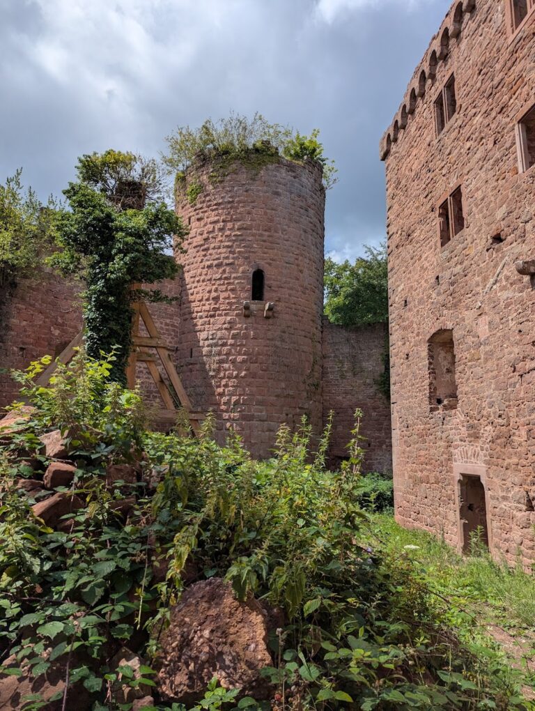
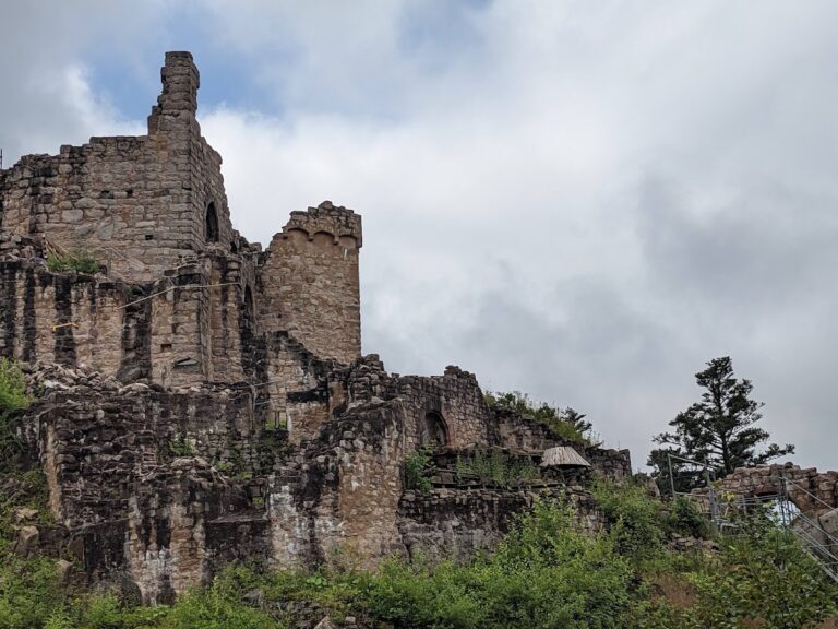
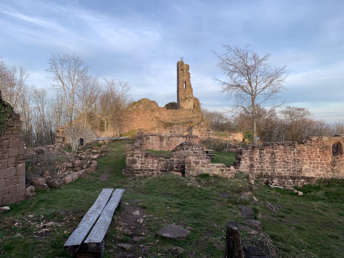
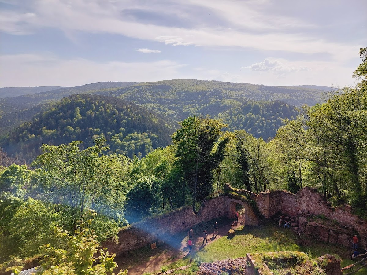
The ruins occupy a spur in the Vosges at an elevation of 565 metres, on the left bank of the Magel in the Guirbaden Forest on the Burckberg. The complex extends about 280 metres from east to west and is approximately 60 metres wide. It consists of an upper castle, a larger lower castle, defensive walls and gates, a moat, a great hall, and an outer settlement for castle retainers. Much of the surviving masonry uses bossed stone, whose projecting outer faces create a rough, rusticated surface.
Upper and lower castles
Upper castle and keep
The eastern upper castle, or citadel, is a small enclosure with a roughly polygonal, rounded plan. Its curtain wall, the defensive wall enclosing a castle, is built from rusticated bossed blocks. A later keep stands on a reddish sandstone base supported by several arches. The eastern keep occupies a rocky promontory, and a large relieving arch, which diverts masonry weight away from a weaker support, strengthens its southern side.
Lower castle and defensive approach
The lower castle extends westward and is about twice the size of the upper enclosure. A cross-wall divides it, and the western end reaches a deep neck moat, a ditch cut across the narrow approach to a fortified spur. The principal approach later came from the west through five gates, while another gate with a drawbridge stood at the eastern end. A large moat separates the western esplanade from the eastern courtyard and keep, and the southwest gate connects the courtyard with the esplanade.
Several gates, including those identified as 3, 4, 19, 21, and 22, remain relatively well preserved along the route from the entrance area to the courtyard. The outer gates were adapted for firearms and retain gun ports. The eastern gate, dismantled by a former owner in 1968, survives mainly in parts of its jambs. Vegetation covers much of the inner walls, while most exterior walls remain visible at heights of approximately one to four metres. A well survives in the courtyard.
Palas
At the western end of the lower castle stands the 33-by-11-metre palas, the principal residential and ceremonial hall of a medieval castle. The building is a comparatively well-preserved Romanesque structure, a medieval form known for sturdy masonry and rounded arches. Its southern gable originally contained four profiled window arches set between columns and topped by a rose window. The design was comparable to the palas at Wildenberg Castle in the Odenwald. After the gable collapsed before 1836, one window opening remained.
Two round-arched windows from the courtyard-facing eastern wall were removed between 1835 and 1843 and installed at the ruins of Altkeller Castle at Ottrott. The courtyard side also had a column-supported portico, of which two of the original eight columns are now held in the depot of the Frauenhaus Museum in Strasbourg. Several round-arched upper-storey windows in the western wall were blocked during later strengthening of the eastern defences. Surviving architectural details include Romano-Byzantine-style capitals.
Outer settlement
Walled settlement and Hunger Tower
Beyond the moat lies a walled settlement for castle retainers, larger in area than the main castle. It was built during Frederick II’s rebuilding phase and included a square western keep known as the Hunger Tower. The substantial tower stands at the western end of the outer settlement, while the settlement’s walls preserve the wider organization of the castle’s supporting community.
Saint Valentine Chapel
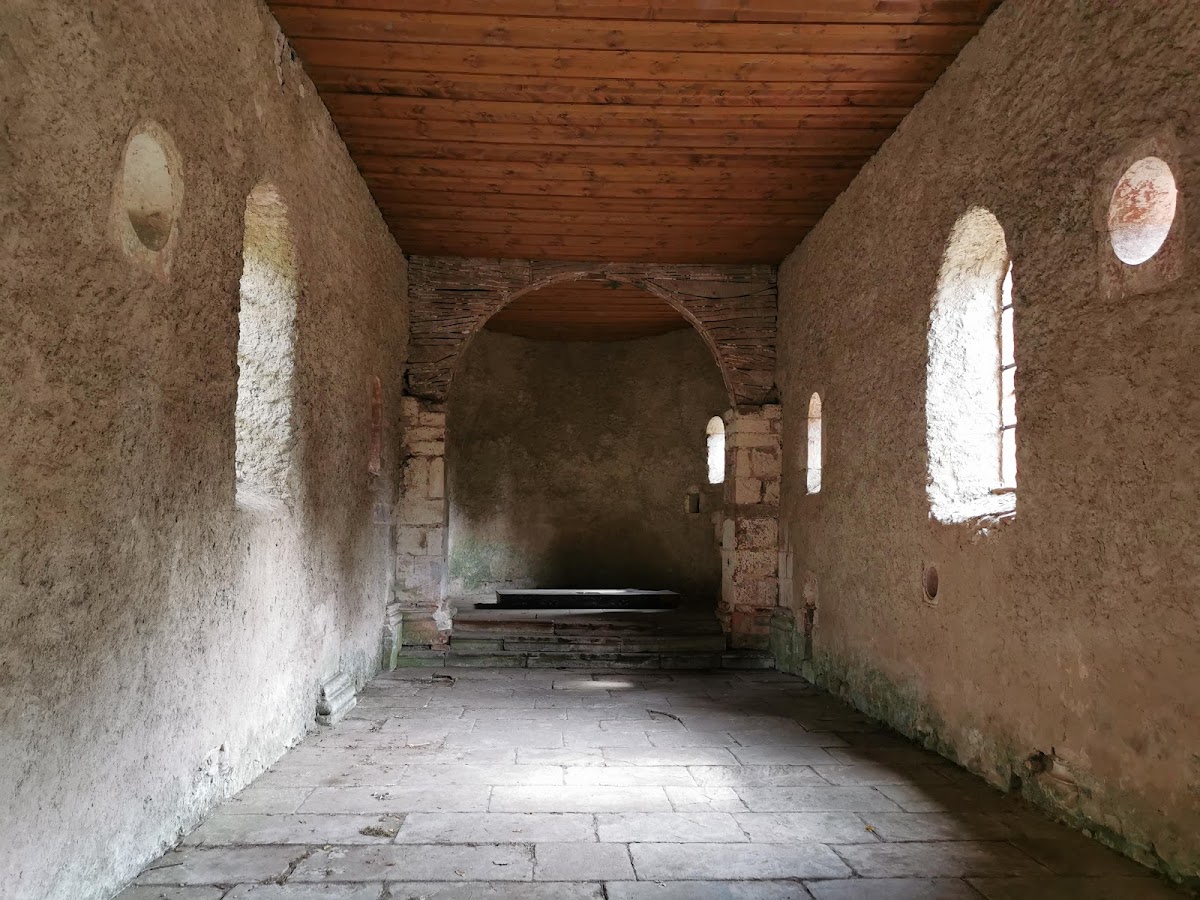
The Saint Valentine Chapel has a Romanesque core and was originally arranged as a three-aisled building. By the fourteenth century, it had been abandoned as part of the castle complex, and some of its bossed stone blocks were reused in the eastern defensive works. After a fire, the chapel was rebuilt in 1850. Its later history includes use as a hermit’s retreat and its continuing role in the Whit Monday pilgrimage.