Château d’Allègre: A Ruined Fortified Settlement in France


Site at a Glance
- Rating
- 4.6
- Popularity
- Low
- Country
- France
- Primary era
- Medieval
- External website
- Open
- Eras represented
- Medieval, Early Modern
- Civilizations
- French
- Site type
- Military
- Remains
- Fortified Town
On this page8 sections
History
Château d’Allègre is a ruined fortified settlement in Allègre-les-Fumades, France, whose first recorded mention dates to 1163. Known then as the castrum de Alegrio, it formed a castle-centered community with residences, defensive works, and spaces connected with service and production. The settlement occupied an elevated position above the middle Cèze Valley and developed through successive medieval phases.
The shared lordship
In 1163, Bernard de Ferreyroles paid homage to Bernard Pelet, Baron of Alès, in connection with the castrum. A parchment issued by Philip II of France in 1211 identified the castrum de Allegrio as lying in the Diocese of Uzès. It described the domain as a coseigneury, a lordship jointly held by several co-lords under the authority of the Bishop of Uzès.
The arrangement gave the knightly co-lords shared rights while preserving the bishop’s overarching authority. The Lord of Portes held high and low justice over the other lords. High justice covered the gravest offenses, including capital cases, while low justice concerned lesser disputes. The Lord of Portes also resided in one of the settlement’s towers.
Changes in lordship
In 1313, Guillaume de Randon, then the dominant lord of the castrum, received homage from eight co-lords: Jaussin de Naves, Pierre Jourdan, Pierre Guilhem Bérard, Raymond de Guilhefred, Guerin and Raymond d’Allègre, Raymond de Cadoine, and Bernard del Puech. In 1314, the principal share of the lordship passed from Guillaume de Randon to the Budos family. The Budos family retained it until it became extinct at the end of the seventeenth century, after which the estate passed to the Prince of Conti, a descendant of Henriette de Budos, Duchess of Montmorency.
Ruin and protection
The castrum had been in ruins since at least the seventeenth century. In 1780, the remaining Allègre estate was sold to Jacques-Marcellin-Denis de Bérard, Viscount of Montalet. Despite the ruined state of the settlement, some peasants continued to live among its remains. The ruins were finally abandoned in 1910, although the Maison Loubier remained occupied until 1906.
Château d’Allègre was listed as a French historic monument by an order dated 25 July 1997. Archaeological work brought the remains of the North Building to light in 2004, and archaeologist Sophie Aspord-Mercier prepared a general plan of the fortified settlement.
Remains
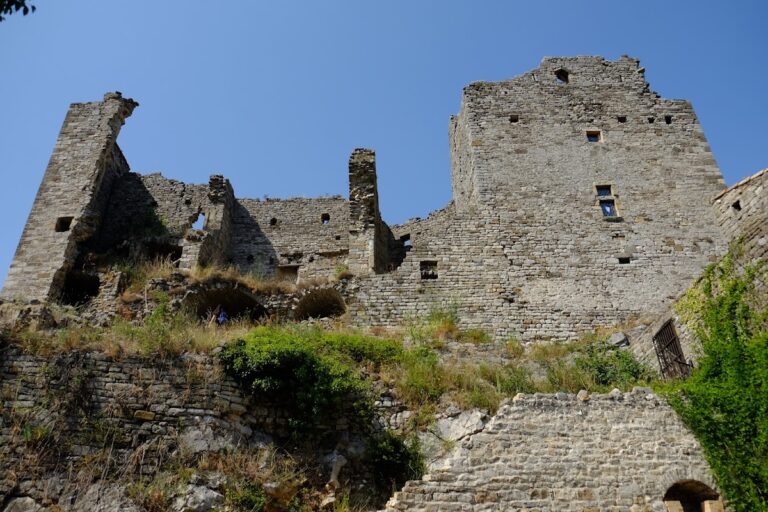
The ruined settlement occupies approximately 1.5 hectares at an elevation of 275 metres. Its position above the middle Cèze Valley gives the site broad views toward the Cévennes, Mont Bouquet, Pic Saint-Loup, Mont Mézenc, and several oppida, fortified settlements commonly associated with elevated pre-Roman or Roman-period communities. Château d’Allègre is visible from about 15 kilometres away. The surviving remains include lower defensive works, towers, houses, a chapel, curtain walls, and the large complex known as the Palatial Ensemble.
Lower enclosure and entrance
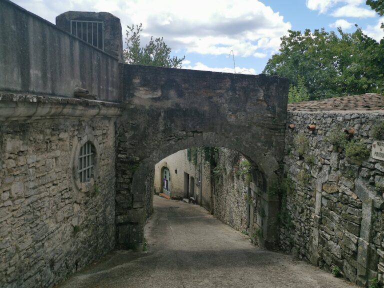
The lower enclosure survives near the Maison Loubier, a former eleventh-century tower that was altered many times and later converted into a dwelling. The entrance porch probably dates from the fourteenth or fifteenth century. Its western side adjoins an eleventh-century Romanesque chapel, a medieval building style characterized by massive construction, thick walls, and rounded arches. A curtain wall, meaning a defensive wall connecting fortified structures, rises above the chapel and dates from the fourteenth or fifteenth century.
Three openings pass through the western enclosure toward the Maison Laurent Vincent. This building is identified as the first house of the village of Allègre below the castle. One part dates to the twelfth century, while another was built in the seventeenth or eighteenth century.
Southern and eastern buildings
The partially ruined South Tower projects over the edge of the cliff. Along the southern cliff edge stands the principal fortress complex, called the Palatial Ensemble. It contained approximately fifteen rooms, including living rooms, guard rooms, service areas, production spaces, and storage areas. Construction and alteration phases extending over two centuries remain visible in the complex, while part of it is buried.
Remains of a separate South-East House survive within the settlement. At the eastern end, the East Noble House remains standing, although cracks run through the walls of its northern section.
Northern fortifications
The North Building dates to the twelfth century and consists of a square tower with an adjoining room. The North-East Tower remains standing on a rectangular plan and has notable masonry. A narrower attached structure has an irregular plan.
Between the North-East Tower and the Maison Loubier stands a blind curtain wall, a defensive wall without openings, dated to the fourteenth or fifteenth century. It incorporates a group of buildings that continued to be altered through the beginning of the twentieth century. Together, these surviving walls and structures show the successive enlargement and adaptation of the fortified settlement.
Nearby sites