Château d’Aguilar: A Medieval Frontier Fortress in France


Site at a Glance
- Rating
- 4.3
- Popularity
- Low
- Country
- France
- Primary era
- Medieval
- Eras represented
- Medieval
- Civilizations
- French
- Site type
- Military
- Remains
- Castle
On this page15 sections
History
Château d’Aguilar is a medieval hilltop fortress in France, about 2 km east of Tuchan in the Aude department. Developed by the lords of Termes and later expanded by the French crown between the twelfth and fifteenth centuries, it controlled access through the Corbières and became part of the royal frontier defenses facing Aragon and Spain.
Early possession and the lords of Termes
Aguilar belonged to the counts of Carcassonne in 1004 and passed with the territory of Peyrepertusès to the count of Besalù around 1010. In his 1021 testament, Bernat Taillefer called Aguilar a pech, meaning a mountain, on the boundary between the counties of Narbonne and Roussillon. The name may derive from the Latin aquilare, or “eagles’ lair,” although a connection with the Visigothic personal name Agila has also been proposed. Whether the site was inhabited or fortified at that time remains uncertain.
Aguilar entered the domain of the lords of Termes at an unknown date, possibly in the late eleventh century. In 1210, during the Albigensian Crusade, the military campaign waged against the Cathars and their supporters in southern France from 1209 to 1229, Simon de Montfort attacked the castle and captured its lord, Raymond de Termes. Raymond was held prisoner at Carcassonne.
After Olivier de Termes lost the castle of Termes to the king in 1228, he made Aguilar his principal residence. He is probably responsible for the castle’s central section and for the development of the fortified village on its southern side. In the summer of 1240, Aguilar served as a gathering point for knights supporting the revolt of the viscount Trencavel, whose family sought to recover its former authority in the Carcassonne region. The rebels later besieged Carcassonne, but the revolt failed.
Transfer to the French crown
Olivier de Termes submitted to the French king after the failed revolt and surrendered Aguilar and the Termenès in May 1241. The castle became a royal fortress administered by a castellan, first recorded there in 1246. About ten years later, Louis IX, king of France from 1226 to 1270, returned Aguilar and most of the Termenès to Olivier in recognition of his service in the Holy Land.
Olivier intended to leave Aguilar to the crown in his 1257 testament. He sold the castle to Louis IX during a stay in Paris in March 1262, and the royal castellan Peire de Mirepoix took possession six months later. An inventory from that period lists religious ornaments and a garrison’s weapons, including six hand crossbows, one larger crossbow mounted in a tower, 300 bolts, 11 iron helmets, and 20 shields.
A royal frontier stronghold
The Treaty of Corbeil in 1258 placed the French-Aragonese frontier south of the Corbières, near Aguilar. The castle consequently became a major position in the frontier-defense system directed from Carcassonne. It was one of the “Five Sons of Carcassonne,” alongside Termes, Quéribus, Peyrepertuse, and Puilaurens. These fortresses defended the French kingdom against Aragon and later Spain until the Treaty of the Pyrenees in 1659.
The garrison listed in 1302 consisted of a castellan, 12 sergeants, a porter, a watchman, and a chaplain. Improved defenses did not prevent a company of 300 routiers from seizing Aguilar at night in 1387 with ladders. The attackers used the castle as a base for ransoming Catalan merchants until an army sent by the king of Aragon defeated them.
Aguilar changed hands again during the conflicts between France and the Habsburg forces of Charles V. Charles captured the castle in 1525. After the failed siege of Perpignan, Spanish forces attacked it in 1542, and German troops serving Charles V captured it in 1543. Peace between Francis I and Charles V returned Aguilar to the French king in 1544. A royal garrison remained until the Treaty of the Pyrenees.
Abandonment and protection
The frontier changed after 1659, ending Aguilar’s strategic importance. The castle was abandoned and gradually became a ruin, while parts of the complex may later have been dismantled rather than repaired. The ruins and their surroundings were registered as a natural site in 1946. The fort became a French historic monument in 1949, followed by the chapel, barbican, castrum walls, quarries, and other remains in 2023. The complete group of remains was classified in 2024. In 2026, Aguilar was included in the UNESCO World Heritage serial property “Royal Capetian Fortresses of Languedoc.”
Remains
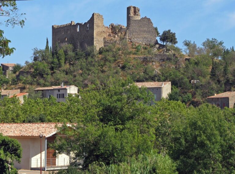
Aguilar stands at about 321 m above sea level on a hill rising 96 m above the plain of Tuchan. The position overlooks the plain and controls access into the Corbières, including routes between Narbonne and Roussillon through the Extrême pass or along the Nouvelles stream. The castle occupies the edge of a small rocky plateau and is arranged as an inner enclosure and a larger outer enclosure, with the defended space between them known as the lices.
Enclosures and defensive works
Inner enclosure
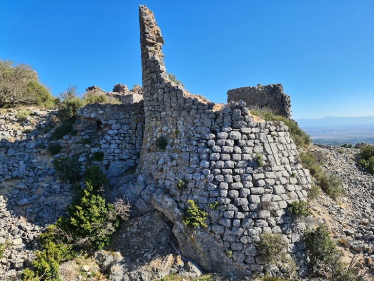
The inner enclosure represents the feudal castle associated with the lords of Termes. Its residential building is essentially twelfth-century, and the enclosure also contains a cistern. The earliest fortification took the form of an irregular polygonal wall built around the middle of the twelfth century. Earlier masonry consists largely of rough or unworked stone, with larger dressed blocks concentrated around corners and entrances.
Outer enclosure
Royal engineers constructed the outer enclosure from 1262 to the beginning of the fourteenth century. Its pentagonal or polygonal plan directs a projecting point toward the side most favorable to an attack. Six semicircular towers strengthen the enclosure, each equipped with loopholes for archers. The masonry uses better-cut, smoothed stone laid in horizontal courses, with rubble packed between the outer and inner faces of the walls.
The two enclosures are separated by the lices, an open or passage-like defended area. The surviving complex also includes sections of curtain walls, fragments of towers, arrow slits, a barbican protecting an entrance, and vaulted spaces giving access to a basement. Together, these features show the successive expansion of the original feudal stronghold into a royal fortress.
Southern slope and fortified settlement
Chapel of Sainte-Anne
On the southern slope, in front of the main entrance, stand the remains of the small Romanesque Chapel of Sainte-Anne. Its surviving fabric forms part of the group of structures associated with the castle and the settlement below it.
Village defenses
Parts of the walls that protected the fortified village survive on the southern slope. The outer works were partly built over this settlement, which disappeared during the fourteenth century. The chapel and village defenses therefore occupy the lower approach to the main castle rather than the central residential enclosure.
Later alterations and surviving fabric
Fifteenth-century works
Changes made during the fifteenth century are represented by surviving casemates with sloping vaults and by a square tower adjoining the northern side of the castle. A later rectangular tower was also added to the enclosure. These works altered the earlier defensive arrangement as military requirements changed.
Central buildings and masonry remains
The buildings grouped in the center of the second enclosure survive in heavily ruined form. Round-arched vaulting, basement access, fragments of towers, arrow slits, and sections of curtain wall remain among the visible masonry. Quarries associated with the complex are also part of the surviving archaeological landscape, while the castle as a whole remains a ruin.
Nearby sites