Cesvaine Castle: An Episcopal Road-Control and Economic Center in Latvia


Site at a Glance
- Rating
- 4.6
- Popularity
- Medium
- Country
- Latvia
- Primary era
- Medieval
- External website
- Open
- Eras represented
- Medieval, Early Modern
- Civilizations
- Holy Roman Empire
- Site type
- Domestic
- Remains
- Castle
On this page11 sections
History
Cesvaine Castle in Latvia was a medieval episcopal stronghold and administrative center of the Archbishopric of Riga, serving road-control and economic functions near the important Koknese–Alūksne route. It stood in the archbishopric’s eastern territories beside the Sūla River, where an earlier Latgalian settlement and wooden stronghold had occupied the opposite side of the valley.
From Jersika to the Archbishopric of Riga
Cesvaine was recorded in 1209 as urbs Zcessowe and had previously belonged to the Principality of Jersika. After the territory came under the authority of the Bishop of Riga, it was returned as a fief to Vsevolod, the ruler of Jersika. In 1213, a wooden Latgalian hillfort at Cesvaine was mentioned on the left bank of the Sūla River.
In 1224, Bishop Albert granted Cesvaine’s revenues to the knight Konrad von Uexküll. The fief was also connected with Konrad’s acquisition of part of the former Jersika realm through his marriage to Vsevolod’s daughter. The settlement therefore became part of the feudal and ecclesiastical system that was developing across the region.
The stone castle and episcopal administration
The exact date when the stone castle was built remains uncertain. The years 1390 and 1399 have traditionally been associated with its construction, but a stone castle is mentioned in writing by 1410, and the castle and its parish are explicitly recorded in 1461. By around 1420, the stone stronghold had replaced the earlier wooden one, while a settlement had developed beside it.
Cesvaine served the Archbishopric of Riga, a medieval ecclesiastical state ruled by the archbishop of Riga. Its castles functioned as administrative, economic, and military centers as well as residences. In 1456, the Bērzaune parish was separated from Cesvaine and placed under the Tiesenhausen vassal family, with Bērzaune Castle becoming its administrative center.
Wars and changing rulers
Cesvaine was repeatedly drawn into conflicts between the Archbishopric of Riga, the Livonian Order, Russia, Poland–Lithuania, and Sweden. The Livonian Order, a military religious order that controlled territories and castles in medieval Livonia, captured the castle in 1479 under Landmeister Bernhard von der Borch. Archbishop Michael Hildebrand recovered it in 1486. Russian forces attacked Cesvaine in 1478 and 1481, as part of wider raids through Livonia.
A destructive attack led by the Lithuanian Grand Duke Kęstutis in 1375 had already affected Cesvaine and the surrounding lands and castles. Later, at the beginning of the Livonian War, a sixteenth-century conflict over Livonia involving Russia, Poland–Lithuania, Sweden, and local Livonian powers, Russian forces attacked the region in 1559 and 1560.
On 18 February 1559, an army of approximately 13,000 Russian troops defeated several hundred archiepiscopal defenders between Cesvaine and Gulbene. The fighting killed 110 archiepiscopal vassals and soldiers. The attackers plundered and burned the surrounding area but failed to take the castle. Its defense was organized by a priest named Christian with help from local inhabitants.
Cesvaine passed to Polish–Lithuanian rule late in 1559. An attempted Russian assault in early 1560 also failed after the defenders opened fire and killed six attackers. The Russians abandoned the attack and limited their actions to plundering the surrounding area. Around 1572, the Cesvaine estates and town were granted to the nobleman Johann Taube.
On 21 August 1577, forces of Ivan the Terrible, the commonly used English name for the Russian tsar Ivan IV, captured Cesvaine after prolonged resistance. Approximately 1,500 defenders were killed, members of the local nobility were executed, and the castle was probably partly destroyed. The settlement was renamed Chistvin.
Poland–Lithuania regained Cesvaine in 1582 after Russia’s defeat in Livonia. The settlement then contained about 80 houses, while approximately 100 farmsteads belonged to the castle estate. The Treaty of Jam Zapolski, concluded that year, referred to Cesvaine as the citadel of its district.
Destruction and later transformation
During the Polish–Swedish War, the castle was captured and severely damaged in 1625. It may still have been usable afterward, since a Swedish inspection in 1633 described its fortifications as relatively strong. Its final destruction and abandonment are uncertain. It is generally believed to have been thoroughly destroyed during the Russo–Swedish War in 1656, although destruction during the Great Northern War is also possible.
The Great Northern War brought renewed devastation to Cesvaine and was accompanied by a destructive plague epidemic. A view from 1661 shows a high main castle and a lower outer bailey, with the main castle’s walls already substantially damaged. In 1700, during the conflict, the local pastor reported fear, the flight of peasants, and their refusal to take part in repairs to the castle’s fortifications. The settlement was subsequently devastated again.
Extensive ruins covered a large area by 1782. A local tradition associated with a discovery in 1778 held that a maiden had been walled into the castle during its construction as a protective sacrifice. Human remains and a shirt fastening were reportedly found behind fallen masonry, and the fastening is represented on the modern Cesvaine coat of arms.
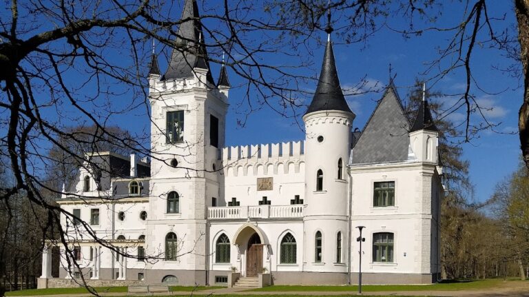
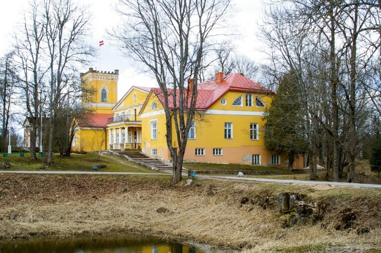
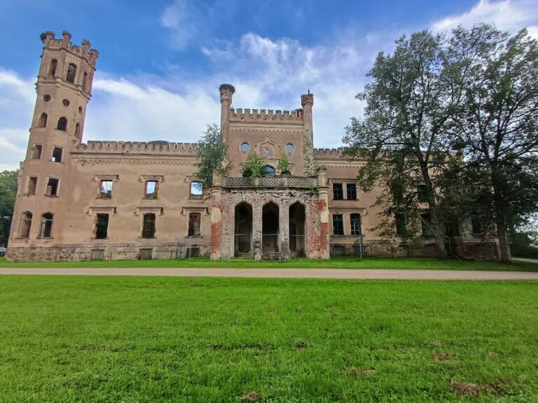
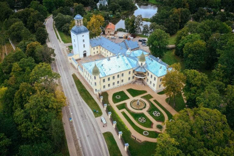
Between 1890 and 1897, Adolf Gerhard Baron von Wulff built the present Cesvaine manor hunting castle on the medieval site. Medieval ruins were dismantled for building material, and the earlier castle was almost entirely demolished. Archaeological excavations directed by Ieva Ose took place beside the surviving castle walls from 2001 to 2003. A fire in the manor castle during the winter of 2002 destroyed its second floor and roofs. The building was later partly repaired, although its central section remained roofless in September 2013.
Remains
The medieval castle occupied a high plateau about 160 metres above sea level beside the Sūla River, in a strongly undulating landscape. The river valley bordered the site to the north and west, reaching approximately 50 metres in width and about 20 metres in depth, while the Sūla itself is described as about 3 metres wide. A former Latgalian settlement stood on another plateau across the valley, and a medieval settlement probably also extended south of the castle.
Natural and artificial defenses
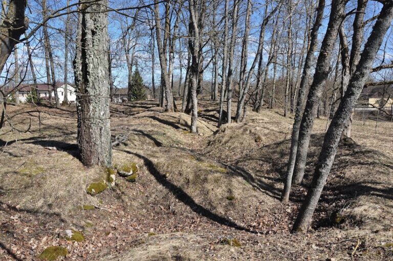
The site’s position provided steep natural defenses along the northern and western edges. Two fishponds with steep banks protected the eastern side, while a manually excavated ditch defended the south. The ditch may formerly have been connected either to a stream or to the fishponds. Two ponds still border the castle mound on the east, and a section of the southern ditch remains visible at the southwestern edge.
Fortified complex
Main castle
A seventeenth-century plan shows a regularly arranged enclosed main castle to the south, measuring approximately 70 by 75 metres in a rectangular or nearly square outline. Four attached wings surrounded a central courtyard, although the precise internal arrangement is uncertain. The layout followed a convent-building or castle-type plan, a fortified arrangement in which residential or administrative wings enclose a central courtyard. A tower above the principal entrance appears to have been a characteristic episcopal feature. A village church was reportedly located within the castle.
The main castle was originally accessible only from the outer-bailey side, through a gate in the middle of its northern wall. The southern opening shown on the seventeenth-century plan was secondary and was cut through the wall later, probably when a road was built across the castle grounds. Most of the main castle now lies beneath the forecourt and square of the present manor hunting castle, whose building occupies much of the former castle area.
Outer bailey
North of the main castle lay a large rectangular outer bailey, a separately enclosed defensive area adjoining the principal stronghold. It covered approximately 70 by 90 metres. Its principal entrance stood in the southwestern corner within a semicircular gate tower, and the approach passed through three separately lockable gates.
The outer-bailey walls were approximately 1.5 metres thick near the gate tower. During the sixteenth century, low semicircular bastion towers were added at the two northern corners. These projecting defensive towers were designed to support firearms and cannon along the walls, adapting the older fortifications to changing methods of warfare.
Surviving medieval fabric
The principal surviving medieval remains are the foundations of the outer bailey’s fieldstone western wall. They extend for approximately 50 metres, measure about 1.5 metres in width, and stand at less than 1 metre high. At the southern end, the ruins of the semicircular gate tower survive to a height of approximately 1 to 2 metres.
The western wall and gate-tower ruins lie beside the western wing of the present manor hunting castle. Together with the eastern ponds and the visible section of the southern ditch, they preserve parts of the medieval enclosure and its defensive setting. Excavations beside the surviving walls in 2001–2003 further examined the castle site before and after the fire that damaged the later manor building.
Nearby sites