Castrum Sablonetum: A Roman Fort near Ellingen, Germany
Site at a Glance
- Popularity
- Low
- Country
- Germany
- Primary era
- Classical
- Eras represented
- Classical
- Civilizations
- Roman
- Site type
- Military
- Remains
- Fort
On this page12 sections
History
Foundation and early occupation
Castrum Sablonetum, also called the Ellingen fort, was a Roman military fort near Ellingen in Germany, built around AD 120 during the early reign of Emperor Hadrian (AD 117 to 138). It formed part of the final development of the Raetian Limes, Rome’s frontier system in the province of Raetia. Occupation began around AD 120, with an estimated margin of five years, and continued until about AD 233. The fort’s ancient name was Castellum Sablonetum, approximately meaning “camp by the sand.”
The first fort was built from timber and earth. Tree-ring dating of wood from Ellingen produced dates of AD 126 and AD 145, although neither can be linked to a particular building event.
Stone rebuilding and the garrison
A major rebuilding took place around AD 182, when the fort received a stone wall and its interior was extensively redeveloped. An inscription above a gate commemorated this work and gave the fort’s ancient name. It names Quintus Spicius Cerialis, the governor who administered Raetia for the emperor and could also exercise military authority. About a year earlier, shortly after taking office, he had arranged for troops from Legion III Italica, based at Regensburg, to rebuild the timber-and-earth fort at Böhming in stone. After Emperor Commodus died in AD 192, his name was erased from the Ellingen inscription as part of a formal condemnation of his memory.
The fort’s garrison is uncertain. Its reduced headquarters has led to the suggestion that it held a detachment from a larger auxiliary unit, meaning troops serving Rome outside the legions. Such a detachment may have come from Theilenhofen or Weißenburg. Another possibility is that the Pedites singulares, infantry attached to the governor’s personal escort and named in the inscription, occupied the fort. A further proposal is that two infantry groups served there with cavalry support.
Abandonment and modern investigation
The fort was probably evacuated during the Alamannic wars, conflicts between Rome and a confederation of Germanic peoples, and had been abandoned by about AD 233 at the latest. Its departure may have been organized.
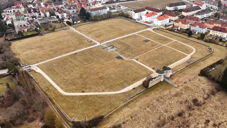
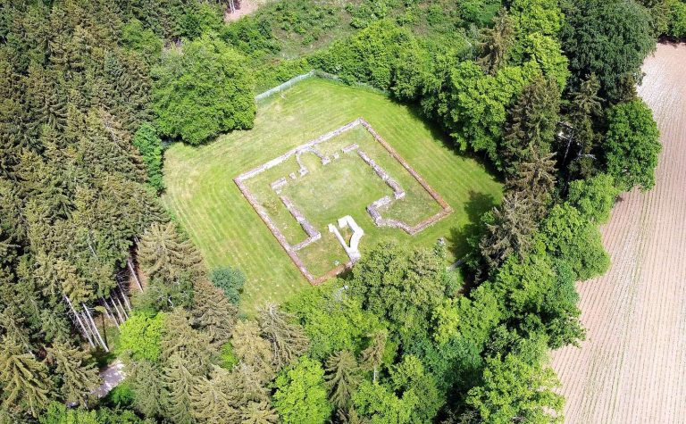
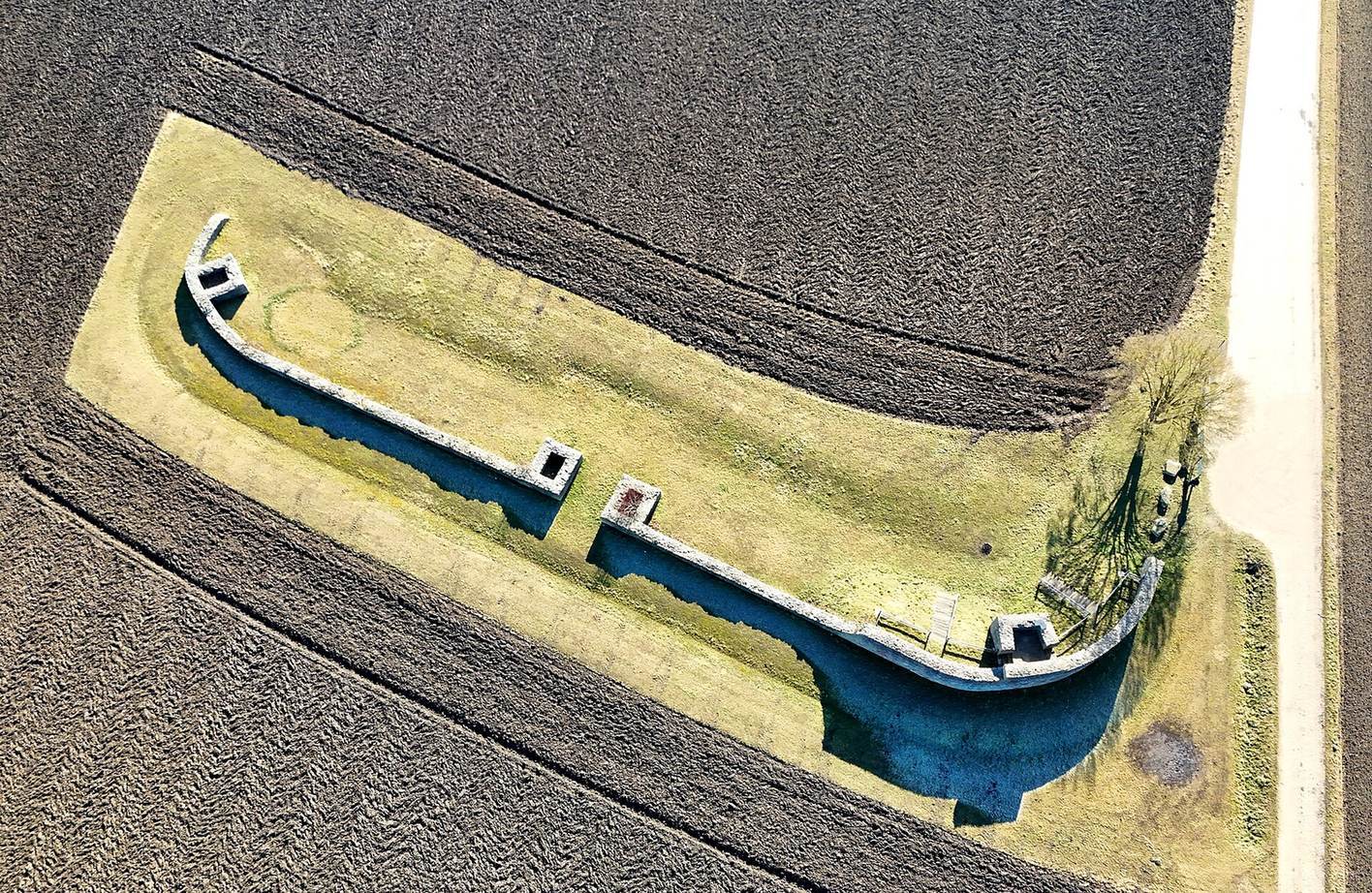
A field called In der Burg, meaning “in the fort,” may reflect continuing local awareness of an earlier stronghold. After general and frontier researcher Karl von Popp drew attention to the name, pharmacist and field commissioner Wilhelm Kohl discovered the fort and began its first investigation in 1895. Extensive excavations followed during land consolidation in 1980 to 1982, examining almost the entire fort and large parts of its associated civilian settlement. A section of the northern frontage was then partly reconstructed.
Since 2005, Castrum Sablonetum has belonged to the UNESCO World Heritage property of the Upper German-Raetian Limes. It is also protected as a registered archaeological monument under Bavarian law.
Remains
Setting and frontier connections
The fort stood on a plateau at roughly 450 metres elevation, about 700 metres east of Ellingen. It lay approximately 1.8 kilometres south of the Limes and nearly four kilometres north of the larger military base at Weißenburg-Biriciana. The position did not allow direct oversight of the lower frontier installations. Visual contact was possible with watchtower Wp 14/33 to the northeast and with towers northwest of the Limes crossing at the Swabian Rezat. The reason for the fort’s topographically inconvenient position remains unexplained. Other nearby forts included Theilenhofen and the Second Ellingen Roman Camp to the west, Oberhochstatt to the southeast, Weißenburg to the south, and the smaller forward fort at Gündersbach to the northwest.
Enclosure and internal roads
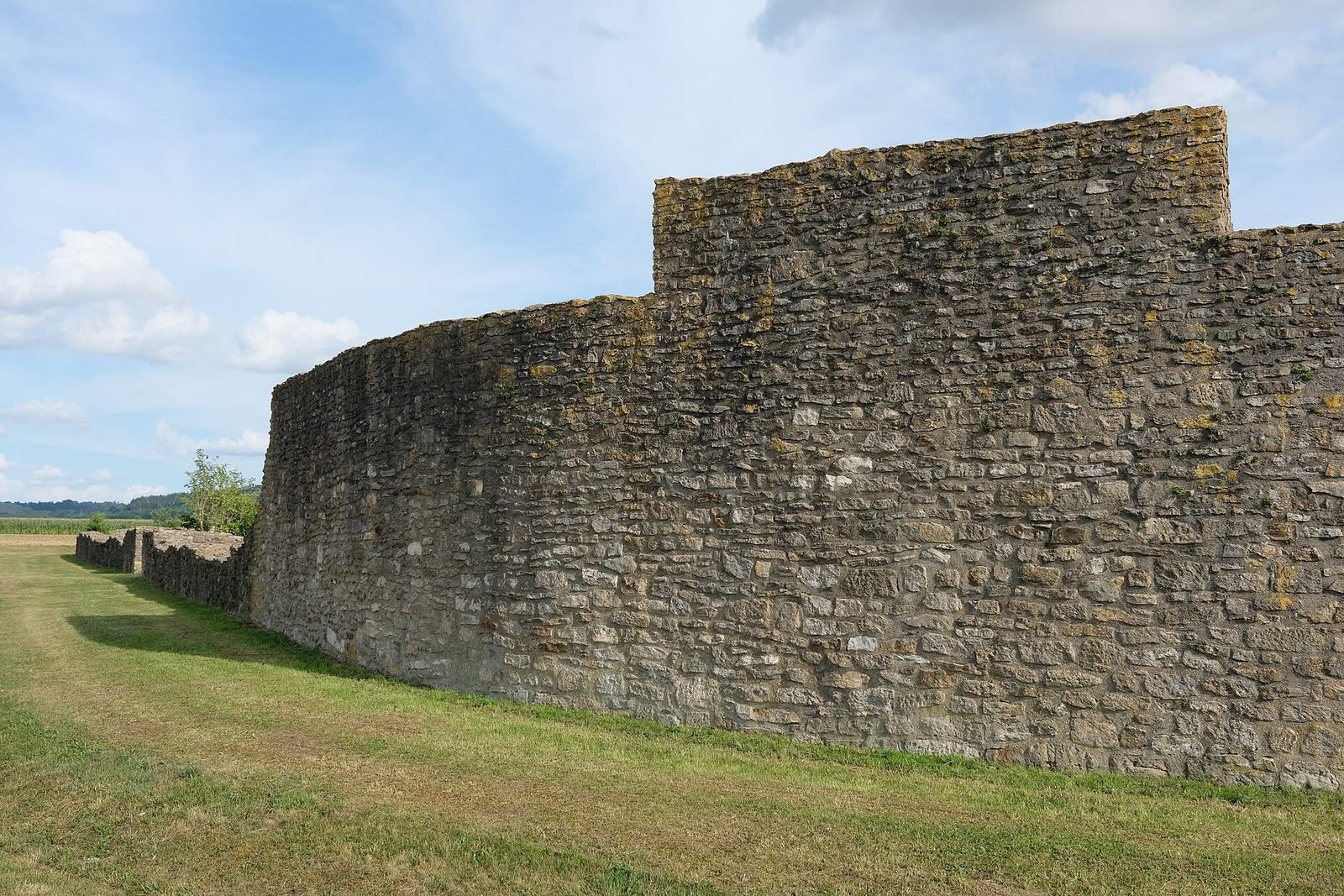
The fort covered about 0.72 hectares and measured approximately 90 by 80 metres. In its final phase, a stone wall with rounded corners enclosed the site. Simple towers stood at the corners, while the north and south gates had paired towers. A single V-shaped ditch, typically five to six metres wide and about two metres deep, ran around the wall. An earthen ramp helped steady the wall and provided a walkway along its top. Inside, gravel-surfaced roads crossed at right angles. The main road ran north to south between the two gates. In plan and size, the fort resembles those at Böhming and Halheim.
Interior structures
Headquarters
A building interrupted the main road between the gates. It has been interpreted as a reduced headquarters, perhaps containing only a shrine for the military standards.
Barracks
A large building occupied much of the eastern half of the fort and contained a double barrack with 24 small living groups, each intended for eight soldiers. Two buildings in the northwest and northeast may also have been barracks, together providing ten more such groups. This arrangement could have housed more than 260 soldiers.
Workshops and other facilities
Buildings in the southern part of the fort probably served as workshops. The larger structure in the southwest corner may have been the commander’s residence. Massive foundations west of the headquarters appear to belong to a granary. A military hospital has also been proposed, though its identification is uncertain. At least five wells, and possibly six, supplied drinking water.
Settlement and finds
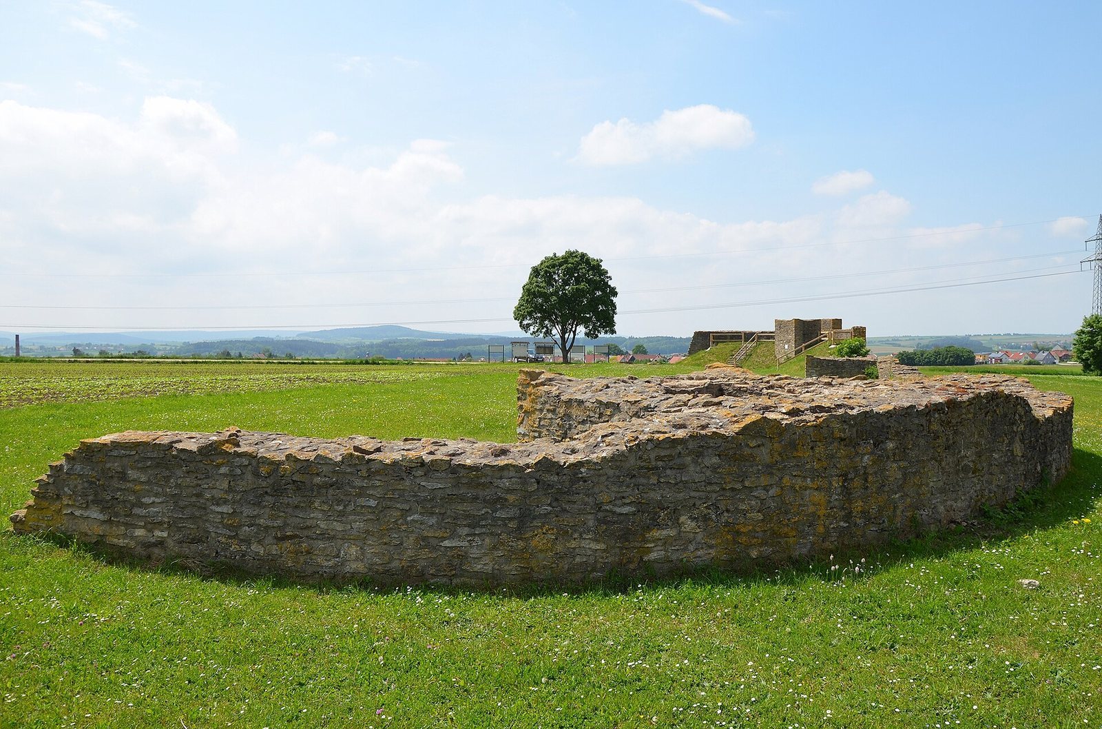
The civilian settlement associated with the fort extended east of its walls and included a small bathhouse. The partially reconstructed building inscription and the extensive finds from the excavations are held at the Römermuseum Weißenburg. The reconstructed section of the fort’s northern frontage includes a gate and corner towers.