Castrum Iciniacum: A Roman Frontier Fort in Germany
Site at a Glance
- Popularity
- Low
- Country
- Germany
- Primary era
- Classical
- Eras represented
- Classical
- Civilizations
- Roman
- Site type
- Military
- Remains
- Fort
On this page18 sections
History
Castrum Iciniacum was a Roman auxiliary fort near Theilenhofen in Bavaria, Germany. Its stone fort was probably built around AD 126 under Emperor Hadrian, following an earlier timber-and-earth camp that likely began around AD 100. The fort guarded the Raetian frontier, part of the Roman Limes, the empire’s frontier system.
Foundation and garrison
The earliest camp was lightly defended with timber and earth. Its foundation is usually placed around AD 100, although a later proposal dates it to after AD 100/101. The stone fort followed, with its approximate date inferred from timber associated with the first military bath.
The garrison was the Cohors III Bracaraugustanorum, or Third Cohort of Bracaraugustans, an auxiliary regiment recruited at Braga in northern Portugal. It combined infantry with cavalry and is estimated to have included about 480 foot soldiers and 128 mounted troops. The cohort was at Iciniacum by the first half of Emperor Antoninus Pius’s reign, from AD 138 to 161, and remained associated with the fort until its end. Its assignments between Raetia and other provinces are not fully clear.
Military diplomas, certificates recording privileges granted to auxiliary soldiers, provide clues to the unit’s service. Diplomas dated to AD 116 describe the cohort as including archers. Another, found at Nördlingen and dated to AD 156, may indicate that a soldier joined the unit at Theilenhofen around AD 130/131.
Settlement and the end of the frontier post
A civilian settlement grew alongside the fort. One building there was destroyed by fire after AD 189, or possibly during the third century. A theatre-like structure and a large square may have been temporary works for an important occasion. A visit by Emperor Caracalla in AD 213 is one possible explanation, but it is not confirmed. The name Iciniacum appears on the Tabula Peutingeriana, a medieval copy of a Roman road map.
The fort burned and is thought to have fallen during the collapse of the Raetian frontier in the mid-250s, conventionally dated to about AD 254. A further known military diploma, from Regensburg-Kumpfmühl and dated to AD 266, still names the cohort; what happened to it afterward is unknown. For a time, the timber-and-earth camp may have formed part of the same complex as the stone fort. After the camp was abandoned, its ground was probably taken into the expanding settlement.
Rediscovery and investigation
Local knowledge of the ruins persisted for centuries. A parish description from the seventeenth century mentions substantial remains, while accounts from the eighteenth century refer to Roman burials in the area. As cultivation spread, masonry was probably dismantled. By 1820 the fort ground had been levelled into fields, and the military bath was noted under the name “sweat bath.” The historian Andreas Buchner first proposed identifying Theilenhofen with Iciniacum, then withdrew the idea; an 1832 account revived it.
Heinrich Eidam examined the fort from 1879 to 1887, exposing much of its west and east walls, part of the north wall, and a tower beside the north gate. A tile stamped with the cohort’s abbreviation helped confirm the presence of a fort. Eidam continued work for the Reich Limes Commission, the German organization established to investigate and document the Roman frontier, from 1892 to 1895. Farmers also excavated sections of the defences.
Investigations of the bath in 1968–1970 led to its conservation and partial reconstruction. Land consolidation in 1969–1970 rearranged parcels to safeguard buried remains and support further research. Aerial archaeology revealed the timber-and-earth camp in 1976. Geophysical surveys of the fort in 2007–2008 and of the settlement in 2010–2011 helped identify structures interpreted tentatively as a theatre and forum. The fort and associated installations belong to the Upper German-Raetian Limes, a UNESCO World Heritage property since 2005, and are protected under Bavarian archaeological law.
Remains
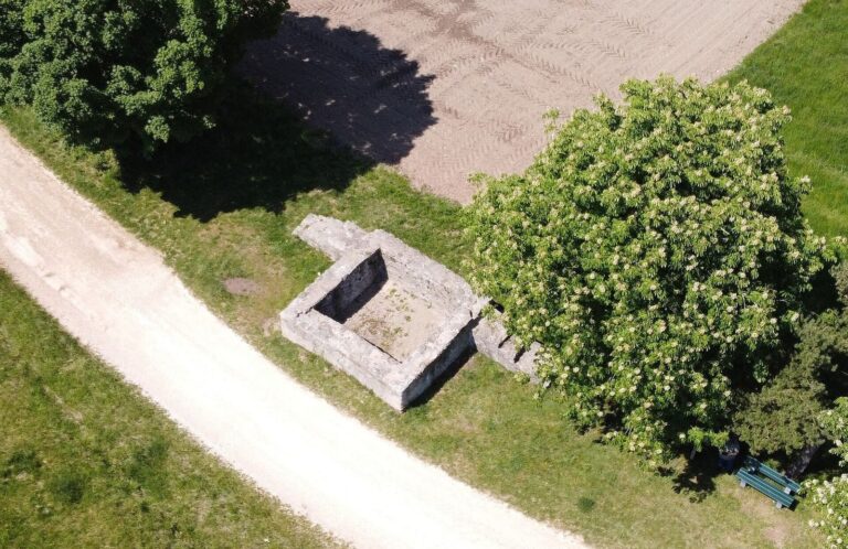
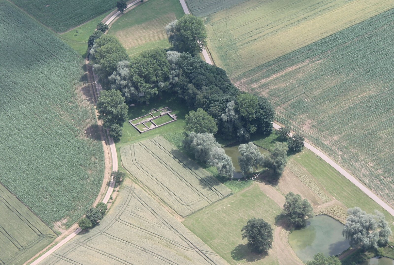
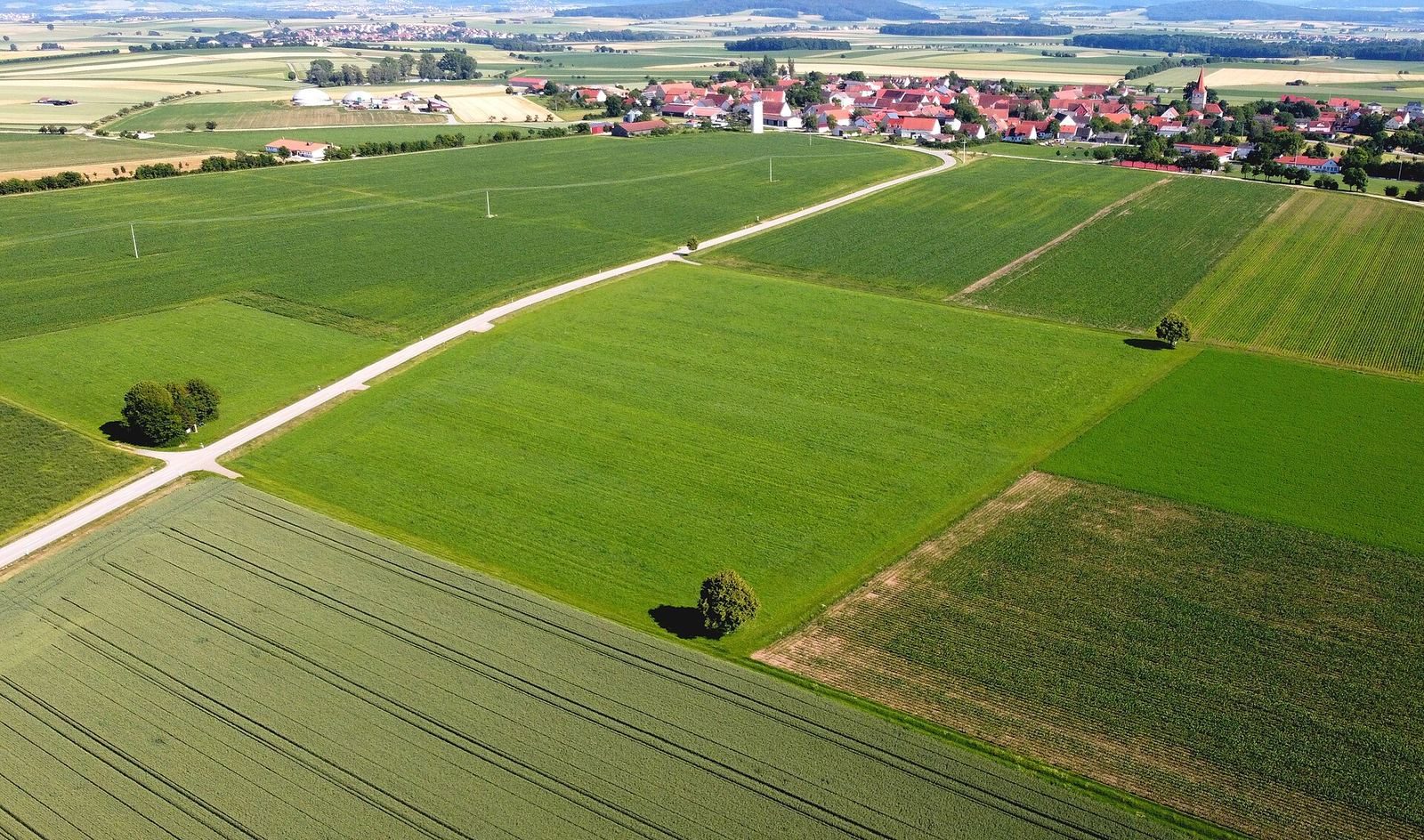
The complex occupied a shallow depression on a plateau about 90 metres above the Altmühl valley, near the upper end of the Echerbach valley. The fort stood at an elevation of about 499 metres, roughly 2.2 kilometres from the frontier wall. Its stone enclosure lay north of an east–west-oriented timber-and-earth camp; the military bath stood farther west, beside a pond in the Echerbach valley. The associated settlement extended south from the fort. The fort land is now cultivated, with field paths following its defences and trees marking its corners.
Military installations
Stone fort
The fort formed a nearly north–south rectangle measuring 196 by 144 metres, an area of about 2.8 hectares. Its northern front faced the frontier. A 1.5-metre-thick wall enclosed the interior, with towers at the corners and two additional towers along the rear section. Four gates served the fort. The south gate had a single entrance that curved inward in a semicircular form.
Three pointed ditches surrounded the enclosure. The two inner ditches ended before the east and west gates, while wooden bridges crossed the other defensive ditches. At the south gate, excavators found remains of a plank bridge over the innermost ditch. From a fort tower, signals could be seen from an estimated nine or ten frontier watchtowers, and the surrounding land lay within a broad field of view.
Headquarters and hall
The fort’s main streets met at its headquarters building, which measured about 40 by 40 metres. A multipurpose hall, approximately 60 by 19 metres, stood in front of it across the east–west cross street. Fragments of a bronze statue found in the hall date to the first half of the third century and may come from an imperial statue once displayed there.
Granary and possible command buildings
A granary with projecting wall supports stood in the rear of the fort. Structures beside it may have served as workshops, an infirmary, or both. West of the headquarters, a larger building of about 41 by 32 metres included a small heated room; Eidam interpreted it as the commander’s residence. Survey results also suggest a possible residence east of the headquarters, in buildings measuring about 26 by 32 metres that may have included an enclosed courtyard and substantial cellars.
Barracks and stables
Geophysical surveys indicate timber barracks and stables in the forward part of the fort. Two double barracks, each about 60 metres long, flanked the northward road and housed horses and riders. Their end buildings contained quarters for a centurion and may also have held rooms for other officers and staff. Smaller, compartmented barracks lay farther south, with two similar barracks in the rear area.
Roads and drainage
The principal streets were paved. A drain began just south of the west gate and ran southwest at an angle of about 70 degrees beneath the fort ditches. After roughly 140 metres it curved around the southeast corner of the timber-and-earth camp, continued west beside the camp’s southern side, and reached the military bath.
Timber-and-earth camp
The camp lay immediately west of the stone fort. It had rounded corners and an east–west orientation, unlike the north–south stone enclosure. Aerial identification gives its dimensions as about 155 by 130 metres, while measurements between ditch centres give 160 by 142 metres. Its main road ran from west to east, then turned northeast beyond the east gate toward the stone fort’s west gate. Surveyed buildings, particularly in the camp’s eastern part, may have been barracks. A second road from the stone fort’s west gate curved around the camp’s northeast corner and crossed its northwestern ditch, indicating a route from a later phase.
Military bath
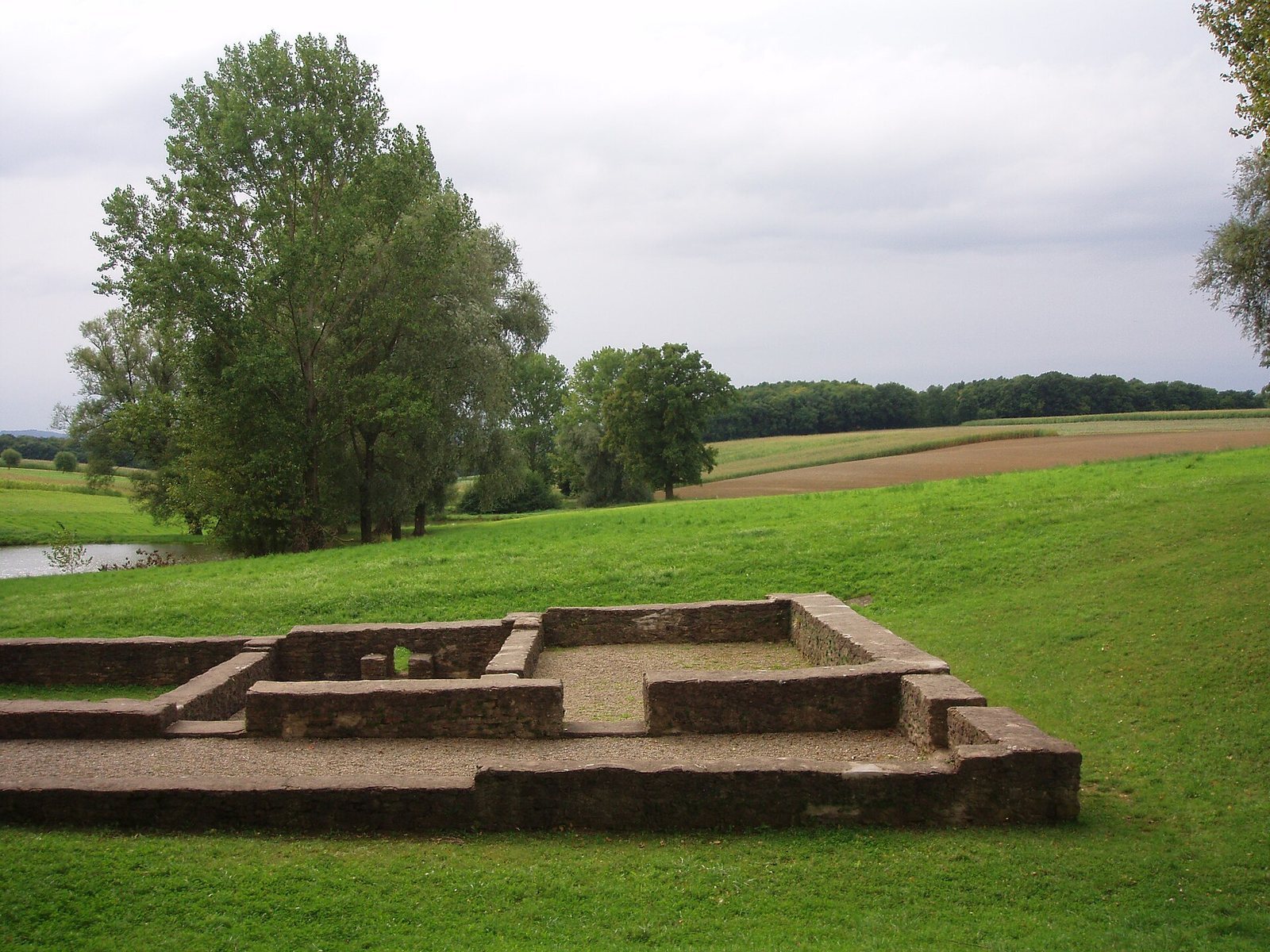
The bath stood about 250 metres west of the fort. Its distance from the garrison may reflect local water conditions. Excavations revealed two building phases, and the surviving layout represents a Roman-style row bath with seven identifiable rooms. The visible remains measure about 16.5 by 28.5 metres. Entry was from the north through a corridor that also served as a changing room, and the floors were paved with slabs of Solnhofen limestone.
A dedication to Fortuna Augusta, the Roman goddess of fortune associated with imperial worship, was found in the changing room in 1970. Dated to AD 140–144, it records that the cohort, under its commander Vetellius, fulfilled a vow to the goddess. Stone and brick supports from the bath’s underfloor heating were moved to protect them from weathering and vandalism. They were assembled in a partial reconstruction at Grünwald Castle Museum to demonstrate how the heating worked.
Settlement and archaeological finds
Settlement structures
Geophysical survey traced the settlement along the road leading south from the fort gate toward modern Theilenhofen. It revealed a theatre-like structure about 75 metres across and a large square measuring approximately 54 by 124 metres. These may have been a theatre and a forum, a central public square for civic life, though both interpretations remain tentative and the structures may have been temporary.
Helmets
Helmets recovered in 1974 from a settlement building include a rare, richly decorated cavalry helmet without a face mask. Its thin construction suggests use in cavalry exercises or parades rather than combat. An iron infantry helmet of the Weisenau type has a delicate cross-shaped reinforcement on its crown and dates to the first half of the second century. A cavalry helmet of the Koblenz-Bubenheim/Weiler type, rooted in Hellenistic tradition, was found with it.
A decorated cheek-piece from another cavalry helmet bears a relief of a standing Bacchant, a follower of Bacchus, holding a bowl and staff. It was nearly complete when found and is now in poorer condition in the Gunzenhausen local history museum.
Other military equipment
Other finds include horse-harness fittings, among them crescent-shaped pendants, as well as scale-armour plates belonging to a soldier and pegs from marching tents. Together with the helmets, these objects reflect the equipment used by soldiers and cavalry at the fort.
Pottery, coins, and a bronze handle
Fine tableware from southern Gaul forms part of the pottery finds. About half of the recorded pieces came from Banassac, while vessels from La Graufesenque were mainly made by potters named Mercato and Mascuus. Silver and bronze coins found on the Weil field in 1837 were attributed to a range of Roman rulers, including Agrippa, Nero, Trajan, Hadrian, Antoninus Pius, Septimius Severus, Caracalla, and Valerian.
A bronze jug handle donated to the Royal Antiquarium in 1840 was made to attach to a vessel that is now missing. Bird-shaped foreparts joined the handle to the vessel, and its attachment carries a Medusa head, a mythological image used as a protective motif, with eyes inlaid in silver. The handle is now held by the State Collections of Antiquities in Munich. Finds from Theilenhofen are also held in museums in Gunzenhausen, Grünwald, and Nuremberg.