Castro of Zambujal: A Fortified Chalcolithic Settlement in Portugal
Site at a Glance
- Rating
- 4.6
- Popularity
- Low
- Country
- Portugal
- Primary era
- Stone Age
- Eras represented
- Stone Age
- Civilizations
- Unclassified
- Site type
- Military
- Remains
- Fortified Town
On this page8 sections
History
The Castro of Zambujal is a fortified Chalcolithic settlement in Portugal, near Torres Vedras, built by communities of the Copper Age during the early third millennium BC. The Chalcolithic was a period when stone tools remained in use while copper metallurgy became increasingly widespread. Zambujal is associated with some of the earliest copper working identified on the Iberian Peninsula and developed into a substantial centre of farming, craft production, and exchange. Occupation continued until about 1700 BC, with isolated finds suggesting limited activity during the transition to the Iron Age and renewed use in the medieval period.
Early settlement and exchange
Zambujal’s inhabitants practiced intensive agriculture and took part in exchange networks that moved gold, copper, amphibolite, and ivory. Copper working continued inside the enclosure throughout the settlement’s occupation. Fish and shellfish remains show that the community also used the nearby marine environment. During the third millennium BC, the settlement stood about one kilometre from a marine inlet in the floodplain of the Sizandro River and the Ribeira de Pedrulhos. The inlet supported fishing and shellfish gathering, helped transport materials, and provided a setting for exchange. Its later silting may have contributed to the abandonment of Zambujal.
The settlement passed through two broad building phases. The earlier phase was associated with imported materials, while the later phase was connected with the Bell Beaker phenomenon, a third-millennium-BC cultural tradition recognized partly through distinctive bell-shaped pottery and related exchange and ritual practices. Zambujal lies within the core area of this tradition. Portuguese Estremadura has been proposed as the region where the Bell Beaker phenomenon began before the middle of the third millennium BC, before spreading rapidly into other parts of Europe during the later Chalcolithic and early Bronze Age.
Successive fortification phases
Detailed analysis identifies 16 construction phases grouped into five major defensive concepts. The first used massive towers linked by walls built with two masonry shells. Curved, segmented fortifications protected the uphill side of the central citadel, while radial walls formed small courtyards around it. The second concept added semi-circular walls with small openings, probably firing slits, to strengthen the citadel and perhaps other defensive lines. During the third, additional wall shells and other changes sealed these openings, while barbicans, courtyards, and semi-circular towers were filled with large stones to create raised platforms.
The fourth concept introduced hollow circular towers against earlier walls. Their upper sections used corbelled vaults, or false domes formed by successive courses of masonry projecting inward. In the fifth concept, after large sections of the first and second defensive lines had collapsed, a new wall with small entrances was built over them. That later wall has not survived. The repeated redesign of the defences reflects a long process of rebuilding rather than a single construction event.
Discovery and archaeological investigation
The Portuguese archaeologist Leonel Trindade discovered Zambujal and first interpreted it in 1932. He investigated the site in 1944 and excavated there from 1959 to 1961 with Aurélio Ricardo Belo. From 1964 to 1973, excavations were directed by Edward Sangmeister and Hermanfrid Schubart in cooperation with the Madrid department of the German Archaeological Institute and the University of Freiburg.
Further German Archaeological Institute excavations began in 1994. Campaigns in 1994 and 1995 were led by Michael Kunst and Hans-Peter Uerpmann, the 2002 campaign by Kunst, Elena Morán, and Rui Parreira, and the 2004 and 2007 campaigns by Kunst with assistance from Nina Lutz. These investigations examined the area around the partly collapsed farmhouse, ground east and north of the fortifications, and the slope below the western side. The excavation work remained unfinished.
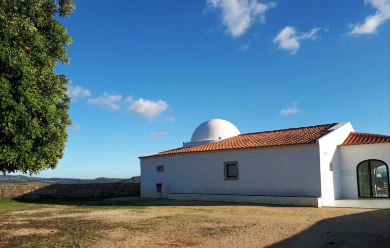
The settlement proved considerably larger than earlier investigations had indicated. It extended beyond the fourth fortification line toward the east and farther up the slope, with habitation areas inside the defences and apparently on the slope below the promontory. A rural adobe farmhouse, now called Casal do Zambujal, partly destroyed the central area of the fortification at an uncertain date. Zambujal became a National Monument in 1946. In 2006, the Municipal Council of Torres Vedras acquired 48 hectares to protect it from further damage, followed by conservation and site-development measures. Most excavated artefacts are kept and displayed at the Leonel Trindade Municipal Museum in Torres Vedras.
Remains
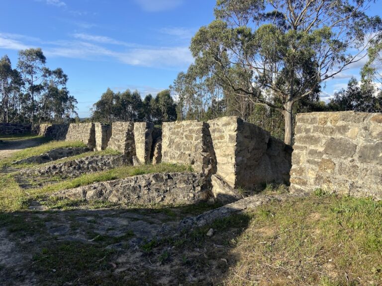
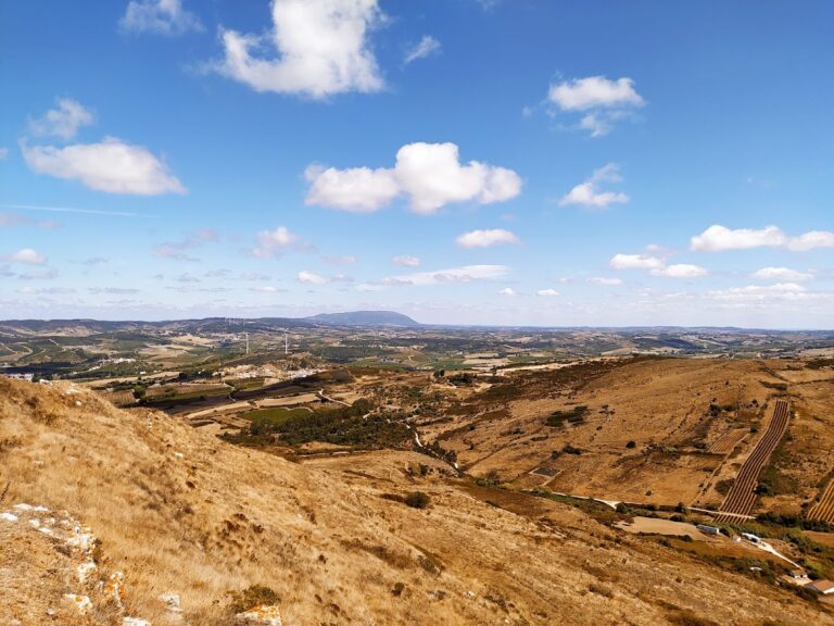
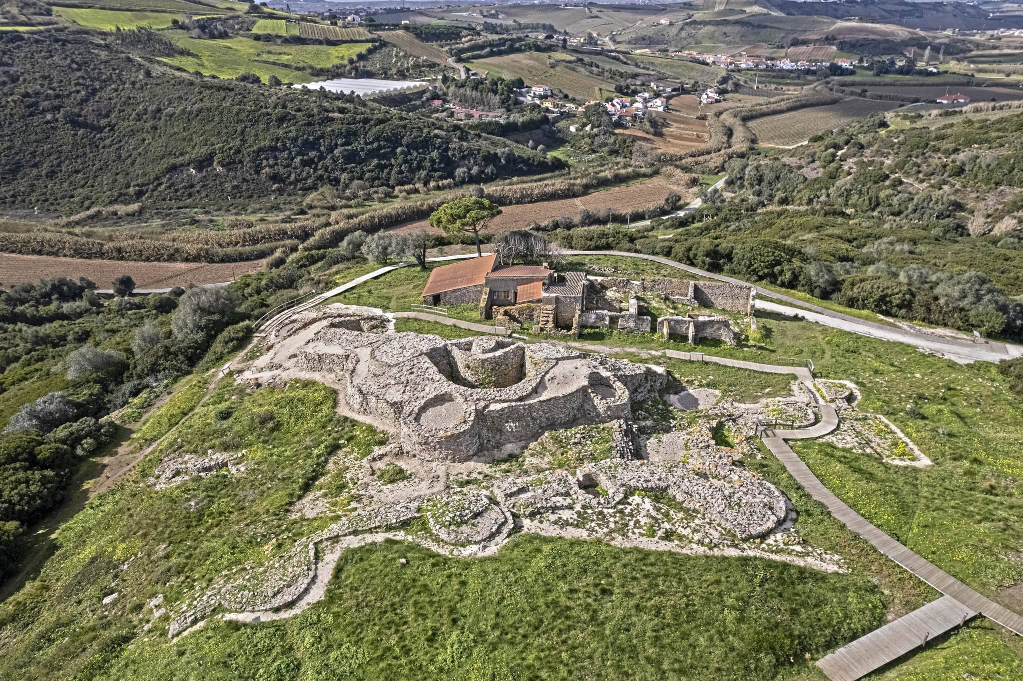
Zambujal occupies a platform on a flank of the Serra do Varatojo, extending toward the Sizandro River about three kilometres from Torres Vedras. Its central fortified area is an approximately elliptical citadel, known as fortification line I. Three further defensive lines, II to IV, extend eastward up the slope. Successive sectional walls surround the citadel, and radial walls divide the spaces between the defensive lines into small courtyards. Repeated additions of inner and outer masonry shells produced a layered defensive system whose central remains are comparatively well preserved.
Central citadel
The inner enclosure measures about 50 metres across. At its centre, a substantial wall surrounds a courtyard approximately 25 metres in diameter. Around this core stood circular and semi-circular defensive structures. Their walls were generally between 1.6 and 3.6 metres thick and between 3 and 7 metres high, with some surviving sections reaching about 4 metres. The central fortification was externally surrounded by about ten circular or semi-circular structures, usually 6 to 7 metres in diameter. Four remain complete, one is partly complete, and five have been destroyed.
Four entrances are identified on the south, north, northeast, and west sides. As many as six additional passages may have linked the central courtyard with the spaces between the inner and outer fortifications. These passages are short and narrow, allowing only one person to pass at a time. The defensive arrangement also included straight, narrow channels, small and large semi-circular towers, walls made with small slabs, and projecting defensive works.
Eastern and outer defences
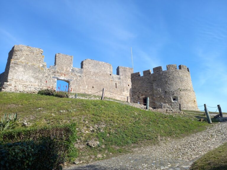
The eastern side of the citadel preserves a particularly well-preserved semi-circular wall, standing in part to about 4 metres. Its small openings face only inward. It has been interpreted as a barbican, an advanced defensive work placed outside or in front of a main fortification. A later wall facing the structure sealed the openings. A large semi-circular wall on the third defensive line may have served a comparable purpose.
The first defensive concept used approximately one-metre-wide walls built with two masonry shells and massive connecting towers. Later stages added further shells, filled selected defensive spaces with stone, and placed hollow circular towers against earlier walls. The upper sections of these towers used corbelled vaults, or false domes. Earthen walls, segmented barriers, raised platforms, and successive strengthening of the northern gateway formed part of the settlement’s changing defensive structure. Large parts of the first and second lines later collapsed before the construction of a subsequent wall that no longer survives.
Houses, production, and archaeological layers
Oval houses about 6 metres in diameter were built from adobe. Habitation also occupied areas within the fortifications and extended onto the slope below the promontory. The small number of surviving round-house remains does not represent the entire population required to build and defend the settlement. Copper working took place within the enclosure during every phase of occupation, while fish and shellfish remains connect daily activity with the nearby former inlet.
The excavated remains preserve extensive and relatively complete layers for the period. The farmhouse damaged part of the central archaeological area, but the surviving fortification and associated deposits retain evidence for the settlement’s successive construction concepts, craft activity, habitation, and changing use.