Castle of Carrazeda: A Ruined Medieval Fortress in Portugal


Site at a Glance
- Rating
- 4.5
- Popularity
- Low
- Country
- Portugal
- Primary era
- Medieval
- External website
- Open
- Eras represented
- Classical, Medieval, Early Modern
- Civilizations
- Portuguese, Roman, Umayyad
- Site type
- Military
- Remains
- Fortified Town
On this page15 sections
History
Castle of Carrazeda is a ruined fortified settlement in Portugal, near Lavandeira, whose earliest occupation dates to the Chalcolithic, or Copper Age, around 3000 BCE. A Roman settlement later developed on the site, and its Roman phase ended when northern barbarians sacked Carrazeda de Ansiães in 409. The site subsequently became part of the changing political and military landscape of the Iberian Peninsula.
From Roman settlement to Muslim fortification
Muslim forces conquered the region in 711. The Muslim community is credited with establishing the settlement’s earliest fortifications, although the settlement was abandoned by about the ninth century. These early defensive works formed part of a longer sequence of occupation in which the plateau was repeatedly adapted to changing political conditions.
The Leónese frontier and the Portuguese kingdom
During the Reconquista, the long Christian expansion and consolidation that reshaped the Iberian Peninsula, the settlement lay within the Kingdom of León. Between 1055 and 1065, Ferdinand I of León and Castile granted it a foral charter. This type of medieval legal charter established local rights, obligations, settlement privileges, and territorial administration, and the grant was intended to encourage repopulation. It is described as one of the oldest territorial charters defining the extent of Portugal’s borders.
After the territory became part of Portugal, Afonso Henriques confirmed the charter in 1160. Sancho I reconfirmed it on 6 April 1198, Afonso II did so in April 1219, and Manuel I issued another charter on 11 June 1510. Afonso III granted Ansiães a fair in 1277, authorizing a periodic market and commercial gathering. The settlement’s territory included agricultural parcels, smaller communities, and varied resources, helping it develop into an important center in the Douro region.
Conflict and the construction of the new castle
In 1372, King Ferdinand granted Carrazeda de Ansiães to João Rodrigo Porto Carrero. João Rodrigues later took up arms for León and Castile, and the resulting conflict was settled by the Treaty of Badajoz in 1382. The settlement’s frontier position continued to give its defenses a military purpose.
Between 1384 and 1496, customs revenues from Freixial, Murça, and Abreiro were assigned to the construction of the new castle. Church funds also helped accelerate the work. In 1443, Regent Peter directed taxes from Freixiel, Abreiro, and Vilarinho da Castanheira toward repairing the castle walls. A substantial part of the outer enclosure may have been erected during the reign of João I.
In 1516, the castle was transferred to Rui Dias de Sampaio. Lopo Vaz de Sampaio, who was born at Ansiães, later served as captain of Cochin from 1524 to 1526 and as governor-general of Portuguese India from 1526 to 1529. By 1527, the settlement contained 35 inhabited buildings, but its lack of potable water, distance from fertile land, and separation from the principal roads contributed to its gradual decline.
Decline, abandonment, and modern preservation
From the late fifteenth century, and especially during the sixteenth century, population shifted toward peripheral settlements. The municipal seat was transferred to Carrazeda in 1734, while the settlement within the castle walls was finally abandoned during the nineteenth century. The defenses were repaired with royal taxes between 1580 and 1591, followed by further local reinforcement efforts in 1640. During the seventeenth century or later, the fortifications were modernized with the Fortim do Cubo and a ravelin, an outwork positioned in front of a fortification. The settlement and its defenses later lost importance to other regional centers and declined into ruin.
The ruins were classified as a National Monument by a decree published on 23 June 1910. The property is owned by the Portuguese Republic and has a cultural function today, while its original function was military. It was transferred to the Portuguese Institute for Architectural Patrimony on 1 June 1992 under Decree-Law 106-F/92. Heritage responsibilities were later incorporated into the Institute for the Management of Architectural and Archaeological Heritage, whose Porto Regional Directorate is assigned to the site.
Conservation work has taken place in several phases. The General-Directorate for Buildings and National Monuments carried out wall recovery in 1944–1945 and 1976, followed by consolidation of the western towers in 1977. A further consolidation and restoration intervention took place during the 1960s. The Archaeological Project for the Castle of Ansiães began in 1995, and excavations inside and outside the perimeter walls were conducted from 1996 to 1998 under the supervision of archaeologist Luís Pereira. A broader recovery project for the castle and medieval town was later undertaken in response to the degraded condition of the complex.
Remains
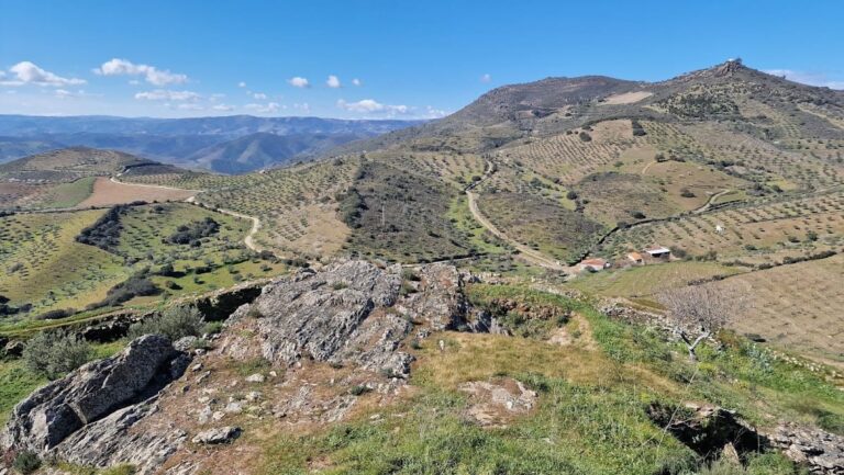
The ruins occupy an isolated rural position on a small plateau near the Serra da Vila, amid vegetation and approximately 200 metres from cultivable land. The site overlooks the Douro valley and broad areas of the Carrazeda plateau to the north, east, and west. Its defensive organization consists of two distinct spaces: a higher oval enclosure centered on the military core, and a lower oval enclosure that contained the medieval and modern town.
The upper fortress
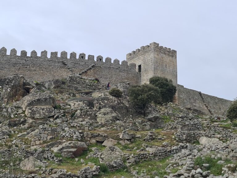
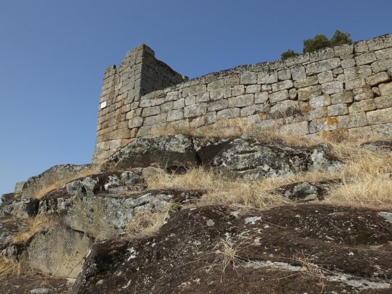
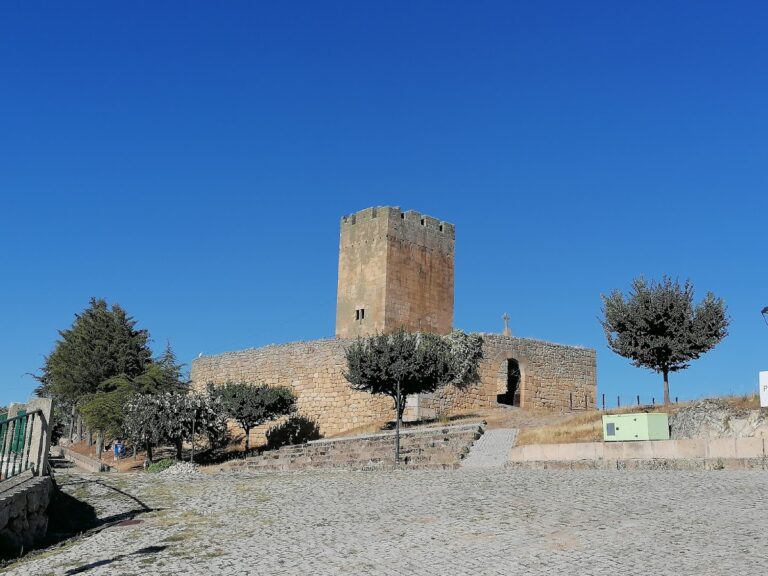
The castle proper is an irregular oval enclosure built mainly of granite and mortar. Its walls are approximately 2.65 metres thick and reach a maximum height of about 6.6 metres. An elevated section contains a smaller quadrangular redoubt. Five rectangular towers reinforce the upper defensive perimeter, which also includes the square keep, the principal fortified tower of the castle. The keep has two internal floors, annexes, and windows on the upper floor. A small Traitors’ Gate lies beside it.
São Salvador Gate and the towers
The main southern entrance is the São Salvador Gate, a round-arched opening formed by two rows of arch stones. Two rectangular towers defended the entrance. One is partly destroyed, while the northern tower is the keep. The Torre dos Lameiros is also destroyed. Other names preserved within the fortification complex include Torre do Sol, São Francisco Gate, São João Gate, and Fonte Vedra Gate.
Cisterns and water storage
A granite cistern with a vaulted roof adjoins the cliff edge within the upper enclosure. It remains obstructed but is in relatively good condition. A second vaulted cistern was dismantled by the Portuguese Institute for Cultural Patrimony and was not reconstructed. Together, these features belong to the practical infrastructure of the fortified core, where water storage was essential to the operation of the castle.
The lower town enclosure
The former town occupied a second, approximately oval interior enclosure around the upper military area. Granite cliffs on the east and south formed part of its defensive line. A second wall, more than 600 metres long, bounded the lower urban enclosure and was reinforced by three rectangular towers. Sections of the eastern and southern sectors survive, while the lower area has suffered extensive damage.
Gates and roads
The southern Fonte Vedra Gate is a round-arched doorway. The principal eastern entrance, the Porta da Vila, gave access toward Lavandeira. The São João and São Francisco Gates opened to the west, and stone roads converged toward the town center. These entrances connected the enclosed settlement with its surrounding routes and helped organize movement through the lower enclosure.
Houses and defensive works
Remains of houses and cubic-shaped spaces survive inside the lower enclosure, with some associated with barbicans, external defensive works protecting an entrance or wall. The urban plan was organized around intersecting roads that structured small neighborhoods and residential areas. Visible foundations, arches, corner stones, door and window lintels, wall fragments, and other structural vestiges preserve parts of this medieval and later settlement.
Religious buildings and nearby remains
Church of São Salvador de Ansiães
The Church of São Salvador de Ansiães is the only preserved building within the castle complex. It is a small Romanesque church inside the outer walls. Romanesque architecture is a medieval style associated with heavy masonry, rounded arches, and compact forms. The church survives among the defensive and residential remains as the complex’s principal preserved religious structure.
Convent of São João
The ruins of the Convent of São João lie approximately 40 metres from the castle entrance. The remains date from the Roman period and form a separate archaeological feature associated with the wider occupied landscape around the fortress.
The complex occupies an area given as approximately 9,594 hectares. Granite and mortar are its principal construction materials, with cement, wood, and iron also associated with the surviving fabric. The walls are substantially degraded, but foundations, arches, gates, towers, defensive fragments, and other structural elements continue to show how the elevated military enclosure and the lower urban settlement were arranged. The castle and the nearby Castle of Vila Flor are described as complementary fortifications placed on small plateaus in a protected zone between a mountain range and three peaks.