Castle Afing: A Medieval Castle Ruin in South Tyrol

Site at a Glance
- Rating
- 4.7
- Popularity
- Very Low
- Country
- Italy
- Primary era
- Medieval
- Eras represented
- Medieval
- Civilizations
- Holy Roman Empire
- Site type
- Military
- Remains
- Castle
On this page6 sections
History
Castle Afing is a poorly understood castle ruin near Jenesien in South Tyrol, Italy. Its builders, original purpose, early name, and date of construction are unknown. The site is identified with the historically recorded Castle Afing, which was associated with the Lords of Afing, a family first mentioned in 1214 through Gottschalk.
The Lords of Afing
The Lords of Afing served as ministerials of the Lords of Wangen. Ministerials were members of a service-based aristocracy who carried out military, administrative, or estate responsibilities for more powerful lords. This relationship placed the Lords of Afing among the locally influential retainers of the area.
The early name and history of the castle later faded from local memory. Its inaccessible position contributed to this loss, as did the early extinction of both the Lords of Afing and the Lords of Wangen. A similar disappearance of historical memory was associated with the nearby remains of Walbenstein.
Rediscovery and Interpretation
The ruin was briefly described in 1929 by Josef Weingartner as a small, then-lost castle with an outwork on an extremely difficult-to-climb rock ledge below the Unterkofler farm. The alternative name Unterkofler-Schlössl comes from this nearby farm. Georg von Hepperger reported a visit made in 1923 and published a ground plan in 1931. That same year, Peter Eisenstecken described an excursion to the remains and photographed them.
In 1947, the Benedictine monk Johannes Weiß recorded local legends that placed a “poor soul” and a rich treasure within the masonry. Georg Innerebner’s detailed 1953 study established a precise location, supplied a topographic map of the spur, and described the surviving structures. Because the surrounding area lacked water and roads, he considered the location and construction effort strikingly disproportionate, while cautiously interpreting the site as a refuge castle. During the 1970s, Otto Eisenstecken reported a possible smelting site on the southern rock head and, with reservations, interpreted it as a wind furnace, a furnace designed to intensify airflow during high-temperature metalworking.
Remains
The Spur and Northern Rock Head
The ruins occupy a steep, ridge-like spur high above the Talfer gorge in the Sarntal. The spur projects about 100 metres eastward toward the Sarner Gorge and drops almost vertically on three sides. Access is easiest from the west, across a rocky saddle and up the steep mountainside, although the approach still requires climbing. Afing lies about 2.5 kilometres to the northwest.
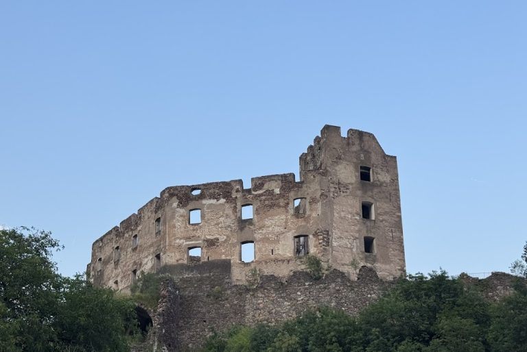
The surviving masonry stands on two small rock heads near the western edge of the spur, close to the saddle. On the higher northern rock head, a masonry quadrangle measures about 12 by 8 metres. Other mortar-built walls survive nearby, with visible masonry reaching roughly two metres in places.
Southern Rock Head
Fewer structural traces remain on the southern rock head, where the surviving masonry is threatened by landslides. The walls are built from Bolzano quartz porphyry and show markedly varied workmanship. Innerebner estimated that the surviving structures contained well over 100 cubic metres of masonry.
A possible smelting site was identified on this southern rock head. Its interpretation as a wind furnace remains uncertain, so the feature provides a tentative indication of high-temperature metalworking rather than a secure explanation of the area’s function.
Nearby sites