Burg Gräbelesberg: A Hilltop Fortification in Baden-Württemberg


Site at a Glance
- Rating
- 4.7
- Popularity
- Very Low
- Country
- Germany
- Primary era
- Medieval
- External website
- Open
- Eras represented
- Iron Age, Medieval
- Civilizations
- Celtic
- Site type
- Military
- Remains
- Fort
On this page7 sections
History
Burg Gräbelesberg is an abandoned hilltop fortification in Germany, situated on the Gräbelesberg plateau about 1,500 metres south of Laufen an der Eyach, now part of Albstadt in Baden-Württemberg. The site originated in prehistory and was fortified again during the early Middle Ages. Its position on a naturally protected plateau gave it a defensible setting above the Eyach Valley.
Early Fortification and Medieval Interpretations
The two-part fortification is probably a Hungarian rampart, meaning an earthwork traditionally linked with defenses against Magyar raids during the early medieval period. The term represents a proposed interpretation rather than a confirmed date or function. Finds from the forward rampart date to the early sixth century, while the chronology of parts of the defensive system remains uncertain. The walls may also have been strengthened during the Middle Ages.
Another interpretation connects the walls with Celtic burial mounds. This view is associated with experts including Kurt Wedler and with the investigations of Pastor Alfred Ludwig Oetinger. Oetinger served in Meßstetten and Hossingen from 1856 to 1868 and carried out extensive excavations in the Hossingen area, first at his own expense and later for the State Collection of Antiquities.
Celtic Context and Later Settlement
Gräbelesberg has also been considered within the wider development of Celtic fortifications along the naturally protected edge of the Swabian Jura. Some defenses in this landscape were erected from about 150 BC in response to incursions by Germanic groups. Gräbelesberg is associated with this defensive tradition, although the meaning and date of its walls remain unresolved.
A farm on the plateau was managed by Peter Storz. In 1856, it passed by gift to the municipality of Laufen and later fell into decay. The widow of the former manager and her mentally disabled son were placed with private households in Hossingen for 45 gulden each. The Gräbelesberg remained within the Hossingen cadastral area until the early twentieth century.
Traditions and Present Status
Local traditions recall a settlement that supposedly disappeared between Burg Gräbelesberg and Burg Tieringen. They also mention an abandoned Stetten and Nüwenghausen, which was recorded in 1477 but has not been securely located. A further legend concerns the Hemmadhäddler, ghostlike figures said to appear at certain times beneath the Baienfelsen. In the story, a carter from Tieringen called to them at midnight. The people in his wagon survived the apparition, but the frightened horses had to be freed by cutting their harnesses, and the wagon was abandoned after becoming stuck in deep clay.
The former fortification is now an archaeological monument. In recent years, efforts have sought to present the area in a museum-oriented manner, preserving its archaeological importance while leaving the interpretation of its origins open.
Remains
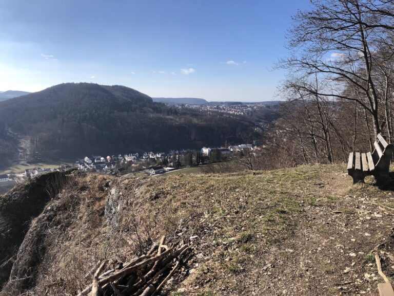
The fortification occupies the relatively level summit plateau of the 915-metre Gräbelesberg. Covering approximately 5 hectares, the plateau rises about 300 metres above the Eyach Valley and connects with the Swabian Jura upland by a narrow ridge. Steep natural slopes protect three sides, while the more accessible rear of the plateau contains the principal artificial defenses.
Ramparts and Ditches
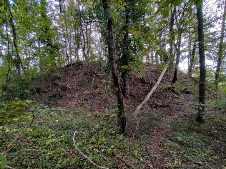
Several ramparts and ditches create a two-part enclosure. Together, they form a double wall-and-ditch system across the accessible side of the summit. The outer defense is a prominent angled rampart carried from rock to rock, where it formed the first barrier against an approaching enemy. The surviving earthworks give the site its character as a Burgstall, the remains of a former fortification whose buildings have disappeared while its archaeological earthworks survive.
Metalworking Evidence
Excavation of the forward rampart produced the lower, tongue-shaped part of a bronze mold. The fragment is 3 centimetres long, 2 centimetres wide, and 0.2 centimetres thick. Its deeply incised decoration includes zoomorphic elements, such as two legs with splayed toes and a head. The incision pierced the piece at one point, while additional perforations near the upper end contributed to its break. The fragment is held at the Württemberg State Museum in Stuttgart.
The mold fragment is most plausibly dated to around AD 600, although its precise animal style cannot be established securely. It is interpreted as a settlement find. Unprocessed iron-ore pellets were also found at the site. If the mold came from its original location, the two discoveries together indicate that a bronze-smithing workshop operated on the Gräbelesberg. The ore was Bohnerz, a pisolitic form of iron ore mined in pits on the plateau.
Nearby sites