Castello di Carafa: A Medieval Fortress in Cirò, Italy


Site at a Glance
- Rating
- 4.4
- Popularity
- Low
- Country
- Italy
- Primary era
- Medieval
- External website
- Open
- Eras represented
- Medieval, Early Modern
- Civilizations
- Kingdom of Naples
- Site type
- Military
- Remains
- Castle
On this page9 sections
History
Castello di Carafa is a medieval fortress in Cirò, Italy, whose construction is estimated to have begun around the tenth century. Built in several phases, it was repeatedly modified under Saracen, Byzantine, Norman, Swabian, and Angevin influences. The castle later became the stronghold and residence of successive noble families before being converted into a palace in the nineteenth century.
From medieval fortress to Carafa stronghold
In 1496, Angevin vassals of the Ruffo family transferred the property to the Carafa family, who served the Aragonese. The Carafas began reshaping the complex as a defensive fortress and established their position in Cirò. This work included the pentagonal bastion, a projecting fortification designed to strengthen defensive fire along the walls.
In 1545, the descendants of Andrea Carafa fell from favor, and the castle was sold to Antonio de Abenante, Baron of Calopezzati. After Abenante was tried for heresy, his possessions were confiscated, and the castle entered the state domain for several years.
Later ownership and changing use
In 1571, the castle was sold to Isabella Caracciolo, Duchess of Castrovillari. It later passed through maternal inheritance to her son, Giovanni Vincenzo Spinelli. In 1735, the castle hosted Charles III of Spain during his journey to Palermo to receive the crown of the Kingdom of Sicily.
The Spinelli family retained ownership until 1842, when the last heir, Mariantonia, was dispossessed and the property was sold at public auction. The Giglio family acquired the complex and converted the fortress into a palace, living there until the mid-1950s.
Modern preservation and the Lilio association
After a period when the castle was publicly accessible, it was closed and remained unused or abandoned until 1980. The Municipality of Cirò now owns the property. Safety interventions have been carried out, and the complex also contains a small local museum.
The courtyard pavement has been associated by hypothesis with the astronomical knowledge of Luigi Lilio, a sixteenth-century Calabrian astronomer and calendar reformer born in Cirò. Its probable completion date, 1564, falls within Lilio’s lifetime, from 1510 to 1576, but surviving written documentation does not establish the connection. Proposed interpretations link the pavement to the calendar reform later promulgated by Pope Gregory XIII in 1582. That reform corrected the relationship between the calendar year and the solar year and is associated with calculations attributed to Lilio.
Remains
Fortress structure
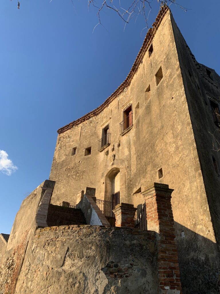
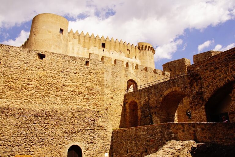
Castello di Carafa has a trapezoidal plan with four sides and towers at the corners. Its principal defensive features include two circular corner towers with battered walls, meaning that their bases slope outward, and a crenellated pentagonal bastion. The pentagonal tower rises from a curved base that probably preserves a trace of an earlier tower.
The complex is arranged on three levels: an underground section, a storehouse level, and an upper level. The distance from the underground cistern level to the merlons is 18 metres. A vaulted entrance hall leads into the courtyard, around which the building ranges contain two large apartments and rooms for servants. Storehouses and stables open onto the courtyard, while cellars lie below.
Below the courtyard is a room approximately 9 metres deep, with a constant temperature of about 18 degrees Celsius. The courtyard pavement is made entirely of locally quarried stone and differs from the paving in the entrance hall and on the access road. Its inclination is described as allowing water entering the castle to be filtered.
Courtyard pavement
Design and construction
The pavement occupies a rhombus-shaped area whose sides measure 17 metres. Three rows of red bricks form its pattern, while river pebbles fill the quadrants. The probable completion year, 1564, appears twice in the central section, formed by bricks set on edge.
At the centre is an eighteen-sided polygon surrounded radially by irregular pentagonal shapes described as petals. Each petal joins an irregular hexagonal form toward the outside. Together, the points create a nine-pointed star, or enneagram, a nine-pointed geometric figure. Two such stars lie within a circle. A second circle surrounds the first and contains broken lines with numbers produced by the arrangement of the bricks. Lines extending toward the cardinal directions form a cross across the pavement.
Proposed astronomical symbolism
Arrow-like bricks run along the north-south arm of the cross, while tetrahedral symbols occupy the east-west arm. The pavement can be divided along 13 axes. Five central axes coincide with the large circle and follow the inclined pattern of the broken lines; eight others pass perpendicularly through the eastern and western sections. Nineteen small arches appear on the left, while circles and rhombuses appear on the right. The angle between the central axis and guide lines extending from the centre toward the distorted outer section is 23.5 degrees.
The western section has been interpreted as representing solar observations, the eastern section as lunar observations, and the centre as the movement of the stars. The nineteen arches, eighteen central petals, and central polygon have been associated with the lunar epact, a number used to calculate the Moon’s age within a calendar year, and with the Metonic cycle, which approximates the correspondence between 19 solar years and 235 lunar months.
The converging arrows on the north-south arm have been interpreted as symbols for the movement of planets around the Sun. The tetrahedral forms on the east-west arm have been associated with solstices and equinoxes. Among these proposed readings are two equinoctial diamonds, two solstitial diamonds, and symbols for the Tropic of Cancer and Tropic of Capricorn. The first circle and its broken lines may represent the movements of the Earth and Sun, while the nine-pointed stars may refer to a traditional calendar based on a nine-sided system.
These readings remain hypothetical. The significance and use of the enneagram are not supported by surviving written records, and the pavement’s astronomical interpretation remains an open question.