Castell de Miralles: A Tenth-Century Fortification in Spain

Site at a Glance
- Rating
- 4.4
- Popularity
- Low
- Country
- Spain
- Primary era
- Medieval
- External website
- Open
- Eras represented
- Medieval, Modern
- Civilizations
- Crown of Aragon
- Site type
- Military
- Remains
- Castle
On this page9 sections
History
Castell de Miralles is a ruined tenth-century fortification in Spain, built above the upper valley of the Miralles stream as part of the defensive line that supported the repopulation of the Anoia river valley. Its position in the Miralles range gave it a role in controlling the surrounding territory.
Early feudal history
The first documentary notice associated with the castle dates to 960, when Borrell II, the count of Barcelona, transferred Castell de la Roqueta to Isarn, son of Sal·la of Sant Benet. In 987, Borrell transferred half the rights and properties of the territory of Miralles to the Bishop of Vic, the senior ecclesiastical authority in the area. The bishop granted those rights as a fief to Ennyec Bonfill de Cervelló, while Borrell had already granted him the other half.
In his testament of 1018, Hug de Cervelló left the castle to his son Alamany. In 1079, Guerau Alamany formally acknowledged his feudal allegiance to the Bishop of Vic. During the twelfth century, the castellany, meaning the office and jurisdiction of the official who administered and defended a castle, was held by the Miralles family as vassals of the Cervelló lineage.
The Cervelló lordship
In 1193, Guerau d’Alamany left the castle to his son Guillem. Guillem was succeeded by his son Guerau de Cervelló, who later left it to his daughter Felipa before departing for the conquest of Mallorca. In 1347, Guerau de Cervelló was described as lord of the barony of La Llacuna, a territorial lordship to which Miralles belonged.
War, succession, and decline
Castell de Miralles played a role in the Catalan Civil War. At the end of February 1463, Gonzalvo de Mendoza persuaded its garrison to support the Generalitat, Catalonia’s representative governing institution. In April, however, Arnau de Cervelló, acting as commissioner of King Joan II of Aragon, occupied the castle.
The castle and barony later passed from the Cervelló family to the Alagó family, barons of Alfajarín, and then to the Montcada family, marquises of Aitona. Through marriage, they subsequently passed to the Fernández de Córdoba family, dukes of Medinaceli. In the nineteenth century, jurisdiction was shared by the marquises of Aitona and Moja.
By 1845, the castle was described as completely ruined. Houses in the lower part of the site remained inhabited, and six families lived there in 1842. These houses formed the municipality’s only settlement until the Spanish Civil War.
Modern conservation
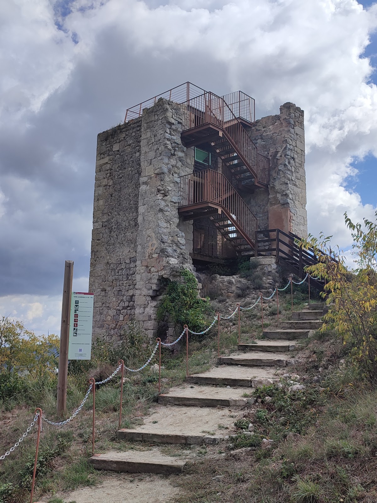
In 2017, an initiative of the municipal government led to the installation of a staircase and several wooden floors inside the eastern tower, creating a viewing platform. The intervention was directed by the architect Carles Solsona Piña and carried out by the Local Architectural Heritage Service of the Barcelona Provincial Council. Castell de Miralles has been protected as a Cultural Asset of National Interest and as a Spanish cultural-interest monument under reference RI-51-0005703 since 1988.
Remains
The castle occupies a hill in the Miralles range at approximately 650 metres above sea level, overlooking the upper valley of the Miralles stream. Its fortified complex follows the terrain and is divided into an upper ward and a lower ward. The surviving masonry consists largely of small, roughly worked stones bonded with lime mortar, with several sections arranged in opus spicatum, a herringbone-like pattern of diagonally placed stones.
Upper ward
The upper ward is an almost rectangular enclosure with rounded corners. It measures approximately 28.7 to 31 metres in length and 20.6 to 23 metres in width. Sections of its walls survive generally more than 3 metres high, with a typical thickness of about 1 metre. The southeast corner, the only one that appears curved, is about 1.5 metres thick, while the southern wall was reinforced at a later stage and reaches approximately 1.9 metres.
Entry was provided by a doorway near the northern end of the western wall, although only its southern jamb remains. A second, badly damaged entrance seems to have stood on the northern side of the eastern wall. Four simple-splayed arrow slits, each about 45 centimetres wide on the inside, were set in the northern wall below a projecting ledge. Further arrow slits were opened in the southeast area and in the western wall. Projecting ledges on the eastern and northern walls may indicate that the enclosure carried a roof and an upper level.
Lower ward and defensive towers
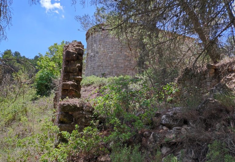
The lower ward includes a south-facing esplanade overlooking the valley. A collapsed wall bounded this area, with towers at its eastern and western ends. The eastern end retains a large square detached guard tower, an isolated defensive tower positioned apart from the main enclosure. It may date from the thirteenth century and may have replaced an earlier tower from the castle’s foundation period. The road leading to the village passes below it.
A smaller tower survives at the western end. It may belong to the tenth century, like the castle itself. Its interior measures approximately 5.2 metres in length and 1.9 metres in width, while its walls are about 80 centimetres thick. Small stones bonded with lime mortar form the structure.
Church and settlement remains
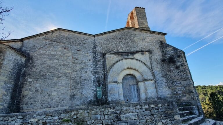
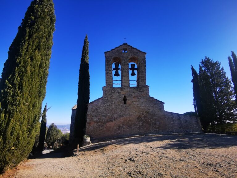
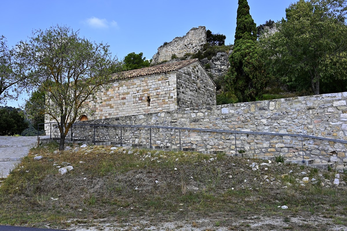
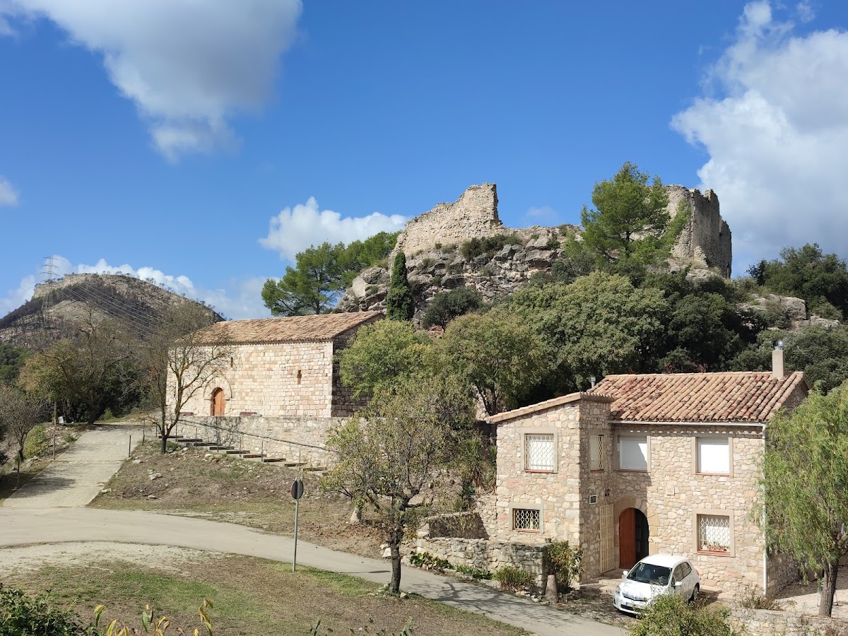
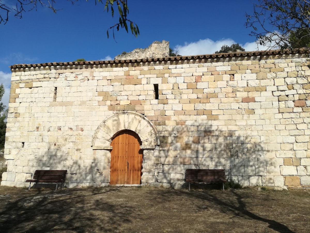
Santa Maria stands below the southern wall of the castle. The Romanesque church was built between the twelfth and thirteenth centuries and remains in good condition.
About 30 metres south of the castle, beyond the church, are the remains of five former dwellings on the flatter part of the site. These houses were rebuilt in the modern period and belonged to the settlement that continued to be inhabited after the fortress itself had fallen into ruin.