Castell de la Granada: A Medieval Territorial Castle in Spain



Site at a Glance
- Rating
- 4.3
- Popularity
- Very Low
- Country
- Spain
- Primary era
- Medieval
- External website
- Open
- Eras represented
- Medieval
- Civilizations
- Crown of Aragon
- Site type
- Military
- Remains
- Castle
On this page12 sections
History
Castell de la Granada is a territorial castle in La Granada, Spain, whose surviving remains belong to a Romanesque fortification constructed in the thirteenth century. The site stood within the territory of the castle of Olèrdola and controlled an important crossroads, linking the ancient Via Augusta, a major Roman road connecting the Iberian Peninsula with the wider Roman road system, with the Mercadera route toward Lleida.
Foundation and episcopal lordship
The site was recorded in 950, when Guilarà, bishop of Barcelona, granted Granada as a fief to Sisovald, who was to build a tower there. A Muslim attack led by Abd al-Malik Yusuf destroyed the tower in 1003. Bishop Aeci ordered its reconstruction in 1005, and the work continued until 1013, when twenty ounces of gold were spent on the tower.
The reconstruction also formed part of a dispute over lordship. Bishop Deodat required Sisovald’s successors to acknowledge the rights of the bishopric, invoking the authority of the counts of Barcelona. A judgment ultimately favoured the bishopric, which retained lordship over Granada until the abolition of seigneurial jurisdictions, or lordly legal rights, in the nineteenth century. The king nevertheless kept the highest jurisdiction.
Roads, markets, and noble possession
Granada’s position at the meeting of the Via Augusta and the Mercadera route encouraged commercial activity. Merchants and traders used the east-west route from Barcelona toward Lleida, and a market developed at Granada in 1080. It became the first market in the Penedès and one of the oldest in Catalonia, continuing until the establishment of the market at Vilafranca.
During the twelfth century, the castle probably passed to the Cervelló family through enfeoffment. The Cervelló family was a medieval Catalan noble lineage. In 1193, Guerau Alemany de Cervelló left the castle of Granada and other possessions to his son Guillem. Fourteenth-century hearth-tax records, however, placed the lordship once again with the bishopric.
Warfare, demolition, and later protection
The castle was besieged during the fifteenth-century civil war. During the War of the Reapers, a Catalan revolt and conflict against the Spanish monarchy fought chiefly from 1640 to 1652, Castilian troops were defeated in the castle’s surroundings.
During the War of the Spanish Succession, an early-eighteenth-century European conflict over the Spanish throne, Philip V ordered the castle demolished at the beginning of the eighteenth century. Philip V was the first Bourbon monarch of Spain and a principal claimant in the succession crisis. The demolition began extensive removal of the castle’s stone. In 1937, stone from the ruins was used to pave a road, and further elements were demolished after the Spanish Civil War of 1936–1939.
Castell de la Granada is listed as a Cultural Asset of National Interest as a historic monument and as a Spanish Asset of Cultural Interest as a monument, under reference RI-51-0005490. It is also included in the Catalan architectural heritage inventory as item 1001.
Remains
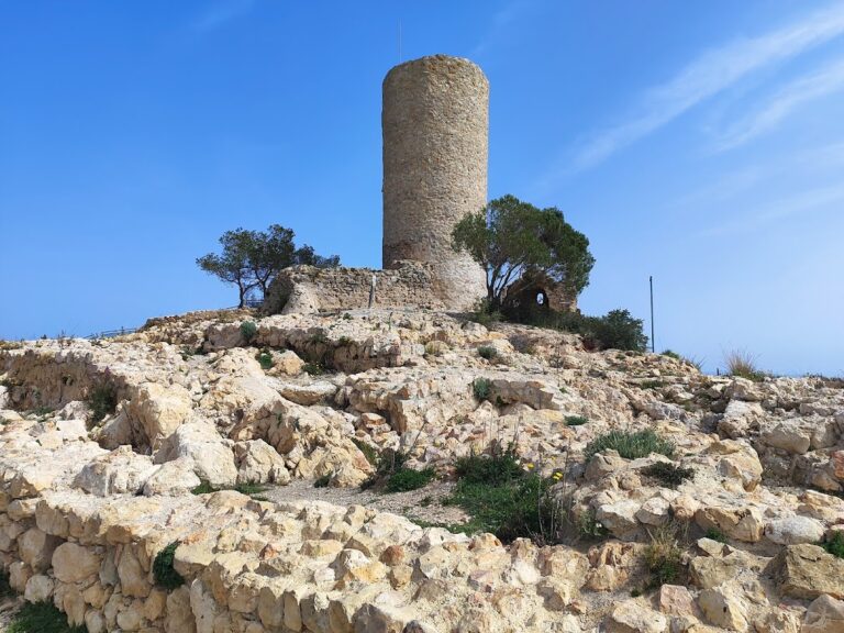
The castle occupies the summit of a small elevation in the upper part of La Granada, at approximately 285 metres above sea level. Its surviving fabric forms part of a rectangular Romanesque fortification, a medieval architectural tradition known for massive masonry, thick walls, semicircular arches, and relatively small openings. The main enclosure measures about 20 metres in length and 10.5 metres internally in width, while its walls are approximately 1.2 metres thick.
Enclosure and tower
Main enclosure
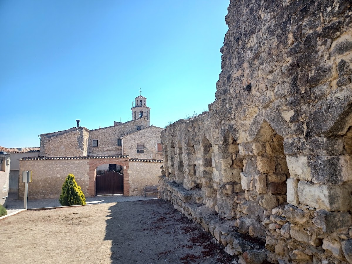
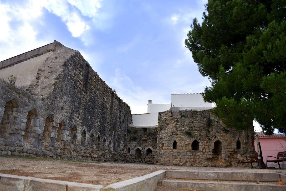
The south and west walls remain standing, together with fragments of the north wall. The eastern wall contained a large entrance formed by a monolithic lintel and a semicircular arch. In 1937, the north and east walls of the main enclosure were demolished, and the surviving walls were reduced in height by approximately 3 metres. The remaining walls reach about 7 metres high.
Southwest tower
A rectangular tower was formerly attached to the southwest corner of the enclosure. Three of its walls survive, while its eastern wall, which once separated the tower from the rest of the fortification, has been lost. The tower’s internal dimensions are approximately 3.4 by 3.9 metres. Its surviving walls form a distinct part of the castle’s defensive plan.
Openings and masonry
Doorways
The semicircular arch of one of the three northern doorways survives. At the westernmost doorway, the visible remains include one jamb, the socket for a door bar, and the pivot socket on which the door turned. These details preserve evidence of how the entrances were secured and operated.
Loopholes
Numerous loopholes remain in the surviving walls. A loophole is a narrow opening in a defensive wall through which defenders could observe or use weapons while remaining protected. The ground-level openings, positioned approximately 1 metre above the ground, measure about 70 centimetres wide and 115 centimetres high. Each is finished with two slabs set at an angle, and the south wall alone contains sixteen of these openings outside the tower area.
Several larger loopholes occur about 2 metres higher in the walls. They are rectangular and measure approximately 70 centimetres wide by 2 metres high. Together with the lower openings, they remain among the most visible features of the fortification’s defensive walls.
Masonry
The walls are built from lightly worked ashlar blocks carefully laid in regular courses. The blocks measure approximately 20 centimetres high by 35 centimetres long. This masonry, along with the rectangular plan, thick walls, semicircular arches, and surviving defensive openings, belongs to the castle whose construction is dated to the thirteenth century.