Caister Roman Fort: A Saxon Shore Military Base in Britain


Site at a Glance
- Rating
- 4.2
- Popularity
- Low
- Country
- United Kingdom
- Primary era
- Classical
- External website
- Open
- Eras represented
- Classical
- Civilizations
- Roman
- Site type
- Military
- Remains
- Fort
On this page14 sections
History
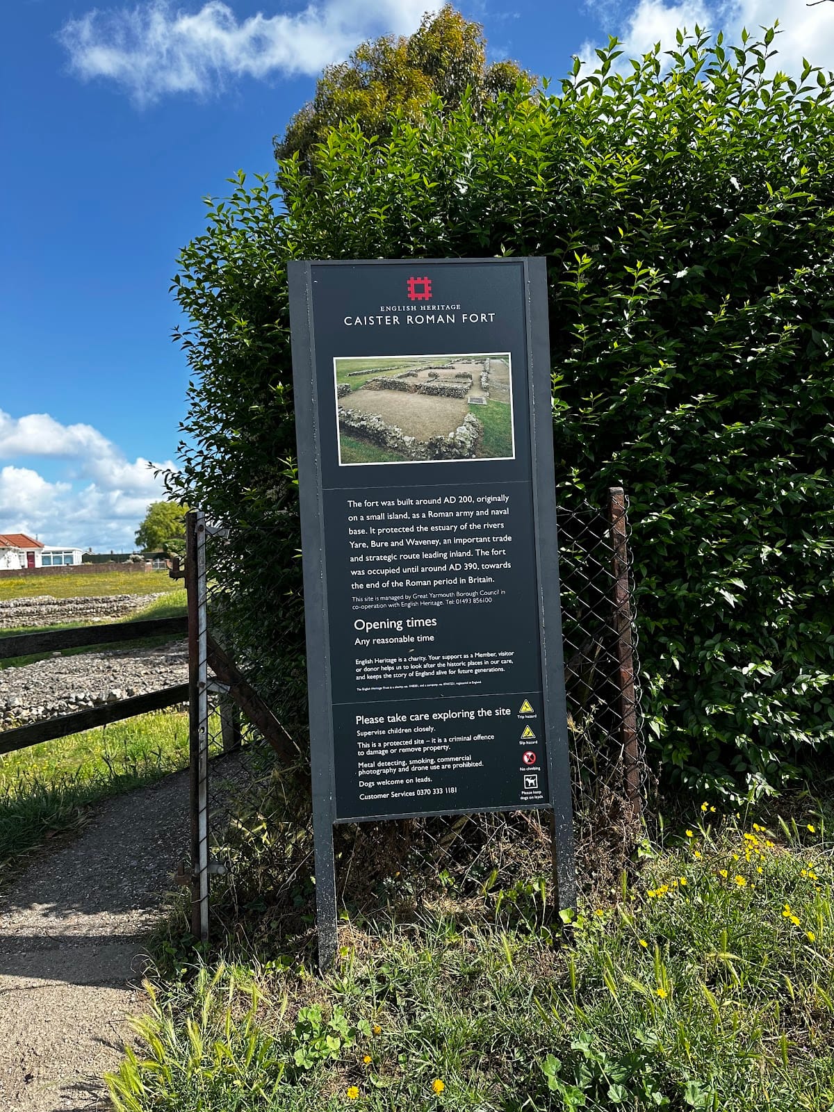
Caister Roman Fort in the United Kingdom was a Roman military and naval installation built around AD 200 during the later Roman period. It formed part of the Saxon Shore, a coastal-defence system whose forts combined garrisons with control of shipping along parts of eastern and southern Britain. Positioned beside the former estuary of the Ant, Bure, Yare, and Waveney, the fort helped protect the waterways and support military operations in the region.
Early fortifications and Roman occupation
An earlier timber fortification at Caister may date from about AD 55. It had a palisade, a defensive fence of wooden stakes, and an outer ditch. The ditches were repaired under the emperor Septimius Severus around AD 196–197, before the later stone fort was probably constructed around AD 200.
The stone fort remained under military occupation until approximately AD 370–390, when Roman forces withdrew from Britain. It may have accommodated between 500 and 1,000 people, including infantry, cavalry, and sailors of the Classis Britannica, the Roman fleet responsible for naval operations around Britain. The exact units stationed there are unknown, and the fort’s ancient name has not been securely identified.
A small harbour settlement probably developed nearby by the middle of the second century. After about AD 260, another fort was built at Burgh Castle on the opposite side of the estuary. The two installations may have worked together to protect merchant shipping and prevent raiders from moving inland, although Burgh Castle may later have replaced Caister. One of the two forts was called Gariannonum, but it remains uncertain which site bore that name.
Late Roman defence and withdrawal
During the fourth century, the garrison increasingly faced Anglo-Saxon and Jutish raiders. These groups used fast ships to land secretly, attack settlements, and possibly establish permanent communities in Britain. The outer ditch at Caister was widened and deepened in the early fourth century, reflecting the changing defensive pressures of the period.
The fort’s military role ended with the withdrawal of Roman authority from Britain around AD 370–390. Ash deposits show that a major fire later damaged one of its internal buildings in the late fourth century. The building was not repaired or rebuilt, reflecting the wider disruption of the site during the final phase of Roman occupation.
Anglo-Saxon and early medieval reuse
Anglo-Saxons occupied the surrounding region after the Roman withdrawal. A settlement developed near the centre of the fort during the Middle and Late Anglo-Saxon periods, while a large Anglo-Saxon cemetery lay to its south.
In AD 633, King Sigebert is said to have given the fort to the Irish missionary Fursa. Fursa probably founded a monastery called Cnobheresburg there, an early medieval monastic place-name associated with East Anglia. The monastery may have continued in use from the seventh to the eleventh century, giving the former military site a later religious role.
Destruction and archaeological investigation
Caister’s ruins were still largely standing in the seventeenth century, but they were probably no longer visible above ground after about 1620. By the first quarter of the eighteenth century, the remains had been completely demolished. Roman pottery and coins were recovered before systematic excavation began.
On 7 March 1936, workers found a hoard of 60 Roman coins in a ditch. The coins had been minted at Lyon, Arles, and Trier between AD 330 and 337, and the latest belonged to the reign of Constantine I. A further hoard may have contained coins issued under Victorinus, Allectus, Diocletian, Constantine II, and Constantius II.
Excavations between 1951 and 1955, followed by later investigations and observations during building work, exposed parts of the defences, the south gate, internal buildings, and roads. Work in 1960–62 examined further areas, including the north-west defences, but modern development prevented the excavation of the entire fort. About 90 percent of the site is now beneath modern housing. The surviving south wall, south gate, guard chamber, building foundations, and part of a ditch have been conserved and are managed by English Heritage.
Remains
Fort plan and defensive circuit
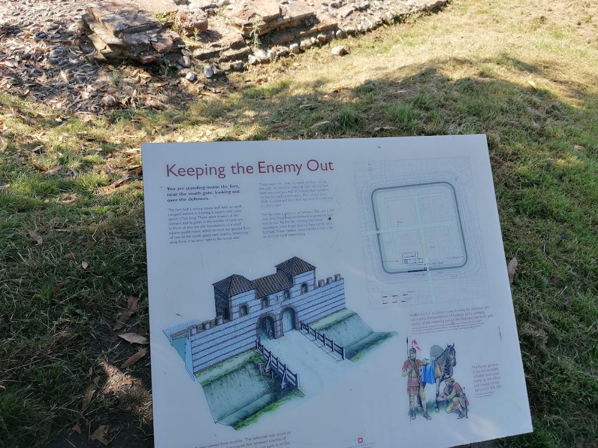
The fort covered approximately 3.5 hectares and followed a slightly irregular, roughly square plan with rounded corners. Each side measured about 175 metres. It stood on an Ice Age glacial moraine of sand and clay, originally occupying a small peninsula or island beside a broad estuary. The former estuary is now largely dry land, and changes in the coastline have left the fort inland.
Walls and towers
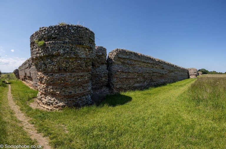
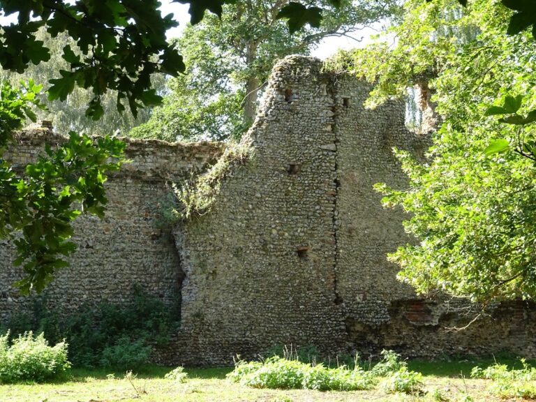
The perimeter wall was about 2.9 metres thick. Its foundations used large flints laid directly on the clay subsoil, while the visible structure was built from local flint and other stone obtained near the coast. An inner earth rampart strengthened the wall and provided access along its length. The wall originally rose approximately 4–5 metres.
A gateway probably stood on each side of the fort, with two square towers projecting inward at each entrance. Square towers also reinforced the corners. At the south-east corner, the foundations of an internally projecting corner tower survive. The south gate had two passageways and an upper guard room measuring approximately 1.8 by 1.6 metres.
Ditches and south entrance
Two ditches enclosed the fort, beginning about 2.7 metres beyond the wall. The inner ditch measured approximately 4.9–5.5 metres across and 1.8 metres deep. A visible section extends for 41.5 metres, while the remainder lies beneath a modern road. A berm, a strip of ground separating defensive features, about three metres wide divided it from the outer ditch.
The outer ditch was approximately 10–11 metres wide and was substantially widened and deepened in the early fourth century. A timber palisade may have supplemented the wall. Postholes at the south gate indicate that a wooden bridge crossed the ditch there.
Roads, harbour, and internal layout
The interior was probably arranged around a rectilinear street grid, although only two roads have been identified. A paved road about 10 metres wide ran north to south from the south gate along the fort’s main axis. A drain divided it into two carriageways. Near the north-east corner, a second road ran east to west for about five metres and had drainage channels along both sides.
A gravelled road led from the south gate for a short distance towards the harbour or docks. A civilian settlement, or vicus, lay west of the harbour. Such a settlement was associated with the Roman fort and would have formed part of the wider military and maritime setting around Caister.
Building 1 and its later uses
Structure and decoration
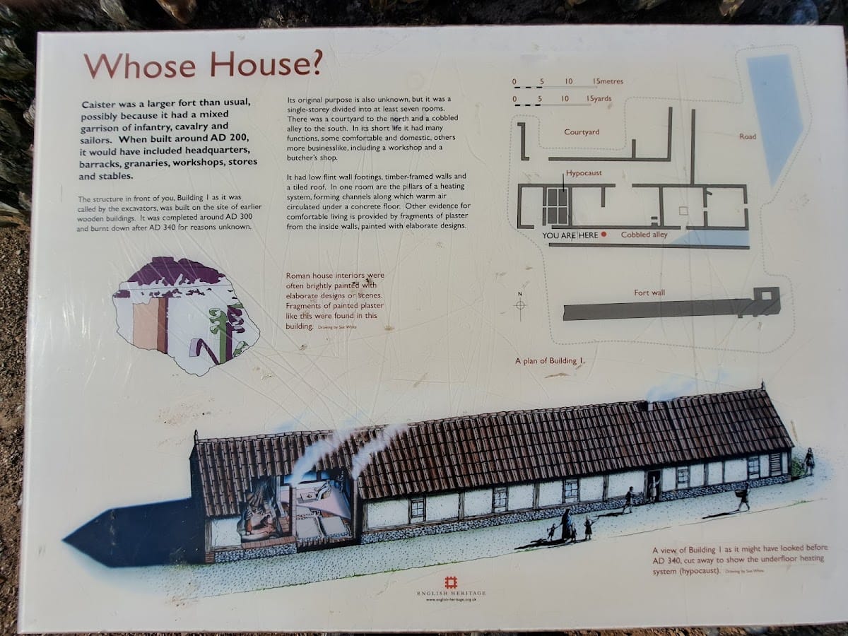
Building 1 stood just north of the south wall on an approximately east–west alignment. Constructed around AD 300 over an earlier timber building, it was a single-storey structure about 45 metres long and 8.5 metres wide. Six rooms of unequal size occupied the main range, while an additional wing extended northward from its western end.
The building had flint foundations between approximately 0.69 and 0.76 metres wide, timber-framed walls about 0.5 metres thick, and a tiled roof. Its plastered internal walls carried elaborate painted patterns. A courtyard lay to the north and a paved road to the south. A parallel wall on the southern side may have formed a portico, a covered walkway, or retained the inner face of the earth rampart.
Rooms and functions
Building 1 probably served several domestic and industrial purposes during the later third and fourth centuries. It may initially have had a representative function and has been tentatively identified as a praetorium, a formal residence or administrative building. Later uses may have included a comfortable residence, workshop, butcher’s shop, and grain store. Earlier interpretations as a sailors’ hostel, hotel, or brothel are no longer accepted.
Room 2 in the western wing contained an unusual hypocaust, a Roman underfloor-heating system in which hot air circulated beneath a raised floor. Two intersecting channels occupied the centre of the room, while brick pillars supported the floor around the edges. Wheat grains lay on the clay floor, and another room contained a stone-slab hearth.
A six-metre-wide corridor in the northern wing ran along the southern and eastern sides of a rectangular courtyard. The courtyard contained an earlier timber-and-masonry building, a water tank about 2.4 metres across, and a grain-drying kiln. Ash deposits show that Building 1 was severely damaged by fire in the late fourth century and was not rebuilt.
Objects, food remains, and religious evidence
Excavated material includes wattle-and-daub walling, pottery, glass, fragments of pewter tableware, and seven small hoards of Roman coins dating mainly from the middle of the fourth century. Fine Terra Sigillata tableware, usually red or orange-red and made in specialized workshops, came from Gaul. Amphorae, large vessels used to transport goods, carried wine and olive oil from the Mediterranean.
Brooches, beads, bracelets, necklaces, rings, and hairpins suggest that women and children may have lived within the fort, perhaps as members of soldiers’ families. Military objects include spearheads, arrowheads, fragments of a cavalry helmet, and belt buckles. Food remains include charred grain, fish bones, more than 10,000 oyster shells, and bones from cattle, hares, foxes, badgers, and ducks.
A statue of Mercury was found inside the fort. Mercury was the Roman god particularly associated with commerce, travel, communication, and trade. Just outside the fort, a bronze votive tablet records Aurelius Atticianus fulfilling a vow to Mercury. The tablet was probably once fixed to the wall of a temple or shrine.